- Asia
-
/ay"zheuh, ay"sheuh/, n.a continent bounded by Europe and the Arctic, Pacific, and Indian oceans. 2,896,700,000; ab. 16,000,000 sq. mi. (41,440,000 sq. km).
* * *
ILargest continent on Earth.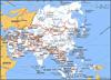 It is bounded by the Arctic Ocean, the Pacific Ocean, and the Indian Ocean; the western boundary, with Europe, runs roughly north-south along the eastern Ural Mountains; the Caspian, Black, Aegean, and Mediterranean seas; the Suez Canal; and the Red Sea. The islands of Sri Lanka and Taiwan and the archipelagoes of Indonesia (excluding New Guinea), the Philippines, and Japan also form part of Asia. Area: 17,226,000 sq mi (44,614,000 sq km). Population (2001 est.): 3,772,103,000. Mountains and plateaus predominate on the continent, with the highest mountains located in Central Asia and north of the Indian subcontinent. Terrain features include Earth's highest peak, Mount Everest, at 29,035 ft (8,850 m), and the lowest natural point, the Dead Sea, at 1,312 ft (400 m) below sea level. The largest of Asia's many arid regions are the Thar and Gobi deserts. It has some of the longest rivers in the world, including the Euphrates, Tigris, Indus, Ganges (Ganga), Yangtze (Chang; the longest river in Asia), Huang He (Yellow), Ob, Yenisey, and Lena. The Caspian, Aral, and Dead seas are major saltwater lakes. More than 15% of Asia's landmass is arable. Asia's principal language groups include Sino-Tibetan, Indo-Aryan, Austronesian, Austroasiatic, and Semitic; important singular languages include Japanese and Korean. East Asia contains three main ethnic groups: Chinese, Japanese, and Korean. The Indian subcontinent contains a vast diversity of peoples, most of whom speak languages from the Indo-Aryan subgroup of the Indo-European family. Because of the influence of China and the former Soviet Union, the Mandarin Chinese dialect and the Russian language are used widely. Asia is the birthplace of all the world's major religions and hundreds of minor ones. Hinduism is the oldest religion to have originated in southern Asia; Jainism and Buddhism emerged in the 6th and 5th centuries BC, respectively. Southwest Asia was the cradle of the so-called Abrahamic religions: Judaism, Christianity, and Islam. Daoism and Confucianism, both of which originated in the 6th or 5th century BC, have profoundly influenced Chinese culture and cultures of surrounding peoples. Asia is marked by great disparities in wealth. A few countries, notably Japan, Singapore, and the oil-rich countries of the Arabian Peninsula, have attained high standards of living; others, such as Bangladesh and Myanmar, are among the poorest. Between these two extremes lie Russia, China, and India. Asia is a country of great cultural diversity, but there are five main cultural influences: Chinese, Indian, Islamic, European, and Central Asian. China has had great influence in East Asia as the source of Confucianism, artistic styles, and the Chinese writing system. Indian influence has been expressed through Hinduism and Buddhism, affecting Tibet, Indonesia, Cambodia, and Central Asia. Islam spread from its original Arabian home to become important in the Middle East, South Asia, Central Asia, and elsewhere. Homo erectus hominids migrated from Africa to East Asia at least one million years ago. One of the earliest civilizations to use writing developed in the Tigris and Euphrates river valleys с 3500–3000 BC (see Mesopotamia). Civilization in the Indus River valley and in northern Syria followed с 2500 BC. Chinese urban civilization began with the Shang dynasty (с 1600–1046 BC) and continued under the Zhou dynasty (1046–256 BC). Indo-European-speaking peoples (Aryans) began to invade India from the west с 1700 BC and developed the Vedic religion. A succession of empires and charismatic rulers, including Alexander the Great, spread their political control as far as military power could carry them. In the 13th century AD Genghis Khan and his Mongol successors united much of Asia under their rule. In the 14th century the Turkic warlord Timur conquered much of Central Asia. Muslim Turks destroyed the remnants of the Byzantine Empire in the 15th century. In the 19th century, European imperialism began to replace Asian imperialism. Tsarist Russia pushed its political control across Asia to the Pacific Ocean, the British gained control of India and Burma (Myanmar), the French dominated eastern Southeast Asia (see French Indochina), the Dutch occupied the East Indies (Indonesia), and the Spanish and later the U.S. ruled the Philippines. After World War II (1939–45), European imperialism largely vanished as former colonies gained independence in the second half of the 20th century.II(as used in expressions)Asia Pacific Economic Cooperation
* * *
Introductionthe world's largest and most diverse continent. It occupies the eastern four-fifths of the giant Eurasian landmass. Asia is more a geographic term than a homogeneous continent, and the use of the term to describe this vast area always carries the potential of obscuring the enormous diversity among the the regions it encompasses. Asia has both the highest and the lowest points on the surface of the Earth, has the longest coastline of any continent, is subject overall to the world's widest climatic extremes, and, consequently, produces the most varied forms of vegetation and animal life on Earth. In addition, the peoples of Asia have established the broadest variety of human adaptation found on any of the continents.The name Asia is ancient, and its origin has been variously explained. The Greeks used it to designate the lands situated to the east of their homeland. It is believed that the name may be derived from the Assyrian word asu, meaning “east.” Another possible explanation is that it was originally a local name given to the plains of Ephesus, which ancient Greeks and Romans extended to refer first to Anatolia (contemporary Asia Minor, which is the western extreme of mainland Asia), and then to the known world east of the Mediterranean. When Western explorers reached South and East Asia in early modern times, they extended this label to the whole of this immense landmass.Asia is bounded by the Arctic Ocean to the north, the Pacific Ocean to the east, the Indian Ocean to the south, the inland seas of the Atlantic Ocean—the Mediterranean and the Black—to the southwest, and Europe to the west. Asia is separated from North America to the northeast by the Bering Strait and from Australia to the southeast by the seas and straits connecting the Indian and Pacific oceans. The Isthmus of Suez unites Asia with Africa, and it is generally agreed that the Suez Canal forms the border between them. Two narrow straits, the Bosporus and the Dardanelles, separate Anatolia from the Balkan Peninsula.The land boundary between Asia and Europe is a historical and cultural construct that has been defined variously; only as a matter of agreement is it tied to a specific borderline. The most convenient geographic boundary—one that has been adopted by most geographers—is a line that runs south from the Arctic Ocean along the eastern slope of the Ural Mountains and then turns southwest along the Emba River to the northern shore of the Caspian Sea; west of the Caspian, the boundary follows the Kuma-Manych Depression to the Sea of Azov (Azov, Sea of) and the Kerch Strait.The total area of Asia, including the Caucasian isthmus and excluding the island of New Guinea, amounts to roughly one-third of the land surface of the Earth. The islands—including the Japanese islands, Taiwan, the Indonesian islands, Sakhalin and other Asian Russian islands, Sri Lanka, Cyprus, and numerous smaller islands—account for about 7 percent of the total. (Although New Guinea is mentioned occasionally in this article, it generally is not considered a part of Asia.) The farthest terminal points of the Asian mainland are Cape Chelyuskin in north-central Siberia, Russia (77°43′ N), to the north; the tip of the Malay Peninsula, Cape Piai, or Bulus (1°16′ N), to the south; Cape Baba in Turkey (26°4′ E) to the west; and Cape Dezhnev (Dezhnyov) (Dezhnyov, Cape), or East Cape (169°40′ W), in northeastern Siberia, overlooking the Bering Strait, to the east.Asia has the highest average elevation of the continents and contains the greatest relative relief. The tallest peak in the world, Mount Everest (Everest, Mount), which reaches an elevation of 29,035 feet (8,850 metres; see Researcher's Note: Height of Mount Everest); the lowest place on the Earth's land surface, the Dead Sea, which averages about 1,312 feet (400 metres) below sea level; and the world's deepest continental trough, occupied by Lake Baikal (Baikal, Lake), which is 5,315 feet (1,620 metres) deep and whose bottom lies 3,822 feet (1,165 metres) below sea level, are all located in Asia. These physiographic extremes and the overall predominance of mountain belts and plateaus are the result of the collision of tectonic plates. In geologic terms, Asia comprises several very ancient continental platforms and other blocks of land that merged over the eons. Most of these had coalesced as a continental landmass by about 160 million years ago, when the core of the Indian subcontinent broke off from Africa and began drifting northeastward to collide with the southern flank of Asia about 50 million years ago. The northeastward movement of the subcontinent continues at about 2.4 inches (6 cm) a year. The impact and pressure continue to raise the Plateau of Tibet and the Himalayas.Asia's coastline—some 39,000 miles (62,800 km) in length—is, variously, high and mountainous, low and alluvial, terraced as a result of the land's having been uplifted, or “drowned” where the land has subsided. The specific features of the coastline in some areas—especially in the east and southeast—are the result of active volcanism; thermal abrasion of permafrost (caused by a combination of the action of breaking waves and thawing), as in northeastern Siberia; and coral growth, as in the areas to the south and southeast. Accreting sandy beaches also occur in many areas, such as the Bay of Bengal.The mountain systems of Central Asia not only have provided the continent's great rivers with water from their melting snows but also have formed a forbidding natural barrier that has influenced the movement of peoples in the area. Migration across these barriers has been possible only through mountain passes.A historical movement of population from the arid zones of Central Asia has followed the mountain passes into the Indian subcontinent. More recent migrations have originated in China, with destinations throughout Southeast Asia. The Korean and Japanese peoples and, to a lesser extent, the Chinese have remained ethnically more homogeneous than the populations of other Asian countries.Asia's population is unevenly distributed, mainly because of climatic factors. There is a concentration of population in western Asia as well as great concentrations in the Indian subcontinent and the eastern half of China. There are also appreciable concentrations in the Pacific borderlands and on the islands, but vast areas of Central and North Asia—whose forbidding climates limit agricultural productivity—have remained sparsely populated. Nonetheless, Asia, the most populous of the continents, contains almost three-fifths of the world's people.Asia is the birthplace of all the world's major religions—Buddhism, Christianity, Hinduism, Islam, and Judaism—and of many minor ones. Of these, only Christianity developed primarily outside Asia; it exerts little influence on the continent, though many Asian countries have Christian minorities. Buddhism has had a greater impact outside its birthplace in India and is prevalent in various forms in China, Korea, Japan, the Southeast Asian countries, and Sri Lanka. Islam has spread out of Arabia eastward to South and Southeast Asia. Hinduism has been mostly confined to the Indian subcontinent.Chakravarthi V. Narasimhan Yury Konstantinovich Yefremov Ed.This article surveys the physical and human geography of Asia. For in-depth treatment of Asia's major geographic features, see specific articles by name—e.g., Himalayas, Gobi, and Tigris and Euphrates rivers (Tigris-Euphrates river system). For discussion of individual countries of the continent, see specific articles by name—e.g., China, India, and Japan. For discussion of major cities of the continent, see specific articles by name—e.g., Bangkok, Jerusalem, Beijing, and Seoul. The principal treatment of Asian historical and cultural development is contained in the articles on Asian countries, regions, and cities and in the articles Palestine, history of (Palestine) and Islamic world (Islāmic world). Related topics are discussed in articles on religion (e.g., Buddhism, Hinduism, and Islam (Islām)) and arts and literature (e.g., Chinese literature, Japanese literature, Central Asian arts, Southeast Asian arts, and South Asian arts). Area (including Asian Russia but excluding the island of New Guinea), 17,226,200 square miles (44,614,000 square km); insular area, 1,240,000 square miles (3,210,000 square km). Pop. (2001 est.), 3,772,103,000.Geologic historyAsia is not only the Earth's largest but also its youngest and structurally most complicated continent. Although Asia's evolution began almost four billion years ago, more than half of the continent remains seismically active, and new continental material is currently being produced in the island arc systems that surround it to the east and southeast. In such places, new land is continuously emerging and is added to the bulk of the continent by episodic collisions of the island arcs with the mainland. Asia also contains the greatest mountain mass on the Earth's surface: the Plateau of Tibet and the bordering mountains of the Himalayas, Karakoram, Hindu Kush, Pamirs, Kunlun, and Tien Shan. By virtue of its enormous size and relative youth, Asia contains many of the morphological extremes of the Earth's land surface—such as its highest and lowest points, longest coastline, and largest area of continental shelf. Asia's immense mountain ranges, varied coastline, and vast continental plains and basins have had a profound effect on the course of human history. The fact that Asia produces about half of the world's petroleum and coal, in addition to being a significant contributor to the global production of many minerals (e.g., about three-fifths of the world's tin), heavily underlines the importance of its geology for the welfare of the world's population.General considerationsThe morphology of Asia masks an extremely complex geologic history that predates the active deformations largely responsible for the existing landforms. Tectonic units (regions that once formed or now form part of a single tectonic plate and whose structures derive from the formation and motion of that plate) that are defined on the basis of active structures in Asia are not identical to those defined on the basis of its fossil (i.e., now inactive) structures. It is therefore convenient to discuss the tectonic framework of Asia in terms of two separate maps, one showing its paleotectonic (i.e., older tectonic) units and the other displaying its neotectonic (new and presently active) units.According to the theory of plate tectonics, forces within the Earth propel sections of the Earth's crust on various courses, with the result that continents are formed and oceans (ocean) are opened and closed. Oceans commonly open by rifting—by tearing a continent asunder—and close along subduction zones, which are inclined planes along which ocean floors sink beneath an adjacent tectonic plate and are assimilated into the Earth's mantle. Ocean closure culminates in continental collision and may involve the accretion of vast tectonic collages, including small continental fragments, island arcs, large deposits of sediment, and occasional fragments of ocean-floor material. In defining the units to draw Asia's paleotectonic map, it is useful to outline such accreted objects and the lines, or sutures, along which they are joined.Continuing convergence following collision may further disrupt an already assembled tectonic collage along new, secondary lines, especially by faulting. Postcollisional disruption also may reactivate some of the old tectonic lines (sutures). These secondary structures dominate and define the neotectonic units of Asia. It should be mentioned, however, that most former continental collisions also have led to the generation of secondary structures that add to the structural diversity of the continent.The paleotectonic units of Asia are divided into two first-order classes: continental nuclei and orogenic (mountain-building) zones. The continental nuclei consist of platforms that stabilized mostly in Precambrian time (between roughly 3.8 billion and 543 million years ago) and have been covered largely by little-disturbed sedimentary rocks; included in this designation are the Angaran (or East Siberian), Indian, and Arabian platforms. There are also several smaller platforms that were deformed to a greater extent than the larger units and are called paraplatforms; these include the North China (or Sino-Korean) and Yangtze paraplatforms, the Kontum block (in Southeast Asia), and the North Tarim fragment (also called Serindia; in western China). The orogenic zones consist of large tectonic collages that were accreted around the continental nuclei. Recognized zones are the Altaids, the Tethysides (further subdivided into the Cimmerides and the Alpides), and the circum-Pacific belt. The Alpides and circum-Pacific belt are currently undergoing tectonic deformation—i.e., they are continuing to evolve—and so are the locations of earthquakes and volcanic eruptions.The Precambrian continental nuclei were formed by essentially the same plate tectonic (plate tectonics) processes that constructed the later orogenic zones, but it is best to treat them separately for three reasons. First, the nuclei occupy only about one-fourth of the area of Asia, and less than one-third of this area (i.e., less than 10 percent of Asia's total) consists of exposed Precambrian rocks that enable geologists to study their development. Second, Precambrian rocks are extremely poor in fossils, which makes global or even regional correlations difficult. Finally, during most of Phanerozoic (Phanerozoic Eon) time (i.e., the past 543 million years), the nuclei have remained stable and have acted as hosts around which the tectonic collages have accumulated in the Phanerozoic orogenic zones.The paleotectonic evolution of Asia terminated some 50 million years ago as a result of the collision of the Indian subcontinent with Eurasia. Asia's subsequent neotectonic development has largely disrupted the continent's preexisting fabric. The first-order neotectonic units of Asia are Stable Asia, the Arabian and Indian cratons, the Alpide plate boundary zone (along which the Arabian and Indian platforms have collided with the Eurasian continental plate), and the island arcs and marginal basins.Chronological summaryThe oldest rocks (rock) in Asia are found in the continental nuclei. Rocks more than 3 billion years old are in the Precambrian outcrops of the Angaran and Indian platforms and in the North China paraplatform. They consist of primitive island-arc magmatic and sparse sedimentary rocks sandwiched between younger basaltic and ultrabasic rocks, exposed along what are called greenstone belts. The basement of the Angaran platform was largely formed by about 1.5 billion years ago. The final consolidation of the Indian platform, however, lasted until about 600 million years ago and included various mountain-building episodes with peaks of activity between 2.4 and 2.3 billion years ago, at about 2 billion years ago, between 1.7 and 1.6 billion years ago, and between 1.1 billion and 600 million years ago. In the Arabian platform the formation of the present basement commenced by arc and microcontinent accretion some 900 million years ago and ended about 600 million years ago, although some of the accreted microcontinents had basements more than 2.5 billion years old and may be detached fragments of Africa.In the North China paraplatform, Chinese geologists have identified a period of intense island-arc magmatism (a process by which molten rock, often formed by the melting of subducted oceanic crust, rises and solidifies to form igneous rock) between 3.5 and 3 billion years ago. These arcs then coalesced into protonuclei by collisions until the end of the Archean Eon (2.5 billion years ago). Final consolidation of the North China paraplatform occurred approximately 1.7 billion years ago. The Yangtze paraplatform is younger, the oldest identified orogenic event being 2.5 billion years old. Its final consolidation took place some 800 million years ago. The Kontum block is poorly known. It contains Precambrian metamorphic rocks with minimum ages of about 2.3 billion years, although the oldest well-dated widespread thermal event falls into the Middle Cambrian (about 520 million years ago) and indicates the time of its final consolidation. The North Tarim fragment is really a thin sliver caught up in younger orogenic belts. Its Precambrian history is not entirely dissimilar to that of the Yangtze paraplatform, although not all major breaks in their sedimentary and structural evolution or the details in their sedimentary successions correlate. The Tarim fragment was also stabilized some 800 million years ago.While other Asian continental nuclei were completing their consolidation, orogenic deformation recommenced along the present southeast and southwest margins of the Angaran platform. This renewed activity marked the beginning of a protracted period of subduction, the development of vast sedimentary piles scraped off sinking segments of ocean floor in subduction zones and accumulated in the form of subduction-accretion wedges at the leading edge of overriding plates, and subduction-related magmatism and numerous collisions in what today is known as Altaid Asia (named for the Altai Mountains). Orogenic deformation in the Altaids was essentially continuous from the Late Proterozoic (about 850 million years ago) into the early part of the Mesozoic Era (about 220 million years ago), in some regions—such as Mongolia and Siberia—lasting even to the end of the Jurassic Period (144 million years ago).The construction of the Altaid collage was coeval with the late Paleozoic assembly of the Pangaea supercontinent (between about 320 and 245 million years ago). The Altaids lay to the north of the Paleo-Tethys Ocean (Tethys Sea) (also called Paleo-Tethys Sea), a giant triangular eastward-opening embayment of Pangaea. A strip of continental material was torn away from the southern margin of the Paleo-Tethys and migrated northward, rotating around the western apex of the Tethyan triangle much like the action of a windshield wiper. This continental strip, called the Cimmerian continent, was joined during its northward journey by a collage of continental material that had gathered around the Yangtze paraplatform and the Kontum block, and, between about 210 and 180 million years ago, all this material collided with Altaid Asia to create the Cimmeride orogenic belt.While the Cimmerian continent was drifting northward, a new ocean, the Neo-Tethys, was opening behind it and north of the Gondwanaland (Gondwana) supercontinent. This new ocean began closing some 155 million years ago, shortly after the beginning of the major disintegration of Gondwanaland. Two fragments of Gondwanaland, India and Arabia, collided with the rest of Asia during the Eocene (some 50 million years ago) and the Miocene (some 13 million years ago) epochs, respectively. The orogenic belts that arose from the destruction of the Neo-Tethys and the resultant continental collisions are called the Alpides and form the present Alpine-Himalayan mountain ranges. Both the Cimmerides and the Alpides resulted from the elimination of the Tethyan oceans, and collectively they are called the Tethysides.Most of the island arcs (island arc) fringing Asia to the east came into being by subduction of the Pacific Ocean floor and the opening of marginal basins behind these arcs during the Cenozoic Era (the past 65 million years). This activity continues today and is the major source of tectonism (seismic and volcanic activity often resulting in uplift) in South and Southeast Asia. In the south and in the southwest, India and Arabia are continuing their northward march, moving at an average of about 1.6 to 2.4 inches (4 to 6 cm) per year. These movements have caused the massive distortion of the southern two-thirds of Asia and produced the nearly continuous chain of mountain ranges between Turkey and Myanmar (Burma) that in places widen into high plateaus in Turkey, Iran, and Tibet. Within and north of these plateaus, geologically young mountains such as the Caucasus and the Tien Shan, large strike-slip faults such as the North Anatolian and the Altun (Altyn Tagh), and rift valley basins such as Lake Baikal—all of which are associated with seismic activity—bear witness to the widespread effects of the convergence of Arabia and India with Stable Asia, in which no notable active tectonism is seen.Stratigraphy and structureThe recorded history of the Precambrian, which covers more than 80 percent of the Earth's geologic history, is divided into two eons: the Archean (Archean Eon), between roughly 3.8 and 2.5 billion years ago, and the Proterozoic (Proterozoic Eon), between 2.5 billion and 543 million years ago. In Asia rocks of Archean age are found in the Angaran and Indian platforms, in the North China and the Yangtze paraplatforms, and in smaller fragments caught up in younger orogenic belts such as the North Tarim fragment. In all these places especially, the early Archean evolution was dominated by intrusions of granodiorite that largely represented subduction-related magmatism and by the formation and deformation of greenstone belts that are probably relicts of old oceanic crust and mantle and immature (i.e., basalt-rich) island arcs. In India the more than 3-billion-year-old mafic (mafic rock)-ultramafic associations of Kolar type with only subordinate sedimentary rocks represent the old greenstone belts that have either intrusive or tectonic contacts with Peninsular gneiss of similar age. The so-called Sargur schist belts within the Peninsular gneiss may be the oldest suture zones in the Indian subcontinent. In the Angaran platform the older (i.e., more than 3 billion years) gneiss-granulite basement shows a progressive development in time from ophiolites (pieces of former ocean floors) and immature basaltic island-arc volcanic rocks to more silicic ( silicon-rich) rocks such as andesites (andesite). In the North China paraplatform this early episode corresponds to the Qianxi Stage (3.5 to 3 billion years ago), in which mafic-ultramafic rocks with silicic sediments developed concurrently with granitic gneisses that were metamorphosed to a high degree.After about 3 billion years ago the coalesced “granitic” island arcs, with intervening greenstone sutures that included more immature arc remnants, began forming the earliest continental nuclei: the Fuping (Fupingian) Stage in the North China paraplatform (3 to 2.5 billion years ago); the earlier Dharwar-type greenstone belts in south-central India; and the Olekma, Timpton-Dzheltula, Batomga, Cupura, and Borsala gneiss-granulite series, in addition to the Chara complex of gneisses and greenstones in the Angaran platform.The present-day continental nuclei largely formed during the Proterozoic through the further agglomeration of the smaller Archean assemblages. The basement structure of the Angaran platform was formed for the most part between 2.1 and 1.8 billion years ago by repeated collisions along what have been dubbed the “second-generation greenstone belts.” This interval also corresponds with the most intense granitic intrusive activity in the history of the platform. Some 1.45 billion years ago, shortly after the Angaran platform stabilized, it underwent a rifting event that created its southern and western continental margins and the large grabens (horst and graben) (elongated downthrown fault blocks between two higher-standing blocks) that extend into the platform from those margins. This rifting may have separated Angara from the North American platform. Orogenic activity, which initiated the evolution of the Altaids, started along this margin about 850 million years ago and created the Baikal mountain belt.In India the activity of the Dharwar greenstone belts lasted into the Early Proterozoic (until about 2.3 billion years ago). Farther to the northwest the Aravali (Aravalli) and the Bijawar groups of sedimentary rocks were deformed by the Satpura orogeny some 2 billion years ago. The Bijawar Group contains the only piece of evidence in Asia for an Early Proterozoic ice age: the Gangan tillite (lithified glacial sediment), probable age about 1.8 billion years. The Aravali orogeny in the same place occurred between 1.7 and 1.6 billion years ago. In northeastern India, orogeny began some 1.7 billion years ago and culminated in a continental collision 950 million years ago in the present Singhbhum area. Widespread granitic magmatism in north-central India lasted until 600 million years ago, and it continued well into the Middle Ordovician (about 466 million years ago) in what later became the Himalayas.In the Arabian platform, the youngest of the major continental nuclei in Asia, a hypothetical rifting event sometime between 1.2 billion and 950 million years ago is thought to have created an ocean basin that clearly existed 950 million years ago in the northeastern part of the platform. The same rifting event may have also created some of the microcontinents with basements older than 2 billion years (such as that exposed at Mount Khidāʿ in Saudi Arabia) that later participated in what is known as the Pan-African episode, a tectonic evolution that also encompassed large parts of present-day Africa and other parts of the Gondwanaland supercontinent. This tectonic evolution was the one that eventually formed the Arabian platform. Following the emergence of the ocean, a variety of island arcs formed between 900 and 650 million years ago by intraoceanic subduction. These arcs and some of the preexisting microcontinents coalesced by collisions that occurred between 715 and 630 million years ago. Following this amalgamation, intracontinental deformation occurred between 630 and 550 million years ago, giving rise mainly to the northwest-southeast–oriented Najd fault belt in central Saudi Arabia and the associated crustal extension along north-south–oriented faults that became especially prominent in the present-day Persian Gulf and the surrounding areas. The Najd faults were predominantly of the strike-slip variety that moved right-laterally during an initial interval of about 20 million years (between 640 and 620 million years ago) but then acted as left-lateral faults until about 570 million years ago. The clastic sedimentary rocks of the Jubaylah Group in Saudi Arabia were deposited in narrow elongate basins formed by the Najd strike-slip faults. These north-south extensional structures have the same genetic relationship with the Najd faults as the present Basin and Range extensional system does with the San Andreas Fault in North America; the Hormuz evaporites ( halite, anhydrite, dolomite) of latest Proterozoic to middle Cambrian (Cambrian B) age were deposited in this system.The oldest rocks in the Yangtze paraplatform are exposed in the southwest in eastern Yunnan province, where those in a gneiss-greenstone association have ages ranging from 2.5 to 1.7 billion years. In the northern part of the block, granites (granite) 2.1 billion years old are known from the Dabie Mountains. In the northwest, along the easternmost edge of the Plateau of Tibet, the oldest rocks are granites known to be about 1 billion years old. A widespread intermediate to silicic volcanism ended the tectonic evolution of the basement of the Yangtze paraplatform between 800 and 650 million years ago.Evidence is scant for the ice age at the beginning of the Proterozoic, but the occurrence of at least three ice ages in the Late Proterozoic is known from rocks in the North Tarim fragment and the Yangtze paraplatform and from Kazakhstan, central India, and northern Korea. The record of these ice ages, plus the laterally consistent stratigraphy of the Late Proterozoic, has enabled geologists to construct a tentative correlation between the rock layers of the continental nuclei in Asia. Another rock group that has aided in internuclei correlation has been the evaporites, particularly halite, gypsum, and anhydrite. Evaporites from the Late Proterozoic to early Cambrian (Cambrian A) time (i.e., dating to about 590 to 530 million years ago) exist in the Arabian (Hormuz evaporites), northwestern Indian (Punjab evaporites), and Angaran platforms. On the basis of their orogenic history and the presence of evaporites, it is now thought that these nuclei may have coalesced at the end of the Pan-African episode and that Angara may have pulled out later, perhaps in the Early Ordovician (about 480 million years ago).The Paleozoic EraThe tectonic events in Asia of the Paleozoic Era (543 to 248 million years ago) may be summarized under three categories: events in the Altaids, events in the Tethysides, and events in the continental nuclei. The identification of Asian Paleozoic tectonic events with those associated with the Caledonian and Hercynian orogenies of Europe, as was done in the older literature, largely has been abandoned owing to the recognition of the haphazard nature of tectonic events whose temporal limits widely overlap.Paleozoic events in the AltaidsThe Altaids constitute a large and complex tectonic collage that accreted around the Angaran platform from late in the Proterozoic to early in the Mesozoic Era. Its oldest part, the Baikalides, formed between about 850 and 570 million years ago along the southern periphery of the Angaran platform. A number of island arcs and microcontinents were accreted onto Angara along a suture containing ophiolitic remnants of old ocean floor.After the Baikalian collisions, rifting outboard of the accreted fragments opened a new oceanic area, the floor of which had begun subducting under the enlarged continental nucleus in early Paleozoic time—perhaps during the Ordovician Period (490 to 443 million years ago). This subduction accumulated a large accretionary prism (wedge of deformed and partially metamorphosed sediments and rocks scraped from the ocean floor as it subducted) consisting of deep-sea muds (now slates), sandstones (deposited by large submarine turbidity currents), and siliceous sedimentary rocks (cherts) that were all structurally mixed with ophiolites (fragments of oceanic crust). These rocks now form the basement of much of the Altai Mountains. Much subduction-related magmatism was associated with the growth of the Altai accretionary prism. Another accretionary prism was growing at the same time in the ocean, far from the Altai, and this material now forms the basement of much of Kazakhstan. It was consolidated and made into a small continent by repeated deformation and magmatism throughout the early Paleozoic.The later Paleozoic development of the Altaid tectonic collage included the convergence and final collision of the Kazakhstan continental block with the enlarged Angaran nucleus during the middle of the Carboniferous Period (about 320 million years ago). The collision occurred along the southwestern Altai suture, the northerly continuation of which is now buried under the younger Mesozoic deposits of the West Siberian Plain. To the east it continues into Mongolia and there unites with the circum-Altaid suture zone coming from the west—i.e., from the Tien Shan. Another Carboniferous collision in the Tien Shan welded the North Tarim fragment to the Altaid collage. Shortly afterward, in the Early Permian Epoch (between 290 and 256 million years ago), north-plunging subduction along the present-day Kunlun Mountains—which originally lay flush to the south of the North Tarim fragment—rifted open the Junggar (Dzungarian) and Tarim basins. These are analogous in their tectonic setting to the present-day Sea of Japan (East Sea).The Altaid evolution came to an end in the west when the Russian platform collided with Asia along the Ural Mountains between the Arctic Ocean and the Aral Sea. This collision occurred during the Carboniferous (354 to 290 million years ago) in the south but later—during the Permian Period (290 to 248 million years ago)—in the north, creating the supercontinent of Laurasia. Later collisions in the south and southeast terminated the Altaid evolution.Paleozoic events in the TethysidesAlong the northern margin of the Tethysides, there was a continuous transition from the Altaid evolution into the Tethyside or, more strictly speaking, into the Cimmeride evolution. In northern Tibet the Kunlun Mountains (a part of the Cimmerides) may also be considered the southernmost representatives of the Altaid collage that was described above. They are made up of a huge subduction-accretion complex and of arc-related magmatic rocks—such as granites, granodiorites, and andesites, the ages of which range from Cambrian A to Late Triassic (i.e., from about 543 to 206 million years ago)—that had begun accumulating along the southern margin of the North Tarim fragment, from which this subduction-accretion complex was later separated by the opening of the Tarim Basin during the Permian. This accretionary complex continues westward into the Pamir and Hindu Kush ranges in Tajikistan and northern Afghanistan and finally constitutes almost the entire pre-Triassic basement of Turkmenistan. The North China block became a part of Asia during the late Paleozoic, although a small westerly vanishing, wedge-shaped ocean between it and the rest of nuclear Asia remained open along a line roughly following the present course of the Shilka River in southern Siberia.Orogenic deformation, magmatism, and metamorphism during the Carboniferous and Permian periods have become known in parts of Asia that then either belonged to Gondwanaland or had just separated from it as a result of the rifting of the Paleo-Tethys Ocean behind the separating Cimmerian continent. In northern and eastern Turkey, southwestern Iran, and Oman, folding and thrust faulting were in places accompanied by granitic and andesitic magmatism and high-temperature, low-pressure metamorphism, all collectively suggesting the activity of a subduction zone dipping under Gondwanaland. The same subduction zone may have been responsible for the rifting of the Neo-Tethys in the middle Permian as a back-arc basin similar to the present-day Sea of Japan.Late Permian andesitic volcanics in the Hoh Xil Mountains in northern Tibet and late Paleozoic granites in western and peninsular Thailand, accompanied by compressional deformation and metamorphism, also suggest that a subduction zone existed along the northern margin of the Cimmerian continent. In these parts of Asia, the separation of parts of the Cimmerian continent from northern Gondwanaland may have already been under way during the Carboniferous, as shown by the deposition of the Phuket Group—a formation of glacially modified clastic sedimentary rocks in western Thailand some 3,600 feet (1,100 metres) thick—and of correlative rocks in adjacent Myanmar (Burma), Malaysia, and the Indonesian island of Sumatra.The Yangtze paraplatform and the Kontum block are believed to have been parts of Gondwanaland (Gondwana) during the early Paleozoic, but they rifted away from it sometime in the Devonian Period (417 to 354 million years ago). Two other fragments in southeastern China, the Huan'an and Dongnanya, have basements that had been consolidated mainly in the Late Proterozoic and that also may have rifted from Gondwanaland sometime during the middle Paleozoic.At least two island arcs collided with the Kontum block along its northeastern margin during the Paleozoic to enlarge it to what is called the Annamia block. The earlier island arc docked along a suture that now coincides with the Annamese Cordillera in northern Vietnam in the Devonian or slightly earlier. The later one collided along a suture zone farther to the north, along the present-day Ma River, during the Early Carboniferous and caused a major south-directed deformation that included considerable thrusting.Subduction during Carboniferous to Permian times was active along the present-day western margin of the Annamia block, giving rise to much arc-related magmatism and mineralization. This same magmatic zone extended down into the eastern half of the Malay Peninsula. Subduction was probably also active along the present western margins of the Huan'an and Dongnanya blocks, although late Paleozoic magmatism there was much sparser than in Southeast Asia.Paleozoic events in the continental nucleiOnly three major nuclei underwent Paleozoic tectonic events not obviously related to their flanking orogenic belts. The Arabian platform underwent a major extensional tectonic event from the Late Proterozoic to the middle Cambrian that created large north-south (“Arabian-trend”) and northwest-southeast (“Najd-trend”) rift basins in which clastics and evaporites (Jubaylah and Hormuz) were deposited. These extensional basins were reactivated repeatedly until the Early Carboniferous and then again in the Late Permian. Active normal faulting in central Saudi Arabia late in the Ordovician (between 449 and 443 million years ago) was coeval with sediment deposition caused by the Saharan glaciation (the Raʾan shales with striated sandstone boulders). A major marine invasion from the east in the Late Permian covered more than half of the Arabian platform. The submergence of the platform coincided with the opening of the Neo-Tethys along its eastern margin and with a global rise in sea level following the Late Carboniferous–Early Permian glaciation in Gondwanaland. Striated pavements and glacial sedimentary deposits in the southern part of the Arabian platform (e.g., the Al-Khlata Formation in Oman) provide evidence of this glaciation.A prolonged period of emergence up to the Late Carboniferous characterized the Paleozoic history of the Indian platform, except for its northern margin, which was involved in the later Himalayan deformation. Late in the Carboniferous, glacially influenced terrestrial sedimentation commenced with the Talcher tillite formation in erosional bedrock depressions. In the Early Permian a number of rift valleys oriented east-west and northwest-southeast originated, possibly related to extensions that farther north led to the opening of the Neo-Tethys. Terrestrial deposition continued in these rifts and in the surrounding areas, with local interruptions, until early in the Cretaceous (144 million years ago), forming the Gondwanan deposits. Farther north in what later became the Himalayas, there was continuous marine sedimentation, with only local interruptions related to global changes in sea level and gentle oscillations of the platform.After the early Cambrian deposition of evaporites in extensional basins, the Angaran platform remained geologically calm, and shallow marine clastic and carbonate rocks were deposited on it. In the Late Devonian (370 to 354 million years ago), however, the platform's present northeastern margin was rifted; in addition to creating a major ocean, this activity produced two large rift valleys that now extend into the Angaran platform (the Vilyuy, or Viliui, and Chatanga rifts). Extensive basaltic volcanism accompanied this rifting event, followed by a period of heavy sedimentation along a northeast-facing continental margin.The Mesozoic EraThe events in Asia of the Mesozoic (248 to 65 million years ago) may be summarized as follows: events in the Tethysides, events in the Altaids, events in the continental nuclei, and events in the circum-Pacific orogenic belts.Mesozoic events in the TethysidesAs the Cimmerian continent was moving across the Tethyan realm—eliminating the Paleo-Tethys Ocean in front of itself while enlarging the Neo-Tethys behind it—it also began falling apart internally. Thus, a northern fragment (consisting of the Farāh block in Afghanistan, the central Pamirs, and the western Qiangtang block in Tibet) became separated from a southern fragment (including the Helmand block in Afghanistan, the southern Pamirs, and the Lhasa block in southern Tibet) by an ocean whose ophiolitic remnants are today encountered in the mountain ranges of eastern Iran, along the Farāh River in Afghanistan, and in the Tanggula Mountains in Tibet continuing to Mandalay in Myanmar. This ocean opened in the Permian and closed early in the Cretaceous (i.e., earlier than about 125 million years ago).The northern fragment of the Cimmerian continent, including much of modern-day Iran and the mountains of northern Turkey along the Black Sea, collided with the Altaid collage along a suture zone that passes north of the Elburz Mountains and south of the Kopet-Dag Range in northern Iran, through the Hindu Kush range in Afghanistan, south of the northern Pamirs and the Kunluns in northern Tibet, and then follows the Jinsha (upper Yangtze) River and continues through western Thailand and into the Malay Peninsula. The collision occurred late in the Triassic in Iran and Southeast Asia (about 220 million years ago) and in the Early Jurassic (about 200 million years ago) between Iran and Indochina. This collision created a massive wall of mountains along the southern border of Asia, called the Cimmeride Mountains (the name taken from the ancient people the Cimmerians, in whose homeland north of the Black Sea the first pieces of evidence for this chain were found at the beginning of the 20th century). These mountains extended from Turkey well into Southeast Asia. The large, rich tin-bearing granite belt of western Thailand and Malaysia was formed during this collision.The southern fragment of the Cimmerian continent soon caught up with the northern fragment; and, following the emplacement in the Late Jurassic (159 to 144 million years ago) of a part of the floor of the intervening ocean onto the Lhasa block in the form of a giant ophiolite sheet, the southern fragment also collided with Asia, eliminating the entire Paleo-Tethys and its marginal basins. Widespread aridity in much of Central Asia during the Late Jurassic was probably a result of the rain shadow that formed behind the wall of the Cimmeride Mountains to the south.The interval from the Late Triassic through the Late Jurassic (about 227 to 144 million years ago) was also the time when the Yangtze paraplatform and the Huan'an, Dongnanya, and Annamia blocks collided with one another and also with the eastern end of the Cimmerian continent and the rest of Asia. This created the multibranched Cimmeride mountain ranges of eastern and southeastern Asia, including the Qin (Tsinling) Mountains (Qin Mountains) that separate North China from South China. Some of the metamorphic rocks in the Dabie Mountains were buried to depths reaching 60 miles (100 km) during the collision of the Yangtze and the North China paraplatforms. These collisions formed another vast tin-bearing granite province in southern China.In the Middle East the rifting of the Cimmerian continent opened the eastern Mediterranean in the Late Triassic (between 227 and 206 million years ago), with Turkey moving away from Africa. In the Early Jurassic (206 to 180 million years ago) the Turkish part of the Cimmerian continent continued to disintegrate and to open a number of new Tethyan branches.The fragmentation of the southern supercontinent Gondwanaland (Gondwana) accelerated in the middle Mesozoic. This fragmentation led to the opening of the central and the southern Atlantic and Indian oceans that was partially compensated by the beginning closure of the Neo-Tethys. In Asia the main subduction zones consuming the Neo-Tethyan ocean floor began forming in the Late Jurassic along the northern margin of the ocean in Iran and in what later became the Himalayas. A unified subduction zone—extending from northern Turkey, south of the Pontic Mountains, through southwestern Iran (the present northern slope of the Zagros Mountains) and Makrān, north of the Salt Range in Pakistan to the present-day Himalayan suture zone along the valleys of the Indus and Brahmaputra rivers, and from there to Myanmar and Sumatra—came into being during the Early Cretaceous (about 120 to 100 million years ago). The vast Late Cretaceous granitic intrusions of the Trans-Himalaya and the Karakoram ranges and the andesitic volcanics that occupy a thin strip from northern Turkey through Iran and Pakistan to the Karakorams and extend beyond the Himalayas into Myanmar, Sumatra, and Borneo are the result of the rapid destruction of the Neo-Tethyan ocean floor.In the Early Cretaceous other entirely intraoceanic subduction zones also formed just north of the former Gondwanan continental margins in Turkey, Iran, and Oman. The attempted subduction of these margins resulted in the emplacement of vast portions of the Neo-Tethyan ocean floor on top of these margins in the form of giant ophiolite sheets, such as the Semail nappe in Oman. These ophiolite nappes (nappe) (i.e., thrust sheets) are major sources of chromite deposits. Also in the Early Cretaceous a small sliver of continental crust that now forms much of southwestern Sumatra rifted from northwestern Australia. This eventually collided with the rest of Sumatra in the Late Cretaceous, resulting in the opening of the northeastern segment of the Indian Ocean.Mesozoic events in the AltaidsMost of the Mesozoic events in the Altaids were the echoes of the Cimmeride collisions farther south. In places these collisions split the old Altaid edifice at high angles to the collision front, creating extensional basins such as the Torghay Valley, just north of the Aral Sea, and the West Siberian Plain, which contains little-deformed Jurassic and younger shallow-water and continental sedimentary rocks with significant hydrocarbon reserves. In other places closer to the collision front, the basement was uplifted along major thrust faults, creating mountain ridges (e.g., in the Tupqaraghan Peninsula on the east coast of the Caspian Sea and the Kyzylkum Desert of southern Kazakhstan). Between these, large compressional basins formed (e.g., the Turkmenian basins) or older ones became accentuated (the Tarim and Junggar), within which large sedimentary thicknesses and important hydrocarbon reserves accumulated. The compressional structures were connected in places with extensional structures through large strike-slip fault systems, the best-known of which runs through the Fergana Valley in southern Central Asia.Mesozoic events in the continental nucleiThe Angaran platform was also affected by the Cimmeride collisions but reacted more mildly than the Altaids. The vast Tunguska trap basalts erupted (volcanism) in the transition between the Permian and Triassic periods, and the eruptions lasted well into the Triassic. They were related to the rifting of the West Siberian Plain and were coeval with basaltic eruptions in the Torghay Valley. The old Proterozoic rifts on the Angaran platform were compressed at the end of the Jurassic, probably in response to the ongoing shortening of the Cimmeride continent.Major Late Jurassic–Early Cretaceous extension and basaltic volcanism affected especially the northern part of the Arabian platform. This extensional event was part of a much wider extensional province in north-central Africa. Yet another such event occurred in the northern and eastern parts of the platform in the Late Cretaceous, creating deep shelf basins.During the Mesozoic, the Indian (India) subcontinent separated from Gondwanaland. Its eastern margin formed early in the Cretaceous (about 140 million years ago), when India separated from Australia. The Early Cretaceous rifting event that affected the eastern margin of the Indian platform also led to some rejuvenation of the older Gondwanan rifts. India separated from Madagascar some 85 million years ago. Another rifting along this margin, about 66 million years ago, removed the Seychelles and Saya de Malha banks in the present western Indian Ocean from India and also gave rise to the huge Deccan trap basalt eruptions, which involved about 50 distinct flows in probably less than a million years.Mesozoic events in the circum-Pacific orogenic beltsThe subduction of the floor of the Pacific Ocean dominated the evolution of the Pacific margin of Asia, especially during the second half of the Mesozoic Era. Large subduction-accretion complexes formed in Japan and in Borneo, and the Kolyma block—forming present-day northeastern Asia—collided with the Angaran platform during the Late Jurassic–Early Cretaceous interval. This collision produced the 375-mile- (600-km-) wide Verkhoyansk (Verkhoyansk Mountains) fold-and-thrust belt, in the front of which coal was deposited in postcollisional molasse basins.A major magmatic arc flanked Asia between Japan and Indochina in the Late Jurassic to Late Cretaceous interval and joined the Neo-Tethyan arc system in Borneo. Late Cretaceous to early Tertiary extensional tectonics along this arc formed many of the offshore basins along the Chinese continental margin.The Cenozoic EraThe Cenozoic (65 million years ago to the present) was the time when Asia acquired its present appearance.The most important tectonic event in the Cenozoic history of Asia was its collision with India some 50 million years ago. This collision took place about 1,250 miles (2,000 km) south of the present location of the line of collision along the Indus-Brahmaputra suture behind the main range of the Himalayas. Since the collision India has “bulldozed” the southern margin of Asia, crumpling both Asia and its own northern margin. A horizontal shortening of some 500 miles (800 km) has accompanied this action, much of the distance taken up by massive thrust sheets in the Himalayas. The Plateau of Tibet (Tibet, Plateau of), the largest and thickest concentration of continental crust on Earth, is a consequence of considerable compression of the Asian continental lithosphere. The plateau has a crustal thickness of some 43 miles (69 km), and widespread volcanicity results from the melting of the lower parts of the thickened continental crust. Extensional basins oriented north-south in Tibet indicate that the massive plateau is spreading under its own weight like a piece of Silly Putty. India still moves northward with respect to Asia at a speed of about 2.4 inches (6 cm) per year, maintaining the high elevations of both the Himalayas and the Plateau of Tibet.The effects of the convergence reach farther north to Lake Baikal. The old Cimmeride compressional basins of Tarim, Dzungaria, and the other smaller ones have been all rejuvenated, as have the intervening mountain ridges such as the Tien Shan. Large strike-slip faults such as the Altun and the Karakoram have redistributed continental material in front of the moving indenter. In the south the collision created the large Ganges basin south of the Himalayas and may have led to a shortening of the southern tip of the Indian subcontinent in the vicinity of Anai Peak.The Arabian platform, which collided with Asia in the Middle Miocene (about 13 million years ago), has continued to converge with it at a rate of some 1.6 inches (4 cm) per year, in the process uplifting both the Zagros Mountains and the entire high-plateau system of Turkey and Iran, which resembles the Plateau of Tibet. A part of eastern Turkey has been pushed out of the way of the indenting Arabian platform along the North Anatolian Fault.The widespread and complicated deformation caused or influenced by the two major Alpide collisions characterizes the Alpide plate boundary zone, the major neotectonic province in Asia. The vast salt steppes and deserts of Asia are located in this province, behind the rain shadow of the Alpide ranges.Subduction under Asia continues in the Tethysides and contributes to tectonism in the Alpide plate boundary zone. Subduction has been consuming the floor of the eastern Mediterranean to the south of Asia Minor, the floor of the Arabian Sea off the coast of the Makrān, and the floor of the Indian Ocean around Southeast Asia. The Banda arc of mainly volcanic islands in Indonesia collided with Australia in the Pliocene Epoch (about 5 million years ago), and arc-related magmatism has not yet ceased.Cenozoic events in Stable AsiaNorth of the Alpide plate boundary zone are the vast expanses of Siberia, where the absence of seismic activity and the subdued relief indicate an absence of active tectonism. The only exception to this is where the Gakkel spreading centre of the Arctic Ocean is propagating into Asia along the Sadko Trough and the Chersky Mountains.Cenozoic events in the island arcs and the marginal basinsThe subduction zone that was active along the eastern margin of Asia late in the Mesozoic started migrating away from the continent in the Late Cretaceous in China. This led to crustal extension that created a number of the present-day offshore basins along the Chinese continental margin. The South China Sea opened as an ocean-floored marginal basin in the Oligocene Epoch (33.7 to 23.8 million years ago). Earlier, a midoceanic subduction zone had come into being along the Kyushu-Palau Ridge, and above it the West Mariana Basin opened in the Oligocene-Miocene interval. Some 5 million years ago the East Mariana Basin began opening behind the present Mariana Island arc. Japan moved away from mainland Asia in the Middle Miocene, opening behind it the Sea of Japan. The Kuril Basin behind the Kuril Islands arc has a similar age.The Cenozoic history of the island arc systems and the marginal basins they delimit against the Pacific Ocean has been dominated by extensional tectonics of the arc massifs concurrent with mainly basaltic and subordinate andesitic volcanism, limited subduction-accretion, and strike-slip faulting (e.g., the Philippine Fault). Some arcs, such as Sengihe and Halmahera, collided with each other, while others have split apart in recent geologic time to create newer marginal basins such as the Okinawa Trough. Some islands, such as eastern Taiwan or those of the Banda arc, have collided with continents. Of the young marginal basins, only the Sea of Japan may have begun closing again. The extraordinarily complex tectonic evolution of the East and Southeast Asian island arcs and marginal basins constitutes an excellent present-day analogue of the processes that may have produced the Altaid collage during the Paleozoic.A.M. Celâl ŞengörLandRelief (Asia)The mountain beltsCharacteristic of the surface of Asia is the great predominance of mountains and plateaus, constituting about three-fourths of the continent's total area. The mountains are grouped into two belts: those located on the stable platforms (cratons) and those located in active orogenic zones. The former usually occur on the margins of the platforms and generally are characterized by smooth eroded peaks and steep faulted slopes. Marginal mountain ranges, with average heights of 8,200 to 9,850 feet (2,500 to 3,000 metres), usually enclose the inner tablelands and plateaus; examples of such ranges include the Western and Eastern Ghats in India, the mountains of the Hejaz and Yemeni highlands on the Arabian Peninsula, and the Lebanon and Anti-Lebanon Mountains in the Levant. The Aldan Plateau and Stanovoy (Stanovoy Range) Mountains lie along the eastern margin of the Angaran (Siberian) platform, where the isolated and uplifted Putoran Mountains are located in central Siberia.Mountains of the orogenic zones are much higher in elevation and have a more complicated structure. Tectonic movements in these zones have given rise to structures of different age and composition. Mesozoic and Cenozoic foldings created boundaries between basic types of mountains over vast areas of Asia. The largest mountain belt on Mesozoic structures extends from the Chukchi Peninsula at the eastern extremity of Asia through the Kolyma (Kolyma Upland), Dzhugdzhur, and Stanovoy ranges to the mountains of southern Siberia (the Sayans and the Altai) and to the Tien Shan and Gissar-Alay. The Chersky and Verkhoyansk (Verkhoyansk Mountains) ranges are the western spurs of this belt.Along the edges of the Central Asian plateaus extend the elongated mountain chains of the Da Hinggan (Greater Khingan), Taihang, and Daxue (Daxue Mountains) ranges. The Hinggan-Bureya mountains (Xiao Hinggan [Lesser Khingan] and Bureya ranges) demarcate the Zeya-Bureya Depression; the Manchurian-Korean and Sikhote-Alin mountain ranges separate the plains of the Amur and Sungari (Songhua) rivers, the Lake Khanka lowland, and the Manchurian (Northeast) Plain. The coastal ranges in the southeast consist of the mountains of southern China and the Annamese Cordillera. A generally latitudinal branch springs from the Pamirs region and runs eastward through the Kunlun, Qilian, and Qin (Qin Mountains) (Tsinling) mountains.The Alpine-Himalayan mountain belt runs in a west-east direction and includes the Taurus Mountains, the Caucasus, the Zagros and Elburz mountains, the Hindu Kush, the Pamirs, the Karakoram Range, the Plateau of Tibet, and the Himalayas; it then turns to the south and southeast, running through the Rakhine (Arakan) Mountains to the islands of the Malay Archipelago. The western part of this belt consists, for a considerable distance, of two series of mountain chains that converge in dense knots in the Armenian Highland, in the Pamirs, and in the southeast of the Plateau of Tibet; the two chains then diverge to encompass the interior plateaus. The average elevation of highlands and marginal ranges increases from west to east from about 2,600 to 3,000 feet (800 to 900 metres) on the Anatolian Plateau to about 13,000 to 16,400 feet (4,000 to 5,000 metres) on the Plateau of Tibet and from about 8,200 to 11,500 feet (2,500 to 3,500 metres) in the Pontic and Taurus mountains to 19,000 feet (5,800 metres) in the Himalayas.On the northeastern and eastern edges of Asia, a vast belt of Cenozoic folding extends from the Koryak Mountains of the Kamchatka-Koryak arc along the Sredinny (Central) range of the Kamchatka Peninsula. The marginal seas of the western Pacific Ocean are bordered by the East Asian islands, which form the line of arcs running from the Kamchatka Peninsula in the north to the Sunda Islands in the south. Volcanic and seismic activity is characteristic of this belt.The plains and lowlandsLow plains occupy the rest of the Asian mainland, particularly the vast West Siberian (West Siberian Plain) and Turan plains of the interior. The remaining lowlands are distributed either in the maritime regions—such as the North Siberian and Yana-Indigirka lowlands and the North China Plain—or in the piedmont depressions of Mesopotamia, the Indo-Gangetic Plain, and mainland Southeast Asia. These plains have monotonously level surfaces with wide valleys, through which the great Asian rivers and their tributaries flow. The topography of the plains in densely populated regions has been greatly modified through the construction of canals, dams, and levees. To the south of the zone of piedmont depressions lie extensive tablelands and plateaus, including the Deccan Plateau in India and the Syrian-Arabian Plateau in the west. In addition, there are the intermontane basins of Kashgaria, Junggar, Qaidam (Tsaidam), and Fergana and the plateaus of central Siberia and the Gobi, all of which lie at elevations of 2,600 to 4,900 feet (800 to 1,500 metres). Most of their surfaces are smooth or gently rolling, with isolated hillocks. The plateaus inside Tibet, the Tien Shan, and the Pamirs lie at elevations of some 12,000 feet (3,700 metres) or more.The islandsA large proportion of the islands of Asia are mountainous. The highlands of Sri Lanka rise to 8,281 feet (2,524 metres); Mount Kinabalu (Kinabalu, Mount) in Malaysia reaches 13,455 feet (4,101 metres); Mount Fuji (Fuji, Mount) on the Japanese island of Honshu has an elevation of 12,388 feet (3,776 metres); and many volcanoes of Sumatra, Java, and Mindanao reach 10,000 feet (3,000 metres).Geologic and climatic influencesThe contemporary relief of Asia was molded primarily under the influences of (1) ancient processes of planation (leveling), (2) larger vertical movements of the surface during the Cenozoic Era, and (3) severe erosive dissection of the edges of the uplifted highlands with the accompanying accumulation of alluvium in low-lying troughs, which were either settling downward or being uplifted more slowly than the adjoining heights.The interior portions of the uplifted highlands and the plateaus and tablelands of peninsular India, Arabia, Syria, and eastern Siberia—all of which are relatively low-lying but composed of resistant rock—largely have preserved their ancient peneplaned (i.e., leveled) surfaces. Particularly spectacular uplifting occurred in Central Asia, where the amplitude of this uplift of the mountain ranges of Tibet and of the Pamirs and the Himalayas has exceeded 13,000 feet (4,000 metres). The eastern margin of the highlands, meanwhile, underwent subsidences of up to 2,300 feet (700 metres). Uplifting as a result of fractures at great depths, of which the Kopet-Dag (Kopet-Dag Range) and Fergana ranges provide typical examples, and of folding over a large radius, examples of which may be seen in the Tien Shan and Gissar and Alay ranges, played a significant role.Erosional dissection transformed many ancient plateaus into mountainous regions. Majestic gorges were carved into the highlands of the western Pamirs and southeastern Tibet; the Himalayas, the Kunlun and Sayan mountains, the Stanovoy and Chersky ranges (Chersky Range), and the marginal ranges of the West Asian highlands were deeply cut by the rivers, which created deep superimposed gorges and canyons.Vast areas of Middle, Central, and East Asia, particularly in the Huang He (Yellow River) basin, are covered with loess (a loamy unstratified deposit formed by wind or by glacial meltwater deposition); the thickness of these deposits on the Loess Plateau of China sometimes exceeds 1,000 feet (300 metres). There are broad expanses of badlands, eolian (wind-produced) relief, and karst topography (limestone terrain associated with vertical and underground drainage). Karst terrain is characteristic of the Kopet-Dag, the eastern Pamirs, the Tien Shan, the Gissar and Alay ranges, the Ustyurt Plateau, the western Taurus Mountains, and the Levant. Tropical karst in South China is renowned for its picturesque residual hills.The mantle of Pleistocene glaciation embraced northwestern Asia only to latitude 60° N. East of the Khatanga River, which flows from Siberia into the Arctic Ocean, only isolated glaciation of the mantle debris and of the mountains occurred, because of the extremely dry climate that existed in northeastern Asia even at that time. The high mountain regions experienced primarily mountain glaciation. There are traces of several periods during which the glaciers advanced—periods separated by warmer interglacial epochs. Glaciation continues in many of the mountainous areas and on the Severnaya Zemlya archipelago. The Karakoram Range, the Pamirs, the Tien Shan, the Himalayas, and the eastern Hindu Kush are noted for the immensity of their contemporary glaciers. Most of the glaciers are retreating. The elevation of the permanent snow line is relatively high, averaging between 14,800 and 16,400 feet (4,500 and 5,000 metres) and reaching 21,000 feet (6,400 metres) in central Tibet.An enormous area of permafrost—some 4.25 million square miles (11 million square km)—covers northern Asia and extends to lower latitudes there than anywhere else in the world. Little snowfall occurs, because of the aridity, and deep freezing of the soil takes place. The depth of the permafrost in continental northern and eastern Siberia exceeds 1,000 to 1,300 feet (300 to 400 metres).Volcanism (volcano) has added broad lava plateaus and chains of young volcanic cones to the relief of Asia. Ancient lavas and intrusions of magma, exposed by later erosion, cover the terraced plateaus of peninsular India and central Siberia. Extensive zones of young volcanic relief and contemporary volcanism, however, are confined to the unstable arcs of the East Asian islands, together with the Kamchatka Peninsula, the Philippines, and the Sunda Islands. The highest active volcano in Asia, Klyuchevskaya, rises to 15,584 feet (4,750 metres) on Kamchatka.Geologically recent volcanism is also characteristic of the West Asian highlands, the Caucasus, Mongolia, the Manchurian-Korean mountains, and the Syrian-Arabian Plateau. In historical times eruptions also occurred in the interior of the continent in the Xiao Hinggan Range and the Anyuy highlands.The regions of AsiaIt is common practice in geographic literature to divide Asia into large regions, each grouping together a number of countries. These physiographic divisions usually consist of North Asia, including the bulk of Siberia and the northeastern edges of the continent; East Asia, including the continental part of the Far East region of Siberia, the East Asian islands, Korea, and eastern and northeastern China; Central Asia, including the Plateau of Tibet, the Junggar and Tarim basins, Inner Mongolia, the Gobi, and the Sino-Tibetan ranges; Middle Asia, including the Turan Plain, the Pamirs, the Gissar and Alay ranges, and the Tien Shan; South Asia, including the Philippine and Malay archipelagoes, Indochina and peninsular India, the Indo-Gangetic Plain, and the Himalayas; and West (or Southwest) Asia, including the West Asian highlands (Anatolia, Armenia, and Iran), the Levant, and the Arabian Peninsula. Sometimes the Philippines, the Malay Archipelago, and the Indochinese Peninsula, instead of being considered part of South Asia, are grouped separately as Southeast Asia. Yet another variation of the basic categories is commonly made to divide Asia into its cultural regions.North AsiaNortheastern Siberia comprises faulted and folded mountains of moderate height, such as the Verkhoyansk (Verkhoyansk Mountains), Chersky (Chersky Range), and Okhotsk-Chaun mountain arcs, all Mesozoic structures that have been rejuvenated by geologically recent tectonic events. The Koryak Mountains are similar but have a Cenozoic origin. Volcanic activity took place in these areas during the Cenozoic. Some plateaus are found in the areas of the ancient massifs, such as the Kolyma Mountains (Kolyma Upland). Traces of several former centres of mountain glaciers remain, as well as traces of lowland originally covered by the sea, such as the New Siberian Islands. The Prilenskoye and Aldan plateaus—comprising an ancient peneplain resting on the underlying platform that sometimes outcrops on the surface—are located in the region. Traces of ancient glaciation also can be distinguished.The dominant feature of north-central Siberia is the Central Siberian Plateau, a series of plateaus and stratified plains that were uplifted in the Cenozoic. They are composed of terraced and dissected mesas with exposed horizontal volcanic intrusions, plains formed from uplifted Precambrian blocks, and a young uplifted mesa, dissected at the edges and partly covered with traprock ( Putoran Mountains). On the eastern periphery is the Central Yakut Lowland, the drainage basin of the lower Lena River, and on the northern periphery is the North Siberian Lowland, covered with its original marine deposits.The West Siberian Plain is stratified and is composed of Cenozoic sediments deposited over thicknesses of Mesozoic material, in addition to folded bedrock. The northern part was subjected to several periods of glaciation throughout the Quaternary Period (the past 1.8 million years). In the south, glaciofluvial and fluvial deposits predominate.In the northern part of the region are the mountains and islands of the Asian Arctic. The archipelago of Severnaya Zemlya is formed of fragments of fractured Paleozoic folded structures. Throughout the region there has been vigorous contemporary glaciation.The main features in the northern region of East Asia include the Da Hinggan (Da Hinggan Range), Xiao Hinggan (Xiao Hinggan Range), and Bureya ranges; the Zeya-Bureya Depression and the Sikhote-Alin ranges; the lowlands of the Amur (Amur River) and Sungari (Sungari River) rivers and Lake Khanka (Khanka, Lake); the Manchurian-Korean highlands running along North Korea's border with China; the ranges extending along the eastern side of the Korean peninsula; the Manchurian Plain (Northeast Plain); the lowlands of the Liao River basin; and the North China Plain. Most of these features were formed by folding, faulting, or broad zonal subsidence. The mountains are separated by alluvial lowlands in areas where recent subsidence has occurred.The mountains of southeastern China were formed from Precambrian and Paleozoic remnants of the Yangtze paraplatform by folding and faulting that occurred during the Mesozoic and Cenozoic eras. The mountain ranges are numerous, are of low or moderate elevation, and occupy most of the surface area, leaving only small, irregularly shaped plains.The islands off the coast of East Asia and the Kamchatka Peninsula are related formations. The Ryukyu Islands, Japan, Sakhalin (Sakhalin Island), and the Kuril Islands are uplifted fragments of the Ryukyu-Korean, Honshu-Sakhalin, and Kuril-Kamchatka mountain-island arcs. Dating from the Mesozoic and Cenozoic eras, these arcs have complex knots at their junctions, represented by the topography of the Japanese islands of Kyushu and Hokkaido. The mountains are of low or moderate height and are formed of folded and faulted blocks; some volcanic mountains and small alluvial lowlands also are to be found.Kamchatka (Kamchatka Peninsula) is a mountainous peninsula formed from fragments of the Kamchatka-Koryak and Kuril-Kamchatka arcs, which occur in parallel ranges. The geologically young folds enclose rigid ancient structures. Cenozoic (including contemporary) volcanism is pronounced, and the peninsula has numerous geysers and hot springs. Vast plains exist that are composed of alluviums and volcanic ashes.Central Asia consists of mountains, plateaus, and tablelands formed from fragments of the ancient platforms and surrounded by a folded area formed in the Paleozoic and Mesozoic eras.The mountains of southern Siberia and Mongolia were formed by renewed uplift of old faulted and folded blocks; ranges are separated by intermontane troughs. The Alpine mountains—the Altai (Altai Mountains), Sayan (Sayan Mountains), and Stanovoy (Stanovoy Range) mountains—are particularly noticeable. They have clearly defined features resulting from ancient glaciation; contemporary glaciers exist in the Altai.The Central Asian plains and tablelands include the Junggar Basin, the Takla Makan Desert, the Gobi, and the Ordos Desert (Ordos Plateau). Relief features vary from surfaces leveled by erosion in the Mesozoic and Cenozoic to plateaus with low mountains, eroded plateaus on which loess had accumulated, and vast sandy deserts covered with wind-borne alluvium and lacustrine deposits.Alpine Asia—sometimes known as High Asia—includes the Pamirs and the eastern Hindu Kush, the Kunlun Mountains, the Tien Shan, the Gissar and Alay ranges, the Plateau of Tibet (Tibet, Plateau of), the Karakoram Range, and the Himalayas. The Pamirs and the eastern Hindu Kush are sharply uplifted mountains dissected into ridges and gorges in the west. The Kunlun Mountains, the Tien Shan, and the Gissar and Alay ranges belong to an alpine region that was formed from folded structures of Paleozoic age. Glaciers are present throughout the region but are most concentrated at the western end of the Himalayas and in the Karakoram Range.The Plateau of Tibet (Tibet, Plateau of) represents a fractured alpine zone in which Mesozoic and Cenozoic structures that surround an older central mass have experienced more recent uplifting. Some of the highlands are covered with sandy and rocky desert; elsewhere in this region, alpine highlands are dissected by erosion or are covered with glaciers. The Karakoram Range and the Himalayas were uplifted during late Cenozoic times. Their erosion has exposed older rocks that were deformed during earlier tectonic events.South Asia, in the limited sense of the term, consists of the Indo-Gangetic Plain, peninsular India, and Sri Lanka. The Indo-Gangetic Plain is formed from the combined alluvial plains of the Indus, Ganges (Ganga), and Brahmaputra rivers, which lie in a deep marginal depression running north of and parallel to the main range of the Himalayas. It is an area of subsidence into which thick accumulations of earlier marine sediments and later continental deposits have washed down from the rising mountains. These sediments provide fertile soil in the Ganges and Brahmaputra basins and in irrigated parts of the Indus basin, while the margins of the Indus basin have become sandy deserts. Peninsular India and Sri Lanka are formed of platform plateaus and tablelands, including the vast Deccan Plateau (India), uplifted in the Mesozoic and Cenozoic. The region includes tablelands with uplifted margins, such as the Western and Eastern Ghats, and terraced and dissected plateaus with lava mantles or intrusions.Southeast Asia is composed of the Indochinese Peninsula and the islands and peninsulas to the southeast of the Asian continent. The mainland consists of the western mountain area and the central and eastern mountains and plains. The western mountain area of Myanmar (Burma) is a fold belt of Cenozoic age. Mountains of medium elevation constitute folded blocks that decrease in size and elevation to the south; the valleys are alluvial and broaden out to the south. Central and eastern Thailand and central and southern Vietnam are characterized by mountains of low and moderate height that have been moderately fractured. The region is one of Mesozoic structures surrounding the ancient mass known as the Kontum block, which comprises plateaus and lowlands filled with accumulated alluvial deposits.Archipelagoes border the southeastern margin of Asia, consisting mainly of island arcs bordered by deep oceanic trenches. The Indian Ocean arcs— Sumatra, Java, and the Lesser Sunda Islands—consist of fragments of Alpine folds that constitute a complex assemblage of rock types of different ages. Vigorous Cenozoic volcanic activity, continuing up to the present, has formed volcanic mountains, and their steady erosion has filled the adjacent alluvial lowlands with sediment.Borneo and the Malay Peninsula are formed from fractured continental land situated at the junction of the Alpine-Himalayan and East Asiatic downwarp regions. The mountains are composed of folded and faulted blocks; the lowlands are alluvial.The Pacific Ocean island arcs, including Celebes (Sulawesi), the Moluccas, the Philippine Islands, and Taiwan, have been built by ongoing tectonic processes, particularly volcanism. Mountain areas of moderate height, volcanic ranges, alluvial lowlands, and coral reef islets are present throughout these regions.Middle AsiaMiddle Asia includes the plains and hills lying between the Caspian Sea to the west and Lake Balkhash to the east. This area is composed of flat plains on continental platforms of folded Paleozoic and Mesozoic bedrock. Individual uplifted portions form low, rounded hills in the Kazakh region, low mountains on the Tupqaraghan and Türkmenbashy (Krasnovodsk) peninsulas of the Caspian Sea, and mesas (isolated hills with level summits and steeply sloping sides) in areas of earlier marine sedimentation, such as the Ustyurt Plateau and the Karakum Desert. Thick accumulations of alluvium have been transported by the wind, forming sandy deserts in the south. Original marine and lacustrine sediments adjoin the shores of the Caspian and Aral seas and Lake Balkhash.West AsiaWest Asia includes the highlands of Anatolia, the Caucasus, and the Armenian (Armenian Highland) and Iranian highlands.The highlands of Anatolia—the Pontic Mountains that parallel the Black Sea, and the Taurus (Taurus Mountains) and Anatolian tablelands—are areas of severe fragmentation, heightened erosional dissection, and isolated occurrences of volcanism. The Greater Caucasus Mountains are a series of upfolded ranges generally running northwest to southeast between the Black and Caspian seas. The Armenian Highland is a region of discontinuous mountains including the Lesser Caucasus and the Kurt mountains. Geologically recent uplifting, in the form of a knot of mountain arcs, took place during a period of vigorous volcanism during the Cenozoic. The region is seismically active and is known for its destructive earthquakes.The Iranian highlands comprise mountain arcs (the Elburz (Elburz Mountains), the Kopet-Dag (Kopet-Dag Range), the mountains of Khorāsān, the Safīd Range (Safīd Mountain Range), and the western Hindu Kush in the north; the Zagros (Zagros Mountains), Makrān, Soleymān, and Kīrthar (Kīrthar Range) mountains in the south), together with the plateaus of the interior and the central Iranian, eastern Iranian, and central Afghanistan mountains. There are isolated volcanoes of Cenozoic origin, a predominance of accumulated remnants resulting from ancient erosion, and saline and sandy deserts in the depressions and stony deserts (hammadas) on the tablelands.Southwest AsiaSouthwest Asia, like much of southern Asia, is made up of an ancient platform—the northern fragments of Gondwanaland—in which sloping plains occur in the marginal downwarps. Its principal components are the Arabian (Arabia) Peninsula and Mesopotamia.The Arabian Peninsula (Arabia) is a tilted platform, highest along the Red Sea, on which the stratified plains have undergone erosion under arid conditions. Plateaus with uplifted margins, Cenozoic lava plateaus, stratified plains, and cuestas (long, low ridges with a steep face on one side and a long, gentle slope on the other) all occur. Ancient marine sands and alluvium, resulting from previous subsidence and sedimentation, now take the form of vast sandy deserts.Mesopotamia (Mesopotamia, history of) consists of the Tigris and Euphrates floodplains and of the deltas from Baghdad to the Persian Gulf. The original lowland is covered with late Cenozoic sedimentation; the elevated plain, on the other hand, has been dissected by erosion and denudation under the continental conditions prevailing in the late Cenozoic.DrainageAsia is a land of great rivers. The Ob (Ob River), Irtysh (Irtysh River), Yenisey (Yenisey River) with the Angara (Angara River), Lena (Lena River) (with the waters of the Aldan (Aldan River) and the Vilyuy (Vilyuy River)), Yana, Indigirka (Indigirka River), and Kolyma (Kolyma River) rivers all flow into the Arctic Ocean. Among rivers draining into the Pacific Ocean are the Anadyr, Amur (Amur River) (combined with the Sungari (Sungari River) and the Ussuri (Ussuri River)), Huang He, Yangtze (Yangtze River) (Chang), Xi (Xi River system), Red (Red River), Mekong (Mekong River), and Chao Phraya (Chao Phraya River). The Salween (Salween River), Irrawaddy (Irrawaddy River), Brahmaputra (Brahmaputra River), Ganges (Ganges River), Godavari (Godavari River), Krishna (Krishna River), and Indus (Indus River) flow into the Indian Ocean, as does the Shatt al-Arab (Arab, Shaṭṭ Al-ʿ), which is the confluence of the Tigris and Euphrates (Tigris-Euphrates river system) rivers. The Kura (Kura River) and Aras (Aras River) rivers flow into the Caspian Sea. Only small mountain rivers flow from Asia into the Sea of Azov, the Black Sea, and the Mediterranean. The Amu Darya, Syr Darya, Ili (Ili River), Tarim (Tarim River), Helmand (Helmand River), and Harīrūd (Tejen) rivers empty into vast interior basins. Some of these rivers end in lakes; others end in deltas in the sands or salt marshes; and still others flow into oases, where all the water is used to irrigate fields or else evaporates.All the Siberian rivers freeze over in the winter, and some freeze to the bottom. In spring widespread flooding occurs as snow fields melt. These rivers are important communication routes, being used by boats during the summer and as roads for sleighs in winter; they also teem with fish.In the dry regions where drainage is landlocked, many large rivers are temporary ones fed by melting snow and glaciers in the mountains; they reach their peak water levels in summer. Rivers in dry regions that are not fed by mountain runoff have little water; their levels vary sharply, and periodically or occasionally they dry up completely. The rivers of the monsoon climate regions reach their maximum volume in summer and are utilized for irrigation. The Asian rivers in the vicinity of the Mediterranean that are not fed by mountain snows grow shallow in summer and sometimes even dry up. In the tropical regions, however, the rivers perennially are full of water.The many lakes of Asia vary considerably in size and origin. The largest of them—the Caspian (Caspian Sea) and Aral (Aral Sea) seas—are the remains of larger seas. The Caspian has been fluctuating in size, and the Aral has been shrinking, primarily because its tributaries, the Amu Darya and the Syr Darya, have been tapped heavily for irrigation purposes. Lakes Baikal (Baikal, Lake), Ysyk-Köl (Ysyk, Lake), and Hövsgöl (Khubsugul) (Hövsgöl Lake), the Dead Sea, and others lie in tectonic depressions. The basins of Lakes Van (Van, Lake), Sevan (Sevan, Lake), and Urmia (Urmia, Lake) are, furthermore, encircled by lava, and Lake Telets was gouged out by ancient glaciation. A number of lakes were formed as the result of landslides (Lake Sarez in the Pamirs), karst processes (the lakes of the western Taurus, in Turkey), or the formation of lava dams (Lake Jingpo in northeastern China and several lakes in the Kuril Islands). In the volcanic regions of the eastern Asian islands, in the Philippines, and in the Malay Archipelago, lakes have formed in craters and calderas. The subarctic has a particularly large number of lakes; in addition to lakes formed as a result of melting permafrost and subsidence, there are also ancient glacial moraine lakes. Many lagoonal lakes occur along low coastlines.The lakes in the internal drainage basins—such as Koko Nor, Lake Tuz (Tuz, Lake), and others—are usually saline. Lake Balkhash (Balkhash, Lake) has fresh water in the west and brackish water in the east. Lakes through which rivers flow are freshwater and regulate the flow of the rivers that issue from them or flow into them; examples of these are Lake Baikal, associated with the Angara River; Lake Khanka (Khanka, Lake) (the Song'acha and Ussuri rivers); Dongting Lake and Lake Poyang (Poyang, Lake) (the Yangtze River); and Tonle Sap (the Mekong). Large reservoirs have also been created by constructing hydroelectric stations.In arid regions groundwater (subterranean water) is often the only source of water. Large accumulations are known to exist in artesian basins and beneath the dipping plains at the foot of mountains; these are associated with the extensive oases of Central Asia, Kashgaria, and many other regions.SoilsThe soils of Asia are marked by the combined effects of climate, topography, hydrology, plant and animal life, age, and economic activities. All of these factors vary considerably from one part of this vast continent to another, from north to south, and from lower to higher elevations in mountainous regions. The soil also shows a horizontal zonality that is especially clearly defined in the continental plains.In the Arctic, where glacial and Arctic deserts predominate, the processes of soil building occur only in rudimentary form. The soils are skeletal and low in humus. The subarctic north of Asia is occupied by a timberless zone of tundra vegetation. The subarctic climate and tundra vegetation give rise to specifically tundra-type soils, which are characterized by poor drainage (due to permafrost) and only a short period in which it is possible for organic substances to decompose. This results in the accumulation of undecomposed organic residues in the form of particles of peat. The poor drainage creates an oxygen-free medium in which a bluish substance known as gley is formed. Thus, peaty-gley soils are most characteristic of the tundra. There are widespread occurrences of movement by solifluction (or mudflows), heaving of the ground because of frost, settling or caving in of the ground from thawing, and formation of stone rings around central areas of debris in regions covered with boulders.Farther south stretches the transitional belt of the forest tundra, where tundra and sparse forest alternate with regularity. Tundra soils alternate with the soils of the taiga (boreal forest) (the cold, swampy forested region). The soils below the frozen taiga are called cryogenic (influenced by frost action). In the mountainous regions the peaty-gley soils are replaced by mountain tundra and weakly developed, often embryonic soils of detritus and stony fragments.The forest zoneThe forest zone occupies the largest part of the temperate zone. Characteristic of soil formation in the forest zone is the leaching process. The forest leaves and needles that fall, together with dead remains of the sparse grass cover, are subjected to decomposition by organic acids in the litter of the forest floor. The duration of the summer season and the amount of precipitation are sufficient for complete decomposition of the soluble soil components, and the soil solutions transport them and leach them into deeper soil horizons (layers). The undecomposed quartz grains remain in the upper horizon, which is therefore infertile; this layer resembles light-gray ashes, which is the reason soils of this type are called podzols (Podzol) (Russian: “under ashes”). Different degrees of leaching occur in the various subzones of the forest zone. A dense rusty brown horizon of wash-down (deposition in an underlying layer of soil) underlies the podzolic portion of the soil profile (or layer); its colour is related to the accumulation of iron and aluminum oxides. This layer, called orstein, or iron pan, is impervious to water and contributes to the self-swamping of the taiga forests. East of the Yenisey River, where permafrost occurs across the entire breadth of the forest zone, soil drainage (and consequently the leaching process) is made more difficult, and the typical podzols are therefore replaced by specific cryogenic taiga soils. Marshes and bog-type soils are widely distributed over a considerable part of the taiga subzones.The deciduous forest subzones of Asia form two distinct areas. In western Siberia there are small-leafed (primarily birch or aspen) forests on gray forest soils. They are more gray in colour than the podzols because of the greater amount of organic substances—such as tree leaves and a more abundant grass cover—feeding these soils. This explains their higher humus content, as well as their greater fertility. The second section of the deciduous forest subzone has survived in East Asia, stretching from the Xiao Hinggan Range in the west to the Japanese island of Honshu in the east; in this subzone abundant warmth and moisture intensify chemical weathering, and iron oxides accumulate even in the surface soil horizons. In this manner brown forest soils, known as forest burozems, are formed.The forest-steppe and steppeSoil cover in the forest-steppe region is formed when the ratio of precipitation to evaporation is in equilibrium and as the leaching process of the wet season alternates with the upward flow of the soil solutions during the dry period. Under these conditions, with organic material resulting from the dense vegetation abundantly available, humus accumulation in the soil is considerable, and dark-coloured soils are formed that are the most fertile in all Asia; known as chernozems (Chernozem), they are the thickest of the forest-steppe and mixed-grass soils. Characteristic of the wooded-meadow plains of the Amur River basin (the “Amur prairies”) are meadow soils that are dark, moist, and often composed of blue gley. In the drier steppes, where vegetation is sparse, the amount of humus is reduced and the content of unleached mineral salts is increased; transport of the dissolved salts to the surface by the upward flow of soil solutions is also intensified. Associated with this process is a bleaching and salinization of the soil. The drier steppes thus form a transitional zone from the shallow southern chernozems to the chestnut soils. Broad expanses of the forest-steppe and steppe are under cultivation and serve as rich granaries. Severe wind erosion occurs during the hot, dry seasons. In many areas surface washout and gully erosion have also impoverished the soil, despite preventive efforts.Through inner Kazakhstan and Mongolia stretches a zone of semidesert, and in Middle Asia, the Junggar (Dzungarian) Basin, the Takla Makan Desert, and Inner Mongolia, there is a belt of temperate-zone deserts. A belt of subtropical deserts extends through the Levant, the Iranian highlands, and the southern edge of Middle Asia. Beneath the semideserts, with their mosaic of desert and arid-steppe vegetation, light chestnut and light brown semidesert soils form; these are low in humus but contain an abundance of strongly alkaline soil. Beneath the deserts, where the supply of organic substances, as well as the humus content, is extremely low, gray-brown soils form in the temperate zone, while gray desert soils (sierozems) develop in the arid subtropics. A great deal of saline soil is present there, and agriculture is possible only with the use of irrigation, which gives rise to specific cultivated types of sierozems.Only in western Asia is the tropical desert zone clearly defined. Broad expanses of this area are characterized by embryonic soils and desert crusts, as well as by blowing sands.The Asian MediterraneanIn the maritime areas of the Asiatic Mediterranean—Anatolia and the Levant—xerophytic (xerophyte) vegetation (vegetation structurally adapted to exist with very little water) of the Mediterranean scrub-woodland types, known as maquis (evergreen), shiblyak (deciduous), and frigana (low-growing thorny, cushionlike bushes), is prevalent. The predominant soils under such vegetation are brown; they have accumulated iron as a result of the intense chemical weathering during the wet Mediterranean winter and of the upward flow of soil solutions during the dry summer. Frigana vegetation is widely represented in the West Asian semidesert highlands. Here soils have developed that are transitional between the brown soils and the sierozems.The subtropical monsoonal regionsTypical of Asia's monsoonal subtropics are soils that formed beneath the evergreen forests that once occupied the southern portion of the Korean (Korea) peninsula, southwestern Japan, and southeastern China. Intensive chemical weathering during the warm and wet summer monsoon season results—as it also does in the more southerly torrid zones—in the decomposition and leaching of many soil minerals, the accumulation of residual iron and aluminum oxides, and the consequent predominance of red and yellow soils as well as of podzolized soils. Agriculture is especially widespread on the alluvial soils of the plains and on terraced slopes in hilly terrain, in both cases dominated by irrigated paddy-rice cultivation.The subequatorial and equatorial regionsSavannas (savanna) (grassy parklands) and dry-tropical deciduous forests predominate in the rain shadow on the leeward slopes of hills, and wet-tropical evergreen forests grow on the rainy windward slopes of hills. Intensive leaching followed by evaporation is characteristic of these soils. Under the wet-tropical forests, red-yellow laterites (laterite) (leached and hardened iron-bearing soils) predominate; beneath the savannas and dry-tropical forests, there are red lateritic soils that change, with increasing aridity, to red-brown and desert brown soils. Beneath the dry savannas of peninsular India are unique black soils called regurs that are thought to develop from basalt rock.In the equatorial zone (southern Malaysia and the Greater Sunda Islands), typical tropical rainforests have developed. In southwestern Sri Lanka and in Java, they have been almost entirely replaced by an agricultural landscape in which mountain slopes and hills are covered with plantations of tea, coconut palms, and rubber trees. The soils are lateritic and are red-yellow or brick-red, with marginal degrees of laterization.In the valleys of the subequatorial and equatorial zones, alluvial soils predominate; they have been developed by thousands of years of cultivation and irrigation of the rice fields. Artificial terracing of the slopes is practiced on a large scale in the mountainous regions, both for purposes of irrigation and to prevent soil erosion.The mountainsIn the mountains zones of different soil types are found at different elevations. As a rule they are skeletal, underdeveloped soils, clearly reflecting the differences in rock structure and origin and in the degree of exposure of the slopes. The boundaries of the vertical zones become higher from north to south, and the number of zones increases. Mountain soils also correspond to the different vegetation zones that occur at different elevations.The vertical soil zones correlate with the landscape zones as elevation increases. A zone of forest, followed higher up by meadows and with snow cover at the highest altitudes, is characteristic of the western maritime regions. On lower slopes in the western Caucasus, for example, broad-leaved mountain forests occur on brown mountain-forest soils; above these are coniferous forests on mountain podzolic soils, followed by stunted trees, followed in turn by subalpine and alpine meadows on mountain-meadow soils, while the highest ridges are covered in perennial snow and glaciers. Associations of desert, steppe, meadowland, and snow zones are widespread in the interior of Asia and sometimes include mountain-forest zones. Characteristic of the Tien Shan, for example, is the predominance of mountain-desert and semidesert landscapes, which occur in association with gray-brown and brown mountain soils in the foothills of the ranges, while higher up are mountain steppes associated with mountain chestnut soils and mountain chernozems. Under parts of the mountain forest-steppe and the mountain forests, the soils are podzolized.Typical of the mountains of eastern Siberia are the taiga-tundra spectra that occur in vertical zones. Thus, mountain taiga on taiga-cryogenic soils is followed by a zone of dwarfed trees, then by mountain tundra, and finally by bald peaks.In eastern Asia the subalpine and alpine meadow zones with mountain-meadow soils sometimes disappear; instead, mountain-forest landscape extends as far up in elevation as the vicinity of the crests and is succeeded only by a zone of stunted trees and shrubs. The spectra of the alpine regions of South Asia (notably the Himalayas) are distinguished by the most complex variety of vegetation and soil types.Effects of human activity on the soilVirgin soils have been greatly transformed in the areas where agriculture has long been practiced. Sometimes primary soils are buried under a thick cultivated layer that is high in humus, nitrogen, phosphorus, and trace elements. The irrigated soils of valleys and deltas of the Murgab (Middle Asia), the Tigris and Euphrates, and the Indus rivers have a layer of agricultural deposits 10 to 15 feet (3 to 5 metres) thick. The “black-land” (heitu) soils of the Loess Plateau in China consist of a fertile layer 1 to 3 feet (30 to 90 cm) thick of organic material accumulated by local farmers. Rice cultivation in the monsoonal regions of Asia has a particular impact on primary-soil cover. The upper layer of these so-called “rice soils” is degraded as a result of regular flooding and is subject to the gleying process. The basic properties of these soils remain constant for centuries, but the soils do not exhibit high fertility.The most harmful and extended phenomenon among the effects of irrigation on soil cover in Asia is that of secondary salinization. This process, which is a result of improper agricultural practices, is widespread in the soils of the arid, semiarid, and subhumid zones of Asia that are irrigated without appropriate drainage. Salt-affected soils account for large areas in Central Asia, South Asia, and Southwest Asia.Soil degradation from erosion has also hurt agricultural production. The areas of most significant erosion have occurred in the Ganges River basin, the lower elevations of the Himalayas, the Huang He basin, and the Loess Plateau. Severe soil erosion has resulted from year-round cultivation of the plains and from deforestation of water-catchment areas in the mountains.ClimateAir masses and wind patternsThe enormous expanse of Asia and its abundance of mountain barriers and inland depressions have resulted in great differences between regions in solar radiation, atmospheric circulation, precipitation, and climate as a whole. A continental climate, associated with large landmasses and characterized by an extreme annual range of temperature, prevails over a large part of Asia. Air reaching Asia from the Atlantic Ocean, after passing over Europe or Africa, has had time to be transformed into continental air—i.e., air that has often lost much of the moisture it absorbed over the ocean. As a result of the prevalent eastward movement of the air masses in the midlatitudes, as well as the isolating effect of the marginal mountain ranges, the influence of sea air from the Pacific Ocean extends only to the eastern margins of Asia. From the north, Arctic air has unimpeded access into the continent. In the south, tropical and equatorial air masses predominate, but their penetration to the centre of Asia is restricted by the ridges of the moutainous belt stretching from the highlands of West Asia through the Himalayas to the mountains of South China and Southeast Asia; in the winter months (November through March), such penetration is further impeded by the density of the cold air masses over the interior.The contrast between the strong heating of the continent in the summer months (May to September) and the chilling in winter produces sharp seasonal variations in atmospheric circulation and also enhances the role of local centres of atmospheric activity. Winter chilling of the Asian landmass develops a persistent high-pressure winter anticyclone over Siberia, Mongolia, and Tibet that is normally centred southwest of Lake Baikal. The area affected by the anticyclone is characterized by temperature inversions and by very cold, calm weather with little snowfall. The winter anticyclone is fed by subsiding upper air, by bursts of Arctic air flowing in from the north, and by the persistent westerly air drift that accompanies the gusty cyclonic low-pressure cells operating within the Northern Hemisphere cyclonic storm system. The high pressure propels cold, dry air eastward and southward out of the continent, affecting eastern and southern Asia during the winter. Only a few of the winter cyclonic lows moving eastward out of Europe carry clear across Asia, but they do bring more frequent changes in weather in western Siberia than in central Siberia. The zone of lowest temperature—a so-called cold pole—is found in the northeast, near Verkhoyansk and Oymyakon, where temperatures as low as −90 °F (−68 °C) and −96 °F (−71 °C), respectively, have been recorded.The outward drift of winter air creates a sharp temperature anomaly in eastern and northeastern Asia, where the climate is colder than the characteristic global average for each given latitude. On the East Asian islands, the effect of the winter continental monsoon is tempered by the surrounding seas. As the air masses pass over the seas, they become warmed and saturated with moisture, which then falls as either snow or rain on the northwestern slopes of the island arcs. Occasionally, however, strong bursts of cold air carry cold spells as far south as Hong Kong and Manila.Cyclonic storms form and move eastward through the zone where the temperate and tropical air masses are in contact, called the polar front, which shifts southward in winter. The winter rainy season in the southern parts of the West Asian highlands, which is characteristic of the Mediterranean climate (climate), is associated with this southward movement of the polar front. In northern areas of West and Middle Asia, the effect of cyclonic action is particularly strong in the spring, when the polar front moves north and causes the maximum in annual precipitation to occur then.During the northern winter, South and Southeast Asia are affected by northeasterly winds that blow from high-pressure areas of the North Pacific Ocean to the equatorial low-pressure zone. These winds are analogous to the trade winds and are known in South Asia as the northeast (or winter) monsoon. The weather is dry and moderately warm. Rainfall occurs only on the windward side of maritime regions (e.g., Tamil Nadu state in southeastern India and southern Vietnam). Some of the cyclonic storms that move eastward through the Mediterranean Basin during the winter are deflected south of the Plateau of Tibet, crossing northern India and southwestern China. Such storms do not often bring winter rain, but they create short periods of cloudy, cool, or gusty weather and are accompanied by snow in the higher mountain ranges.In summer the polar front shifts northward, causing cyclonic rains in the mountains of Siberia. In West, Middle, and Central Asia, a hot, dry, dusty, continental tropical wind blows at this time. Over the basin of the Indus River, the heating creates a low-pressure area. Known as the South Asian (or Iranian) low, it appears in April and is fully developed from June to August. The onset of monsoon in India and mainland Southeast Asia is related to changes in the circulation pattern that occur by June—specifically, the disintegration of the southern jet stream and the formation of low pressure over southern Asia. The monsoon air masses flow into this monsoonal low-pressure zone from a cell of high pressure just off the eastern coast of southern Africa. Because of the Coriolis force (the force caused by the Earth's rotation), winds south of the Equator change direction from southeast to southwest in the Arabian Sea and the Bay of Bengal. This southwest monsoon bursts upon the Malabar Coast of India in early June and gradually extends northward over most of India and mainland Southeast Asia. It brings considerable rainfall, which in most of these areas accounts for 80 to 90 percent of the total annual precipitation.In eastern Asia the Pacific Ocean polar front creates atmospheric disturbances during the summer. From a summer high-pressure centre over the western Pacific, the warm and moist summer monsoon blows from the southeast toward the continent. To the south of latitude 38° N, where the warm Kuroshio (Japan Current) approaches the coast of Japan, the summer monsoon brings protracted rains and high humidity; together with high temperatures, this creates a hothouse atmosphere. Becoming chilled as it passes over cold ocean currents to the north, this air brings fogs and drizzling rains to Northeast Asia.Summer in China is a time of variable air movement out of the western Pacific. If that drift is strong and low pressure over the continental interior is intense, the summer monsoon may carry moisture well into Mongolia. If neither the drift nor the continental low is strong, the China summer monsoon may fail, falter over eastern China, or cause irregular weather patterns that threaten the country with crop failure. The monsoon there is less dramatic than in other areas, accounting for 50 to 60 percent of China's annual rainfall.Tropical cyclones (tropical cyclone), or typhoons, may occur in coastal South, Southeast, and East Asia throughout the year but are most severe during the late summer and early autumn. These storms are accompanied by strong winds and torrential rains so heavy that the maximum precipitation from the typhoons locally may exceed the total amounts received during the normal summer monsoons.In winter continental tropical air prevails in tropical Asia; in summer it is replaced by equatorial ocean air. The winter season's dry and warm winds, directed offshore toward the equatorial low-pressure axis, are analogous to trade winds but simultaneously act as the South Asian continental monsoon. The dry spring that follows changes abruptly and dramatically into the rainy summer with the onset of the monsoon. The summer monsoon brings enormous amounts of rain (up to about 25 inches [635 mm] in a month). Over the areas of Asia closest to the Equator—southern Sri Lanka, Malaysia, and the Greater Sunda Islands—equatorial air prevails continuously, accompanied by even temperatures and abundant rainfall in all seasons. The Lesser Sunda Islands have a tropical monsoon climate; their wet and dry seasons are regulated by the calendar rhythm of the Southern Hemisphere, which is characterized by a wet summer from November to February and a dry winter from June to October.The influence of topographyDifferences between the climatic conditions of the various regions of Asia are determined to a considerable degree by topography. Different elevation-based climatic zones are most clearly defined on the southern slopes of the Himalayas, where they vary from the tropical climates of the foothills, at the lowest levels, to the extreme Arctic-like conditions of the peaks, at the highest elevations. The degree of exposure also plays a large role. The sunny southern slopes differ from the shady northern ones, and windward slopes exposed to moist ocean winds differ from leeward slopes, which, lying in the wind (and rain) shadow, are necessarily drier. The barrier effect is most pronounced in the zone of monsoon circulation (i.e., East, Southeast, and South Asia), where rain-bearing winds have a constant direction. In addition to the physical isolation of the leeward slopes from the moisture-laden winds, these slopes also experience the foehn effect, in which a strong wind traverses a mountain range and is deflected downward as a warm, dry, gusty, erratic wind. Contrasts of climate resulting from exposure are manifested clearly in the Himalayas, the Elburz Mountains, Japan, Taiwan, the Philippines, the Tien Shan, the region to the east of Lake Baikal (Transbaikalia), and many other places.The isolating barrier effect of the relief on the climate is demonstrated most clearly in the West Asian highlands and in Central Asia. In these regions the surrounding mountains isolate the tablelands of the interior from moisture-laden winds. The massiveness of the interior highlands is also a significant factor; it gives rise to local anticyclones during the cold months of the year.The average January temperature over a considerable part of Siberia is below −4 °F (−20 °C), and in the Verkhoyansk region it reaches −58 °F (−50 °C). Near the coast Pacific Ocean air moderates the average temperature to from 23 to 5 °F (−5 to −15 °C). The January isotherm (a line connecting points of equal temperature) of 32 °F (0 °C) extends eastward from the Anatolian and Iranian highlands; skirts the southern edge of the Pamirs, the Karakoram Range, and the Himalayas; and runs northeastward through China to south of the Shandong Peninsula and through the southern Korean peninsula and central Honshu. An isotherm of 68 °F (20 °C) is traced along the Tropic of Cancer and one of 77 °F (25 °C) farther south. In July the maximum temperatures are found in the lowlands of Mesopotamia and the Arabian Peninsula and in the Thar (Thar Desert) and Takla Makan deserts (Takla Makan Desert). The 68 °F (20 °C) isotherm moves as far as latitudes 55° to 60° N, but, in the eastern Gobi and near the cool Pacific Ocean, it bends to the south. Along the far northeastern coast of Asia, the average temperature in July is below 50 °F (10 °C), which is typical for a tundra climate. The greatest amplitude in annual temperature range on Earth occurs near the “cold pole,” which has remarkably warm summers; the annual range may exceed 175 °F (97 °C).Annual rainfall in the equatorial belt is approximately 80 inches (2,000 mm); it is 80 to 120 inches (2,000 to 3,000 mm) and more (300 to 500 inches [7,600 to 12,700 mm] in places) on windward maritime slopes in South, Southeast, and East Asia. In Cherrapunji in northeastern India, some 900 inches (22,900 mm) of rain fell in seven months in 1891. Precipitation averages less than 40 inches (1,000 mm) annually on tropical lee slopes. In the subtropical and temperate monsoon climates there is adequate rainfall, amounting to about 24 to 80 inches (600 to 2,000 mm) annually. Annual precipitation is less than 10 inches (250 mm) in northeastern Siberia and averages 6 to 8 inches (150 to 200 mm) but may be less than 4 inches (100 mm) in some places in the deserts of West, Middle, and Central Asia.Climatic regionsThe distribution pattern of precipitation throughout the year is varied. Relatively uniform moisture is characteristic of the Asian equatorial zone. Maximum summer precipitation and minimum winter precipitation are the rule in the subequatorial zones and in other regions with monsoon climates, as well as in those areas where there is summer movement of the fronts—the polar front in the mountains of southern Siberia and the Arctic front in the subarctic regions. Wet winters and dry summers are typical of the Mediterranean climatic region in West Asia, where precipitation is associated with the winter activity of the polar front. This polar-front activity, accompanied by maximum precipitation, occurs in the spring in the interior parts of the West Asian highlands. Summer and winter precipitation merges in some parts of Asia. In the Kolkhida area east of the Black Sea, the summer rains—brought by the northwesterly Atlantic air currents—merge with the cyclonic Mediterranean winter rains. In some areas of Japan, Korea, and eastern China, there is uniform precipitation when, in addition to the summer monsoon, the winter monsoon brings moisture.As the aggregate result of these various meteorological patterns, the following types of climate may be distinguished in Asia: the tundra climate (associated with the cold, treeless plains of the Arctic lowlands of Asia); the cold, sharply continental climate of eastern Siberia; the cold, moderately humid western Siberian climate; the humid, subtropical climate associated with the Kolkhida region; the desert climate of the temperate zone; the Mediterranean subtropical climate of the western edge of West Asia; the subtropical desert climate; the mountain-steppe highland subtropical climate of West and Central Asia; the alpine desert climate; the climate of the eastern Pamirs, the Karakoram Range, and the Plateau of Tibet; the climate of the tropical deserts; the temperate monsoon climate of the East Asian part of Siberia and the northern parts of Japan and eastern China; the subtropical monsoon climate of southern Japan and of southeastern China; the subequatorial monsoon climate of South Asia, eastern Java, and the Lesser Sunda Islands; and the equatorial climate of the Greater Sunda Islands. All the various features of the types of climate mentioned exert a strong influence on other natural conditions, as well as on the landscape as a whole.Human activities, both cultural and economic, have distinctive effects on climate. One example of this is provided by the microclimates associated with cities and with large industrial complexes. The emission in these areas of quantities of dust and gases can alter temperatures and change wind patterns. Such conditions are characteristic, for example, of the Tokyo metropolitan area and the industrial region of northern Kyushu in Japan, of Kolkata (Calcutta) and the industrial area of the northeastern part of peninsular India, and of the industrial regions of the Kuznetsk Coal Basin in south-central Siberia.Yury Konstantinovich Yefremov Aleksandr Maximovich Ryabchikov Nina Nikolaevna AlexeevaPlant lifeAn immense range of vegetation is found in Asia, the result of the continent's wide diversity of latitude, elevation, and climate. Natural conditions, however, are not entirely responsible for the associations of trees, plants, and grasses of Asia; natural landscapes have been transformed by more than eight millennia of farming and other human activities.The geographic pattern of vegetationThe natural landscape has been least affected by people in sparsely populated North Asia. Vast plains, continentality, and the nearness of the Arctic Ocean explain the presence there of a zone of tundra—cold-tolerant low-lying vegetation in an area of permafrost (permanently frozen subsoil)—similar to that found in the European part of Russia and in Canada and Alaska. In more flourishing parts, the tundra has a discontinuous covering of lichens, mosses, sedges, rushes, some grasses, cushions of bilberries, and dwarf trees of willow and birch; in the far north, lichens grow on favourable hillsides. Because of the greater number of hours of daylight during the summer months, when the Arctic Circle receives the same amount of light energy as the tropics, the tundra in this season is covered with bright flowers. Nevertheless, climate conditions are extreme. In the Severnaya Zemlya archipelago, off the Arctic coast, thawing begins in May and frosts begin in August, although in some years frosts may occur at night throughout the short summer. The soil never thaws below a depth of 2 to 3 feet (60 to 90 cm); consequently, hollows are badly drained and turn into peat bogs. Windy conditions speed evaporation, and the frozen soil cannot absorb water to compensate for this, so surface drought often results in wind erosion and the removal of sediments deposited by annual riverine floods.The tundra belt extends still farther south on higher ground. In the Arctic, tundra in the Ural Mountains begins at about 3,000 feet (900 metres), but at latitude 53° N it begins at 4,250 feet (1,300 metres). Tundra extends over large areas of the Chersky, Verkhoyansk, and Kamchatka mountain ranges.The taiga (boreal forest) ( boreal forest) zone—a belt of mainly coniferous forest—begins south of the tundra, after a transitional zone of “wooded tundra” and forest galleries found along streams between the tundra-covered watersheds. Taiga, although essentially coniferous, contains hardy deciduous trees such as aspen and birch; there are sections of grass and shrub steppe in the drier zones. Larches (larch) account for more than one-third of the vast Siberian forest, while pines cover about one-fourth and spruces a tiny fraction. The geographic distribution of particular types of vegetation is determined chiefly by climate. Spruce, for example, unable to survive temperatures below −36 °F (−38 °C), is not found east of the Yenisey River. The taiga has a thin undergrowth of cranberries and bilberries, and there are numerous extensive peat bogs.The broad-leaved deciduous forest of western Siberia also does not extend east of the Yenisey—where it gives way to the coniferous forests of central Siberia—but it reappears in eastern Siberia near the Sea of Okhotsk; poplars, birches, and alders are numerous there, as are various conifers and larches. Forests around the Ussuri River include maples, ashes, walnuts, elms, and lindens, in addition to species already mentioned.South of the Siberian forests are found forest-steppes, with forest galleries lining the rivers. Forest-steppe and meadow-steppe vegetation is predominant on the Manchurian (Northeast) Plain. The steppe ( grassland) zone runs from Kazakhstan through the Altai Mountains to the Da Hinggan (Greater Khingan) Range. Herbaceous cover of feather grass, rootstock grasses, and sagebrush is utilized for grazing. Farther south discontinuous semidesert and desert vegetation predominates. To the east the steppes stretch toward the southern part of the Ordos Desert, forming the transition to the monsoonal landscapes of eastern China.Tibet, which is chiefly dry and cold, has a scattered vegetation of halophilic (salt-tolerant) bushes and species of the genus Artemisia.The monsoonal climate in East Asia brings hot and rainy summers, giving rise to a great variety of temperate and tropical vegetation. China has the most varied vegetation of any country in the world, with about 30,000 species, excluding mushrooms and mosses. This enormous variety of plants, which includes a large number of relict forest species, is explained by the negligible impact that Pleistocene glaciations had on the region's climate.About two-thirds of Japan's total area is forested, whereas much of China is deforested (roughly one-seventh of China is under forest cover); sizable tracts remain untouched, however, in the remote rugged regions of China, and many small areas have been reforested. One reason for this difference between the two countries is the traditional respect the Japanese have had for their scenery and, consequently, the strict forestry regulations that have been promulgated and enforced. In addition, the rugged topography and inaccessibility of many of Japan's forested areas have limited the possibilities for economic exploitation. The best examples of East Asian forest, therefore, are found in Japan, such as in the Kii Peninsula of Honshu.North of the Yangtze River, much of China was once covered by primeval deciduous forest, most of which has been removed to create farmland. South of the Yangtze, the “true” Chinese forest was prevalent before 1800. A wild growth of trees and shrubs survives, however, throughout the cultivated areas, and parklike tree growth and stands of bamboo are widespread. The original forest cover included 60 different genera of tall trees; among the temperate genera were oak, maple, linden, chestnut, hornbeam, and a species of hickory, and among the tropical genera were magnolia, the tulip tree, the camphor tree, the Spanish cedar, sweet gum, catalpa, and lianas (vines). A variety of conifers of both hemispheres also occurred there, and in the mountains of eastern Sichuan there grew a rare and ancient Chinese conifer, the dawn redwood (Metasequoia glyptostroboides). Palm trees are found throughout South China and southern South Korea, as well as in the southern parts of Japan; many varieties of bamboo also are found in these regions.China has been proceeding energetically with a program of reforestation. The new forests, however, consisting largely of pines, do not resemble the primeval forests.The wettest parts of peninsular India (such as the Western Ghats) and of Southeast Asia have magnificent tropical forests (tropical rainforest) noteworthy for the variety of their plant life. A significant feature of South Asian vegetation is the family Dipterocarpaceae (yielding aromatic oils and resins), which is represented there by more than 500 species. In parts of peninsular India and Southeast Asia that have a seasonal monsoon climate (with four to eight dry months per year), moist- and dry-deciduous forests thrive. Many of the tree species, such as teak, sal, and sandalwood, are highly valuable and are heavily exploited. In areas with a prolonged dry season and less precipitation (e.g., northwestern India, the interior of the Deccan Plateau, and the “dry zone” of Myanmar [Burma]), savanna woodland and thorny thickets of acacias and euphorbias are the predominant natural vegetation. In all of the major climate zones of South and Southeast Asia, and particularly on the alluvial plains, much of the natural vegetation has been cleared to make way for agriculture.Mangrove swamps thrive in the sheltered muddy coasts and deltas. Their outermost edges are represented by species of Rhizophora (red mangrove), followed by those of Bruguiera and Avicennia (white mangrove). The bogs on the landward edges of these swamps abound with the semiaquatic nipa palm.Primeval evergreen rainforest remains in a few parts of South and Southeast Asia. Secondary forest covers a much larger area. The once universally dense forest has given way to parklike forest and wooded savanna as a result of intensive grazing, tree harvesting, and shifting (slash-and-burn) agricultural practices. Extensive fires in such areas have produced a herbaceous landscape, as in the cogonales (areas of coarse tall grasses, used for thatching) of the Philippines.Hevea brasiliensis, the rubber tree introduced into tropical Asia from South America in the 1870s, is particularly important in plantations in Malaysia and Indonesia.In the higher mountains of Southeast Asia, the cooler humid-tropical climate gives rise to deciduous and coniferous temperate forest at elevations of between about 4,250 and 10,000 feet (1,300 and 3,000 metres). Above this level low forests of plants, mostly shrubs of the heath family, are often found. Diverse types of trees grow in the mountain forests of the region. The Rakhine (Rakhine Mountains) (Arakan) Mountains of Myanmar, for example, are covered with a thick mantle of little bamboos. In the eastern Himalayas sal is intermingled with Castanopsis (a small genus of nut-bearing trees) and pines. Above these are found forests of shrubs and trees of the laurel family and, higher still, oaks and conifers; between about 10,000 and 13,000 feet (3,000 and 4,000 metres), forests of firs occur. The central Himalayas present strikingly beautiful landscapes in the following upward succession: dry sal forest; pine forest; cedars, spruces, pines, and oaks; firs, birches, and tall rhododendrons; rhododendron bushes and junipers above 13,000 feet (4,000 metres); and perpetual snows above 16,000 feet (4,900 metres).West AsiaIn West Asia naturally wild vegetation no longer occurs in clearly defined zones but is dispersed in small areas. The region is predominantly arid; desertlike depressions such as the Kyzylkum Desert (Kyzylkum) of Uzbekistan and Kazakhstan, the Karakum Desert of Turkmenistan, and the Rubʿ al-Khali (Empty Quarter) of the Arabian Peninsula contrast with the moist, forested mountains that lie between them. Three climatic zones, however, characterize West Asia: a continental climate in the northern regions; a dry zone, except where northerly winds bring moisture to the mountains, to the south; and a Mediterranean climate along the western edges.A few examples of the variety of vegetation associated with these climatic zones may be cited. In the Karakum Desert grows a strange xerophytic (xerophyte) tree, the saxaul, which is oddly shaped, gnarled, and leafless; it is widely used for firewood, and its young sprouts make excellent fodder for camels. Between the galleries of saxauls the desert is interspersed at wide intervals with bushes and tufts of grass. A fringe of steppe covers the area between the Fertile Crescent (which sweeps in an arc from the Tigris-Euphrates valley to the Mediterranean) and the north and west of the Syrian Desert. With more than 2,000 species of plants—more than in the whole of the Sahara—the borders of the Syrian Desert are noteworthy for their floral variety. The moist northern slopes of the Pontic Mountains in northern Turkey are covered by magnificent forests of beeches and conifers, with an undergrowth of tall cherry laurels, hollies, and creepers. This type of forest is also found in Georgia and on the northern slopes of the Elburz Mountains in Iran. Along the Mediterranean border of Asia, the natural vegetation is similar to that in other parts of the Mediterranean region: holm oak (an evergreen oak), Aleppo pine (used in shipbuilding), cistus, mastic tree (which yields mastic, an aromatic resin), and other species are found in landscapes of thick underbrush and open scrubland. Extensive forests, with such species as the cedar of Lebanon, once grew in this region, but logging and heavy grazing by livestock have reduced many once-forested areas to grassland and scrubland.Vegetation and societyVegetation in traditional civilizationAsia's indigenous vegetation has provided many of the world's food crops—including most of the cereal grains, oilseeds, fruits, and vegetables—and its lands provided one of the great cradles of agriculture. Three primary centres for the domestication of these plants have been postulated. One was in the southwest, consisting of sites in the Levant and northern Syria, southeastern Anatolia, Transcaucasia, and the Zagros Mountains. Wild strains of wheat, barley, certain legumes, cherry and peach trees, and grapevines were domesticated in those regions. The second centre was in the south and east (northeastern India, peninsular Southeast Asia, the Sunda Islands, and southern China), where rice, root crops such as taro and yams, and fruit trees such as bananas and mangoes were domesticated. The third centre was in North China and adjacent regions, where foxtail millet, soybeans, and hemp were first cultivated.Asian plant life also has provided building materials, such as wood, bamboo, and thatch; ramie and flax for clothing and hemp for rope and sacks; bamboo, widely used in the making of utensils; and the bark of the paper mulberry, used in the manufacture of bark cloth and paper. In addition, silkworms are fed mulberry leaves; lacquer is made from the lacquer tree (Rhus vernicifera); and a multitude of other items are obtained from plants, including many drugs and pharmaceuticals.Human impact on natural landscapesAgriculture (agricultural technology) (both rain-fed and irrigated), livestock grazing, and forestry have transformed Asian ecosystems. Three areas have undergone the greatest modification by agriculture: the broad band of predominantly wheat, corn (maize), and barley cultivation across southern Siberia and northern Kazakhstan; a large belt of wheat, corn, millet, and soybean cultivation across North China; and the monsoonal zone of rice cultivation that stretches from India through Southeast Asia and South China to the Korean peninsula and Japan. Agricultural landscapes predominate in those regions, and natural vegetation is confined to rugged terrain. The impact of human activity in the arid regions is intensive in the irrigated areas of Mesopotamia, Middle Asia, the Indus River valley, and scattered oases. Pastoral activities have had a major impact on the vast belt of Asian steppes and deserts from the Arabian Peninsula to the Gobi and on the scrublands and former woodlands of the Asian Mediterranean region.Areas with some of the least-disturbed ecosystems occur in northern and eastern Siberia, the Plateau of Tibet, and the mountain ranges of Central Asia. By contrast, areas exhibiting some of the most drastic changes to natural conditions include the eastern margins of the Thar Desert in India, Inner Mongolia and the Ordos region in China—all of which have been subject to intensive desertification from livestock overgrazing—and the Aral Sea basin in Middle Asia. Regarding the latter, large-scale irrigation for cotton cultivation reduced the flow of the Amu Darya and Syr Darya, which feed the sea, and thus severely reduced its area; a toxic mixture of salts and pesticide residue from the dried seafloor has been spread by dust storms throughout the region.Pierre Gourou Aleksandr Maximovich Ryabchikov Nina Nikolaevna AlexeevaAnimal lifeThe Himalayas, stretching from east to west, form a barrier that largely prevents the movement of fauna (faunal region) southward or northward. Thus, Asia north of the Himalayas, with parts of western Asia and most of East Asia, belongs to the Palearctic (Old World) subregion of the Holarctic (Holarctic region) zoogeographic region (roughly, the Northern Hemisphere north of the tropics). Asia south of the Himalayas is called the Oriental, or Indian, region. The boundary dividing these zones east and west of the Himalayas is not well marked, however, as the mountain chains there often have a north-south trend facilitating migration of animals between them.Asian faunal habitats have been subjected to the same disruption from human activities that has affected the continent's vegetation, particularly in regions of extremely dense population (e.g., the great Indian river valleys and the plains and lowlands of eastern and southern China). Asia's vastness and its numerous remote regions, however, have made it possible for many animal species to live practically undisturbed by human activity. Nonetheless, the threat of extinction remains for many species, most notably for the giant panda (panda, giant) of China and the Sumatran rhinoceros and orangutan of Southeast Asia.The Palearctic regionA distinction can be made between the animal life of the tundra in the north and that of the adjacent taiga farther south. The taiga in turn merges into the steppes, which have their own distinctive forms of animal life. Finally, the faunas of East and Southwest Asia have their own distinguishing characteristics.The tundraSince the tundra subsoil is frozen throughout the year, burrowing animals cannot live there; and, as the tundra is partly free from snow only during the short summer, conditions for life are poor. Most animals, including the reindeer, Arctic hare, Arctic fox, and wolf, live there in summer only and migrate in autumn, but the lemmings stay, feeding on the herbage buried beneath the snow. Polar bears are occasionally found throughout the year along the coasts of the Arctic and northern Pacific oceans, where they feed mainly on seals and fish. Hibernation is impossible, for the short summer does not allow enough time for the necessary accumulation of food reserves in the body.Birds (bird) are numerous during the summer, but they also desert the tundra in winter—except for such birds as the willow grouse and the ptarmigan, which live in tunnels in the snow and feed on berries and leaves. Many species of waders, such as the gray plover, the sanderling, and several kinds of sandpipers, migrate to the tundra and breed there in the summer, feeding principally on mosquitoes in the wet areas. Mosquitoes are also the staple food of passerine birds (true perching birds), such as the snow bunting and the Lapland bunting. Gyrfalcons (large Arctic falcons), rough-legged buzzards, and skuas (large dark-coloured rapacious birds of northern seas) prey on these smaller birds and on lemmings. Several kinds of geese and ducks, the Arctic tern, and species of divers occupy the moist parts.The taiga fauna is much richer than that of the tundra. The taiga is the haunt of the brown bear, wolf, glutton (a kind of wolverine), otter, ermine, sable, lynx, elk, forest reindeer, hare, and several kinds of squirrels. Birds include species of grouse and woodpeckers and the pine grosbeak, crossbill, siskin, redpoll, red-spotted bluethroat, rubythroat, redwing, fieldfare (a medium-sized thrush), nutcracker, and Siberian jay. Wading birds include the terek sandpiper, which frequents marshes and pools.The rivers of North Asia are inhabited by many common freshwater fishes and by several kinds of sturgeons, including the sterlet. Lake Baikal has a unique aquatic life, including many endemic species of sponges, worms, and crustaceans and the Baikal seal (Phoca sibirica; see photograph—>).The steppesThe animal life of the steppes differs as much from that of the taiga as from that of the tundra. It includes many burrowing rodents, such as jerboas, marmots, and pikas, and larger mammals, such as numerous antelope. The steppes were the original home of the northern cattle (Bos taurus), the horse, and probably the Bactrian (two-humped) camel; it is doubtful that any of these remain as truly wild animals. Typical birds are bustards, quails, sand grouse, and the red-legged hobby. Hoopoes and rollers are common locally, and bee-eaters and the common sand martin nest along riverbanks. Waterfowl inhabit the reed beds of the great rivers, as do locusts, which periodically migrate in immense swarms, devastating crops.Wild sheep and goats live in the mountains and on the plateau regions to the north of the Himalayas. Tibet is the home of the wild yak, which is in great danger of extinction, although the domesticated yak survives.East and Southwest AsiaThe eastern part of the region—consisting of northeastern and eastern China, the Korean peninsula, and Japan—has several endemic varieties of deer. The Siberian tiger, originally native to southeastern Siberia, northeastern China (Manchuria), and Korea, now survives only in a small region along the border between Russia and China. The endangered giant panda inhabits the mountain forests of central China; the lesser, or red, panda—the giant panda's only close relative—is a much smaller Himalayan mammal. Some species of animals are endemic to Japan, including a monkey related to the tailless Barbary macaque of Gibraltar.The large rivers of China have a rich fish life, among which a species of paddlefish (Psephurus gladius) from the Yangtze and Huang He is of interest, as it is one of the two survivors of an otherwise extinct family, the other remnant of which is the paddlefish of North America. Another freshwater animal is the giant salamander, found in Japanese waters. Southeast Asia and southern China are the home of most members of the carp family, from which the various forms of goldfish are derived.The animal life of Anatolia is much like that of the rest of the Mediterranean region, but that of Israel, Syria, and Arabia also includes an African element, such as a species of hyrax and—in Lake Tiberias (the Sea of Galilee (Galilee, Sea of)) and the Jordan River—fish of the African genus Tilapia, including the Nile perch. The donkey may have been domesticated in Southwest Asia, and the dromedary (one-humped) camel was originally native to the drier portions of Middle Asia.The Oriental regionMammalsThe greater part of the Oriental region is tropical. The northwestern part is dry and partly desert, so animal life is chiefly confined to the forms related to those of the dry parts of the Ethiopian and Palearctic regions. Elsewhere, monkeys are common. Apes are found only in tropical rainforests; gibbons inhabit regions of Assam (in northeastern India), Myanmar, the Indochinese Peninsula, and the Greater Sunda Islands, while orangutans are restricted to the islands of Sumatra and Borneo, where they are in danger of extinction.The Asiatic distribution of the African lion is now confined to the Gir Forest National Park of the Kathiawar Peninsula in India, where it is protected, but a few specimens may still occur in southeastern Iran. The tiger is now found from the Himalayas to Sumatra, though its range was once much wider. Leopards range throughout the region, except in Sumatra. Civets and mongooses are numerous. The badgerlike ratel lives in the hilly districts of peninsular India and is even to be seen as far west as Israel. Jackals are plentiful in India; the striped hyena is confined to drier parts. Both are absent from the east.Flying and ordinary squirrels are common in woodlands; the gaur (a large wild ox) is found in India and Myanmar, the banteng (the Malayan wild ox) in Myanmar and south to Borneo and Java but not in Sumatra.The most common antelope is the blackbuck, found in open brush-covered wild areas and cultivated plains throughout India, except on the Malabar Coast; the nilgai, or blue bull, and the chousingha (a four-horned antelope of northern India) occupy hilly regions south of the Himalayas. Species of deer include musk deer in the pine zone of the Kashmir region, Nepal, and the Indian state of Sikkim; sambar deer practically over the whole region; and muntjac (barking deer) ranging northward into southernmost China.Chevrotains (small hornless deerlike ruminants) are typical, and wild pigs are also widely distributed. The Indian one-horned rhinoceros is protected and confined to Nepal and Assam; the Sumatran two-horned rhinoceros is now restricted to the deep forests of Malaysia, southern Sumatra, and northern Borneo; the one-horned Javan rhinoceros population numbers only a few dozen. The Asian tapir lives in dense forests in southern Myanmar, Malaysia, and Sumatra. The Indian elephant is found throughout the region. Scaly anteaters, or pangolins—also found in Africa—are characteristic. The tropical breed of cattle (Bos indicus), known as the Brahman or zebu and recognizable by its shoulder humps, was domesticated in India, as was the water buffalo, which is now distributed from Egypt to central China and the Philippines.BirdsGame birds are important. The Indian peacock can be seen throughout India, whereas another species of peacock (Pavo muticus) is restricted to Java. Numerous species of pheasants live in the forests of Myanmar, Thailand, Indochina, Malaysia, Sumatra, and Borneo. Jungle fowl are unique to the Oriental region and are the source of all domesticated chickens. Pigeons occur in great variety, but the number of species of parrots is small compared with other tropical regions. Water and wood kingfishers are represented by many species. Hornbills show their greatest development in the Oriental region. The Indian hoopoe is common in India but is only a migratory bird in the southeastern part of the region. Among cuckoos the brain-fever bird—an Asian hawk cuckoo that takes its name from the suggested effect of its repetitious cry—is well known. Eagles, osprey, falcons, hawks, kites, and buzzards all occur; in the western part vultures are numerous and are found even in towns. The forests are inhabited by many species of woodpeckers. The barbets (loud-voiced tropical birds) are characteristic, the best known being the coppersmith bird. Bee-eaters and rollers are common in India, but, whereas the former can be found as far as the Malay Archipelago and beyond, rollers are absent in the southeast except in Celebes and beyond. The passerine birds are very numerous. The house crow, the Indian grackle, and the common mynah are familiar birds in India. Drongos (Old World passerines, usually black with hooked bills), flycatchers, bulbuls, tailorbirds, orioles, and many others are widely distributed, and broadbills are typical. Among the herons the white cattle egret is common throughout the region, whereas spoonbills, cranes, and gulls are mostly confined to the western part.Reptiles and amphibiansOf the crocodiles the gavial, which has long slender jaws and a soft inflatable nose tip, is restricted to the large rivers of northern India; a species of an allied genus is found in Sumatra and Borneo; and the mugger (the common freshwater crocodile) and the estuarine crocodile have a wider distribution. Freshwater turtles and land tortoises are well represented. Lizards are numerous, and flying lizards are also typical of the region. Chameleons are chiefly African, but one species is found in peninsular India and Sri Lanka. Snakes are numerous, among them the poisonous krait, cobra, and Russell's viper. Frogs and toads are abundant.The freshwater fish life of the Oriental region is rich. The carp and catfish families have many native genera and species. The labyrinth fish (so named for a labyrinthine outpocketing of the gill chamber that permits them to take oxygen from air as well as from water), to which the climbing perch and the gourami belong, are characteristic of the fish life of the region, as are spiny eels.InvertebratesInsects, arachnids (scorpions, spiders, ticks, and mites), mollusks, and other invertebrates inhabit the region in great numbers. Large birdwing butterflies, allied to the well-represented swallowtails, are typical. Almost all known families of scorpions are present. Among land shells the absence of Helicidae (a family of land snails that have lungs), common in the Palearctic region, is noteworthy. Their place is taken by other forms, such as Hemiplecta, and by land mollusks that have horny or shelly plates on their posterior dorsal surfaces.Lieven Ferdinand de Beaufort Aleksandr Maximovich Ryabchikov Nina Nikolaevna AlexeevaPeople (Asia)Fossil evidence indicates that Asia has been under occupation by human species for at least one million years and possibly longer. The first humans in Asia may have descended from groups of the extinct species Homo erectus that migrated to the continent from Africa. There is much debate as to whether modern Asian peoples evolved from these early humans or represent the descendants of anatomically modern peoples who migrated out of Africa beginning about 100,000 years ago.A discussion of Asian peoples and their cultural development cannot entirely exclude other parts of the Old World. The relatively recent, Western conceptual division of the Eurasian landmass into “Europe” and “Asia” has only minor significance in relation to the historic patterns of human occupation of the continent. The cultural diversity of Asia is greater than that of any other continent, because it represents ethnic types and linguistic systems that have evolved over long periods of time in separated regional homelands with distinct physical environments, as well as repeated patterns of modification and intermixture that have resulted from both peaceful and militant migrations. Some Asian territories have become highly diversified ethnic and linguistic mosaics in which there are mixed and overlapping elements.Ethnic groupsThe two primary prehistoric centres from which migrations of modern human populations over the continent took place were Southwest Asia and a region comprising the Mongolian plateaus and North China.From prehistoric to historic times, possibly beginning as early as 60,000 years ago, movements from Southwest Asia continued toward Europe and into Central Asia (including Middle Asia) and East Asia; significant movements into India and Southeast Asia also took place. There were probably small divergent migrational movements in other directions that became swallowed up in later patterns of mixing.Important Asiatic migrations, however, also originated in Central Eurasia. Such movements must have begun as early as 10,000 years ago, but probably the most significant of these migrations for the present ethnic and linguistic makeup of the continent were those of the Indo-European-speaking peoples, beginning about 2500 BC. These peoples migrated both west into Europe and south and southeast into Southwest and South Asia. The Aryans (Aryan), speaking a language ancestral to the modern Indo-Aryan languages, invaded northern India beginning about 2000 BC. People speaking an early Iranian language (Iranian languages) probably spread into Iran about the same time. Migrations out of Central Asia continued into the early centuries AD as Mongols (Mongol) pushed westward Turkic peoples, who occupied large parts of western Central and Southwest Asia. These westward Asiatic movements also produced, over a period of time, much mixing of early European and Asiatic peoples in Central and West Asia. Northern Asia continued to be inhabited chiefly by thinly distributed residual elements of ancient eastern Asian peoples, although some fairly late northward movements of Turkic peoples did take place. In addition, prehistoric countermovements along the China coast may have carried early Asiatic migrants from South China and Southeast Asia northward into southern Korea and Japan; in the latter these peoples mixed with and gradually supplanted the indigenous Ainu, who were of uncertain origin.Within the broad zone of Central Asia, recurrent movements retracing older migratory routes have created overlapping and fragmented ethnic groups. Secondary and tertiary intermixing of many of these regionally derived groupings has resulted in still more complex patterns of ethnic identity and distribution. Thus, the original speakers of Uzbek (Uzbek language), a Turkic language, were probably people from eastern Central Asia similar in appearance to Mongolians; some of them migrated westward to near the Volga River at an early date, then moved southward to become intermixed with peoples who probably spoke Iranian languages and looked much like modern Iranians. Uzbeks are now widely distributed in Central Asia.An ancient migration similar in impact to that of the Indo-European-speakers in West Asia was that of the Austronesian speakers in Southeast Asia. Both linguistic and archaeological evidence suggest that the first Austronesian languages may have been spoken on the island of Taiwan about 4000 BC. Some Austronesian speakers traveled south and west to settle Indonesia, the Malay Peninsula, and parts of Indochina, where they may have mixed with preexisting populations; from Indonesia, Austronesian speakers later colonized Madagascar, off the coast of Africa. Others spread first south and then east along the coasts of New Guinea and the Bismarck Archipelago, probably mixing with earlier inhabitants. From there, speakers of the Oceanic (Oceanic languages) subgroup of Austronesian—which includes the Polynesian languages, most of the languages of Micronesia, and many languages of Melanesia—spread to nearly all of the islands of the Pacific, including distant Hawaii and Easter Island. Today, Austronesian languages are spoken throughout insular Southeast Asia and beyond.Another major series of prehistoric and early historic migrations originating in what is now southern China involved the ancestors of many of the present-day inhabitants of mainland Southeast Asia. As Chinese civilization and Chinese-speaking people expanded southward from their original homeland in North China beginning during the Zhou period (1111–255 BC) and increasingly from the Qin and Han periods (221 BC–AD 220) up to modern times, the original inhabitants of South China, speaking languages in the Tibeto-Burman (Tibeto-Burman languages), Tai (Tai languages), and Hmong-Mien (Hmong-Mien languages) (Miao-Yao) families, either merged with the Chinese-speaking population or migrated southward or into upland enclaves in southern China. Those who migrated to the south were among the ancestors of the Burmans, the Lao, the Thai, and Southeast Asian minorities such as the Hmong (Miao), the Shan, and the Karen.There have been many small-scale movements apart from the main trends, and these have complicated the ethnic picture of particular regions. For example, some scholars hypothesize that a nomadic ethnic group moved out of India about 1000 BC and became the ancestors of the contemporary European Roma (Rom) (Gypsies). A great variety of peoples also settled in the Caucasus region, including speakers of Iranian and other Indo-European languages, speakers of languages in at least two language families found only in the Caucasus, and speakers of Turkic (Turkic languages) languages.Historical migrationsWithin historic time the aggressive expansion of particular ethnic groups has either driven weaker groups away from their territory or resulted in the newcomers' assuming control of the territory and reducing the older inhabitants to the status of ethnic minorities. Some of these weaker ethnic groups eventually have lost their identity through intermixture. In some instances a new ethnic group with its own dialect has resulted from the mixing. Some areas now consist of multiple enclaves of distinct ethnic groups (ethnic group), each following its own way of life. In parts of Southeast Asia, for example, ethnic distinctions correspond to topography, with larger groups dominating state societies based in the coastal and riverine lowlands and minority groups with a smaller-scale tribal or clan-based organization occupying the interior uplands. Within what are now India and Pakistan the migration of Indo-Aryan speakers eastward and southward produced discontinuous patterns of ethnicity.Militant campaigns of Arabs (Arab) spread Islam and Arab political structures out of Arabia westward into Africa and Spain, northward through the Levant into Anatolia, and eastward into Central Asia, Persia, India, and the Malay Archipelago. Beginning in the 7th century AD and lasting until the 16th century, these efforts brought a substantial Arab migration to Southwest Asia.During the period of European imperialism, the penetration by Russians into North and Central Asia and by western Europeans into the oceanic fringes of South and East Asia carried these peoples to all parts of the Eurasian continent. The expansion of commerce after the arrival of Europeans gave further impetus to a preexisting stream of migration from coastal China to Southeast Asia. The British also encouraged migration from the Indian subcontinent to Malaysia and Singapore. Since the 17th century the resultant intermixing of peoples has produced new ethnic identities, including the Anglo-Indians of India and the Burghers of Sri Lanka. Intermarriage between Chinese immigrant men and local women has produced many people of mixed origin in Indonesia, Malaysia, Thailand, and the Philippines. The introduction of American soldiers of European and African American ancestry to East and Southeast Asia during and after World War II has further complicated the ethnic mosaic in China, South Korea (Korea, South), Japan, Vietnam, and the Philippines. These modern mixings of peoples were once considered a new phenomenon but are increasingly being viewed as a continuation of historical patterns of migration and cultural diffusion.Multiethnic statesThe development of modern forms of political administration among Asian states has produced some distinctive regional patterns. The Soviet Union (Union of Soviet Socialist Republics) was the first state to organize administrative districts on an ethnolinguistic (ethnolinguistics) basis; some 100 separate ethnic groups were officially recognized during the Soviet period, with about 60 occupying ethnic territories with administrative status at major or minor levels. The larger units, such as Kazakhstan and Uzbekistan, became separate republics with the dissolution of the Soviet Union, while others have retained some degree of autonomy within Russia. China under the communist regime adopted a similar system and modified the imperial political structure in regions containing ethnic or linguistic minorities—primarily in South and southwestern China, northwestern China, and Central Asia. Ethnic territorialism was relatively fixed and stable in the Soviet Union; but in China changes have occurred in the boundaries of its autonomous regions, and not all minorities have been granted internal territorial autonomy.In India, where hundreds of languages are spoken and many ethnic groups coexist, ethnolinguistic recognition occurs only at the state level. The boundaries of many Indian states now roughly follow linguistic limits. Many minorities have not been given territories of their own, and the question of ethnic and linguistic territorial autonomy has given rise to considerable unrest within India. In both India and Pakistan, the tribal and frontier agencies formed during British rule have become full states on the basis of their cultural unity.Myanmar (formerly Burma) attempted with some success to resolve the problems of integrating ethnic minorities into a modern political structure after several upland ethnic minority groups militantly opposed forms of limited territorial autonomy offered by the government. Throughout most of the countries of Southeast Asia, ethnic minorities have been slow to receive formal recognition, although many governments now have developed policies for incorporating minorities into the national life.Malaysia is a multiethnic state in which Malays (Malay) constitute roughly half the total population and Chinese about one-third, with Indians and tribal minorities making up the remainder. The Malaysian constitution does not recognize the country's pluralistic composition: Malay is the official language, with English also being recognized officially; Islam is a state religion (although religious freedom is guaranteed); and the head of state must be a Malay. Political parties, however, often represent ethnic groupings, and there are—in practice—many ways in which all ethnic elements are represented.In most states of Southwest Asia, ethnic, linguistic, and religious minorities exist without formal recognition of their status. Lebanon, for example, is ethnically and linguistically Arab, but a significant proportion of its people are Christian and its Muslim population is divided between Sunnites and Shīʿites. Israel has a sizable Arab minority, and Iran is only about half Persian in ethnic and linguistic terms. In the Arab-majority states of the Persian Gulf, there are substantial populations of migrant workers from South and Southeast Asia, as well as significant minorities of Shīʿite Muslims.LanguagesThe languages of Asia are richly diverse. The vast majority of the people of continental Asia speak a language in one of three large language families: Altaic (Altaic languages) (consisting of Turkic (Turkic languages), Mongolian (Mongolian languages), and Manchu-Tungus (Manchu-Tungus languages) [Tungusic] subfamilies), Sino-Tibetan (Sino-Tibetan languages) (consisting of Chinese (Chinese languages) and Tibeto-Burman (Tibeto-Burman languages) languages), and Indo-European (Indo-Iranian languages) (consisting of Indo-Aryan (Indo-Aryan languages), Iranian (Iranian languages), and Slavic languages, as well as Armenian (Armenian language)). The peoples of peninsular and insular Asia, however, speak numerous other languages, including those in the Austroasiatic (Austroasiatic languages), Tai (Tai languages), Hmong-Mien (Hmong-Mien languages) (Miao-Yao (Hmong-Mien languages)), and Dravidian (Dravidian languages) families, as well as Japanese (Japanese language), Korean (Korean language), a vast number of Austronesian languages, and the unrelated languages lumped together within the Paleo-Siberian (Paleo-Siberian languages) areal category. Also spoken on the western bounds of Asia are Arabic (Arabic language) and Hebrew (both Afro-Asiatic (Afro-Asiatic languages) languages) and the Caucasian (Caucasian languages) languages, consisting of at least two unrelated families. Except for the extensive eastward expansion of Russian (Russian language) (a Slavic language), the pattern of language distribution in Asia has remained relatively stable since the 18th century.However, many of the languages spoken by ethnic groups numbering a few thousand or less have become functionally extinct and exist today, if at all, only in the records of linguists. These fragile groups cannot long withstand the onslaught of more politically and economically influential languages that often are imposed along with new cultural patterns.Among the dominant languages that have gained speakers is Russian (Russian language), which remains the primary public language in Siberia and is still important in the Central Asian republics, having been taught to large numbers of non-Slavic inhabitants. Similarly, Mandarin Chinese (Chinese languages)—now generally called putonghua (“common language”) in China—is spoken by more people than any other language in the world, although such regional languages as Wu (Wu language) and Cantonese (Cantonese language) also retain their vitality.In India, where some 20 languages are officially recognized, the larger regional languages are not losing ground, despite enormous increases in the Hindi-speaking population. The major languages of northern India, including Hindi (Hindi language), evolved from Sanskrit (Sanskrit language) and are members of the Indo-European language family, while the languages of southern India belong to the Dravidian family and include Tamil (Tamil language) and Telugu (Telugu language). More than 10 different scripts are used in India. An Indian banknote has its value written on it in 13 Indian languages and also in English. Hindi is the official language, though English is also used officially. The dominance of Hindi has become a political issue in parts of India where it is not the primary language, particularly in the Dravidian-speaking south.The island nations of Southeast Asia, each with hundreds of local languages, have adopted national languages to facilitate communication. Indonesia's official national language is Bahasa Indonesia (Indonesian languages), but hundreds of local languages and dialects remain in use across the vast archipelago. Javanese (Javanese language), for example, has more than twice as many native speakers as Bahasa Indonesia. The Philippines, which also has hundreds of local languages and dialects, has adopted Pilipino (Pilipino language) (a standardized form of Tagalog (Tagalog language)) as a national language, although it is the first language of only about one-fourth of the population. English—the language of administration when the Philippines was a U.S. possession—remains in wide use; both English and Pilipino are official languages.Factors such as ethnic migration, extended commerce, and political flux continue to complicate language patterns in many parts of Asia. Around the old Central Asian oases and in southern Siberia, migrants from Russia and exiled ethnic groups have created ethnically and linguistically mixed regional populations. As European Russians moved into the new cities in Central Asia and western Siberia, Russian became the language of the cities; the older languages have been confined chiefly to the countryside. In other areas, the economic attraction of the cities, both for foreigners and for the rural poor, has created urban linguistic patterns of increasing complexity.ReligionAsia is the birthplace of all the world's major religions and hundreds of minor ones. Like all forms of culture, Asian religions may be considered geographically in terms of both their places of origin and their distribution.Hinduism, with a polytheistic and ritual tradition comprising numerous cults and sects, is the oldest of several religions that originated in South Asia. It remains a unifying force of Indian culture and the social caste system—which Hindu tradition sees as a reflection of the relative spiritual purity of reincarnated souls. The religion has had little appeal outside the Indian cultural context. Except on Bali and other “Hinduized” islands of Indonesia, Hinduism is practiced outside the subcontinent mainly by Indian expatriates.Jainism and Buddhism emerged in reaction to prevailing Hindu practices in the 6th and 5th centuries BC, respectively. Although Jainism never spread significantly beyond two present-day states of northwestern India, its principles of nonviolence and asceticism have deeply influenced Indian thought.Buddhism arose in northeastern India as a “universal” alternative to hierarchical religion, offering nirvana, or enlightenment, to individuals regardless of culture or social station. In the centuries following its foundation, Buddhism gave rise to two main divergent schools: Theravada, which claimed orthodox adherence to the teachings of the religion's founder, the Buddha, and Mahayana, which held its teachings to be the fullest account of the Buddha's message. The monastically oriented Theravada predominates today in Sri Lanka and mainland Southeast Asia, while the more liberal Mahayana, with its proliferation of philosophical schools and sects, has had an immeasurable impact on the civilizations of China, Korea, and Japan. Vajrayana (Vajrayāna), or Tantrism, is an esoteric form of Buddhism practiced in Tibet, Nepal, Bhutan, and Mongolia. In India itself, the once sizable Buddhist population has diminished to a small number of adherents.Sikhism, a monotheistic Indian religion, was founded in the Punjab in the late 15th century AD and has fueled that region's modern demands for independence. The current Indian state of Punjab has a Sikh majority.Southwest AsiaSouthwest Asia (the Middle East) is the cradle of three great monotheistic systems: Judaism and its offshoots Christianity and Islam. Judaism, founded in the eastern Mediterranean region some 4,000 years ago, posits a covenant relationship between God—the source of divine law—and humankind. Most Asian Jews (Jew) now live in Israel, although there are small Jewish communities in various other areas of the continent. In the 20th century a number of Jewish sects and reform movements founded elsewhere accompanied immigrants to Israel. Christianity, which began as a movement within Judaism emphasizing salvation of the soul over observance of the law, has become in the course of 2,000 years the most widespread of the world's religions, predominating in Europe and in European-derived cultures. It is practiced by sizable minorities in many Asian countries and by a Roman Catholic majority in the Philippines.Islam (Islām) dominates as the state religion of most Southwest Asian countries, and a substantial majority of Muslims live in Asia. From the Arabian Peninsula, where it was founded in the 7th century, Islam spread throughout the Middle East, into Central Asia and parts of South Asia, and across the Bay of Bengal to Malaysia and to Indonesia, which remains predominantly Muslim. The majority of Asian Muslims belong to the orthodox Sunnite branch, except in Iran and Iraq, where members of the more esoteric Shīʿite branch are in the majority. Muslims constitute important minority populations in India, the Philippines, and China. Among the other religions that developed in Southwest Asia are Zoroastrianism, an ancient religion that survives in Iran and India and contains both monotheistic and dualistic elements; and Bahāʾī (Bahāʾī faith), a universalist faith founded in Persia (Iran) in the mid-19th century.Ancient Chinese religious and philosophical traditions survive in the form of two main schools, Daoism (Taoism) (Daoism) and Confucianism, both of which originated in the 5th or 6th century BC. The two schools differ in orientation—Daoism stressing mystical experience and the individual's harmony with nature and Confucianism emphasizing the duty of the individual in society and government—but both have profoundly influenced Chinese and Chinese-derived culture. Indigenous Chinese folk religious traditions continue to influence the practice of both Daoism and Confucianism, as well as Buddhism, which has many adherents in China. Confucianism, Daoism, and Buddhism are also widespread in Korea, where indigenous Korean religious traditions remain important as well.Shintō encompasses the indigenous religious beliefs and practices of the Japanese people. Although among some practitioners this tradition has absorbed the influences of other belief systems, such as Confucianism, Daoism, and Buddhism, its fundamental principles linking sacred power, ritual observance, and imperial nationhood remain unique to Japanese culture.Other religionsIn addition to the major religions discussed above, numerous localized spiritual practices are found throughout Asia. animism, for example, is particularly common among some ethnic minorities of South and Southeast Asia. Mystical shamanism remains characteristic of numerous North and Central Asian peoples, and shamanistic cults are also found in South Korea and Japan.Settlement patternsEcological factorsAgriculture remains the mainstay of Asia, though the proportion of the population engaged in agriculture is steadily declining. Although marginal lands in many parts of South and East Asia have been brought under cultivation, and many former pastoral ranges in Southwest and Central Asia are now irrigated, the broad ecological factors touched upon above have continued to give rise to geographic variations in population and economic activity. Parts of South and East Asia can support dense populations. Moister regions in the southwest—for example, in Turkey and northern Iran—support large populations. In Southwest and Central Asia in general, however, agricultural productivity and population density vary markedly with the regional pattern of precipitation or the availability of water from humid highlands nearby. In the Central Asian republics the older pastoral nomadism has been transformed into organized transhumance (i.e., the seasonal migration of stock between lowlands and mountains); consequently, the families that were formerly nomadic have become permanent residents in villages, and only herders accompany the flocks and herds. Northern Asia remains a semideveloped frontier region with short-season crops growing in favoured southern localities, even though breeding of newer varieties has extended agriculture northward. The Arctic fringe is being developed on the basis of mineral resource exploitation, but only in particular localities. Siberia has remained lightly populated, with the population concentrated in scattered local centres. The agriculturally productive river plains of South Asia, China, and Southeast Asia have supported dense rural populations and large cities since the beginnings of civilization. Irrigated agriculture has provided the surplus to sustain urban elites.Population densities have everywhere increased, and the modernization of agriculture, increased mineral exploitation, and industrialization have brought cultural change. Some of the small ethnic groups have been dying out, but larger groups often have accepted change and have increased in numbers. In South and East Asia, growing lowland populations have been pressing hard on the available land as population densities exceed 2,000 persons per square mile (750 per square km). In Indonesia, government programs have encouraged farmers to relocate from Java, one of the most densely populated places on Earth, to more thinly populated Indonesian islands, where ethnic Javanese have sometimes come into conflict with indigenous peoples.Similarly, in Central Asia, both Chinese and Russian settlement programs have moved peoples from heavily populated regions into frontier zones in order to develop both agricultural and industrial resources. In southern Siberia the Soviet settlement program spread a thick wedge of European Russians and assorted ethnic minorities eastward to the Pacific Ocean and northward along every river valley to the Arctic Ocean. As a result, many of the Paleo-Siberian ethnic groups have been submerged and absorbed. Old trading posts, oasis towns, and the few old cities of southern Siberia and the Central Asian republics have been developed into modern industrial (industrialization) centres; these have been linked to modern transport systems by which raw materials and manufactured products flow to the European regions. Most new cities have been populated largely by European Russians, with Asian peoples remaining chiefly in the rural areas. The modernization of Southwest Asia—through the renaissance of Turkey and the impact of petroleum exploitation on the Arabian Peninsula, Iraq, and Iran—has altered many of the old patterns of ethnic groupings in those areas. A further alteration of the historic pattern came in 1948 with the creation of the State of Israel, to which large numbers of Jews from North Africa, the Middle East, Europe, and North America have migrated.Urban settlementAbout two-fifths of all Asians live in and around cities and towns, and increasing urbanization is heightening regional contrasts in population density. Israel, Japan, and Singapore are among the most highly urbanized countries in the world, and Asia claims several of the world's largest metropolises. Two basic factors account for this concentration: natural population growth in the cities themselves and large-scale rural-to-urban migration. In many cities, such as Kolkata ( Calcutta), Mumbai (Bombay (Mumbai)), Bangkok, Jakarta, Manila, and even Shanghai, the ceaseless influx overwhelms the existing capacity to provide jobs, services, and appropriate shelter for new arrivals. The results are squatter settlements and shantytowns that may contain as many as half of the city's people. Such areas typically lack proper water supply, electricity, sanitation, and transportation facilities, although over time the quality of the makeshift dwellings often improves.A distinctive adaptation on a large scale, called the extended metropolis, is emerging in some areas. In this development, the expanding peripheries of the great cities merge with the surrounding countryside and villages, where a highly commercialized and intensive form of agriculture continues yet where an increasing portion of the farmers' income is derived from nonfarm work. Some decentralization of urban industry occurs, and many new industrial and service jobs become available for the rural population. Movement of goods and people is extensive, if basic, achieved with bicycles, mopeds, carts, trucks, buses, and trains. The quasi-rural environs of urban centres offer to investors and residents alike advantages such as lower land costs, better labour markets, and less congestion and environmental pollution than exist in the cities proper. The extended metropolis model is thus an alternative form of urban growth that helps to divert what might otherwise be an overwhelming flood of migrants to the great cities. Beijing- Tianjin, Shanghai-Nanjing (Nanking), Hong Kong–Guangzhou (Canton), Delhi– New Delhi, Mumbai- Pune, and Seoul are examples of a form of growth that can lead eventually to the kind of megalopolitan development found in the Tokyo-Yokohama (Tokyo-Yokohama Metropolitan Area)–Ōsaka-Kōbe (Ōsaka-Kōbe metropolitan area) corridor of Japan.Demographic trendsAsia comprises roughly one-third of the world's land area and about three-fifths of its population. The continent includes the two most populous countries, China and India, which together account for some two-fifths of all people.Early population distributionAbout 1750 it would have been relatively easy to describe the population and ethnic distribution of Asia. The whole of northern Eurasia was rather lightly populated by diverse Paleo-Siberian, Tungusic, and Turkic peoples who engaged in hunting, foraging, fishing, or herding. Some groups, such as the Nenets, Sakha, and Chukchi, had somewhat distinctive economies focused on a single activity or on activities that changed seasonally.Central Asia (Central Asia, history of), Tibet, and Mongolia formed a mixed zone dominated by nomadic pastoralists such as the Buryat Mongols and the Kyrgyz, while the lower plateaus and river valleys were sprinkled with agricultural districts settled by the Tajik, Uighur, Uzbek, and other groups. Population density was relatively light; mountain regions were occupied only in summer, but there were locally concentrated populations centred on such large oases as Tashkent, Samarkand, Kashi (Kashgar), and Ürümqi (Urumchi), with smaller groupings around lesser sources of water. A similar pattern prevailed in Southwest Asia, which at that time was inhabited by Iranian, Arab, and Turkic peoples, with a scattering of minority ethnic groups. Population was concentrated around cultivable areas, water resources, or grass pastures.South and East Asia showed a more complex dual set of patterns. The largest components consisted of the highly civilized lowland populations, long settled on their land and engaged in sedentary agriculture and handicraft manufacturing. Market towns and cities were scattered over the countryside, and many small port towns dotted the seacoasts. Population density was heaviest in the best agricultural lowlands, which had also been occupied the longest, such as the North China Plain, the Yangtze River (Chang Jiang) valley, southern Japan, coastal Vietnam, the lowlands of Java, and the Ganges (Ganga) and Indus river valleys.Smaller components included the diverse ethnic groups scattered in wet deltaic lowlands, such as those of the Ganges, Irrawaddy, Chao Phraya, and Mekong rivers; the central plain of the island of Luzon in the Philippines; and northern Sumatra and the Malay Peninsula. Groups also were scattered throughout most of the hill and lower-mountain country. Their economies combined hunting and gathering with sedentary or shifting cultivation (shifting agriculture) (the cultivation of new land for each successive crop). Generally, these less-densely populated areas had small populations scattered in village settlements that were sustained by subsistence economies (subsistence farming); limited handicraft manufacturing took place, and trade was confined to minor products. The Naga (Nāga) of northeastern India, the upland Karen of Myanmar, and the Hmong (Miao) (also known as Miao) of Laos exemplified this lifestyle. Toward the end of the 18th century, European colonial efforts were beginning to integrate the production systems of eastern Eurasia into patterns of world trade. Supplying Europe with raw materials, which was to characterize the early 20th century, also commenced at this time.20th-century changesBy the 20th century, great changes had taken place in both the ethnic patterns and the associated lifestyles in Asia. Many smaller ethnic groups faced challenges to their autonomy as the spread of nation-states and economic exchange across the continent integrated them into larger social, political, and economic units. By the mid-20th century, the Soviet Union and China had extended their economic and political control over Siberia and Central Asia, the former colonial lands of South Asia had achieved independent statehood, and the component territories of the old Ottoman Empire had been reshaped into the modern nations of Southwest Asia. Meanwhile, the introduction of modern forms of transportation, communication, and finance integrated even formerly remote regions into national and global economies. Many of the hundreds of small ethnic groups were absorbed into the populations of nation-states, many old languages declined, and many formerly distinctive ways of life persisted only as remnants or artificially preserved societies.Political and economic predominance in nearly all of the new or expanded nation-states lay in the hands of one or more of the country's ethnic groups. In the former Soviet Union and present-day Russia, ethnic Russians have been the dominant group. In China, ethnic Chinese hold most positions of power. In Indonesia, the Javanese have dominated political life, while power in other Southeast Asian countries has tended to remain with lowland peoples such as the Vietnamese in Vietnam and the Burmans in Myanmar; in those areas, upland tribal peoples such as the Hmong (in Vietnam) or the Shan (in Myanmar) often face disadvantages.The expansion of dominant ethnic groups has steadily restricted the territory available for older, simpler societies; and modern economic patterns have largely replaced earlier practices. It is still possible to identify the region in which the Yukaghir formerly lived as a separate culture group in eastern Siberia, but—for the few hundred Yukaghir who remain—political absorption, acculturation, and internal social decay have made the classic description of the group largely a historic one. Many former horse-riding, tent-dwelling, sheep-herding Karakalpak now drive tractors on the grain farms established by the Soviets, live in permanent villages, and speak Russian in public. Some men of the Chota Nagpur hill region of eastern India, who formerly engaged in hunting and practiced shifting cultivation, now work in the steel mills of Jamshedpur. The remnant Ainu of northern Japan today are gathered into “cultural villages,” where their traditional wood carving and bear dances attract a flow of tourists from other parts of Japan.Contemporary trendsThere is a great variation in population growth rates in Asia. Growth rates are falling in most Asian countries, but, even so, the United Nations has estimated that the continent's population will exceed five billion by 2050—an increase of more than two-fifths from its estimated population in 2000. By 2050, according to these estimates, India's population will have overtaken that of China. Advanced Japan has an almost static, but aging, population. Kazakhstan, Armenia, and Georgia have falling populations. The Arab countries of the Middle East, however, have some of the world's highest population growth rates: more than 3 percent annually in some Arab countries. In part this reflects Muslim traditions, which have frowned on birth control and granted women less control over fertility. The next fastest-growing area is South Asia. The growth rate in the region's largest country, India, though high, fell significantly during the 1990s, as did that in Bangladesh, although Pakistan maintained a high rate of growth. The growth rate in Southeast Asia as a whole is somewhat lower, but it varies widely by nation, with the highest rate in Laos and a relatively low rate in Thailand. East Asia, currently the most populous region, has a relatively low growth rate. This reflects not only Japan's nearly static population, where the fertility rate has actually dropped below the replacement level, but also the impact of China's one-child policy, which contributed to an annual growth rate of less than 1 percent by the late 1990s. The regions with the lowest growth rates are North and Central Asia, where some countries' populations are actually declining. These variations across Asia reflect differences in culture, religion, education, economic development, and government policies.Most non-Islamic Asian countries, aware of the adverse impact high rates of population growth have on economic growth and social progress, embarked on official birth-control programs, which have met with considerable success. Japan's program perhaps has been the most effective. In existence since World War II, it includes well-publicized family-planning services, legalized abortion, and the provision of contraceptive devices. Indeed, the birth rate in Japan has dropped so dramatically that the median age of the population is increasing, and the population is projected to begin declining by 2010. In China fines and other penalties have been imposed on parents who have a second child without government approval, although China announced in 1999 that this one-child policy would gradually be liberalized. South Korea, Taiwan, India, and Sri Lanka offer family-planning and birth-control services. Similar policies and plans exist in some Islamic countries, such as Pakistan, but have less overt public support. The Southeast and Southwest Asian countries lag behind in formal programs, but public consciousness and basic planning have grown.In some Asian countries, particularly India and Sri Lanka, as well as in Pakistan and a few other predominantly Muslim countries, males outnumber females in all age groups, while other countries, such as China, show a marked surplus of males in most age groups. This sex ratio differs from that found in Western industrial countries, and there is controversy about its cause. In many Asian societies, there is a cultural preference for sons, and there is evidence that female fetuses in several Asian countries have been selectively aborted (abortion). In some countries social attitudes may account for the difference in mortality rates of the sexes after birth, through preferential treatment and feeding of males, for example. In China the one-child policy has led to an imbalance in favour of male children. In many countries marriage still occurs earlier than in Western countries, and this may further tip the overall balance in favour of males because of the relatively high mortality rate of young mothers in childbirth.EconomyGeneral considerationsWhile the economies of most Asian countries can be characterized as developing, there is enormous variation among them. The continent contains one of the world's most economically developed countries, Japan, and several that are impoverished, such as Afghanistan, Cambodia, and Nepal. This variation has a regional dimension. Most of the countries of Southwest Asia fall within one of the middle-income categories as defined by the World Bank. Exceptions are Israel and the Persian Gulf states of Kuwait, Qatar, and the United Arab Emirates, which are considered high-income. Most of the countries of North and Central Asia fall within the low-income category, except Russia (Siberia), Kazakhstan, and Uzbekistan, all considered lower-middle-income. Likewise, all the countries of South Asia are considered low-income, apart from lower-middle-income Sri Lanka. Except for China and North Korea, which are considered low-income, East Asia is the most prosperous part of the continent. Most countries in this region are considered upper-middle-income, and Japan is considered high-income. China, which has experienced dramatic rates of economic growth since the late 20th century, may be poised to achieve lower-middle-income status. Many of the countries of Southeast Asia have likewise achieved high rates of growth and have moved into one of the middle-income categories or even, in the case of Singapore and Brunei, into the high-income category. Exceptions are Myanmar (Burma), Laos, Cambodia, and Vietnam, which remain within the low-income group.The explanation for these varying degrees of development is complex and multifaceted. Before World War II, Japan was alone in Asia in having developed a domestically owned, financed, and managed industrial base. Other countries relied on the exchange of basic raw materials and commodities such as rubber, tea, and tin for industrial products, often supplied by Western colonial powers. Since then different countries have adopted different strategies to achieve economic development. From the 1950s through the '70s, the continent's two largest countries—India and China—both adopted policies of self-sufficiency and internal development, limiting the role of external trade and investment. During that period, countries also chose between socialism—i.e., relying on state ownership of economic enterprises as a pathway to development—and capitalist development based on private ownership. The contrasting success of these two economic systems can be seen nowhere better than in the Korean peninsula, where capitalist South Korea has achieved a relatively high level of prosperity, while socialist North Korea has experienced repeated famines and economic difficulties. The economic success of capitalist Hong Kong, Taiwan, and Singapore was undoubtedly one of the reasons why China moved during the 1980s and '90s from state socialism to increasing reliance on private ownership and capitalist economic relations, even though the Chinese Communist Party retained absolute political power.Industrialization has provided the primary means of economic development. For some economies this has meant manufacturing consumer goods, such as electronics, footwear, or clothing, often as contractors for foreign firms. The countries that have experienced the most dramatic growth, however, such as South Korea, Singapore, and Taiwan, have provided state support for domestically owned firms, invested heavily in education, and moved from low-cost manufacturing to more advanced economic activities generating greater returns. For countries such as Saudi Arabia, other Persian Gulf states, and Brunei, growth has come from exploiting valuable petroleum and natural gas reserves—but in general these countries have found it hard to develop economic sectors independent of oil production for future sustainable growth.Despite these changes, a majority of people in Asia are still engaged in agriculture, usually working small peasant holdings. In China and India, agriculture is still by far the biggest employer, though it provides a diminishing share of gross domestic product. The greatest poverty in these countries is thus usually found in rural areas. But the acceleration of urbanization since the mid-20th century has meant that increasing numbers of rural peasants are leaving the land for the cities.The population shift from rural areas to the cities in Asia is an unprecedented migration. In China, systems of residential permits aim to control the flow, but many peasants move to Chinese cities even without official permits. In Indonesia, by contrast, there is effectively no control, although there are policies to try to diffuse the location of new industrial employment. As industry has become increasingly mechanized, it has often not provided much proportional growth in employment. It is the service sectors of the expanding cities that have shown the fastest growth in employment in recent years. In the poorer countries much of the employment growth is in what is known as the informal sector—a term referring to small, often family-owned businesses operating outside state regulation or control and mainly engaged in petty services or petty manufacturing.To date, increases in food production have allowed most countries to feed their growing populations, but the balance between population growth and food supply has been delicate. The dominant methods by which the major grain crops are produced remain labour-intensive. Crop yields vary greatly throughout Asia. For example, rice production per acre in Bangladesh is about half that of South Korea. Only about one-fifth of Asia's land is arable, and it has been increasingly difficult to expand production by extending the amount of cultivated land, although in some areas, such as western Indonesia, forest has continued to be cleared for colonization. In most tropical and subtropical parts of Asia, cropping intensity has risen—i.e., arable land increasingly has been cultivated for more than one crop (and in some areas, such as Bangladesh, sometimes even three crops) each year. Major efforts to increase production have occurred through the so-called Green Revolution, which involved introducing hybrid seed strains that have been responsive to chemical fertilizers. This technology has required controlled water supplies and has led to increases in irrigation and the use of pesticides. Mechanization has been important for some crops, such as wheat and corn (maize), but in general it has not been so important for rice growing. It is thought that a more significant barrier to further agricultural development has been the uneven distribution of land. This problem has been particularly acute in the poorer countries of Asia. While governments have made concerted efforts to produce workable land-reform programs, progress has been slow; this has been particularly conspicuous in the Indian subcontinent and the Philippines. In the socialist countries, land reform was attempted through collectivization, but in general land has been given back to peasants to farm individually. Anxiety that the growth potential of the Green Revolution has been slackening has contributed to arguments for introducing genetically modified organisms. Asian countries, however, have responded cautiously to such proposals.Asian economic interdependence grew significantly during the late 20th century as a product of trade, investment, and better access to information. Japanese investment has dominated much of East and Southeast Asia. Formal organization of the regional economy remains relatively weak, although the Association of Southeast Asian Nations ( ASEAN) has worked reasonably well. For most of these countries, however, trade with other Southeast Asian countries has grown less quickly than trade with Japan. In 1995 the South Asian Association for Regional Co-operation proclaimed a South Asian Free Trade Area as one of its policy goals, but such a zone has not yet been realized. The Persian Gulf countries have sometimes achieved sufficient unity to act together through the Organization of Petroleum Exporting Countries (OPEC; which includes non-Asian members) to control oil prices, but otherwise there has been little regional integration in Southwest Asia. Siberia, the Asian portion of Russia, suffered after the collapse of Soviet central planning in the early 1990s, and the Russian central government subsequently abandoned the region to manage on its own. The remote location and fierce climate have discouraged private investors from trying to exploit much of Siberia's vast mineral and timber resources, except for the heavily developed petroleum and gas deposits of western Siberia.ResourcesThe immensity of the continent and its geologic diversity explain the mineral wealth of Asia, which includes reserves of almost every important mineral. Abundant reserves of coal, petroleum, natural gas, uranium, iron, bauxite, and other ores are either being exploited or awaiting development; much wealth also remains to be surveyed. However, at times the inaccessibility of some of these reserves has constituted a barrier to their exploitation.Mineral resourcesAsia has enormous reserves of coal, amounting to nearly three-fifths of the world's total, but they are unevenly distributed. The largest reserves are found in Siberia, the Central Asian republics, India, and especially China; Indonesia, Japan, and North Korea have smaller but nevertheless economically important reserves. China has chiefly high-grade coal reserves. Every province has at least one coalfield, but the largest reserves are in Shanxi and Shaanxi in the Ordos River basin in the north. Sichuan, Shandong, and the Northeast (Fushun, in Liaoning province) are old coal-producing regions with good reserves, and a coal-mining area with large deposits has been developed in central Anhui, north of the Yangtze River (Chang Jiang). Mines in Ningxia and Gansu supply northern industrial plants, but their reserves are not clearly known. The long-known reserves in western Hebei are being exploited.Enormous coal reserves are found in North and Central Asia, and some 200 fields have been worked throughout the region. Most of the known coal supplies of North Asia lie in Siberia, but the total extent and quality of Siberian deposits have not been fully explored. The Ural Mountains are not rich in coal, but there are some small fields of lower-grade coals. The Kuznetsk Basin in south-central Siberia has become a giant producer. The Minusinsk Basin in the central region of western Siberia, the Kansk region to the north along the Trans-Siberian Railway, the Cheremkhovo area west of Lake Baikal in south-central Siberia, and the Bureya River basin in the southeast also are the major areas of Siberian production. Many smaller deposits have been worked to supply local regions, such as the small and scattered fields north of Vladivostok and on Sakhalin Island in the Far East. The Qaraghandy fields in east-central Kazakhstan contain the largest deposits in Central Asia; during the Soviet period, however, mining was not expanded there after sources of better coals began to be worked in western Siberia. The Ekibastuz field, north of the main Qaraghandy fields, also is a producer of high-quality coal. Smaller deposits also are worked in Uzbekistan, as well as in the valleys of Kyrgyzstan and Tajikistan. The Chinese and Indian economies in particular have depended heavily on coal, and their coal consumption has grown along with their industrial economies since the late 20th century. Concern has been raised by environmentalists about the possibility that increasing coal consumption in these two countries would raise global atmospheric carbon dioxide levels.At least two-thirds of the world's known crude oil and natural gas reserves are found in Asia; the proportion may prove higher as Siberia, the Caspian basin, and the seas of southeastern Asia are further explored. Many of the island chains bordering eastern Asia have geologic formations favouring petroleum accumulation, and oil fields—both on land and offshore—are in production in the Indonesian islands of Sumatra, Java, and Borneo and in China, Brunei, and Malaysia. Western Asia has the largest known oil reserves, located in Saudi Arabia, Iraq, Kuwait, Iran, Qatar, and the United Arab Emirates. Other regions in Southwest Asia have limited amounts of oil, and known petroleum reserves on the Indian subcontinent are small as well. However, significant deposits of natural gas were discovered in Bangladesh during the 1990s.Malaysia is the only important oil-producing area on the mainland of Southeast Asia, although offshore waters may yield production after further exploration; Vietnam also has some offshore potential. The area of the South China Sea has been actively tested, but disputes among the surrounding countries about sovereignty over the Spratly Islands has inhibited development. The Philippines is negligible as a producing region, and the petroleum production of Japan is also small. North and South Korea appear to have virtually no prospects of production, but China has a number of oil-producing fields in the provinces of Sichuan, Gansu, and Xinjiang and in the Northeast. The Qaidam Basin in northwestern Qinghai province also is a producing region. Some oil has been derived regularly from oil shales found in the Northeast, and natural gas is exploited in Sichuan and in the Northeast.Siberia produces more natural gas than Southwest Asia and is a significant oil producer as well. The flanks of the Ural Mountains have a number of large oil fields and small gas fields. The rich gas field in the northern Ob River basin at Berezovo indicates that the entire Ob basin may yield natural gas. In the east the Lena River basin, north of Yakutsk, also contains large gas reserves.Azerbaijan and the former Soviet republics of Central Asia also possess large deposits of oil and natural gas. Much of this is centred in the Caspian basin, particularly in areas claimed by Azerbaijan. The capital, Baku, has become a new world centre for oil exploration. The reserves, which the former Soviet Union hardly noticed, may prove to be substantial. Turkmenistan and Kazakhstan share in Caspian output. Uzbekistan has a major gas field at Gazli in the Kyzylkum Desert southeast of the Aral Sea and oil fields in the southeastern part of the country. Although the landlocked region is not as remote as Siberia, its oil and gas producers have debated whether to export production to the world market through Russia or to build pipelines across Iran to the Persian Gulf, across the politically unstable Caucasus region to the Black Sea, or to the Mediterranean ports of Turkey.Reserves of uranium ore are found in Asia's ancient crystalline rocks. The richest ore fields are found in Kyrgyzstan, between Osh and Tuya Muyun. China and India have their own deposits. Chinese uranium resources are thought to be in northern Xinjiang and southern Hunan provinces.Many regions of Asia have deposits of iron ore, although not every country has its own domestic supply. South Korea, Taiwan, Sri Lanka, and several smaller countries in Southwest Asia appear to have only small iron ore supplies. Japan has far less than is needed by its large iron and steel industry and depends largely on imported supplies. The Philippines exports ore. Malaysia produces a considerable volume. Thailand, Myanmar, and Pakistan have fair amounts of relatively low-grade ores, and Vietnam and Turkey have good ores in substantial volume. Indonesia and India both have large deposits of good iron ores that are reasonably distributed.Although China formerly was regarded as deficient in iron ores, huge quantities of varying grades of ores have been discovered that are widely distributed and often located close to coal supplies. Regional centres of ore mining, smelting, and fabrication are located at Anshan in Liaoning province; near Beijing; in southern Anhui, west of Shanghai; in central China, east of Wuhan; in southern Inner Mongolia, north of Baotou; in central western Gansu; and on Hainan Island, off the southern coast. Large iron ore deposits also occur near Chongqing. Iron ore in small local volumes is widely located in Guizhou and Yunnan in the southwest. China now ranks among the world's major producers of iron ore.Iron ore long has been extracted from the Ural Mountains, and there appears to be a virtually unlimited supply of low-grade ore in the Qostanay Basin east of the Southern Urals in northwestern Kazakhstan and southwestern Siberia. Large deposits of medium-grade ore have been found northwest of Lake Baikal, close to the Cheremkhovo coal deposits. Smaller deposits have been located in several locations in eastern Siberia. In Central Asia the main deposits are found in eastern Kazakhstan.ferroalloy metalsAsian resources of nickel (nickel processing) are not extensive. There is a notable ore field at Norilsk, in north-central Siberia; Indonesia, China, and the Philippines also possess reserves and produce substantial quantities of nickel. Asian countries with reserves of chromium include Turkey, the Philippines, India, Iran, and Pakistan; reserves are also found in northwestern Kazakhstan. Manganese is found in abundance, with large reserves in Transcaucasia, Central Asia, Siberia, and India; Chinese reserves also are considerable. Southern China has exceptionally large deposits of tungsten. Tungsten reserves in Central Asia also are important, as are those of molybdenum.Nonferrous base metalsAsia is not richly endowed with copper. In Central Asia the main sites are Olmaliq, southeast of Tashkent (Uzbekistan); Zhezkazgan, west of Qaraghandy; and Qongyrat, on Lake Balkhash (Kazakhstan). In Siberia, production is mainly from the Kuznetsk Basin. Japan's once widespread copper ore reserves are no longer worked, and the Philippines has limited reserves. China has deposits in Gansu, Hebei, Anhui, and Hubei, but production is insignificant. Turkey, Myanmar, Malaysia, Mongolia, India, and North Korea have small reserves.Significant reserves of tin exist along a north-south axis running from southwestern China through the Malay Peninsula to Indonesia. Thailand, Myanmar, Vietnam, Laos, and Yunnan province in China also have deposits of tin. Siberia has substantial reserves in Transbaikal and also in the Sikhote-Alin Mountains of the Far East.The largest reserves of lead and zinc in Asia are located in the Kuznetsk Basin of Siberia and in central and eastern Kazakhstan. China also has abundant deposits of zinc and lead ores, and North Korea has important lead resources.Asia has enormous reserves of bauxite. The largest fields are located in Kazakhstan and in south-central Siberia in the Sayan Mountains. There also are large deposits in India, Indonesia, Turkey, and Malaysia, as well as significant reserves in China.Important quantities of mercury occur in south-central China and in Siberia. Magnesite is common in Asia. There are large deposits of antimony in central China; Turkey and Thailand also have substantial reserves.Precious metalsMany Asian countries have produced gold from alluvial stream deposits in past centuries, and some have continued to do so. Small volumes of alluvial gold are produced in Myanmar, Cambodia, and Indonesia, and the headwaters of the Yangtze River in the Tibetan border region yield some gold. India formerly was a large producer of gold from lode mines, but the best ores appear to have been exhausted. North and South Korea, Taiwan, and the Philippines have significant gold ore reserves and periodically produce gold from small lode mines.Gold has been produced from Siberian (Siberia) lode mines in the Central Ural Mountains for centuries, and in the 19th century there were several gold rushes to work alluvial stream deposits farther east on the Lena and Yenisey rivers. Siberian gold production is now considerable, and lodes are worked in several locations, centring on the upper reaches of the Kolyma River in the northeast. In addition, platinum is mined near Norilsk in the Central Siberian Plateau in northern Siberia. Another major lode is in eastern Kazakhstan at Auezov, south of Semey.Nonmetallic mineralsReserves of asbestos are localized; it is abundant in China, in South Korea, and on the eastern slope of the Central Urals in Siberia. mica is abundant in eastern Siberia and is also found in large quantities in India. Asia has vast reserves of rock salt, but the hills and “glaciers” of salt in southern Iran have not been exploitable. Deposits of sulfur and gypsum are abundant in Central and West Asia. Japan has large reserves of sulfur. Kazakhstan has large deposits of phosphates in the Tupqaraghan Peninsula on the eastern shore of the Caspian Sea and other scattered deposits of lesser value. Diamonds are produced in east-central Siberia and in India. India and Sri Lanka are significant producers of rubies, sapphires, and many semiprecious stones, such as moonstones and agates. Myanmar and Cambodia also have important supplies of rubies, sapphires, and other gems.Asia's water resources constitute a vast potential, both for generating hydroelectricity (hydroelectric power) and for irrigating crops. Water is important for irrigation (irrigation and drainage) in many Asian regions that are either arid (as in much of Central and Southwest Asia), subject to long dry seasons because of pronounced monsoonal (seasonal) variation in rainfall (as in much of South and Southeast Asia), or subject to seasonal high water and floods (for example, from the spring snowmelt in Siberia, the Himalayas, and the mountains of Central Asia). Other regions, such as Indonesia, are particularly susceptible to longer-term climate variation, such as that caused by the El Niño phenomenon.The management of water has been a prime focus of Asian peoples since the earliest civilizations were established on the continent; perhaps the most graphic expression of this is the Islamic tradition of building a garden in the desert, complete with splashing fountains. As ever-larger dams (dam) have been built, however, resistance has increased from opponents concerned with the environmental and social harm that such dams can cause.Siberian rivers have an excellent hydroelectric potential, for when dammed they provide low falls with an enormous flow volume. However, the extreme cold temperatures of winter freeze lakes and streams and keep water levels low for much of the year, which hinders exploitation. The Far East, with its abundant precipitation and great differences in water level, has an immense generating potential, although the remoteness of eastern Siberia has discouraged industrialization.East Asia's waterpower potential varies by region. Japan, a mountainous country whose short rivers have steep drops but relatively small volumes of water flow, has already harnessed much of its hydroelectric potential; generating capacity, however, is increased by heavy rains, particularly in summer. The waterpower potential of northern China is extremely limited because the flow of the Huang He and other northern rivers is erratic and because these rivers carry heavy volumes of silt. The hydroelectric potential of China south of the Qin (Tsinling) Mountains, however, is great.The Yangtze River has considerable waterpower potential. The Three Gorges Dam project on the central Yangtze near Yichang, which has been under construction since 1993, has been the largest and most ambitious attempt to harness this potential. When completed, the dam will create a vast reservoir that will facilitate ship transport upstream and control the river's periodic flooding, and the dam is expected to generate an enormous quantity of hydroelectricity. However, the project has attracted considerable controversy. Flooding the river basin will submerge numerous cities, towns, and villages and several sites of archaeological and cultural interest, and it will necessitate resettling more than a million people in a region with a shortage of available land.The hydroelectric and irrigation potential in South Asia also varies by region. In Pakistan nearly all agriculture depends on the Indus River and its tributaries in the Punjab, and the waters of the Indus basin are highly regulated, with numerous barrages and canals providing water for irrigation. The Western Ghats, which slope down abruptly to the western maritime plains, would theoretically allow dams to harness water flowing down the steep slope; however, the rivulets that rise on the summit have an insignificant volume of flow in winter. Rivers on the eastern slope of the Deccan Plateau, such as the Mahanadi and the Godavari, lend themselves to the construction of low dams with great volumes of flow, as also do the Himalayan rivers entering the Gangetic Plain. Nearly all of the highly seasonal rivers of peninsular India have been dammed. One exception was the Narmada River, where work began in the 1990s on the first in a series of 30 large dams. Construction of these dams has been vigorously opposed by environmentalists both within India and internationally.The Himalayan ranges represent one of the world's greatest “water towers,” with rich possibilities for utilizing steep drops for generating hydroelectricity. During the summer monsoon the heaviest precipitation on Earth falls there on the highest mountains. Nepal has a vast theoretical hydroelectric potential. Environmentalists worry that earthquakes in this seismically active region could cause the dams to fail. Some also argue that large dams might themselves instigate earthquakes (earthquake), because the weight of the water in reservoirs could press on faults in the mountains and because water under pressure lubricates faults. Engineers, however, believe that they can address these problems. An obstacle to such development is the fact that the Ganges (Ganga)–Brahmaputra basin spans five countries—China, India, Nepal, Bangladesh, and Bhutan. Power, irrigation water, and flood control would benefit India and Bangladesh most, but the sites of the projects would be mostly in Nepal and Bhutan.In Southeast Asia the Mekong passes through six countries; again development has been stalled by regional political difficulties. In arid West Asia water politics are highly serious, as shown by the tensions among Syria, Israel, and Jordan over the use of the Jordan River. Another dispute, between Iraq and Syria on the one hand and upstream Turkey on the other, concerns the Tigris and Euphrates rivers, whose headwaters lie in Turkey. Turkey had already built several dams, including the Atatürk Dam (Ataturk Dam), on the two rivers, and construction has been underway on two more dams on the Euphrates, at Birecik and Kargamış, since the 1990s. Iraq and Syria have objected strongly to both projects, because they feared that the water supply would be reduced, that they would not be able to control water-flow timing, and that the quality of water would be diminished. Concern was also raised that water issues might give rise to future armed conflicts within the region.Biological resourcesAsia's vastness and widely varying climatic conditions have produced the enormous diversity of life described in the discussions of plant (Asia) and animal (Asia) life. The distribution of economically valuable species, however, is highly uneven. The Arctic north of the continent and large areas of the central mountain massif—known as “the roof of the world”—are practically barren. In addition, even where there is water—and nowhere is water conservation pursued more carefully than in Asia—there are still many areas of undrained swamp. Conservationists, who believe these swamps are resources in their own right, hope that they will remain undrained. The continent's naturally occurring biological resources—combined with the produce of intensive crop cultivation and widespread animal husbandry—constitute a large portion of its total economic output.Botanical resourcesMuch of northern Siberia, south of the Arctic Circle, is covered by commercially exploitable coniferous and mixed forest. The great deciduous forests of northeastern India, Myanmar, Thailand, Malaysia, and Indonesia contain teak and other valuable hardwoods, as well as bamboo. Mangrove forests line the waters of the Ganges and Irrawaddy deltas and many small stretches of coast along the Malay Peninsula, Indonesia, and the Philippines. But in the Indian subcontinent lowland, forest has given way to cultivated land as population has expanded; agriculture has similarly reduced the natural forest areas of China to insignificance, except in the Northeast. Japan, on the other hand, is relatively heavily forested in relation to its area and population, although much of the present cover is planted forest. At one time, more than half of the Philippines was heavily forested, but tree cover in those areas—particularly in the good commercial forests—has been reduced considerably. Interest in the genetic resources of the forests is increasing. India's neem tree, for example, produces an insecticide, used by farmers for generations, that is now being exploited commercially.Grasslands (grassland) in uncultivated steppe and semidesert areas form the other class of economically significant vegetation. These regions are the homeland of numerous animal species important to humans, such as the horse, and they continue to support huge livestock populations.Animal resourcesDomesticated animals—principally sheep and goats, but also cattle, poultry, and pigs in agricultural areas—are the most economically important animal species. Hides, wool, and dairy products are of great economic significance in many areas. In Central Asia the horse and the yak traditionally are the riding animal and the beast of burden, respectively; in Arabia the camel is both. Reindeer herds are kept in the northern tundra of Siberia, where they feed on mosses and shrubs. In India cattle are especially prized as sources of milk and butter, and the oxcart is still ubiquitous in rural areas. In India, Myanmar, and Thailand elephants work as draft animals in the lumbering industry; particularly in Southeast Asia the water buffalo is an important draft animal as well as a source for milk and butter.Among Asia's populations of wild animals, the valuable fur-bearing mammals of Siberia have long been hunted. North of the Himalayas, game birds such as ptarmigans, grouse, plovers, and various kinds of waterfowl are found. South of the Himalayas, pigeons, pheasants, and other game birds are taken. Various kinds of hawks and falcons, trained to hunt, have their habitat in Arabia and other parts of Asia.Fish and other sea creatures and various kinds of crustaceans and mollusks are heavily exploited by the populations of East and Southeast Asia. The coastal areas of India, Bangladesh, and Thailand are being developed for export shrimp farming on a large scale. Numerous freshwater species—such as the sturgeon in the Caspian Sea and the rivers of Siberia, which is prized for its caviar—are also commercially significant, although the Caspian is threatened with polluted water from the Volga and by contaminants and spills from the oil industry. The Indus has its own species of blind dolphin, and the great rivers of South Asia are home to the giant mahseer fish, threatened by pollution, overfishing, and habitat loss.Resource developmentThe utilization of Asia's natural resources has depended, to a large extent, not only on the development of technology but also on political circumstances. Thus, until the end of World War II and the beginning of the process of decolonization in Asia, most Asian countries were not free to develop their own natural resources independently and without reference to the economic interest of a colonial power. Cultural attitudes also have affected the utilization of resources. In India cultural taboos prohibit the slaughter of cattle either for food or to conserve resources when the animals are no longer productive.The value of natural resources also varies with the prevailing technology. For example, by applying new technology to the production of cereals, the same area of land can give greatly increased yields. Modern technology has enabled improvements in many other areas—e.g., in Japanese production of silk or cultured pearls. Technology also may make it possible to exploit mineral wealth that previously was unusable because it was inaccessible or juxtaposed with other minerals.Asia extracts an immense wealth of minerals, of which its mineral fuels—coal, petroleum, and natural gas—are of greatest value. The largest Asian coal producers are China and Russia (Siberia), followed by India, Kazakhstan, North Korea, South Korea, and Japan. Considerably smaller quantities of coal are mined in a number of other countries. The Arab countries of Southwest Asia collectively are the principal producers of petroleum in the world. The major Middle Eastern mines are in Saudi Arabia, the United Arab Emirates, Iran, Kuwait, Oman, and Iraq. Russian Siberia is also a major petroleum producer, as are China, Indonesia, and Malaysia. The biggest supplier of natural gas is Siberia, and the Central Asian republics, Indonesia, Saudi Arabia, the United Arab Emirates, and Iran are also important.The largest producers of iron (iron processing) ore and ores for ferroalloys (ferroalloy) are China, Siberia, India, Iran, Kazakhstan, and North Korea. Together these six account for almost all of the ore mined on the continent. India and China are among the major world producers of manganese ore and between them account for virtually all of Asia's output. Asia's biggest producer of chromite is Kazakhstan, followed by Turkey, India, and Iran. Some tungsten is mined in China, Central Asia, North and South Korea, Thailand, and Myanmar. Nickel is extracted in Indonesia, Siberia, China, and the Philippines. Central Asia has become an increasingly important producer of many of the ferroalloys.Asia is one of the world's main producers of tin-in-concentrates (tin) (i.e., tin ore that has been partially processed to increase the proportion of tin in it), providing more than half of the world's total output. The most important Asian tin producers are China, Indonesia, and Malaysia. There is also considerable production of copper ore in Uzbekistan, Kazakhstan, the Philippines, China, and Indonesia.The bauxite produced in Asia represents only a small part of total world production, and China, India, Siberia, and Kazakhstan are the most important Asian producers. China and Siberia are among the world's leading producers of gold, and Uzbekistan and the Philippines are also important. Asia accounts for more than half of the world's output of graphite, mostly from China and South Korea.Timber, fisheries, and animal husbandryLogs (logging) are exported from China, Siberia, Malaysia, Indonesia, and Myanmar to industrialized and timber-deficient countries, especially Japan. Thailand and Myanmar produce special varieties of timber such as teak. Thai teak is also exported to other parts of the world. Malaysia and Indonesia are among the world's leading producers of commercial hardwoods. Although output from Philippine forests has been reduced, valuable hardwoods and the soft “Philippine mahogany” are still produced.Wood in the enormous forestland of Siberia ranges from pine around the Bratsk area to a mixture of pine, larch, aspen, birch, and other species in the region south of Lake Baikal. Logging and transport operations are highly mechanized and have been facilitated by a road-building program.Bamboos (bamboo) are an important component of wet-evergreen, moist-deciduous, and dry-deciduous forests in the tropical parts of Southeast Asia. At higher elevations and in temperate climates of Asia—as in Bhutan, China, Japan, and Nepal—many of the genera found in tropical parts are represented by different species, and other genera are common in China and Japan. Pure bamboo forests are common on slopes where temporary cultivation has been practiced in Myanmar, Bangladesh, and other areas.The exploitation of Asian fisheries (commercial fishing) increased during the late 20th century. Japan has created a well-organized fishing fleet that can go nearly anywhere in search of catches, although it has been accused of environmental insensitivity, because the techniques used to catch tuna have also killed many dolphins and turtles. Freezing and canning fish products have allowed international trade to increase dramatically. In some countries freshwater fish are an important component of the diet of the local people; raising fish in culturally controlled ponds is significant in southern China, Indonesia, and the Philippines. Fish from big delta regions such as the Ganges in Bangladesh provide local populations with a valuable source of protein. Overall, China catches the world's greatest tonnage; however, Thailand has become one of the world's most important fish exporters, largely because of its shrimp and prawn farming.Raising sheep and goats for meat and wool is especially important in China, India, Pakistan, and Iran; these animals (livestock) also are raised in nearly all the other countries of Asia, although the sheep population of Southeast Asia is small. Seminomadic pastoralism is practiced on the steppelands of Central Asia, as it is in parts of Afghanistan, Pakistan, Iran, and Saudi Arabia. Angora goats are herded in Anatolian Turkey to provide the silky mohair for which they are noted. Silkworms are raised for their silk in China, Japan, India, and the Central Asian republics.While dairy (dairying)ing is important in a few areas such as India, Pakistan, Central Asia, and Turkey, there is little large-scale beef-cattle farming; the Central Asian republics, however, have attempted to develop such patterns. Both China and Japan have discarded their traditional avoidance of milk products, and both countries have growing urban dairy industries. China, the world's largest producer of pork, is the principal producer in Asia, with Japan a distant second. The poultry (poultry processing) industry has made rapid strides, and the production of both eggs and broiling chickens has gathered much momentum. Feed availability for poultry is one of the major factors limiting the sector's growth and development. Straw, obtained from rice crops, is the primary fodder for livestock in southern Asia, with cattle feed usually supplemented by concentrates such as oil cake.In spite of the large number of cattle and sheep in the region, the production of hides and skins is only slowly reaching internationally significant levels. For many tanneries the quality of flaying and curing has to be improved.Agriculture (agriculture, origins of)By far the greater part of Asia remains uncultivated, primarily because climatic and soil conditions are unfavourable. Conversely, in the best growing areas an extraordinarily intensive agriculture is practiced, made possible by irrigating the alluvial soils of the great river deltas and valleys. Of the principal crops cultivated, rice, sugarcane, and, in Central Asia, sugar beets require the most water. Legumes, root crops, and cereals other than rice can be grown even on land watered only by natural precipitation.The traditional method of irrigation (irrigation and drainage) in Asia is by gravity water flow. The water from upstream storage reservoirs or diversion dams is carried through canals to field distributaries. In some systems the fields adjoin one another, and the water is able to flow from one field to the next; it may, however, take some time for the water to move across the fields back to the canal system. The disadvantages of this system include water loss by evaporation and seepage and the possibility that the continuously flowing water will carry with it soil nutrients, fertilizers, and pesticides. In Japan and Taiwan water is moved by small electric pumps, which operate continuously during the growing seasons.Increasing attention has been given to pumping underground water. The use of ordinary pumps as well as of deep-bore well turbine pumps has become common, especially in India, Pakistan, and Iran. Such irrigation avoids some of the disadvantages of flow irrigation and allows for easier drainage.The most important modern development in Asian agriculture has been the introduction of new high-yielding strains of cereals (cereal). Several Asian countries have utilized this technology, and the yield per acre for cereals has increased substantially since the late 1960s. These improved yields can be attributed to partnership between international organizations, such as the International Rice Research Institute (IRRI) in the Philippines, and national agricultural research stations. Thus, in the case of rice, countries have adapted the IRRI strains to local conditions and have implemented their own seed improvement programs and extension (advisory) services to farmers. Access to a reliable water supply has been crucial to the new agricultural technology, which has also required using fertilizer in conjunction with the improved cereal seeds that have been developed. Huge irrigation projects in southern Siberia, Central Asia, and Pakistan have been rapidly altering traditional agricultural patterns.Principal cropsCereals and grainsrice is the staple food crop for most Asians. Asia produces some 90 percent of the world's total supply of rice. Except in the Middle East, Pakistan, Afghanistan, Siberia, Central Asia, and Malaysia, rice occupies more land area than any other single crop. The total proportion of land under rice cultivation, as compared with total arable land, is highest in Vietnam, Bangladesh, and Sri Lanka; it varies between one-fourth and half in most Asian countries outside the Middle East, Central Asia, and Siberia. In spite of this, many countries (among them Sri Lanka and Bangladesh) are not self-sufficient in rice. Thailand, Pakistan, and Vietnam are notable rice exporters.The black-earth (chernozem) belt across southern Siberia is cultivated with several grains, of which wheat is the most important. Wheat is also the dominant crop in Central Asia (notably Kazakhstan), the Middle East, Afghanistan, and Pakistan. Grain crops, chiefly wheat, are cultivated in North China—where soybeans are also grown—and in Japan. Barley is grown in China and India, among other countries. Corn (maize) is raised in China, Siberia, Central Asia, India, the Philippines, Thailand, North Korea, and other countries. India, China, Pakistan, and Central Asia also grow sorghum and millet. Intensive use of water resources from wells and from river-fed irrigation systems has enabled grain crops to be raised in Iraq, Iran, Pakistan, and northern India.Fruits and vegetablesThe continent produces a variety of tropical and subtropical fruit, mainly for domestic consumption. Transport facilities, where available, can be used only for limited distances. In view of the climatic conditions and the general lack of refrigerated transport, consumption tends to be seasonal and confined to areas close to centres of production. Among the main varieties of fruit produced are bananas, mangoes, apples, oranges and other citrus fruits, pineapples, papayas, and some specialities such as mangosteen (a dark reddish brown fruit), litchi (a grape-shaped fruit in a brittle red rind), and durian (a large oval fruit with a prickly rind, a soft pulp, and a distinctive odour). Citrus fruit is produced in the lands bordering the Mediterranean Sea, in Transcaucasia, and in China and Japan. Taiwan, the Philippines, and Malaysia export bananas to Japan.Except in a few countries—such as the Philippines, Taiwan, and Malaysia, which grow and can pineapples for export— canning surplus fruit has been developed only to a limited extent. In view of the tremendous potential for greater fruit production, it is possible to increase canning of both fruits and fruit juices for export.The same factors affect the production of vegetables. Vegetables are grown mainly for local consumption, and only tubers can be transported over distances and stored for any period of time. Taiwan has had success canning mushrooms and asparagus, and both products have become leading exports.Cash cropsAsia is noted for several plantation cash crops, of which the most important are tea, rubber, palm oil, coconuts, and sugarcane. Jute, a commercial fibre, though it has decreased in significance, remains a major export crop of Bangladesh. Cotton is important to the states of Central Asia and is also a major crop in India and Pakistan. Rubber was brought to Asia from Brazil in the 19th century; the major producers are Indonesia, Thailand, and Malaysia, with lesser amounts from India, China, and the Philippines. Palm oil has become important in Indonesia and Malaysia. Tea (tea production) is grown on commercial plantations in the uplands of India, Sri Lanka, and Indonesia; and China, Taiwan, and Japan produce several types of tea on smallholdings. Coconuts are an important crop in the Philippines, Indonesia, India, and Sri Lanka. India, the world's leader in sugarcane production, grows primarily for domestic use, whereas the Philippines, Indonesia, and Taiwan produce for both domestic consumption and export. Tobacco is grown widely, notably in China, India, Turkey, Central Asia, Pakistan, and Indonesia. Date palms are cultivated, particularly in the Arabian Peninsula. Licorice is grown in Turkey. A large variety of spices are grown in India, Bangladesh, Sri Lanka, and Southeast Asia, particularly Indonesia.ManufacturingIndustrial development in Asia has been remarkable since the end of World War II. Most spectacular was Japan's emergence as a global manufacturing superpower in the first postwar decades, but more recently the focus has been on countries such as South Korea, Taiwan, and Malaysia. Nonetheless, Asia's industrial output is still far less than its proportion of world population. Although heavy industry has been important to the economies of the larger Asian countries, light manufacturing has been more conspicuous. In the lesser-developed and newly industrialized countries, labour-intensive industries have remained the most important. Medium-technology industries have been significant in many Asian economies regardless of their stage of development. Unequal regional development is a political problem in large countries such as China and India. Parts of western India are developing rapidly, while the east stagnates; similarly, China's prosperous coastal belt is outstripping inland areas.Heavy industry and engineeringThe wide variety of mineral resources in Asia provides the basis for several metallurgical industries. Some, as in Russia (Siberia), are based on local resources, while others, as with Japan's steel industry, rely on imported ores. The major producers of steel are China and Japan, respectively first and second in the world; other important steel producers in Asia are Siberia, South Korea, India, Taiwan, and Turkey. Japan, China, South Korea, India, and Taiwan are the major steel consumers, although the consumption of steel is increasing in other countries. Japan, China, and India also are the region's leading producers of metallurgical coke.The leading primary producers of aluminum in Asia are China, Russia, India, and the Persian Gulf countries, particularly Bahrain. There is also some production of copper, zinc, lead, and tin in Asia, with China and Japan leading in the production of zinc and lead and Malaysia in the production of tin. Japan, China, and India are leading consumers of tin.Japan produces every variety of engineering goods, from tankers and locomotives to miniaturized electronic equipment. Since World War II, India has also gradually diversified its engineering industries and now produces heavy capital goods (machines and tools used to manufacture other goods), various types of industrial machinery, prime movers (engines and other sources of motive power) and boilers, diesel engines, sewing machines, machine tools, agricultural machinery, and all types of electrical equipment. In addition, India produces radio receivers, metal manufactures, railway rolling stock, automobiles, bicycles, and precision instruments. China has also made considerable progress in the field of engineering industries. Other Asian countries have primarily concentrated on producing durable consumer goods. Manufacturing based on computer hardware, software, and information processing has grown fast in Japan, Singapore, Malaysia, Taiwan, and South Korea and has also established fast-growing enclaves in India—particularly around Bangalore and Mumbai (Bombay).Chemicals and petrochemicalsThe consumption of nitrogenous and phosphatic fertilizers (fertilizer) has greatly increased in Asia, largely because additional countries have begun to use the advanced techniques and improved seeds that have become available. The major consumers of fertilizers, per acre of arable land, have been Japan and South Korea. Because of their vast size and the increased use of fertilizers, India and China are, in absolute terms, among the major consumers. India has greatly increased its production, especially of ammonium sulfate, and has also experimented with fertilizers that have a much higher nitrogen content, such as urea. Production of phosphatic fertilizers has also been increased in Asia, especially in Indonesia.While Asia's main sources of natural gas and crude oil lie in the Persian Gulf region, western Siberia and Central Asia, China, Malaysia, and Indonesia, the continent's petrochemical industry is more widely distributed, with especially heavy concentrations in countries with skilled workforces and strong domestic demand for petrochemical products. Thus, the leading centres of petrochemical manufacturing in Asia are Japan, China, and Siberia. Saudi Arabia, the world's leading crude oil producer, refines only slightly more petroleum than South Korea, which, like Japan, has to import nearly all of its crude oil and natural gas. Other countries with significant petrochemical industries are India, Iran, Indonesia, Singapore, the smaller Persian Gulf countries, Azerbaijan, and Turkmenistan.Asia also produces and consumes common chemicals such as caustic soda, soda ash, and sulfuric acid; Japan and China are the leading producers of these, followed by India.The textile industries, particularly cotton, have expanded greatly in Asia since World War II. China (including Hong Kong) is the world's largest exporter of cotton textiles. Pakistan is another major exporter, while Japan, India, South Korea, Turkey, and Bangladesh also are prominent in the international market. The industry produces cotton yarn, cloth, and finished garments. There is also some processing of wool (both yarn and woven fabrics) in the region. China, Japan, India, and Turkey are among the main producers and consumers; China is Asia's chief producer of woolen fabrics. South Korea, Japan, and India also have become major producers of woven rayon and acetate fabrics. South Korea and Japan have turned to noncellulose synthetic fibres, especially nylon, acrylic, and polyester, as well.Industries based on processing agricultural products—e.g., canning, food and beverage processing, and footwear manufacture—continue to be important in most Asian countries. The consumption of pulp and paper throughout the continent has grown steadily, largely because standards of living are higher. The major consumers are China, Japan, and India, and the major producers are China, Japan, Siberia, and India. Feedstock includes grasses and bamboos as well as timber.pharmaceutical manufacture also has become important, although its development has varied from country to country. Japan, for example, has established a pharmaceutical industry, the research and development capabilities of which are comparable to those achieved in western Europe and the United States; whereas in many of the other Asian countries pharmaceutical manufacture consists of only fabricating products from basic drugs, imported in bulk, which are then marketed for domestic consumption or for export.HandicraftsTraditional cottage industries and handicrafts continue to play an important role in the economies of all Asian countries. They not only constitute major manufacturing activities in themselves but are also often the only available means to provide additional employment and raise the level of living for both rural and urban populations. In view of the growing world market for products of traditional Asian cottage industries and for Asian handicrafts, there is room for considerable expansion. During the 1990s significant improvements were made in marketing these products in wealthy countries. Some, however, have raised ethical questions about the use of child labour in some of these industries, such as carpet making in South Asia.EnergyThe per capita consumption of energy in Asia outside the oil-producing countries of the Middle East is considerably lower than the world average. China is by far the largest producer in Asia. While Japan produces about half as much, it consumes more energy than China in per capita terms. India produces slightly less energy than Japan, but, with its vast population, its per capita consumption is much lower. In China and India coal is the dominant source of energy for generating electricity (electric power), but in both countries about one-sixth of the electricity supply comes from hydroelectric sources. Kyrgyzstan and Tajikistan both largely depend on hydropower from the Pamir and Tien Shan ranges, and Sri Lanka also relies heavily on hydropower. Japan and South Korea are the only countries in Asia where a substantial portion of the electricity (about one-third) comes from nuclear power (nuclear energy). China and India have nuclear power plants, but they contribute little to national supplies. Many countries of the Middle East have per capita energy-consumption figures considerably higher than the world average. Electricity there is generated using domestic oil and gas supplies.Geothermal (geothermal energy) power in Asia is most developed in Siberia, with plants at Makhachkala, Lake Baikal, and Kamchatka; Uzbekistan has a plant at Tashkent; and Japan has two small plants. The only other Asian country to use geothermal power is the Philippines. Small gas-turbine generating stations also have been installed in many countries. Pakistan uses natural gas for both thermal and gas-turbine generation. Bangladesh is expanding electricity generation from domestic gas supplies.Services (service industry)The service sector has grown markedly in Asia since the mid-20th century, and in most countries it now constitutes the most important component of the economy. Service activities account for some three-fifths or more of the gross domestic product (GDP) of economically advanced countries such as Japan, Taiwan, and Singapore and exceed half of the GDP in countries such as South Korea and Thailand. In China the service sector's proportion of the GDP jumped dramatically after the country reacquired sovereignty over Hong Kong and Macau, both with economies that are based largely on services. Banking and other financial activities have grown significantly in importance, and Hong Kong, Tokyo, Singapore, and other major Asian cities have become integral parts of the global banking system; nearly all such cities also have stock exchanges.Tourism has developed considerably since World War II and has been a major component in the growth of the Asian service sector. There have been increases not only in the number of non-Asian visitors but also in the number of Asian travelers within Asia. The Japanese in particular have been avid tourists in Asia, notably in Southeast Asian countries. The most-visited places include Hong Kong, Japan, Thailand, China, Singapore, India, Pakistan, Turkey, Syria, and Israel. Hong Kong and Singapore both have a large entrepôt trade and attract visitors partly because they are duty-free ports. The number of tourists visiting China has grown since that country began lifting travel restrictions in the 1970s. India and Thailand both have well-established tourist sectors, which cater to visitors not only of their historic cities and palaces but also of their coastal resorts; Thailand is also known for its sex trade. Nepal is a popular destination for trekkers in the Himalayas, while nearby Bhutan strictly rations the number of visitors it allows into the country. Parts of Indonesia, particularly Bali, have become popular with tourists from Australia and Europe, as reaching those destinations has become easier. Israel has a large and multifaceted tourist industry, while Turkey has become a major holiday resort for Europeans. Vietnam is emerging as a destination for tourists wishing to see less heavily visited countries. Siberia and Kamchatka have begun to attract travelers seeking wilderness experiences.Trade (international trade)Historical backgroundIn ancient times, regions of Asia had commercial relations among themselves as well as with parts of Europe and Africa. In the earliest days nomadic peoples traded over considerable distances, using barter as the medium of exchange. Particularly important in such trade were fine textiles, silk, gold and other metals, various precious and semiprecious stones, and spices and aromatic products. Trade between Europe and Asia expanded considerably during the Greek era (about the 4th century BC), by which time various land routes had been well established connecting Greece, via Anatolia (Asia Minor), with the northwestern part of the Indian subcontinent. Further development of land and sea routes from the Mediterranean basin, especially to southern India, occurred during Roman times. This east-west trade flourished in the first four centuries AD but was subject to considerable vicissitudes in later centuries. During that period trade also expanded considerably to Southeast Asia and to China through what are now Malaysia and Cambodia.After Spain and Portugal, in the 15th century, became interested in discovering a direct sea route to Asia—an interest that led to the European discovery of the Western Hemisphere—the era of the great circumnavigators arrived in the 16th century. Portugal was one of the first countries to attempt to establish a monopoly over the lucrative spice trade with the East, and it founded a network of trading outposts in Asia. The Spanish, meanwhile, established control over the Philippines. The Dutch and the British started similar enterprises at the beginning of the 17th century, each country establishing its own East India company. The British began by centring their activities on the Indian subcontinent and extended their control to Burma (now Myanmar), Ceylon (now Sri Lanka), and Malaysia. The Dutch first concentrated on Ceylon but later expanded into and concentrated on Southeast Asia, particularly Indonesia. The French were able to establish only minor footholds on the Indian subcontinent, but their 19th-century penetration of the Indochinese Peninsula was more successful. Over time these European trading companies developed into colonial empires.The East India companies of Europe came seeking the exotic products of Asia: silks, cottons, and precious commodities such as spices and aromatic products. These products required the skilled labour of weavers and farmers or soil and climatic conditions unique to the region.As the East India companies developed and imposed colonial rule, a new pattern of trade emerged. Generally speaking, the colonial countries became the exporters of raw materials and imported the finished products from their colonial rulers. For example, Britain ceased importing finished cotton goods from India and instead imported raw cotton to be spun and woven in the new industrial mills. Cotton cloth was then exported back to India, where indigenous weavers lost their employment. Steel products from cutlery to railway locomotives were exported to Asian countries from Europe. During that period tea and tobacco also entered into international trade, and jute became a monopoly product of the Indian subcontinent. After the British went to war with China to block Chinese efforts to ban opium imports, opium was traded legally by British merchants from India to China and was a source of tax revenue for the government of India. From the 17th to the second half of the 19th century, Japan had limited trading relations primarily with Korea and China and prohibited trade with Western countries apart from a small Dutch trading post in southern Japan.The latter half of the 19th century and the early part of the 20th constituted the heyday of colonial (colonialism, Western) rule. By the first decade of the 20th century, Japan had emerged as a major military and naval power, and it gradually developed into an important trading partner with the rest of the world. The era that followed was that of the colonies' struggle for political independence, which reached its climax immediately after World War II. Less than two decades after the end of the war, the great British, French, and Dutch empires had virtually ceased to exist in Asia.After independence many countries in Asia sought to develop industries of their own to produce substitutes for their former imports. This happened under both socialist and nonsocialist regimes. A few countries—Japan the most notable among them—lacking natural resources but endowed with an educated labour force, opted for promoting new industrial production for export instead of import substitution. In general this strategy has paid off better, particularly for Japan and the “four tigers”—Hong Kong, South Korea, Taiwan, and Singapore. At the beginning of the 21st century nearly all countries were responding to the globalization of production by promoting exports and opening domestic markets to international competition to varying degrees. Such liberalization exposed those economies to the volatility of international markets, and there were major currency collapses and episodes of capital flight in the late 1990s. Although most Asian economies had begun to recover by 2000, there was still a legacy of unemployment, poverty, and resentment for many.Contemporary trade patternsIn view of the division of labour that existed between the colonial countries and the metropolitan powers in colonial days, it is not surprising that until the 1970s the economies of the independent countries of Asia often were more competitive than complementary. For some countries intraregional exports have amounted to only a small fraction of total exports. However, in East and Southeast Asia intraregional trade has grown in importance. Japan has assumed a prominent role in Asian trade, and South Korea, China, and Taiwan have also traded more heavily with other Asian countries. Because many of the countries of East and Southeast Asia have maintained substantial trade surpluses and because those regions as a whole have been net exporters, many of those countries have derived most of their imports from other Asian countries, while their main export market has often been outside the region, often in the United States.Asia is the biggest producer of rice in the world, and rice remains an important commodity of intraregional trade. It is an important export item for countries such as Thailand, Pakistan, and Vietnam.The countries of Transcaucasia and Central Asia, members of the Commonwealth of Independent States, still trade largely within the former Soviet bloc as a result of both history and location. However, those countries have also steadily increased trade with the countries of the European Union and with Turkey and Iran. The most important trading partners of Turkey and Cyprus are the countries of the European Union. Indeed, the chief trading partners of most South and Southwest Asian countries lie outside the region—in the European Union, North America, and East Asia.There has been an effort on the part of Asian countries to improve their trading position by joining organizations of commodity producers. Among these are the International Sugar Agreement, the Asian and Pacific Coconut Community, and the International Tea Committee. These organizations have been designed not so much to promote intraregional trade as to help stabilize the prices of primary products produced in Asia and exported to other parts of the world. The most prominent and occasionally successful of these groups is the Organization of Petroleum Exporting Countries (OPEC), which is dominated by the major oil-producing countries of Southwest Asia.The Association of Southeast Asian Nations ( ASEAN) has fostered joint economic ventures among its member states and has worked to reduce trade barriers. Although some consider it the most successful of the Asian regional blocs, intrabloc trade accounts for less than one-third of its members' exports. Trade between India and Pakistan, which could be of great mutual benefit, has been hampered by poor political relations between the two countries. There are some hopes that the South Asian Association for Regional Co-operation will be able to implement a South Asian Free Trade Area by 2015, although commerce between member countries remains small. The Gulf Cooperation Council embraces members from around the Persian Gulf. Trade within the bloc has not grown much, because the economies are too similar. The Asia-Pacific Economic Cooperation has been more successful, but this group is intercontinental, not strictly Asian; it includes the middle-income countries of Southeast (including most ASEAN members) and East Asia as well as Pacific-coast countries in both North and South America.Exports from the Persian Gulf are still dominated by petroleum. Oil is Indonesia's most important export, but it accounts for less than one-fourth of the country's export earnings. However, apart from the countries of Central Asia, most other Asian countries now earn more from exports of manufactured goods than from any raw commodity. Bangladesh established a successful apparel industry within a decade. Local manufacturing firms—for example, automobile producers in Korea or Malaysia—increasingly have become part of multinational combines. China exports an extensive range of inexpensive consumer goods. One of India's fastest-growing exports is software and data processing—since it has become possible for companies in Europe and North America to beam data by satellite for processing. The number of trained programmers in India, the relatively low pay scale, and above all the common use of English by educated people give India a comparative advantage over most other Asian countries in this international trade.TransportationReference has already been made to the main transport systems that linked Asia and the Western world. Until the 19th century the land, or caravan, routes, supplemented by oceangoing vessels, were predominant. In the latter half of the 19th century there was a major shift to seagoing vessels. Rail and road transport has become important for moving passengers within individual states and for transporting bulk goods over longer distances. Concurrently, there has been considerable development of ports and harbours—including container facilities in the larger ports—which have been linked to their hinterlands by rail and road. Air transport has proved to be not only the speediest but also often the cheapest means of transport, especially for costly items of relatively small weight and bulk. Air transport has played a particularly important role in landlocked countries—such as Afghanistan, Nepal, and Laos—and in the opening up of relatively inaccessible and fragmented areas, such as Indonesia.Within Asian countries, diesel trucks, buses, and jeeps have been replacing draft animals for internal traffic, as roads and highways have been extended in most countries. Motorbikes and motorcycles have also become common in many areas for hauling goods short distances. Carts hauled by draft animals (mostly oxen or buffalo) are still used where roads are unpaved or poorly maintained, and they may be seen in large cities of the poorer regions.Inland navigation is important in certain countries; a good river and canal system is capable of carrying goods and passengers at small cost over considerable distances. Among the countries with well-developed inland water transport systems are Bangladesh, the countries of mainland Southeast Asia, and China. There are also great riverine ports such as Kolkata (Calcutta) in India, Yangon (Rangoon) in Myanmar, Bangkok in Thailand, and Ho Chi Minh City in Vietnam. Oceangoing ships can navigate the Mekong River to inland ports such as Phnom Penh, in Cambodia, and can sail up the Yangtze River to Wuhan, China. Ultimately, it may be possible to connect even Laos with the sea by improving navigation facilities on the Mekong. The Yangtze, Sungari, and Xi rivers of China provide a wide network of routes for motorized barges, supplementing traditional water transport.A number of pipelines (pipeline) have been constructed to move petroleum products, especially in Southwest Asia, western Siberia, and the Caucasus region. Pipelines have considerable advantages, such as economy and speed, but they also have the disadvantage of being subject to sabotage and to political vicissitudes when they cross international boundaries. For example, the war between Russian troops and rebels in Chechnya was partly about control over possible pipeline routes between the Caspian and Black seas.Additional ReadingGeneral worksGraham P. Chapman and Kathleen M. Baker (eds.), The Changing Geography of Asia (1992), offers a country-by-country survey of the continent. Good overviews are found in the Cambridge regional encyclopaedias, including Francis Robinson (ed.), The Cambridge Encyclopaedia of India, Pakistan, Bangladesh, Sri Lanka, Nepal, Bhutan, and the Maldives (1989); Trevor Mostyn (ed.), The Cambridge Encyclopaedia of the Middle East and North Africa (1988); Archie Brown, Michael Kaser, and Gerald S. Smith (eds.), The Cambridge Encyclopaedia of Russia and the Former Soviet Union (1994); Richard Bowring and Peter Kornicki (eds.), The Cambridge Encyclopaedia of Japan (1993); and Brian Hook (ed.), The Cambridge Encyclopaedia of China, 2nd ed. (1991). A useful overview of Southeast Asia is Clive J. Christie, Southeast Asia in the Twentieth Century: A Reader (1998).Atlases of the regions and countries of Asia include Tübinger Atlas des Vorderen Orients (1977– ), a major publication on the Middle East, comprising a geographic atlas covering physical geography and a historical atlas arranged chronologically, with text in both German and English; Richard Ulack and Gyula Pauer, Atlas of Southeast Asia (1989); Joseph E. Schwartzberg et al. (eds.), A Historical Atlas of South Asia (1978; reissued with additional material, 1992); The Population Atlas of China (1987), compiled by the Population Census Office of the Chinese government; The National Economic Atlas of China (1994); P.J.M. Geelan and D.C. Twitchett (eds.), The Times Atlas of China (1974); A. Ebato and K. Watanabe (eds.), Atlas of Japan: Physical, Economic, and Social, 2nd rev. ed. (1974); The National Atlas of Japan, rev. ed. (1990), compiled by the Geographical Survey Institute of the Ministry of Construction; and S. Muthiah (ed.), A Social and Economic Atlas of India (1987), and An Atlas of India (1990).Up-to-date statistics on demographic, social, and economic indicators are available in Asia Yearbook, published by the Far Eastern Economic Review; and World Development Report (annual), published for the World Bank; as well as in major annuals such as The Asia & Pacific Review; The Europa World Year Book; The Far East and Australasia; The Middle East and North Africa; and Economic and Social Survey of Asia and the Pacific, published by the United Nations.Graham P. ChapmanGeologic historyWorks dealing with the general geology of Asia include Peter Molnar and Paul Tapponnier, “Cenozoic Tectonics of Asia: Effects of a Continental Collision,” Science, 189(4201):419–426 (August 8, 1975), the classic paper on the subject; Li Chün-yu et al., Explanatory Notes to the Tectonic Map of Asia (1982); International Geological Congress, Tectonics of Asia (1984); A.M. Celâl Şengör, The Cimmeride Orogenic System and the Tectonics of Eurasia (1984), and “Tectonic Subdivisions and Evolution of Asia,” Bulletin of the Technical University of Istanbul, 40:355–435 (1987); A.M. Celâl Şengör et al., “Evolution of the Altaid Tectonic Collage and Palaeozoic Crustal Growth in Eurasia,” Nature, 364(6435):299–307 (July 22, 1993); and S. Maruyama et al., “Mesozoic and Cenozoic Evolution of Asia,” in Zvi Ben-Avraham (ed.), The Evolution of the Pacific Ocean Margins (1989), pp. 75–99. Magmatic and metamorphic development is examined in J.L. Whitford-Stark, A Survey of Cenozoic Volcanism on Mainland Asia (1987); and V.S. Sobolev et al. (eds.), Metamorphic Complexes of Asia (1982; originally published in Russian, 1977). Duncan R. Derry et al., World Atlas of Geology and Mineral Deposits (1980), provides a graphic summary of the mineral wealth of Asia and its relation to its geology.The following are regional studies. Treatments of North Asia include International Geological Congress, Geology of the USSR (1984); and Victor E. Khain, Geology of the USSR, vol. 1, Old Cratons and Paleozoic Fold Belts (1985). East Asia is analyzed in Robert Orr Whyte et al. (eds.), The Evolution of the East Asian Environment, 2 vol. (1984); Asahiko Taira and Masayuki Tashiro (eds.), Historical Biogeography and Plate Tectonic Evolution of Japan and Eastern Asia (1987); Masaru Kono and B. Clark Burchfield (eds.), Tectonics of Eastern Asia and Western Pacific Continental Margin (1990); and J. Angelier (ed.), Geodynamic Evolution of the Eastern Eurasian Margin (1990), the last two published as special issues of Tectonophysics, respectively, vol. 181 and 183. Discussions of Southeast Asia include Warren Hamilton, Tectonics of the Indonesian Region (1979); Dennis E. Hayes (ed.), The Tectonic and Geologic Evolution of Southeast Asian Seas and Islands, 2 vol. (1980–83); Pham Quoc Tuong et al. (eds.), First Conference on Geology of Indochina (1986); Charles S. Hutchinson, Geological Evolution of South-East Asia (1988); and Dennis E. Hayes (compiler), A Geophysical Atlas of the East and Southeast Asian Seas (1978). South and Southwest Asia are addressed by Harsh K. Gupta and Frances M. Delany (eds.), Zagros, Hindu Kush, Himalaya: Geodynamic Evolution (1981); K. Nakazawa and J.M. Dickins (eds.), The Tethys: Her Paleogeography and Paleobiogeography from Paleozoic to Mesozoic (1985); Peter Molnar, “A Review of Geophysical Constraints on the Deep Structure of the Tibetan Plateau, the Himalaya, and the Karakoram, and Their Tectonic Implications,” in R.M. Shackleton, J.F. Dewey, and B.F. Windley (eds.), Tectonic Evolution of the Himalayas and Tibet (1988), pp. 33–88; A.M. Celâl Şengör et al. (eds.), Tectonic Evolution of the Tethyan Region (1989); M.P. Searle, The Geology and Tectonics of the Karakoram Mountains (1991); Allison Macfarlane, Rasoul B. Sorkhabi, and Jay Quade (eds.), Himalaya and Tibet: Mountain Roots to Mountain Tops, Special Paper No. 328 of the Geological Society of America (1999); and Lewis A. Owen and Frank Lehmkuhl (eds.), “Late Quaternary Glaciation and Paleoclimate of the Tibetan Plateau and Bordering Mountains,” Quaternary International, vol. 65–66, no. 1 (April 2000).A.M. Celâl Şengör Lewis OwenLandBroad surveys of physical features of the continent as a whole or of large parts of it include Dudley Stamp, Asia: A Regional and Economic Geography, 12th ed. (1967); Pierre Pfeffer, Asia: A Natural History (1968); N.A. Gvozdetskiy and N.I. Mikhailov, Physical Geography of the USSR: Asiatic Part, trans. from Russian (1971); Ewan W. Anderson, The Middle East: Geography and Politics (2000), rev. ed. of W.B. Fisher, The Middle East, 7th rev. ed. (1978); C.S. Pichamuthu, Physical Geography of India, 4th ed. (1980); O.H.K. Spate et al., India and Pakistan: A General and Regional Geography, 3rd rev. ed. (1967); Encyclopedia of New China (1987); Zhao Songqiao, Physical Geography of China (1986); and Jin-bee Ooi, Peninsular Malaysia, new ed. (1976). A useful bibliography of the physical geography of the Indian subcontinent is Thomas A. Rumney, Readings in the Physical Geography of South Asia (1989). Specific ecological characteristics are addressed in R. Misra, “Indian Savannas,” in François Bourlière (ed.), Tropical Savannas (1983), pp. 151–166; Charles A. Reed (ed.), Origins of Agriculture (1977); and Natural Resources of Humid Tropical Asia (1974), a UNESCO research report.Overviews of environmental zones include T.C. Whitmore, Tropical Rain Forests of the Far East, 2nd ed. (1984); Tropical Forest Ecosystems (1978), a UNESCO report; H. Walter et al., “The Deserts of Central Asia,” in Neil E. West (ed.), Temperate Deserts and Semi-Deserts (1983), pp. 193–236; and Vaclav Smil, The Bad Earth: Environmental Degradation in China (1984). Climatic patterns are examined in William C. Brice (ed.), The Environmental History of the Near and Middle East Since the Last Ice Age (1978); U. Schweinfurth, H. Flohn, and M. Domrös, Studies in the Climatology of South Asia (1970); and Jen-hu Chang, Atmospheric Circulation Systems and Climates (1972). Plant life is treated in Arnold Newman, Tropical Rainforest: A World Survey of Our Most Valuable and Endangered Habitat with a Blueprint for Its Survival (1990); and Harry G. Champion and S.K. Seth, A Revised Survey of the Forest Types of India (1968).Lewis OwenPeopleMarvin Harris, Culture, People, Nature: An Introduction to General Anthropology, 5th ed. (1988), puts the peoples of Asia in comparative ethnic context. Among many works on comparative religions, S.A. Nigosian, World Faiths (1990), provides a cogent and thoughtful description of all of Asia's major and a number of minor religions; John Y. Fenton et al., Religions of Asia, 2nd ed. (1988), gives a good explanation of East and South Asian religions; and Joseph M. Kitagawa (ed.), The Religious Traditions of Asia (1989), collects essays of leading scholars on the religions of South, Southeast, East, and Central Asia. Ian Charles Harris (ed.), Buddhism and Politics in Twentieth-Century Asia (1999), is a useful overview of the way religion affects contemporary society. Mustapha Kamal Pasha, South Asia: Civil Society, State, and Politics (1997), covers the region's contemporary politics. For details of ethnicity and language in one very complex region, Roland J.-L. Breton, Atlas of the Languages and Ethnic Communities of South Asia (1997), is a remarkable work.A comprehensive account of the cultures and history of South Asia is to be found in Graham P. Chapman, The Geopolitics of South Asia (2000). Michael E. Brown and Sumit Ganguly (eds.), Government Policies and Ethnic Relations in Asia and the Pacific (1997), gives an excellent overview of culture and contemporary politics. Peter Beaumont, Gerald H. Blake, and J. Malcolm Wagstaff, The Middle East, 2nd ed. (1988), surveys the human geography of Southwest Asia. Somewhat broader in regional scope is Mushtaqur Rahman, Muslim World (1987), which includes topics of physical geography. Akbar S. Ahmed, Discovering Islam: Making Sense of Muslim History and Society (1988), perceptively focuses on the Muslim peoples and their histories.Urbanization and the growth of great cities as key human processes transforming the lives of millions of Asians are considered in depth in Graham P. Chapman, Ashok K. Dutt, and Robert W. Bradnock (eds.), Urban Growth and Development in Asia, 2 vol. (1999); and Fu-Chen Lo and Yue-man Yeung (eds.), Emerging World Cities in Pacific Asia (1996), is also useful.EconomyUp-to-date accounts of economic development in Asia include Jonathan Rigg, Southeast Asia: The Human Landscape of Modernisation and Development (1997); Shireen T. Hunter, Central Asia Since Independence (1996); Ross H. McLeod and Ross Garnaut (eds.), East Asia in Crisis: From Being a Miracle to Needing One? (1998); and Christopher Hudson (ed.), The China Handbook (1997). Christopher Howe (ed.), China and Japan: History, Trends, and Prospects (1996), offers a more historical view of East Asian development. A discussion of development in India is Jagdish N. Bhagwati, India in Transition: Freeing the Economy (1993). Frank M. Go and Carson L. Jenkins, Tourism and Economic Development in Asia and Australasia (1997), treats the role of tourism in opening and changing Asia. The linkage between environment and development and, in particular, the problem of water shortages are the focus of Graham P. Chapman and M. Thompson (eds.), Water and the Quest for Sustainable Development in the Ganges Valley (1995); and Nurit Kliot, Water Resources and Conflict in the Middle East (1994).Graham P. Chapman▪ ancient Roman provinceancient Roman province, the first and westernmost Roman province in Asia Minor, stretching at its greatest extent from the Aegean coast in the west to a point beyond Philomelium (modern Akşehır) in the east and from the Sea of Marmara in the north to the strait between Rhodes and the mainland in the south. The province was first constituted when Attalus III, king of Pergamum, bequeathed his dominions to the Romans in 133 BC. At that time the province contained many different communities at different stages of development.The province was rich in natural resources, and its dyestuffs and woolen textiles were famous. Under the Roman Republic, however, its prosperity was ruined by commercial exploitation, taxation, and war, so that its advance toward Hellenization and urbanization, begun under the Seleucid and Pergamene kings, was impeded. Most communities welcomed Mithradates VI of Pontus as a liberator from Roman oppression.Under the Roman Empire, recovery was rapid. Asia was a peaceful province, governed by a proconsul of consular rank. (Under the republic the governor had usually been a former praetor.) It was divided into assize districts, which the governor or his three assistants (legati) visited to dispense justice. The provincial assembly, called the koinon of Asia, to which the cities sent representatives, was already active during the late republic. It met annually in different cities, chose the officials known as Asiarchs, passed resolutions, made appeals, sent deputations on provincial matters, and organized the worship of the emperor.The great cities of Asia were leading educational and cultural centres in the Eastern Roman Empire. Important Christian communities and bishoprics grew up within the province, as did important heresies, such as Montanism. During the 3rd and 4th centuries AD the province lost much of its economic importance as the development of the Balkan provinces, military needs, and the founding of Constantinople turned the empire's main lines of communication away from the Aegean and toward the northwest. Yet the province's reserves of products and manpower and its relative immunity from devastation made it an important factor in the survival of the Eastern Roman Empire. Under Diocletian (reigned AD 284–305) it was divided into seven smaller provinces.* * *
Universalium. 2010.