- North America
-
—North American.the northern continent of the Western Hemisphere, extending from Central America to the Arctic Ocean. Highest point, Mt. McKinley, 20,300 ft. (6187 m); lowest, Death Valley, 276 ft. (84 m) below sea level. 400,000,000 including Central America; ab. 9,360,000 sq. mi. (24,242,400 sq. km).
* * *
Continent, Western Hemisphere.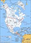 The third-largest continent on earth, it lies mostly between the Arctic Circle and the Tropic of Cancer. It is almost completely surrounded by bodies of water, including the Pacific Ocean, the Bering Strait, the Arctic Ocean, the Atlantic Ocean, and the Caribbean Sea and Gulf of Mexico. Area: 9,361,791 sq mi (24,247,039 sq km). Population (2001 est.): 454,225,000. Shaped like an inverted triangle, North America was apparently the first continent to achieve its current approximate size and shape. Its geologic structure is built around a stable platform of Precambrian rock called the Canadian Shield. To the southeast are the Appalachian Mountains and to the west are the younger and much taller Cordilleras. These mountains extend the length of the continent and occupy about one-third of the total land area. The Rocky Mountains constitute the eastern Cordillera. The highest point is Mount McKinley. The Mississippi River basin, including its major tributaries, the Missouri and Ohio, occupies more than one-eighth of the continent's total area. Generally temperate climatic conditions prevail. Arable land accounts for about one-eighth of the land area and forests for about one-third. English, the primary language of the U.S., predominates, followed by Spanish; French is spoken in parts of Canada. Most of the continent's population of European descent is found in the U.S. and Canada. Intermarriage between whites and Indians was common in Mexico, and mestizos constitute about three-fifths of the Mexican population. North America has a mixture of developed, partly developed, and developing economies, adequate reserves of most metallic resources, and the world's largest reserves of cadmium, copper, lead, molybdenum, silver, and zinc. It is the world's leading food producer, largely because of mechanized and scientific farming in the U.S. and Canada. Among the continent's democratically governed states are Canada, Mexico, Costa Rica, and the U.S. The nations of North America have sought hemispheric unity as members of the Organization of American States, which also includes South American countries. They also sought stronger economic ties, and in 1992 Canada, the U.S., and Mexico signed the North American Free Trade Agreement (NAFTA), which called for the elimination of most tariffs and other trade barriers between the three countries. The first inhabitants were American Indians, who migrated from Asia about 20,000 years ago. The greatest pre-Columbian civilizations were in Mesoamerica (see Mesoamerican civilization) and included the Olmec, Maya, Toltec, and Aztec, who were conquered by the Spanish. The continent long remained sparsely settled and undeveloped. Beginning in the 17th century it underwent a profound transformation with the coming of Europeans and the Africans they introduced as slaves. The style of life became Latin American south of the Rio Grande and Anglo-American to the north, with enclaves of French culture in Canada and Louisiana. Slavery, practiced in the 16th–19th centuries, added a significant minority culture of African origin, especially in the U.S. and the Caribbean (see West Indies). The huge industrial economy of the U.S., its abundant resources, and its military strength give the continent considerable global influence.
* * *
▪ 1998IntroductionNorth America.The National Hockey League (NHL) season for 1996-97 saw the Detroit Red Wings win the Stanley Cup for the first time in 42 years. But the long-awaited fan celebration ended three days after the Wings' victory parade when a limousine crash left defenseman Vladimir Konstantinov hospitalized and fighting for his life with a critical head injury. The crash similarly injured Sergey Mnatsakanov, the Red Wings' masseur, and hurt defenseman Vyacheslav Fetisov.A key event in the Red Wings' championship season occurred on Oct. 9, 1996, when the franchise made a bold trade and acquired left wing Brendan Shanahan and defenseman Brian Glynn from the Hartford Whalers for Paul Coffey, centre Keith Primeau, and a number one draft choice. Shanahan's impact on the Red Wings was immediate. He was named an alternate captain, helped the team to a 2-0 victory over Edmonton in his Detroit debut, and went on to lead the club in scoring with 88 points on 47 goals and 41 assists. Shanahan also recorded consecutive hat tricks (three-goal games) against Pittsburgh and San Jose. Among other milestones, Wings coach Scotty Bowman (see BIOGRAPHIES (Bowman, William Scott )) reached his 1,000th NHL victory on Feb. 8, 1997, when Detroit outlasted Pittsburgh 6-5 in overtime, and Sergey Federov, one of five Russians on the roster, scored five goals in an overtime win against Washington.In the 82-game season contested by the NHL's 26 teams before the play-offs began, the division winners were defending champion Colorado, which compiled the league's highest total for victories (49) and points (107), Dallas (104), New Jersey (104), and Buffalo (92). They led the 16-team field into the play-offs.Like the Red Wings, the Philadelphia Flyers made amends for a lengthy streak of disappointing seasons by reaching the Stanley Cup final series for the first time since 1974-75. The Flyers moved through the play-offs to the Eastern Conference championship by defeating the Pittsburgh Penguins, Buffalo Sabres, and New York Rangers, in that order, all by four games to one. Detroit had a more competitive struggle on its way to the Western Conference title. The Red Wings ousted the St. Louis Blues four games to two and defeated the Anaheim Mighty Ducks 4-0, three of the games being decided in overtime. A remarkable defensive effort enabled the Wings to outshoot the Ducks 232-131 in a series that was a prelude to a redemptive four-games-to-two victory over the Colorado Avalanche—the team that had knocked Detroit out of the play-offs one year earlier.Detroit's combination of speed, power, and stifling defense proved an insoluble problem for Philadelphia as the final series evolved into a startling mismatch. It produced the 19th series sweep in Stanley Cup history and the Flyers' first four-game losing streak since 1994. The Red Wings never trailed after any period in the series, thanks to the play of goalie Mike Vernon, who limited the opposition to two or fewer goals in 17 of 20 play-off games. The Red Wings won the first two games in Philadelphia by identical 4-2 scores and routed the Flyers 6-1 when the series moved to Detroit for game three. On June 7 in Detroit, before a crowd of 19,983 at Joe Louis Arena, the Red Wings took the decisive fourth game 2-1 as Vernon stopped 26 of 27 shots. The series proved a major embarrassment to centre Eric Lindros, the Flyers' team captain, who scored only one goal during the Wings' sweep, and to his coach, Terry Murray, who was fired six days after it ended.Vernon won the Conn Smythe Trophy as the most valuable player in the Stanley Cup, and Dominik Hasek of Buffalo took the Vezina Trophy for goaltending during the regular season. Hasek also won the Hart Trophy as the regular season's most valuable player and added a dubious entry to his résumé by drawing a three-game suspension and $10,000 fine—the year's most severe punishment—for assaulting a reporter. Mario Lemieux of Pittsburgh, in his final NHL season, won the Ross Trophy as the league's highest scorer (122 points).Brian Leetch of the Rangers won the Norris Trophy as the outstanding defenseman, and Mike Peca of Buffalo won the Selke Trophy as the best defensive forward. The Lady Byng Trophy for good sportsmanship went to Paul Kariya of Anaheim for the second straight season, and defenseman Bryan Berard of the New York Islanders took the Calder Trophy as the season's top rookie. The Jack Adams Award for the outstanding coach went to Ted Nolan of Buffalo, who nevertheless was fired.Off the ice, the NHL announced plans to become a 30-team league with the addition of expansion franchises in Nashville, Tenn. (starting in 1998-99), Atlanta, Ga. (1999-2000), and Columbus, Ohio, and Minneapolis-St. Paul, Minn. (2000-2001).RON REIDInternational.In the 61st world ice hockey championship, contested by 36 nations, Dean Evason and Owen Nolan of Canada scored the vital goals against Sweden to capture their nation's 21st title at the Pool A tournament in Helsinki, Fin., in May. It was Canada's second victory in four years and the third time in five years that the Swedes had had to settle for the silver medal. The first final to be decided in a best-of-three series, it reached a climax in a tension-filled third game.The two finalists had played one another in one of the two initial groups. At that time Sweden cruised to a 7-2 victory and then went on to win the six-team group without defeat, with Canada second and the United States third. The three qualified for the medal round along with the top three in the other group, the Czech Republic, Finland, and Russia. Sweden again beat Canada in the medal round, but the Canadians, with teamwork steadily improving, proved a clear second best, ahead of the Russians and Czechs.Sweden won the first game of the best-of-three final 3-2 but lost 3-1 in the second game, setting the stage for a nail-biting finale. Evason, the Canadian captain and the only member of the team without a National Hockey League contract, put the puck home from the edge of the crease to open the scoring in the 19th minute. Two minutes into the second period, a pass from Travis Green found Nolan perfectly placed to slide in what proved to be the winning goal. From then on, Canada's confidence was brimming over. Sweden could make little impression until, with a little over a minute left, Michael Nylander scored a goal in a feverish late onslaught, but Canada held on for a hard-earned 2-1 victory. It came as no surprise when Canada's Sean Burke and Sweden's Tommy Salo were voted the top two goalies in the tournament.The Czechs beat the Russians 4-3 for the bronze medal, with Finland fifth and the U.S. sixth, followed by Latvia, Italy, Slovakia, France, Germany, and Norway, the latter failing to win a single game. Attendance exceeded 13,000 for each of the 13 major matches at Helsinki's new Hartwell Arena. The top 11 teams qualified automatically for the 1998 Pool A tournament in Switzerland, but because this had been expanded from 12 to 16 teams, they were to be joined by Belarus (1997 Pool B winners), Switzerland (the host nation), Japan (as best Far East team), and the two leaders of a qualifying tournament to be held between Norway, Kazakstan, Austria, and Poland.Belarus won all of its seven games in the Pool B tournament in Poland; Ukraine topped Slovenia at the head of Pool C in Estonia; and Croatia triumphed over South Korea in Pool D in Andorra. Vacancies left by the expansion of Pool A enabled the promotion of Ukraine, Slovenia, and Estonia from Pool C to B and of Croatia, South Korea, Spain, and Yugoslavia from Pool D to C.The 20th European Cup, open to national club champions, was won by Lada Togliatti of Russia, which defeated Modo Domsjö of Sweden 4-3 in the final at Oberhausen, Ger. Düsseldorfer from Germany took the bronze medal. A new interclub European League consisting of 20 teams from 12 nations was won by TPS Turku of Finland. A projected revamped format for 1998 would allow the league to replace the European Cup as the sport's major competition in Europe. It had taken more than 20 years to develop the league, and subsequent further enlargement was envisioned, with the possible addition of North American participation.Canada defeated the U.S. 4-3 in the final of the fourth women's world ice hockey championship at Kitchener, Ont. Finland finished third. Six nations qualified for the first women's Olympic Games tournament at Nagano, Japan, in 1998.HOWARD BASS* * *
Introductionthird largest of the world's continents, lying for the most part between the Arctic Circle and the Tropic of Cancer (Cancer and Capricorn, Tropics of). It extends for more than 5,000 mi (8,000 km) to within 500 mi (800 km) of both the North Pole and the Equator and has an east-west extent of 5,000 mi. It covers an area of 9,355,000 sq mi (24,230,000 sq km).North America occupies the northern portion of the landmass generally referred to as the New World, the Western Hemisphere, or simply the Americas. Mainland North America is shaped roughly like a triangle, with its base in the north and its apex in the south; associated with the continent is Greenland, the largest island in the world, and such offshore groups as the Arctic Archipelago, the Bahamas (Bahamas, The), the Greater (Greater Antilles) and Lesser Antilles, the Queen Charlotte Islands, and the Aleutian Islands.North America is bounded on the north by the Arctic Ocean, on the east by the North Atlantic Ocean, on the south by the Caribbean Sea, and on the west by the North Pacific Ocean. To the northeast Greenland is separated from Iceland by the Denmark Strait, and to the northwest Alaska is separated from the Asian mainland by the much narrower Bering Strait; North America's only land connection is to South America at the narrow Isthmus of Panama (Panama, Isthmus of). Mount McKinley (McKinley, Mount) in Alaska, at 20,320 ft (6,194 m) above sea level, is the continent's highest point; and Death Valley in California, at 282 ft (86 m) below sea level, is its lowest. North America's coastline of some 37,000 mi (60,000 km)—the second longest of the continents after Asia—is notable for the great number of indentations, particularly in the northern half.The name America is derived from that of the Italian merchant and navigator Amerigo Vespucci (Vespucci, Amerigo), one of the earliest European explorers to visit the New World. Although at first the term America was applied only to the southern half of the continent, the designation soon was applied to the entire landmass; those portions that widened out north of the Isthmus of Panama became known as North America, and those that broadened to the south became known as South America. According to some authorities, North America begins not at the Isthmus of Panama but at the narrows of Tehuantepec (Tehuantepec, Isthmus of), with the intervening region called Central America. Under such a definition, part of Mexico must be included in Central America, although that country lies mainly in North America proper. To overcome this anomaly, the whole of Mexico, together with Central and South American countries, also may be grouped under the name Latin America, with the United States and Canada referred to as Anglo-America. This cultural division is a very real one; yet Mexico and Central America (including the Caribbean) are bound to the rest of North America by strong ties of physical geography. Greenland also is culturally divided from, but physically close to, North America.North America contains some of the oldest rocks on the Earth. Its geologic structure is built around a stable platform of Precambrian rock called the Canadian (Laurentian) Shield. To the southeast of the shield rose the ancient Appalachian Mountains; and to the west rose the younger and considerably taller Cordilleras, which occupy nearly one-third of the continent's land area. In between these two mountain belts are the generally flat regions of the Great Plains in the west and the Central Lowlands in the east.The continent is richly endowed with natural resources, including great mineral wealth, vast forests, immense quantities of fresh water, and some of the world's most fertile soils. These have allowed North America to become one of the most economically developed regions in the world, and its inhabitants enjoy a high standard of living. North America has the highest average income per person of any continent and an average food intake per person that is significantly greater than that of other continents. Although it is home to less than 10 percent of the world's population, its per capita consumption of energy is almost four times as great as the world average.North America's first inhabitants are believed to have been ancient Asiatic peoples who migrated from Siberia to North America sometime during the last glacial advance, known as the Wisconsin Glacial Stage, the most recent major division of the Pleistocene Epoch (about 1,800,000 to 10,000 years ago). The descendants of these peoples, the various Indian and Eskimo groups, largely have been supplanted by peoples from the Old World. People of European ancestry constitute the largest group, followed by those of African and of Asian ancestry; in addition there is a large group of Latin Americans, who are of mixed European and Indian ancestry.James Wreford Watson Ed.This article treats the physical and human geography of North America. For discussion of individual countries of the continent, see the articles Canada, Mexico, and United States of America (United States). See also coverage of North American regions under the titles West Indies and the individual countries of Central America. For discussion of major cities of the continent, see specific articles by name—e.g., Mexico City, New York City, and Toronto. For discussion of the indigenous peoples of the continent, see the articles Native American and pre-Columbian civilizations. The principal treatment of North American historical and cultural development is contained in the articles mentioned above and in the article Latin America, history of. For further discussion of arts and literature, see the articles American literature, Native American arts (Native American art), Canadian literature, and Latin American literature.Geologic history (North America)General considerationsContinents (continent) have collided and broken apart repeatedly over geologic time. When they separate, new ocean basins develop between the diverging pieces through the process of seafloor spreading (seafloor spreading hypothesis). Spreading, which originates at oceanic ridges, is compensated (to conserve surface area on the planet) by subduction—the process whereby the seafloor flexes and sinks along inclined trajectories into the Earth's interior—at deep-sea trenches. Closure of ocean basins by subduction of the seafloor results in continental collisions.The material moved laterally from spreading ridges to subduction zones includes plates of rock up to 60 mi (100 km) thick. This rigid outer shell of the Earth is called the lithosphere, as distinct from the underlying hotter and more fluid asthenosphere. The portions of lithospheric plates descending into the asthenosphere at subduction zones are called slabs. The many lithospheric plates that make up the present surface of the Earth are bounded by an interlinking system of oceanic ridges, subduction zones, and laterally moving fractures known as transform faults. Over geologic time the system of plate boundaries has continually evolved as new plates have formed, expanded, contracted, and disappeared.The outermost layer of the lithosphere is called the crust. It is composed of low-density material crystallized from molten rock (magma) produced by partial melting of the lithosphere or asthenosphere. The average thickness of the oceanic crust is about 4 mi (6.4 km). Oceanic plateaus (oceanic plateau) and seamounts (seamount) are localized areas of abnormally thick oceanic crust that have resulted from submarine volcanism promoted by hot jets of magma, or plumes, rising from deep within the Earth's interior (i.e., from the mantle). Oceanic crust is transient, being formed at the oceanic ridges and destroyed at the trenches. It has a mean age of about 60 million years.Continental crust is thicker, 22 mi (35 km) on average and less dense than oceanic crust, which accounts for its mean surface elevation of about 3 mi (4.8 km) above that of the ocean floor (Archimedes' principle). Continental crust is more complex than oceanic crust in its structure and origin and is formed primarily at subduction zones. Lateral growth occurs by the addition of rock scraped off the top of oceanic plates as they are subducted beneath continental margins. Such margins are marked by lines of volcanoes, often in volcanic arcs, that form additions to the crust—the result of partial melting of the wedge of the asthenosphere situated above the descending slab and below the continental plate (melting is promoted by the release of water from the slab, which lowers the melting point in the wedge). Subduction zones (subduction zone) located within ocean basins (where one oceanic plate descends beneath another) also generate volcanic arcs; these are called island arcs (island arc). Island arcs consist of materials that tend to be transitional between oceanic and continental crust in both thickness and composition. The first continents appear to have formed by accretion of various island arcs.Continental crust resists subduction. Consequently, the mean age of the continents is almost two billion years, more than 30 times the average age of the oceanic crust. Thus, continents are the prime repositories of information concerning the Earth's geologic evolution, but understanding their formation requires knowledge of processes in the ocean basins from which they evolved.Tectonic (plate tectonics) frameworkStructural planNorth America is somewhat unusual among the continents in having stable interior lowlands of great antiquity that are almost completely enclosed by younger orogenic belts (belts of former or actual mountain ranges resulting from crustal deformation related to subduction or continental collision). These lowlands include the Canadian (Laurentian) Shield and an interior platform of crystalline rock that is covered by a veneer of virtually flat-lying sedimentary rock.The continent's peripheral orogenic belts originated at plate boundaries. They are of Paleozoic (Paleozoic Era) age (about 540 to 250 million years ago) in the east and Mesozoic (Mesozoic Era) to Cenozoic (Cenozoic Era) age (about 250 million years ago to the present day) in the west. These belts are partly covered, and locally breached, by coastal plain sediments of the Arctic Ocean in the north, the Gulf of Mexico in the south, and relatively young volcanic fields in the west. A gap in the Paleozoic orogenic belts between the Appalachian Mountains of Newfoundland and the East Greenland Caledonides is a consequence of seafloor spreading along a failed arm of the Mid-Atlantic Ridge, which later stepped eastward to separate the Appalachians and the Greenland Caledonides from the European Caledonides.The Canadian ShieldThe Canadian Shield is the principal area of North America where rocks of Precambrian (Precambrian time) age (i.e., those that are more than about 540 million years old) are exposed at the surface. The shield was rifted apart between Canada and Greenland by seafloor spreading in the Labrador Sea and in Baffin Bay between 90 and 40 million years ago. The rift subsequently moved to the east of Greenland, forming the Reykjanes Ridge that now separates the North American plate from the European plate. The Greenland Shield is largely ice-covered. At intervals during the past 2.5 million years, the Canadian Shield was also a centre of glacial ice accumulation from which continental ice sheets advanced southward repeatedly.The shield is an aggregate of at least four discrete continents that were fused together between about 2.0 and 1.8 billion years ago. Three of the constituent continents behaved as relatively rigid dies, called cratons (craton), on which the adjoining cratons were molded during their mutual aggregation; the Slave craton lies to the northwest, the Nain craton to the northeast, and the Superior craton to the south of the intervening nonrigid Churchill province, which may be composite in origin. The structural grain of the cratons is truncated at their margins, suggesting that they originated by the fragmentation of larger continents that formed more than 2.6 billion years ago. Small remnant basins of essentially flat-lying Precambrian sedimentary rocks are arbitrarily included in the shield because of their age, although they have more in common structurally with the interior platform and basins.Interior platform and basinsNearly horizontal strata of sedimentary rocks overlie Precambrian crust that extends beyond the limits of the Canadian Shield. The sedimentary cover is less than a mile thick on the platform, but it increases to about 2.5 mi (4 km) in the Hudson Bay, Michigan, Williston, and Illinois sedimentary basins and to 4 mi (6 km) and more in troughs adjacent to the peripheral orogenic belts. The sedimentary rocks provide sensitive records of differential basement subsidence, the geomorphic evolution of the peripheral orogenic belts, fluctuations of sea level, and climatic changes related in part to latitudinal continental drift.Paleozoic (Paleozoic Era) orogenic beltsErosional remnants of ancient mountain ranges occur along the eastern, northern, and southern margins of the continent. The mountains were formed mainly between 400 and 300 million years ago, when North America collided with other continents to form the ancient supercontinent of Pangaea (Pangea). The Ouachita Orogen (Ouachita orogeny) (mountain chain) formed when the south-facing margin of North America collided with South America, the Appalachian Orogen (Appalachian orogenic belt) when the southeast-facing margin collided with northwestern Africa, the Caledonian Orogen (Caledonian orogenic belt) when the northeast-facing margin collided with northwestern Europe, and the Franklinian Orogen when the Arctic margin collided with crust that now underlies the Barents shelf off northern Europe and Alaska north of the Brooks Range. The portions of the orogenic belts next to the continental interior are composed mainly of folded sedimentary rocks indigenous to North America. The parts closer to the modern oceans are more diverse and include rock masses that originated outside the continent. A striking observation from paleogeographic reconstructions is that the present-day ocean basins opened along lines near the lines of closure of the preceding Paleozoic oceans.Passive continental marginsSediments and rocks younger than 200 million years are draped across the rifted eastern, northern, and southern margins of the continent. These rifted margins extend out under the ocean as the shallow continental shelf—an important area for fisheries—and were formed when the Atlantic and Arctic oceans and the Gulf of Mexico began to open. Rivers transported great quantities of sediment to the Gulf of Mexico and the Arctic Ocean. In both areas the resulting sediments are now pierced from below by fingerlike masses of salt, called salt domes, that often are many miles in diameter. In the Arctic, sediments older than about 40 million years were crumpled during the counterclockwise rotation of Greenland as it drifted away from northeastern Canada. Sediments deposited along the Atlantic margins of North America lie mostly underwater.The youngest mountain ranges (the Cordilleras) formed along the western margin of the continent and around the Caribbean Sea. The development of the Cordilleras occurred mainly after the Atlantic Ocean began to open and North America started drifting westward over the floor of the Pacific Ocean, about 180 million years ago. As a result, sedimentary and volcanic rocks were sheared off the Pacific Plate that was being subducted and were accreted to the leading (western) edge of the continent (so-called suspect terranes). Simultaneously, volcanic arcs formed inland of the continental margin. For about 30 million years North America has been overriding the East Pacific Rise, a centre of seafloor spreading, resulting in a fundamental segmentation of the Cordilleras. As the seafloor west of the spreading axis moves sideways (northward) relative to North America, those segments of the continental margin that have crossed the spreading ridge (i.e., California and northwestern Canada) are characterized by faults (the San Andreas (San Andreas Fault) and Queen Charlotte) with right-lateral displacements and by the absence of trenches or volcanic arcs.The present Caribbean Sea floor originated as a submarine plateau in the eastern Pacific basin. For about 80 million years it has progressively penetrated the gap formed earlier by the separation of the North and South American plates. As the two plates (including the western Atlantic) drifted westward, subduction and arc volcanism occurred along the eastern margin of the Caribbean, and the northern and southern margins of the Caribbean were sheared and dismembered. Arc volcanism in Central America is related to subduction of the Pacific Ocean floor at the Middle America Trench off the region's Pacific coast; it is mirrored by subduction of the Atlantic floor beneath the Lesser Antilles volcanic arc.Cenozoic volcanic fieldsvolcanism in the Cenozoic Era (i.e., roughly the past 65 million years) is related to subduction-zone processes, mantle plumes, and crustal stretching. Volcanic arcs occur in the Lesser Antilles, Central America, Mexico, the Cascade Range, the Gulf of Alaska, and the Aleutian Islands. Vast areas of Mexico, New Mexico, and Colorado east of the main volcanic arc were blanketed by volcanic ash flows between 38 and 28 million years ago. Lines (or tracks) of volcanic activity that become older from east to west may emanate from melting sites, or hot spots, beneath the drifting continental plate. The Anahim volcanic belt of central British Columbia and the Snake River lava plain of Idaho are examples of such tracks. The Yellowstone caldera marks the active eastern end of the Snake River track. The Columbia Plateau basalts of Oregon and Washington, which are 14 to 17 million years old, resemble lava floods associated with the establishment of mantle plumes. Flood basalts in coastal and offshore eastern Greenland are related to the separation of Greenland and northwestern Europe under the influence of the Iceland mantle plume about 68 million years ago. Lavas in coastal areas of western Greenland are related to the separation of Greenland from Baffin Island. The Basin and Range Province, a vast area of crustal stretching in the western United States, contains numerous relatively small volcanic fields, mostly less than about 15 million years in age.Tectonic evolutionNorth America is an ancient continent in several respects. It contains some of the oldest rocks on the Earth, its interior has been stable for the longest period of time, and it was the first continent to achieve approximately its present size and shape. Although its known geologic history spans almost 4 billion years, two ages stand out as turning points. The first was about 1.8 billion years ago, when several continental fragments coalesced to form the stable crust underlying the Canadian Shield and northern interior platform. The second occurred about 600 million years ago, when fragmentation of ancestral North America created the continental margins along which the peripheral orogenic belts developed. It was then that the present size and shape of the continent was determined.4.6 to 3.0 billion years agoThe oldest rocks in the world occur in the Canadian Shield. Their ages have been calculated from precisely measured ratios of the radioactive decay of trace amounts of certain isotopes in the rock sample. The ratio of neodymium and samarium was used to estimate the age of the faux amphibolite volcanic deposits of the Nuvvuagittuq greenstone belt in Quebec, Canada. These rocks are estimated to be 4.28 billion years old. In addition, a similar uranium-lead technique revealed that the Acasta gneisses, which occur southeast of Great Bear Lake in the northwestern corner of the shield, were at least 3.8 billion (and possibly up to 3.96 billion) years old. In the northeastern part of the shield, rocks as old as 3.8 billion years are found on the formerly contiguous coasts of western Greenland and Labrador. Rocks in the Minnesota River valley, near the southern limit of the shield southwest of Lake Superior, range in age up to 3.66 billion years. There are many occurrences of rocks between 3.5 and 3.0 billion years old, but, like the older rocks, none are known to be more than a few tens of square miles in extent. The compositional range of the old rocks is essentially the same as that of much younger rocks, implying similar processes of formation.3.0 to 2.6 billion years agoThe interval between about 3.0 and 2.6 billion years ago was one of rapid crustal growth in North America, during which most of the Canadian Shield and the crust beneath the northern Great Plains was formed. In any given region, relatively thin primeval oceanic crust evolved into thick continental crust over a period of about 50 million years. The repeated melting and resolidification of this crust led to progressive vertical differentiation as lighter components separated from heavier ones and were distributed at the top. As the thickened crust emerged above sea level, it was stripped by erosion and redeposited in adjacent depressions as detrital sediment. As exposed in the Canadian Shield, the thickened crust consists of many varieties of granitic intrusions separated by belts of folded and faulted volcanic and sedimentary rocks. These deformed rocks are known as “greenstone belts” and contain economically viable concentrations of gold, silver, copper, zinc, and lead. Regional geologic mapping and isotope dating indicate that the processes of crustal thickening tended to occur incrementally in zones a few tens of miles wide and many hundreds of miles long. The overall process of crustal transformation has much in common with activity associated with plate convergence, where oceanic volcanic arcs and derived sedimentary rocks are accreted onto the leading edge of the overriding plate and later are intruded by magmas generated in the mantle above the subducted plate.2.6 to 2.0 billion years agoThe continental crust that had been assembled by about 2.6 billion years ago soon began to break up into continental fragments. The largest of these fragments forms the Superior province, which is located in the south-central part of the Canadian Shield and is some 1,500 mi (2,400 km) wide. The Slave province (300 mi [480 km] wide) and the Nain province (500 mi [800 km] wide) are located in the northwestern and northeastern parts of the shield, respectively. Between these three provinces is the sprawling Churchill province—which may be a composite of four or more individual fragments named the Wyoming, Hearne, Rae, and Burwell subprovinces. The process of continental breakup began about 2.45 billion years ago along the southern margin of the Superior province, producing extensive sets of parallel dikes (vertical sheets of crystallized intrusive magma) and rift valleys containing lavas with chemical compositions characteristic of plates undergoing horizontal stretching. Following continental separation, sediments accumulated on subsiding continental shelves. (The shelf sediments, deposited about 2.4 billion years ago, are particularly significant in that they contain discrete layers strewn with boulders dropped from shelf ice, implying that seawater then had a temperature range similar to that of the present.) Continental fragmentation continued episodically until about 2 billion years ago. During this period an unusual sedimentary deposit consisting mostly of alternating iron-rich minerals and chert—banded iron formations—accumulated in the area south of Lake Superior, in Wyoming, and in Labrador. Similar deposits of like age are found on other continents, and they form the principle source of iron ore today. Because it is difficult to track the drift of continental fragments of such antiquity, it is not known how many parent continents are represented by the fragments now located in North America. Striking similarities between contemporaneous shelf sediments on the southern margins of the Wyoming and Superior provinces and between the crust of the Superior and Hearne provinces, however, suggest that they originally may have been juxtaposed.2.0 to 1.8 billion years agoThe continental fragments constituting interior North America coalesced between about 2.0 and 1.8 billion years ago. The amalgamation began about 1.97 billion years ago, when the Slave province collided obliquely with the western Churchill province. The collision produced the Thelon orogenic belt, which stretches from central Alberta to the northwestern corner of Greenland. About 1.85 billion years ago the Superior province collided with the southern Churchill province to form the bowlike Trans-Hudson orogenic belt, the crest of which underlies Hudson Bay. The zonation of the Trans-Hudson belt is typical of collision zones: granitic rocks representing the eroded roots of a continental volcanic arc occur along the Churchill province margin, the medial zone comprises relics of oceanic island arcs, and the Superior province margin is characterized by shelf sediments overthrust by slivers of oceanic crust. The Nain province had already collided obliquely with the eastern Churchill province about 1.82 billion years ago, forming the Torngat Mountains, which parallel the coast of northern Labrador. All three collisions were preceded by subduction of oceanic plates beneath the Churchill province. Consequently, the Churchill province experienced much more magmatism, metamorphism, and deformation in this interval than did the Slave, Superior, or Nain provinces.The external margins of the composite protocontinent also were active between 1.9 and 1.8 billion years ago. Volcanic island arcs were accreted to the western margin of the Slave province, forming the Wopmay Orogen; to the southern margin of the Superior province, forming the Penokean Orogen; and to the southeastern margin of the Nain province, forming the Ketilidian Orogen. Thus, what is now the stable interior of the continent was, about 1.85 billion years ago, laced with great mountain ranges. In the following 50 million years all but the southern part of the interior platform had coalesced into a craton that has changed little since.1.8 to 1.6 billion years agoThe buried crust underlying the southern part of the interior platform was accreted immediately after the continental fragments to the north had coalesced. This younger crust in the interior platform has been sampled by oil drilling. It extends westward beneath the Colorado Plateau of western Colorado and eastern Utah and the surrounding Cordilleras and eastward into parts of the younger Grenville and Appalachian orogenic belts. This crust is much like that formed earlier in the shield: diverse granitic bodies intrude altered and deformed volcanic and derived sedimentary rocks. The rocks are believed to have originated in oceanic volcanic island arcs between about 1.8 and 1.7 billion years ago. They were accreted piecemeal to the protocontinent to the north and then subjected to regional northwest-southeast compression between about 1.7 and 1.6 billion years ago. This event, called the Mazatzal orogeny, may be related to a collision between ancestral North America and an unknown continent to the south, and it concluded the main accretionary stage of North America.1.6 to 1.3 billion years agoHundreds of granitic and subordinate basaltic magma bodies were emplaced in a broad zone from southeastern California to the coast of Labrador about 1.6 to 1.3 billion years ago. The magmas were generated by repeated partial melting in the crust and mantle over a period of about 250 million years. In Labrador, where the magmas are best exposed, they form large, subcircular intrusive bodies, called batholiths (batholith), that are up to 95 mi (150 km) in diameter and 6 mi (10 km) thick. The magmatism was most profuse in the new crust of the southern interior platform, which was blanketed by up to 4 mi (6 km) of volcanic ash flows derived from the partial melting of the lower crust.This magmatism seems not to have been induced by deformation of the continental plate but may have been a consequence of hot mantle upwelling beneath the plate. (A similar style of magmatism occurred from 300 to 150 million years ago in new crust near the active southern margin of the supercontinent Pangaea. Heat buildup beneath the stationary supercontinent induced a large-scale upwelling from the mantle that ultimately contributed to supercontinental breakup. By analogy, North America may have been part of an earlier supercontinent between about 1.6 and 1.3 billion years ago.)A thick sedimentary prism exposed in the northwestern corner of the Canadian Shield and the adjacent Cordilleras may mark a contemporaneous continental margin. To the south a series of localized basins developed in what is now the Rocky Mountains. The Belt Basin, centred in Idaho and western Montana, contains large base-metal ore bodies embedded in sediments up to 12 mi (19 km) thick. It originated as an enclosed basin floored by highly stretched continental crust or trapped oceanic crust, which is analogous to the structure found in the present-day Black Sea.1.3 billion to 950 million years agoThe interval between about 1.3 billion and 950 million years ago began with continental rifting and culminated in the Grenville orogeny along the southeastern margin of the continent. Northwest-trending dikes were intruded in a short interval of time across the entire northwestern half of the Canadian Shield 1.27 billion years ago. The dikes radiate from the northwestern corner of the shield, which was flooded by mantle-derived lava. Lava fields and fault-bounded sedimentary basins also formed in northern Baffin Island and in northeastern and northwestern Greenland. These deposits signify rifting that may have accompanied the opening of an ocean basin to the northwest. The closure of that basin may be recorded by southeast-directed thrust faulting in some of the same deposits. In the southeastern shield, from the Great Lakes to southern Greenland, rift-related magmatism began about 1.33 billion years ago and continued episodically for about 230 million years, when mantle-derived lava up to 16 mi (26 km) thick flooded the 800-mi- (1,280-km-) long Midcontinent Rift that arcs through western Lake Superior. These lava flows constituted a large copper ore source in Michigan for much of the 20th century; mining has since ceased in this area. The short time span and large volume of magma effused suggest that hot mantle plume heads impinged on the base of the North American Plate in northwestern Canada and Lake Superior about 1.27 and 1.10 billion years ago, respectively.The Midcontinent Rift developed contemporaneously with northwest-directed crustal-scale thrusting in the Grenville orogenic belt. The belt is exposed principally along the southeastern margin of the Canadian Shield, but inliers occur in the Appalachians, the East Greenland Caledonides, Texas, and Mexico. It has been traced at depth across the eastern and southern fringes of the interior platform. Thrusting occurred mainly between about 1.15 and 1.05 billion years ago and caused a doubling in the thickness of the crust, the rise of great mountains, and the exhumation of rocks altered under midcrustal conditions of elevated temperature and pressure. Sediment eroded from the Grenville orogenic belt was carried away by rivers and deposited in what is now the western Arctic platform and the northern Canadian Cordillera. The northwestern part of the Grenville belt consists of crust that belonged to the continent before thrusting began; the southeastern part comprises slices of crust formed offshore between about 1.5 and 1.3 billion years ago and accreted to the continent at the time of Grenvillian thrusting. The orogenic belt presumably records collisions between eastern North America and other continents and belongs to a contemporaneous system of orogenic belts that is represented on other continents. The collisions are thought to be related to the amalgamation of a new supercontinent called Rodinia.950 to 600 million years agoBetween about 950 and 600 million years ago, renewed rifting led to continental breakup along the north-facing (Franklinian), northeast-facing (Caledonian), southeast-facing (Appalachian), south-facing (Ouachita), and west-facing (Cordilleran) margins of North America. Rifting began about 780 million years ago in the Cordilleras and somewhat later on the other margins. It was accompanied by deposition of thick, laterally continuous wedges of sediment, sporadic volcanism, and intrusive magmatism. The sediments typically include glacial deposits and contain the first soft-bodied animal fossils. The identities and former positions of the continents that drifted away from North America are subjects of much speculation: the Cordilleran margin may have been juxtaposed with Australia and eastern Antarctica, the Ouachita margin with southern Africa, the Appalachian margin with western South America, and the Caledonian and Franklinian margins with northwestern Europe and Siberia.Paleozoic and early Mesozoic time600 to 250 million years agoFollowing continental breakup, lithospheric cooling caused the rifted margins to subside, which—combined with a concomitant global rise in sea level—resulted in extensive flooding of continental shelves. A sheet of sandstone was deposited below these advancing waters as the shoreline was pushed far into the continental interior. As sources of sand retreated, the then-equatorial continent became framed by broad, shallow shelves on which limestones thousands of feet thick accumulated. Shallow-shelf conditions were interrupted by the accretion of volcanic island arcs or continental fragments, culminating about 300 million years ago when Laurentia collided with the southern hemispheric continent of Gondwana (Gondwanaland (Gondwana)) to form the supercontinent Pangaea (Pangea).The first collision occurred between about 470 and 460 million years ago, when a volcanic arc collided with and deformed the Appalachian margin (the Taconic orogeny). Younger volcanic arcs, some built on strips of crust that originated on the northwestern margin of Gondwana, then drifted northward and were accreted to the Appalachian margin between about 450 and 410 million years ago (the Acadian orogeny). Simultaneously, the continent Baltica (consisting of the Baltic Shield and the Russian platform) collided with Laurentia to form the Caledonian orogenic belt of eastern Greenland and Norway. In the northern continental interior a zone of crustal shortening of Caledonian age (about 420 to 400 million years ago) extends from the Boothia Peninsula of north-central Canada northward to the Arctic Ocean and southward to Hudson Bay. The Franklinian margin of Canada and Greenland was deformed between about 380 and 360 million years ago (the Ellesmerian orogeny), when northern extensions of the Caledonian orogenic belt were sheared westward to northern Ellesmere Island; these extensions occur as so-called exotic crustal fragments, all of which have histories that are more than 380 million years old and incompatible with the adjacent indigenous Franklinian margin.The early history of the Cordilleras is difficult to interpret because of later dismemberment, but volcanic arcs that formed mainly between about 380 and 360 million years ago were accreted to the continent from California to Alaska immediately thereafter. The resulting deformation (the Antler orogeny) was close in age to the Ellesmerian orogeny in the Arctic. The arcs formed on or near ancient continental crust (about 2.0 to 2.4 billion years old), but the origin of the material in these arcs is uncertain. By about 330 million years ago the northern Arctic islands of Canada had begun to subside; the resulting Sverdrup Basin would be the major repository of sediment carried by rivers draining the continental interior until the Gulf of Mexico formed some 150 million years later.In the southern Appalachians, deformation related to the amalgamation of Laurentia and Gondwana (the Alleghenian orogeny) also began about 330 million years ago. Relative northward motion of Gondwana caused its western promontory to override the Ouachita margin about 305 million years ago. The collision caused discontinuous crustal deformation (the ancestral Rocky Mountains) throughout the southwestern United States. By about 290 million years ago Gondwana was impinging to the northwest against the southern Appalachians, further complicating structures formed by the earlier collisions and producing a broad belt of new thrust faults and folds along the northwestern periphery of the orogenic belt. In the northern Appalachians broadly contemporaneous sideways faulting was caused by the lateral escape of crustal wedges from the area of continental indentation and later by a counterclockwise rotation of Gondwana relative to Laurentia about 270 million years ago. By that time another volcanic island arc had formed off the western margin of Laurentia and was accreted to the Cordilleras between about 260 and 240 million years ago (the Sonoma orogeny). Mountains resulting from crustal thickening in each of the aforementioned collision zones caused foreland basins to form on adjacent parts of the interior platform. These basins captured interior-bound sediment eroded from the mountains. Genetic links between the collisions and the ovoid basins of the continental interior (Michigan, Illinois, and Williston basins) are more tenuous.250 to 120 million years agoThe opening of the present-day Atlantic Ocean was presaged by rift faulting and related sedimentation on the eroded surface of the Appalachians beginning about 230 million years ago. The rifts were flooded by mantle-derived lavas about 200 million years ago and filled with red sandstones. Seafloor spreading began in the proto-Atlantic basin between about 180 and 160 million years ago, and sediment began to accumulate on the subsiding continental terrace. Simultaneously, rifting along the Ouachitas led to the separation of Yucatán, creating the Gulf of Mexico in its wake. Evaporation caused salt to precipitate on the floor of the enclosed Gulf of Mexico basin. Sediment carried by rivers draining the continental interior began to fill the basin from the north, a process that has continued to the present.After separating from Gondwana, Laurentia drifted westward, overriding the floor of the eastern Pacific basin. This was reflected in the Cordilleras by an upsurge in arc magmatism on the continental margin between about 180 and 140 million years ago. Thrust faulting and folding crumpled the sedimentary rocks to the east (the Sevier orogeny). In addition, former offshore island arcs and other oceanic crustal fragments were accreted to the advancing continental margin. The central part of the Cordilleras in Canada and Alaska was accreted piecemeal, also between about 180 and 140 million years ago, but there is disagreement as to whether the western part was accreted in the same interval or between about 110 and 70 million years ago (the two parts are separated by the deeply eroded granitic batholiths exposed in the Coast Mountains of British Columbia).Late Mesozoic and Cenozoic time120 to 30 million years agoAfter the opening of the Gulf of Mexico ceased, South America drifted away from Yucatán, creating a proto-Caribbean gulf that opened eastward into the Atlantic and was separated from the Pacific basin by an east-dipping subduction zone and related volcanic arc near the present location of Central America. Sometime between 80 and 60 million years ago, a large submarine plateau composed of unusually thick oceanic crust (possibly formed in the Pacific basin during initiation about 90 million years ago of a hot spot now located beneath the Galápagos Islands) arrived at the subduction zone opposite the proto-Caribbean gulf. Because the oceanic plateau was too buoyant to be subducted, it began to override the proto-Caribbean gulf, carrying the Antilles volcanic arc on its prow. The plateau—which now floors the Caribbean Sea—continued its penetration into the westward-drifting North and South American plates until the volcanic arc on its northeastern margin (the Greater Antilles) collided with the Bahamas limestone platform sometime between about 60 and 35 million years ago. This collision initiated a reorganization of Caribbean tectonics. The collision zone, notably the island of Cuba, was sheared off the Caribbean Plate and became fixed to the North American Plate. An east-dipping subduction zone was reestablished beneath Central America, detaching the Caribbean Plate from the Pacific. Continued subduction of the central Atlantic lithosphere beneath the eastern part of the Caribbean Plate gave rise to the Lesser Antilles volcanic arc.Meanwhile, seafloor spreading (seafloor spreading hypothesis) in the Atlantic basin moved northward: continental separation occurred at about 120 and 100 million years ago on the eastern and northern margins, respectively, of the Grand Banks of Newfoundland; about 90 million years ago in the Labrador Sea; and about 70 million years ago in Baffin Bay and eastern Greenland. Continental breakup in the northern North Atlantic about 70 million years ago was accompanied by voluminous volcanism related to inception of a mantle plume from a hot spot now centred beneath Iceland. Afterward, spreading was concentrated on the eastern side of Greenland along the Reykjanes Ridge. Spreading in the Labrador Sea and in Baffin Bay resulted in the counterclockwise rotation of Greenland around an axis near Devon Island in the Canadian Arctic islands. To the northwest the rotation of Greenland caused widespread folding and faulting of sediments in the Sverdrup Basin between about 70 and 35 million years ago (the Eurekan orogeny). In the western Arctic, far-northern Alaska was relocated from its former position adjacent to the Arctic margin of Canada. There is disagreement as to whether the relocation was accomplished through a counterclockwise rotation or a left-lateral shearing of Arctic Alaska relative to Arctic Canada. Separation of the two began about 92 million years ago and created the oceanic Amerasia basin in its wake.North America continued to override the Pacific basin, but tectonic activity in the Cordilleras varied in space and time according to the age, angle, obliquity, and relative velocity of the oceanic plates being subducted beneath the continental margin. From about 120 to 80 million years ago, the relative eastward motion of the Pacific floor resulted in crustal accretion and arc magmatism along the western continental margin. Thereafter, the inception of a new oceanic spreading ridge resulted in subduction with a strong northward component of motion in Canada and Alaska. Consequently, the main locus of accretion and arc magmatism shifted to southern Alaska, and strips of previously accreted crust were displaced northward along the western margin of Canada.In the western United States a broad region of crustal shortening developed as far east as the Rocky Mountains between about 80 and 50 million years ago (the Laramide orogeny). Simultaneously, arc magmatism ceased near the coast but migrated up to 600 mi (950 km) to the east. These effects are attributed to changes in the angle of the subducting slab, which became shallower, coincident with increased subduction velocity and the hypothesized subduction of a buoyant oceanic plateau. A sharp decrease in subduction velocity in the northwestern United States and adjacent Canada between about 60 and 50 million years ago coincided with an end to thrusting in the Rocky Mountains and an episode of crustal extension and melting to the west. In the southwestern United States and Mexico, crustal stretching and melting triggered extensive volcanism between about 40 and 30 million years ago and may have been caused by the collapse or thermal dissipation of the low-angle slab. In general, crustal extension was most evident in areas of earlier crustal thickening, a relationship which suggests that overthickened crust was susceptible to gravitational collapse when plate convergence slowed.30 to 2.5 million years agoAbout 30 million years ago North America began to override the East Pacific Rise, an oceanic spreading ridge. This activity placed a progressively longer segment of the coast in contact with the plate west of the ridge. The western plate—which contains the Pacific Coast Ranges of California—has been moving to the northwest relative to North America along the San Andreas Fault system. Active subduction and arc volcanism have been limited to the regions south (the Sierra Madre Occidental) and north (the Cascade Range) of the San Andreas system, which now extends from the Gulf of California in Mexico to Cape Mendocino in northern California. (An analogous gap in subduction and arc volcanism between northern Vancouver Island and the Gulf of Alaska is related to the Queen Charlotte Fault system.) To the east, crustal stretching and related volcanism has continued to shape the distinctive topography of the Basin and Range Province. The Colorado Plateau, however, has resisted the stretching that has occurred on three sides of it. East of the Cascade Range, a great flood of mantle-derived (basaltic) lava formed the Columbia Plateau between about 17 and 14 million years ago. Subsequently, the locus of magmatism migrated eastward, forming the Snake River basin and the active Yellowstone volcanic centre. This and other lesser volcanic tracks across the Cordilleras may be products of stationary mantle plumes overridden by the drifting continent. Uplift rates have increased in the past few million years in many parts of western North America, notably in the Sierra Nevada, the Colorado Plateau, the Coast Mountains, the Rocky Mountains, and the Great Plains, but the underlying causes are not well understood.The past 2.5 million yearsContinental ice sheets developed about 2.5 million years ago in North America, a date based on the appearance of ice-rafted debris in ocean-sediment cores. As glaciation began much earlier in Antarctica (about 37 million years ago), it is suspected that a specific causal factor—presumably involving a change in ocean-atmosphere circulation—was involved in addition to the overall global cooling trend related to the emergence of greater continental landmass over the past 70 million years. Proposed causes include establishment of the Isthmus of Panama and the increase of plateau uplifts in the western United States and Central Asia. From about 2.5 until about 1.0 million years ago, the ice sheets may not have reached as far south as the Great Lakes. According to oxygen-isotope records from ocean-sediment cores (the isotopic ratios are correlated with glacial ice volume), glaciation waxed and waned with a 41,000-year rhythm that corresponded to the variation in the proximity of the Earth's orbit to the Sun (the obliquity cycle), the effect of which is greater at higher latitudes. Almost 700,000 years ago, the maximum extent of the ice sheets reached the Great Lakes. It is then thought that glacial periodicity came to be governed primarily by the 100,000-year orbital-eccentricity cycle, although the 23,000- and 19,000-year precessional cycles also came into play—the climatic effect of the latter being stronger at lower latitudes. (For an explanation of these and related matters, see Pleistocene Epoch: Cause of the climatic changes and glaciations (Pleistocene Epoch).)At the time of the last glacial maximum (about 18,000 years ago), ice sheets had spread from centres located (in descending order of size) southeast and northwest of Hudson Bay, Greenland, the Canadian Cordillera, Baffin Island, and Newfoundland. The last glacial recession took place from about 13,000 to 6,000 years ago but was interrupted by a sharp advance between about 11,000 and 10,000 years ago (called the Younger Dryas event) that was most evident around the North Atlantic. The advance coincided with an apparent temporary diversion of glacial meltwater from the Mississippi River to the St. Lawrence drainage system. It has been postulated that this discharge of cold fresh water disrupted the Atlantic Ocean circulation system that warms the North Atlantic. A more recent cooling episode, the so-called Little Ice Age between about AD 1450 and 1850, has had no satisfactory explanation. The repeated glaciations scoured the Canadian Shield and deposited glacial debris in the continental interior to the south. In modern times this glacial drift has aided farming in the southern portion of North America; what the north lacks in soil, however, it makes up for in fresh water.Paul F. HoffmanThe landAlthough the geologic processes that shaped the North American (North America) continent have been so important that the 19th-century American historian Frederick Jackson Turner (Turner, Frederick Jackson) once contended that the life of America flowed down the arteries of its geology, the continent nevertheless is mainly seen through its climate, soils, and vegetation. The resultant physiographic regions dominate the contemporary geography of the continent.ReliefThe central shieldThe central shield, named the Canadian (Canadian Shield) or Laurentian Shield by geologists, consists of a low plateau (averaging about 1,400 ft [400 m] in elevation) that is tilted at its edges and is most depressed at Hudson Bay, its centre. It has a rough surface of old, worn mountains and domes that rise above flat, geologically ancient basins. The shield represents an area that has undergone extensive erosion and sculpting by ice and weathering processes. The southern edge has the mountainous Algomans and Laurentians (more than 2,000 ft [600 m] high) and rises to above 5,000 ft (1,500 m) in the great dome of the Adirondacks (Adirondack Mountains). The eastern edge is somewhat higher, rising to nearly 6,000 ft (1,800 m) in the Torngats (Torngat Mountains) and more than 7,000 ft (2,100 m) on Baffin Island; in Greenland too, it tilts up to more than 6,000 ft. The western rim is much lower, reaching only about 600 ft (180 m) in parts. The Snare and Nonacho ranges west of Hudson Bay lift the edge of the plateau to nearly 2,000 ft. Faulting broke the northern rim into a series of prongs, extending into southeastern Ellesmere Island and across Victoria Island, with sea-drowned channels and low sedimentary basins in between, forming the Canadian Arctic Archipelago.The entire shield was under successive ice sheets during the Pleistocene Epoch (about 1,800,000 to 10,000 years ago), and its high eastern rim still contains relics of these glacial advances and retreats. Ice-cut valleys in the higher areas, ice-plucked basins everywhere, and ice-deposited ridges known as eskers and drumlins point to a major centre of ice accumulation and dispersion over central Labrador, still noted for its heavy snow cover. This is where the great continental glaciers originated. Greenland also was a main centre of glacial advance and retreat, while Keewatin in western Canada was an important secondary focus. Much of the shield has been scraped bare by glacial erosion; smooth, bare bedrock surfaces are commonplace. After most of the ice had melted and its tremendous weight had been lifted from the crust, portions of the shield began to rise, leaving traces of former beaches along the coasts of Greenland, Baffin Island, Labrador, and the Gulf of St. Lawrence (Saint Lawrence, Gulf of); these provided narrow but vital benches for human settlement. Ice-cut rock basins have left countless lakes, and parts of the surface of the central shield are almost more water than land.The marginal mountainsThe Appalachians (Appalachian Mountains)Erosion also profoundly altered the marginal mountains. The Appalachians (Appalachian Mountains) have been planed down to such an extent that their crest lines are smooth-topped for hundreds of miles. In Canada the highest level lies at about 4,000 ft (1,200 m), in the flattops of the Shickshocks (French: Chic-Chocs); another level exists at 2,000 ft (600 m) on Mount Carleton (Carleton, Mount); and lower ones lie at roughly 1,100 ft (300 m) and 600 ft (180 m) in the Acadian ranges. In New England, mountains like Mounts Washington (Washington, Mount) and Monadnock, which are composed of highly resistant rock, rise above a broad mass of ridges at just above the 2,000-ft level; these ridges, in turn, rise above the 1,100-ft-high New England Upland. Pleistocene glaciation deepened and straightened the valleys, strewing their sides and parts of the coast with debris. Portions of sea-buried end moraines, which mark the limit of the tonguing glaciers, form offshore banks and islands east and south of Newfoundland, Nova Scotia, and New England. The unglaciated Appalachian Mountains—i.e., those located south of the Susquehanna River—have long flat-topped summits at elevations of about 2,500 ft (750 m) and broad terraces at 500 to 600 ft (150 to 180 m). The Ridge and Valley section's pattern of drainage consists of short, deep gaps across the ridges and long parallel stretches in between. East of the Blue Ridge extends the Piedmont Upland, terminating abruptly in the fall line, where its rivers plunge down over rapids or falls to the Atlantic Coastal Plain. The Hudson-Mohawk gap represents a major break between the northern and the southern Appalachians and affords a natural point of entry to the interior of the continent.The CordillerasTaking up about one-third of North America, the Cordilleras completely dominate Alaska and Central America and swell out widely in the United States as the Rocky Mountains.In Canada the Cordilleras consist of six well-marked zones: (1) the 10,000- to 12,000-ft-high (3,000- to 3,700-m) Rocky Mountains, continuing north into the Brooks Range of Alaska, (2) the Rocky Mountain Trench, a profound fault feature forming the headwaters of the Columbia, Fraser, Peace, and Yukon rivers, (3) the interior uplands and old fold mountains from the Selkirk and Okanogan ranges in the south to the Cassiar Mountains and the Yukon Plateau in the north, mostly lying at elevations of about 2,400 feet (700 m) but with ridges above 8,000 ft (2,400 m), (4) the Coast Mountains, extending north into the Alaska Range and including lofty volcanoes in the north, (5) the Inside Passage from Puget Sound to Alaska, which is possibly a downfaulted zone flooded by the sea, and (6) a structurally complex outer island arc, running from Vancouver Island to the Aleutian Islands. The magnificent scenery of the northern Rocky Mountains, including U-shaped valleys often extending westward into sea-drowned fjords, has resulted from frequent glaciation, and some areas still nurse sizable glaciers.In the United States, the Rockies, typified by flat or gently folded sedimentary rocks, sweep south from Canada into northern Montana as the Lewis Range. They then change to a group of domes or long anticlines with “parks” or broad basins between them. This park-and-dome area is characterized by the “peeling back” of younger rocks from the cores of much older, primary rocks at the heart of the upfolded anticlines. The southern Rockies have striking volcanic peaks. West of the Rockies and east of the Pacific Coast Ranges is a vast region of intermontane plateaus, extending from eastern Washington state to northern Mexico. The immense lava tablelands of the central Columbia–Snake River basin are known as the Columbia Plateau. To the south lie the Basin and Range Province and the Colorado Plateau. The former, extending from southern Oregon and Idaho to northern Mexico, apparently is the result of the splitting of a broad central plateau by a great number of fault-block ridges, the slopes of which plunge under basins partly filled with debris that has been weathered and transported downslope from the ridges. The region includes all of the continent's major deserts. The Colorado Plateau is a massive feature with a series of relatively flat-bedded tablelands, made steplike by faulting action and intruded by domes of igneous rocks. Its slow rate of uplift was matched by the steady downcutting of the Colorado River and its tributaries, producing the Grand Canyon—one of the most spectacular gorges in the world. Westward rise the mountains of the Sierra Nevada, which reach to nearly 15,000 ft (4,500 m), are intensively folded and faulted, and continue north in the Cascade Range, which is marked by some of North America's most beautiful volcanic cones. Seaward of this mountain zone is a line of depressions marked by Puget Sound, the Central Valley of California, and the Gulf of California. These are separated by knots of volcanoes, as in the Klamath Mountains, and enclosed by the ranges along the Pacific coast, including the Olympic Mountains of Washington. This whole area has been profoundly faulted because it lies near the western edge of the North American tectonic plate, which is grinding against the offshore Pacific plate. Along some of the faults, notably the San Andreas (San Andreas Fault), earthquake shocks occur, and occasionally these have produced devastating results.In Mexico the folded ranges of the Sierra Madre to the west and east of the central Mexican Plateau terminate in the grandeur of a mass of high volcanoes of 15,000 to 17,000 ft (4,570 to 5,200 m) located to the south of the fertile lake-filled basins of Guadalajara and Mexico City. The Balsas River basin then makes a distinct break. To the south the Sierra Madre del Sur and the mountains of Guatemala and Honduras exhibit a west-east trend. This structural region includes a sweep of fold mountains of 4,000 to 6,000 ft (1,200 to 1,800 m), with Caribbean extensions in Jamaica, southern Cuba, the island of Hispaniola, and Puerto Rico. These mountains swing southward through the West Indies, a chain of volcanic islands fringed with coral reefs or limestone plateaus. Another arc, of two lines of fold mountains on either side of a trench through western Nicaragua, dominates Central America and links it with the folds of western Colombia in South America.The lowlandsIrregular ridges of coarse morainic deposits mark the outer limits of the advance of the Cordilleran ice sheets, which swept down preexisting river valleys in the Rockies. Broad, low moraines also mark the southern limit of the larger, thicker continental sheets, which advanced south out of Canada. The long, tonguing loops of end moraines of the continental ice sheet are prominent features north of the Missouri and Ohio rivers—some running for hundreds of miles and standing 300 or 400 ft (90 or 120 m) above the plains. Several glacial advances—at least three major ones but perhaps as many as eight or more—successively covered the lowlands with glacial drift.Glaciers began advancing into the mid-continent as early as two million years ago. Deposits left by some of these early ice sheets now lie buried in Iowa and Minnesota and crop out as old, low-relief landscapes in eastern Kansas and Nebraska. Later, the “superglaciation” known as the Illinoian advanced as far south as southern Illinois about 135,000 years ago. Finally, the last major advance of the ice—the Wisconsin glaciation (Wisconsin Glacial Stage)—began about 115,000 years ago and left behind most of the hills, valleys, and surficial glacial deposits in the upper Great Lakes region. By about 7,000 years ago it was essentially gone. Meltwaters from this ice sheet occasionally ponded in front of the wasting ice mass, leading to vast, flat lake plains that have been drained and are now intensively farmed—for example, the plains west of Toledo, Ohio, or the vast flatlands of Lake Agassiz in eastern North Dakota and southern Manitoba. Major river valleys that carried summertime meltwaters, such as the Missouri, Illinois, Wabash, and Mississippi, dried up in winter, allowing the cold winds to blow silty river sediment onto the uplands. Today much of the Midwest's fertile soils have formed in deep deposits of this windblown glacial silt, known as loess.In the ice-free areas, lowlands formed because of the continued action of rivers. Streams debouching from the Rockies have spread sands, occasionally whipped up into sand hills, well beyond their banks; those funneling into the Mississippi River have created a vast plain that is known as the Mississippi delta. In addition, the Coastal Plain is marked by lines of sand hills, which are the relics of stranded beaches that eroded as the plains were lifted slowly out of the seas in postglacial times.DrainageDrainage conditions and water supply are affected markedly by climate, though they also reflect topography. North America has one of the longest rivers in the world (the Mississippi) and also a drainage system with one of the greatest water capacities (the Great Lakes–St. Lawrence system). It is a continent of immense rivers—largely because of their vast drainage area in the long and broad plains between the central shield and the marginal mountains. Rivers that rise in the Canadian Shield, the Appalachians, or the Cordilleras and flow into the Interior Lowlands must travel a great distance to reach the sea. The Great Lakes–St. Lawrence system on the east and the Mackenzie River on the west drain much of the outer edges of the shield. The Nelson River takes advantage of the low saddle in the shield to carry out the waters of the Saskatchewan River and the Red River of the North by way of Lake Winnipeg (Winnipeg, Lake) to Hudson Bay, which also has fairly long rivers draining into it from the uptilted edges of the shield. The vast Missouri-Mississippi-Ohio system receives waters from the Cordilleras, the Canadian Shield, and the Appalachians to unite the Central and Gulf lowlands in the heartland of the continent. From the Rocky Mountains, long rivers such as the Colorado (Colorado River), Columbia (Columbia River), Fraser, (Fraser River) and Yukon (Yukon River) flow west to the Pacific. Fed by perpetual snowpacks and ice, they are particularly valuable as sources of water in the arid Southwest.There is a marked east-west asymmetry to North America's drainage: the chief continental divide, along the Rockies, is well to the west, thus shedding the longest rivers to the east. The longest tributaries—the Peace (Peace River) into the Mackenzie, the Saskatchewan into the Nelson, and the Missouri (Missouri River) into the Mississippi—are all west of the main streams. The chief gulfs— Hudson Bay, the Gulf of St. Lawrence (Saint Lawrence, Gulf of), and the Gulf of Mexico (Mexico, Gulf of)—taking the discharge of many of the rivers, are to the east. All these factors facilitated travel by European settlers from their Atlantic bases into the heart of North America. Considerable north-south disparity also exists in North America's drainage pattern: there are no rivers or lakes south of the Rio Grande that approach the size of those found to the more humid north.Lakes abound in North America. Most of them are products of glaciation, which has had a vast effect on the continental drainage pattern—notably by widening the passes through the northern Appalachians and the Cordilleras and by forming big lakes in ice-deepened basins. The Great Lakes proper have a fascinating history, as Lakes Superior (Superior, Lake) and Huron (Huron, Lake) were vast synclinal depressions even in Precambrian times. In place of the present eastern lower Great Lakes (Erie (Erie, Lake) and Ontario (Ontario, Lake)), a scarp-and-vale topography existed, with the high front of the Niagara limestone scarp separating vales of shale to the west and east. The glaciers preferentially flowed down the vales and synclines and greatly deepened them into ice-cut basins, where water gathered; as the ice melted away, the Great Lakes formed. While the ice front of the glaciers was blocking the St. Lawrence outlet, the early lakes drained southward into the Mississippi-Ohio, the Susquehanna, and the Mohawk-Hudson systems. When the ice retreated from the Gulf of St. Lawrence, the lakes sought the lower outlet through the St. Lawrence River, decreasing the level of the Great Lakes and leaving beaches around them that stand out as raised beaches, or strandlines. The land, depressed under the enormous weight of the ice, has been rising since, lifting the old beaches above the present diminished bodies of water. Similar strandlines follow the Gulf of St. Lawrence, once under glacial Lake Champlain (Champlain, Lake); Lake Winnipeg (Winnipeg, Lake), once part of the immense glacial Lake Agassiz (Agassiz, Lake); and Lake Athabasca (Athabasca, Lake) and Great Slave (Great Slave Lake) and Great Bear lakes (Great Bear Lake), which also are the relics of once deeper and larger glacial lakes. The western lakes were formed by ice blocking the free drainage of water to Hudson Bay or the Beaufort Sea. Farther south, in the Great Basin, a pluvial (rainy) period of climate during the Pleistocene, matching the ice age in the north, gave rise to the enormous Lakes Lahontan and Bonneville. The Great Salt Lake is a relic of Lake Bonneville (Bonneville, Lake), the ancient strandlines of which are up to 1,000 ft (300 m) above the present shoreline. Similarly, present-day Lake Chapala (Chapala, Lake) in Mexico represents only a small portion of the large body of water that accumulated on the Mexican Plateau and whose level fluctuated during several pluvial periods. The contribution of all these lakes—and many more—to the drainage of North America has been outstanding. Much of the relatively flat Canadian Shield is so riddled with lakes and swamps as to form an amphibious landscape.The river regimes of North America exhibit great variety. Northward-flowing rivers—such as the Yukon (Yukon River), Mackenzie (Mackenzie River), Red River of the North, and Nelson (Nelson River) and the rivers of eastern Canada—freeze in winter. Because their upper courses then thaw before the lower sections are free of ice, their lower (northern) reaches frequently flood, especially if the thaw is late enough to coincide with early summer rains. The St. Lawrence (Saint Lawrence River and Seaway) runs high in spring and early summer, because any winter precipitation in its drainage basin falls on a frozen surface and serves to heighten runoff during the spring thaw.The Mississippi (Mississippi River) system also is frequently swollen in spring as melting snows in the upper parts of the drainage basin are added to runoff from spring rains in the southern Great Plains and southeastern states; flooding can then become a major hazard. River water is kept high by the rains that tropical gulf air and local convection storms bring until midsummer. A marked falloff then occurs, giving way to full flow in late autumn and winter as polar continental air reactivates mid-continental storm tracks. Most other eastern rivers have two periods of high water, occurring in early summer and late winter.In the American Southwest, winter is the main period of flooding, as rivers dwindle appreciably in summer. The northern Pacific region, by contrast, has rain in all seasons, though with a winter maximum. In the southern tropical regions, rivers have a much more regular regime, running full throughout the year, except in the dry rain-shadow areas leeward of the mountains.Soils (pedology)Before 1960, climate was the main basis used for categorizing soils, with a division first into humid and arid groups and then into subgroups according to the way in which temperature and moisture acted together to produce different horizons (layers) in the soil. Since then, soil classification has come to depend on the unique characteristics of soils and their horizons. The current system of soil classification, called soil taxonomy, involves hierarchical groupings of soils based on strictly defined types of horizons, temperature, colour, drainage or wetness, chemistry, and mineralogy. Twelve major categories of soils have been identified, all of which can be found in various parts of North America. Most of these still can be placed into two broad groupings that reflect their general vegetation cover: forest soils and grassland, desert, and tundra soils.Forest soilsForest soils are widespread in North America and typically occur in humid regions.Spodosols (Spodosol)The cool temperate climatic zone is characterized by spodosols, which typically form on sandy materials under coniferous or mixed coniferous and deciduous forest. They are easily recognized by a leached, acid, grayish white horizon near the surface and a dark, brown to black subsoil B horizon. Relatively infertile because of deep leaching of otherwise nutrient-poor sands, spodosols are best left to forest or to crops that prefer acid conditions, such as potatoes and hay. They extend under the boreal forest (taiga) from Alaska to Newfoundland.Andisols (Andisol)Only since about 1989 have andisols been recognized as a distinct soil category. Andisols are formed in volcanic ash and are found throughout the tectonically active belt of the Cascades and north into Canada. There, layers of ash have accumulated and formed these highly fertile, though easily eroded, black soils.Alfisols (Alfisol)Alfisols are found in the warm-summer subregion of the cool temperate zone, primarily in the Laurentian mixed-forest vegetation region. They are characterized by an upper horizon leached of iron and aluminum compounds, humus, and clay. These materials accumulate in the subsoil, where they form a reddish, clayey subsoil. Alfisols are the moderately fertile, grayish brown soils so typical of the glaciated parts of the northeastern United States; large parts of the dairy regions of Wisconsin and New York are centred on these soils, as is much of the fertile Ohio valley.Ultisols (Ultisol)Bright red and yellowish red ultisols occur south of the glaciated areas, extending southward from the Ohio valley and Chesapeake Bay to the Gulf Coastal Plain. They correspond to the area of the southeastern mesothermal climate, which has a long growing season and rainfall of up to 60 in (1,500 mm) per year. Deep leaching and great age have resulted in the loss of many of the essential nutrients from these soils; heavy fertilization is required for such typical crops as tobacco, cotton, soybeans, and corn (maize). Because many ultisol areas of the southern United States have been in row-crop tillage for several centuries, severe erosion has resulted, further limiting their productivity.Oxisols (Oxisol)The tropical climates of southern coastal Mexico and Central America, with constantly high temperatures of 65 to 82 °F (18 to 28 °C) and perennial rainfall of 80 to 120 in (2,000 to 3,000 mm), have caused intense weathering. The resulting soils, called oxisols, are deep red in colour, are infertile, and may even harden irreversibly into bricklike laterite after being drained and cultivated. In these soils, red iron and aluminum hydroxide and sesquioxide compounds, the residual products of rock decay, have accumulated. Deep and strongly acidic, these lateritic soils support primarily grazing and pastoral activities or swidden agriculture.Soils in this group cover an extensive area of North America and generally are found in the drier or colder regions of the continent, where trees are not common.Mollisols (Mollisol)Marking the transition between humid and arid soils, mollisols are found in the open parklands, the tallgrass prairies of the Great Plains, and the humid prairies of the western Central Lowlands. Unlike the forest soils mentioned above, these soils have formed under grassland vegetation and have been heavily influenced by the closely matted roots in the dense sod of the thick-growing grasses. The roots eventually decay underground, turning into humus and giving mollisols a dark brown or black colour. With a short rainy period from April to mid-July followed by considerable evaporation during the dry, sunny summer, whatever leaching that occurs is not pronounced. The leached horizon is shallow and passes down to a horizon in which the upward movement of water caused by evaporation from the surface has brought up salts, especially lime. Extremely fertile soils of neutral pH, mollisols make up most of the Wheat Belt of the central Great Plains and the productive wheat-growing Palouse area of eastern Washington. Farther east, where rainfall is higher, the Corn Belt of Illinois and Iowa also is centred on mollisols.Vertisols (Vertisol)Vertisols form in materials with a high clay content where there are distinct wet and dry seasons; they are distinguished by the large, deep cracks that form in the surface during dry periods as the clays within shrink and dry. These soils are limited in North America to small areas of Mexico and Texas. When irrigated, vertisols are highly productive for growing cotton and corn (maize) and for use as rangeland. When they are used as a foundation for houses and other structures, problems can result as the soils swell when wet and shrink when dry.Aridisols (Aridisol)Characterizing the dry climates of the intermontane basins of the United States, most of the Mexican Plateau, and the southwest Pacific Coast, aridisols are found where vegetation is sparse and where, accordingly, little humus has formed at the surface. Leaching is rare and virtually ineffective; strong evaporation leads to the upward movement of alkaline salts through capillary action, which often leaves a skin of white salt—lime—crystals on the surface. Aridisols are too rich in lime and, often, sodium to be fertile unless they are extensively irrigated and the salts are removed.Gelisols (Gelisol)Recognized as a distinct soil order in the late 1990s, gelisols are soils of very cold climates. They contain permafrost within 6.5 ft (2 m) of the surface. The active (seasonal thaw) layer of gelisols and the upper part of the permafrost contain materials that show evidence of cryoturbation (the mixing of materials from different horizons, caused by the freezing and thawing of the soil; also known as frost churning) or ice segregation. These soils are limited geographically to the polar regions where tundra vegetation is widespread, as well as localized areas at high elevations. The extremely cold landscapes where gelisols are found cause dramatically slowed soil processes and a high sensitivity to human contact. Today, most areas of Gelisols remain in native vegetation.Other soilsThree soil types are distinguished by their relative youth—i.e., their greater affinity to parent minerals than to the vegetation associated with them—and can be found scattered across most vegetational environments.Entisols (Entisol)The very youngest and least-developed soils are entisols. These soils strongly resemble their geologic parent materials, as there has been insufficient time to alter these materials into soils with strongly developed horizons. Disturbed landscapes also have soils classified as entisols, such as the many square miles of land occupied by freeway medians and urban centres in North America. Natural landscapes such as the Sand Hills of Nebraska also are areas of entisols. These soils also occur on steep mountain slopes where long-term erosional processes keep pace with soil-formation processes and deep soils cannot form. Because disturbed or eroded sites or recently deposited materials such as river alluvium are common in all landscapes, entisols are found widely scattered throughout North America.Inceptisols (Inceptisol)Inceptisols are slightly more weathered and developed than are entisols; like entisols, inceptisols are not uniquely associated with any particular climatic regime but are widespread across the continent. They are common in the tundra landscapes of northern Canada and in the high elevations of the Cordilleras, and they constitute the fertile soils of the Pacific Northwest and of the coasts of British Columbia and Alaska. Many of the soils formed from acid glacial tills in the mountains of New England are also inceptisols.Histosols (Histosol)Saturated with water for many months of the year, histosols constitute nothing more than deep accumulations of organic materials. They are especially common beneath the coniferous forests and swamps of the Great Lakes area and in Canada, where geologically recent glaciation has left many areas of standing water or shallow lakes. The cool climate of these areas also limits decomposition of wood fragments, grasses, sedges, and mosses that may have accumulated in the wet sites. Histosols are also known as peat and muck soils. In some areas the muck is mined and used as a soil amendment.ClimateThe enormous width of the continent in the higher latitudes has led to a great extension of Arctic and cool temperate climates, while the tapering south has greatly reduced the land area under tropical climates. Most storms are driven from west to east by a strong mid-continental airflow called the jet stream, and these storms most often converge on the New England region. Thus, the Cordilleras of Canada and the United States have climatically wet, windward slopes facing the Pacific and dry, leeward slopes facing the interior.While the greater part of North America falls within the temperate zone—a fact that made it attractive to European settlers—large cool-to-cold areas lie in the north and extend as far south as the Ozark Mountains in winter. The continent's northerly position means that Greenland, the Canadian Shield, the Mackenzie Lowlands, and the northern part of the Cordilleras have unusually long and cold winters. Much of this land has permanently frozen subsoil ( permafrost) and is under snow and ice most of the year. The frequently frozen seas interlacing the Canadian Arctic Archipelago, together with innumerable northern lakes, allow for an enormous chilling effect on the air above, and the temperatures for these huge regions are 6 to 8 °F (3 to 4 °C) cooler than the average for their latitude. The North Pacific, warmed by an extension of the Kuroshio (Japan Current), has a positive anomaly of 8 to 10 °F (4 to 6 °C) warmer than the average for its latitude, but this warmth seldom penetrates inland, owing to the blocking influence of the Cordilleras. Related trends over the northern part of the North Atlantic affect Iceland and Europe rather than North America but still raise the temperatures off the northeast coasts by perhaps 2 °F (1 °C). The climate thus shows marked contrasts between maritime and continental areas. Notably warm temperatures extend northward along the west coast from Vancouver Island to Alaska, while a great cold loop extends down the Mackenzie plains and the Canadian Shield over the heart of the continent. The chilling effects of the immense Greenland ice cap drag cold continental conditions southward over the northeast coast at least as far as Newfoundland. The average January temperatures of Annette Island in the Alaskan panhandle, 34 °F (−1 °C), of Fort Smith, N.W.Terr., −14 °F (−26 °C), and of Nain, Newfoundland and Labrador, 1 °F (−17 °C), show the difference between coastal and continental conditions and also between the west and the east coasts; these differences are negligible in the tropical parts of North America.Most of the continent is humid and provides an adequate water supply for settlement and development. From mid-California north, the windward sides of mountains along the Pacific coast are bathed with rain- or snow-laden westerlies, giving from 40 to 200 in (1,000 to 5,000 mm) of precipitation per year. Westerlies again reassert themselves east of the Rockies—especially east of the Missouri River and Red River of the North—bringing moderately wet (20 in [500 mm]) to wet (45 in [1,100 mm]) conditions in the central and eastern regions. Two main areas exist where precipitation amounts generally are low. The first is in the far north and northeast, under the influence of extremely cold and relatively dry air, where only a thin dusting of winter snow and a meagre fall of summer rain occur. This climate characterizes the Canadian Arctic Archipelago and Greenland. The other dry area is in the south and southwest, where the midlatitude high-pressure system produces subsiding and descending air that greatly inhibits rainfall and where dry rain shadow areas form because of mountainous terrain. The high pressure also leads to dry offshore winds from mid-California to southern Mexico. Since these winds blow from the interior out to sea, they carry little moisture, with annual precipitation in that area usually less than 10 in (250 mm). Large parts of the western Great Plains and intermontane regions of the American Southwest are dry because of rain shadow effects.Air massesThe continent's air masses reflect different conditions of temperature and humidity; they include northern and southern components, subdivided into continental (dry) and maritime (moist) types. In the north are found the Arctic air mass, over Greenland and the Canadian Arctic Archipelago; the polar continental, over northern central Canada; the maritime polar Pacific, over the Gulf of Alaska and the northern Pacific shores; and the maritime polar Atlantic, off the Atlantic provinces of Canada and New England. The southern half of the continent is characterized by the subtropical maritime Pacific air mass, off the southwestern United States; the tropical continental mass, over the intermontane basins of the Cordilleras from Utah southward; and the maritime tropical, centred in the Gulf of Mexico and the Caribbean.The polar continental (polar air mass), the maritime tropical, and the maritime polar Pacific are the most influential air masses. Polar continental air reflects the spread of a negative temperature anomaly over much of the continent. It is a dry, cool-to-cold mass of stable air forming under an immense dome of high pressure above the Canadian Shield, with winds blowing outward to sweep over Labrador and New England or southward across the Great Lakes and the Great Plains. At its maximum it extends from the Canadian Arctic Archipelago to the Gulf Coast. In winter it joins with the Arctic air mass over Greenland to make a formidable body of cold, heavy air that carries subzero weather as far south as the Ohio River valley and may overflow the Appalachians and penetrate into the Rockies. Exceptionally, it can produce killing frosts in the Central Valley of California, the Texas Gulf Coast, and central Florida. In the spring it shrinks northward before the swift advance of the maritime tropical air, which is drawn northward as the heart of the continent heats up. This air mass is warm, moist, and unstable and is responsible for many summer rains and severe weather events. The storm-generating maritime polar Pacific air mass is active from northern California to Alaska, especially in the winter, when its mild, wet air reflects the North Pacific temperature anomalies. When the tropical continental air mass moves to the north and east, it is responsible for extremely hot, droughtlike conditions in the Great Plains in the summer and for mild spells in the Great Lakes region in the fall; the latter period is called “Indian summer.”Storm tracksWhere cyclones (low-pressure cells) develop persistently along the advancing air-mass edges, strong storm tracks occur. Pacific storm tracks thread the Strait of Georgia, Puget Sound, and the Inside Passage to Alaska. In summer they shift north of Prince Rupert; in the depth of winter they migrate southward to San Francisco. Moving up the Columbia and Fraser river valleys, these storms weaken as they pass through the Cordilleras, only to strengthen again on the lee side as they join with a stream of Pacific air that overtops the mountains. These storms then draw in air from the polar continental air mass on their advancing cold sectors and from moist tropical gulf air in their warm sectors. As the polar continental air mass begins to expand in September, a line of storms tracking from the Mackenzie River to James Bay develops, migrating progressively southward to reach a track from Texas to Ohio in January. As the tropical gulf air mass expands north, the successive tracks become activated again until, in August, the gulf air brings a swirl of storms to the Mackenzie. Most of these storm tracks begin in the western plains, converge on the Great Lakes–Ohio area, and then bunch together in the cyclonically active St. Lawrence–Hudson–Mohawk zone. The Atlantic Coastal Plain becomes a storm track in winter as tropical maritime air contests the advance of the continental air from the north.Climatic regionsDiffering continental climatic regions reflect the considerable amount of Arctic land, the great spread of temperate conditions, and the small but significant tropical area; dry climates also stand out in strong contrast to the prevailingly humid ones.The Arctic zoneIncluding the northern parts of the Canadian Shield and Alaska, the Canadian Arctic Archipelago, and Greenland, the Arctic zone is dominated by Arctic and polar continental air masses and is perennially cold or cool. Temperatures below 0 °F (−18 °C) last 5 to 7 months, and subfreezing temperatures can persist for 8 to 10 months. Only between June and September do temperatures frequently rise above 32 °F (0 °C). The frost-free season does not exceed 60 days. Precipitation is low—especially in the far north—with 2 to 4 in (50 to 100 mm) of summer rain, plus 30 to 60 in (760 to 1,500 mm) of winter snow.The cool temperate zoneThe cool temperate zone extends from Newfoundland to Alaska and from Hudson Bay to the Ohio River. It is dominated by the polar continental air mass, especially during the long, cold winters. After the period of “Indian summer” that continues into October, temperatures fall quickly and do not rise substantially until April or early May. In January and February they drop to below 32 °F (0 °C) in the Ohio River valley and below 0 °F (−18 °C) north of the Great Lakes, with minimum temperatures as low as −20 to −80 °F (−29 to −62 °C). Winter killing of crops and spring and autumn frosts are a hazard in the Canadian parts of the region, where the frost-free season is from 90 to 120 days. A swift transition occurs with spring; tropical gulf air raises monthly mean temperatures to more than 50 °F (10 °C) in June and to more than 60 °F (16 °C) in July. Precipitation is moderate, from 15 to 35 in (380 to 900 mm); as evaporation is low, however, most precipitation is effective for plant growth. The maximum precipitation occurs in summer and fall, when the James Bay, Alberta, and Wyoming storm tracks are activated and when moist gulf air is in place.The warm temperate zoneOn the southeast coasts of the United States, the warm temperate zone extends to the Mississippi River and over the Gulf Coast; the zone is strongly influenced by the warm, moist tropical air mass that originates over the Gulf of Mexico. The long frost-free season exceeds 200 days. Tropical air spreads north in February and dominates the region until November, when polar continental air occasionally invades. Winters are mild, with January means of 40 to 54 °F (4 to 12 °C). July averages are tropical, with highs exceeding 80 °F (28 °C).This warmth and the long growing season allow subtropical crops such as cotton and peanuts (groundnuts) to be grown. Rainfall is ample (40 to 60 in [1,000 to 1,500 mm]) and benefits from the presence of the Colorado and Texas low-pressure systems and from thunderstorms that flare up on warm afternoons in the tropical maritime air. Because the landmass is intensely heated, frequent thunderstorms dot the landscape in this region, especially in early summer. Hurricanes are an annual hazard along the Gulf of Mexico and up the lower Mississippi valley.In the American Southwest a Mediterranean type of climate is found. Summers are dry there, because tropical continental air is dominant. July means of 70 to 80 °F (21 to 27 °C) are typical, with bright, sunny skies. Winters are mild (45 to 50 °F [7 to 10 °C]) and somewhat wet, with polar Pacific airs swinging south and bringing occasional heavy rain. Frost and snowfall are rare but may occur when polar continental air thrusts through to the coast. Los Angeles has a record low temperature of only 23 °F (−5 °C). Annual rainfall totals of 15 to 30 in (380 to 760 mm), along with high evaporation rates, often are insufficient for growing crops during the summer; supplemental irrigation is necessary.The tropical humid climateCentral America, with its tropical humid climate, has no real winter; even the coldest month averages above 64 °F (18 °C). With summers of 80 to 82 °F (27 to 28 °C), the mean annual temperature range is lower than the usual daily range, a characteristic which is markedly different from most of North America. Rainfall is ample and regular, with 45 to 80 in (1,100 to 2,000 mm) where the easterly trade winds blow onshore. Lee valleys, however, often are quite dry. Summer hurricanes frequently occur, causing much damage.Dry climatesAbout one-third of North America, including the high Arctic latitudes, has a dry climate. Chief dry areas lie in the American Southwest, where a combination of the midlatitude high-pressure belt, the tropical continental air mass, and rain shadow effects behind the high Sierra Nevada has led to lack of rainfall. Summer winds blow from the continent outward, discounting the effect of Pacific subtropical air. As the winds move down in altitude from high interior plateaus, they become drier and warmer. The intermontane region of the United States and Mexico, from the Columbia River basin to Guadalajara, and the Pacific coast from San Diego, Calif., south to Mazatlán, Mex., are therefore arid, receiving less than 10 in (250 mm) of rain per year. Some years have no rain. The Great Plains, from the South Saskatchewan River to Mexico, are semiarid, with 8 to 15 in (200 to 380 mm) of rainfall; the high mid-continental jet stream usually is depressed southward over them, strengthening down-moving dry wind from across the Rockies and tending to fend off cyclones from tropical gulf or polar continental air masses. The high Arctic areas are dry because most of the open water (which could act as a source of moisture) is frozen for six to nine months of the year and because the cold air that dominates the region can hold little moisture.Plant and animal lifeNorth American vegetation communities and their associated fauna are closely allied to soil, as their habitats, too, reflect the powerful influences of climate. Forests dominate the humid regions and once covered about two-thirds of North America; grassland, scrub, desert vegetation, or tundra typify the dry third of the continent.Forest communitiesThe Pacific coniferous forestOffering one of the great spectacles of the continent, the Pacific coniferous forest consists of immense redwoods and firs forming vast cathedral-like groves, where the tall trunks rise hundreds of feet like great pillars to support a canopy of evergreen branches overhead. A long growing season, moderate temperatures, and a heavy, constant supply of moisture have combined to foster the tallest and largest trees found in North America. redwood and western cedar along the north coast of California give way to Douglas fir and western hemlock from Oregon to British Columbia and Sitka spruce in Alaska. In the south, red-stemmed arbutuses lend a Mediterranean touch; giant-leaved maple, oak, and ash are common in the middle sector; and birch and aspen are the subdominants in the north. This coastal forest is one of the continent's chief sources of construction timber. It also is a major source of pulp and paper and a home for large numbers of red deer and mountain elk and also for black bears, lynx, and beavers. Fish-eating hawks and eagles abound. North America's greatest runs of salmon are seen there, as the fish swarm upstream to spawn in mountain lakes; while off the Queen Charlotte Islands lies one of the continent's chief halibut fisheries. The meeting of the Kuroshio, a warm current from across the Pacific, with the cool water along the western offshore deeps provides ideal conditions for abundant fish life. The faulted and glaciated coasts, with great fjords and perennial rivers, attract fish inland and thus facilitate fishing.The boreal forestOne of the greatest sweeps of forest in the world, the boreal forest (or taiga) extends in a vast and virtually unbroken sheet of green eastward from the Aleutian Islands through Alaska and northern Canada to the island of Newfoundland. Its conifers are much shorter than those of the Pacific Coast but grow in denser, sometimes almost impenetrable, stands. The boreal forest essentially is the domain of spruce and balsam fir, with various species of pine becoming significant in the west and jack pine and tamarack in the east; interspersed among the conifers are such deciduous species as white birch and aspen. From Alaska through the Mackenzie plains to Keewatin, white spruce dominates; through eastern Canada and upland New England, the black spruce is common, especially on wet soils. The region is the Western Hemisphere's greatest source of pulpwood.Great herds of caribou (reindeer) shelter in the northern fringes of this forest in the winter. They are preyed upon by packs of timber wolves. Farther south, deer, elk, and moose are still common, though their numbers have been reduced by humans. Both black and brown bears are frequently seen, especially in berry patches. Many fur-bearing animals, including martens, mink, beavers, muskrats, and squirrels, can be found. In the spring pickerel run up the rivers to spawn, and lake trout and whiting live in the cool, deep waters of the innumerable northern lakes. Whitefish are caught in great numbers in Great Slave Lake, but because of pollution they are much less prevalent in the Great Lakes than they once were. Cod and haddock are found in vast numbers on the banks off Newfoundland southward to New England, where the cold Labrador Current mixes with part of the warm Gulf Stream, thus stimulating aquatic conditions and encouraging fish life.The boreal forest is home to an enormous bird population. Year-round residents include species of jay, owl, raven, and woodpecker, while summer migratory birds include such waterfowl as the common loon, mallard duck, and Canada goose and large flocks of warblers and other songbirds. Summer also brings huge swarms of blackflies and mosquitoes, which are a nuisance to humans but are an important food source for fish and birds.The Cordilleran forestThe Cordilleran forest lies between the Pacific coniferous forest and the northern Great Plains and is south of the interior boreal forest. On the west it is made up of cedar and Douglas fir, with Sitka and Engelmann spruce at higher elevations; while, in the east, it has more pine and spruce, with lodgepole pine and white spruce making close, straight-limbed stands. On the intermontane plateaus and ridges, western hemlock and yellow or sugar pine form groves with parkland between. Elevation and aspect dictate tree distribution, with tall and dense fir woods occurring on the wetter faces at lower levels, spruce blanketing the higher slopes, and pine abundant mainly on the drier exposures. At elevations above the tree line, scattered clumps of subalpine firs are found in sheltered areas, these giving way to alpine tundra at higher elevations and ultimately to ice and snow on the highest peaks and cirques. Animal life is rich there, as this region is the continent's chief game preserve. Species include elk and deer in the fir-spruce forests, antelope in the open parkland, and goats high up in the alpine pastures. Preying on these are the mountain lion and the occasional pack of wolves. The grizzly bear keeps to higher and less-accessible haunts, but the black bear is common in the lower forests. This forest is one of the few remaining habitats of the wolverine. Mountain trout are abundant in streams.The Laurentian mixed forestLying in the warm-summer region of the cool temperate zone, the Laurentian mixed forest occurs in the Great Lakes–St. Lawrence, the upper Mississippi–Ohio, and the New England lowland regions. It consists mainly of deciduous hardwoods—maple, beech, oak, hickory, elm, ash, and birch—but also has a good deal of coniferous softwood, including pine and the eastern hemlock. White pine and white and red oak once were abundant but have largely been cut for timber. American elm, which formerly was dominant in the moister soils, has been greatly reduced nearly everywhere by Dutch elm disease. The long, hot, humid days of summer, when tropical gulf air predominates, lead to huge-crowned, large-leaved trees, which shed their cover with the return of winter and continental polar air masses. Rain or snow fall most of the year and thus provide ample moisture for dense growth. Deer are common, especially in areas of partially cleared land where a patchwork of forest and agricultural fields exists, but the moose population has been reduced by overhunting. Wolves too have largely been hunted out, a fate that the bear also is suffering, and beavers have been reduced to a small population. Squirrels and chipmunks are still common, but wild mink and marten have become rare. The passenger pigeon that once made this forest its home was hunted to extinction, but numerous other bird species reside there permanently or as summer migrants. Waves of gypsy moth caterpillars defoliate these forests on occasion.The Eastern Upland forestAlso known as the Acadian forest in Canada, the Eastern Upland forest covers much of the central and northern Appalachians and New England; there, polar continental air is pronounced, while elevation modifies the tropical maritime winds. The growing season ranges from 90 to 120 days, and winter cold brings subzero temperatures. The forest, therefore, consists of fast-growing evergreen softwood species such as black spruce and balsam fir, along with aspen, alder, birch, and numerous flowering species. Deer are plentiful, as are small fur-bearing animals such as muskrat and squirrel. This forest has been especially hard-hit by acidic precipitation caused by effluent from coal-fired industry of the Ohio valley region; in some areas, red spruce stands have been almost totally killed.The Eastern mesophytic forestExtending from the mid-Atlantic states to northern Florida, the Eastern mesophytic forest is a mixture of hardwoods and softwoods. On the clays of river bottoms and the sands of the coastal plain, great-crowned oaks form a tall, dense forest, mixed with hickory, walnut, and yellow poplar on the lower slopes of rivers and with ash and elm on the higher slopes. Chestnut and elm at one time were widespread but have been virtually eliminated by diseases. With warm summer temperatures and abundant rainfall, many subtropical trees and bushes, such as pawpaws, crape myrtles, magnolias, laburnums, rhododendrons, and mimosas, flourish. Live oaks and gum trees are also distinctive of the area. On the sandy soils left by old stranded shorelines, magnificent stands of loblolly, longleaf, and slash pines form the Southern Pineries, now one of America's major sources of timber and pulpwood. Occasional hurricanes bring torrential rains and high winds to the forest, resulting in the widespread blowdown of trees. Likewise, during times of drought the pine barrens become tinderboxes and burn rapidly. The white-tailed (Virginia) deer, black bear, raccoon, and opossum are typical animals. Wild turkey (turkey), once plentiful but then made rare through overhunting, have made a comeback.Mangrove thicketsRinging southern Florida and the Mexican lowlands facing the Caribbean, mangrove thickets are backed by oak and palms. Ibis fleck the woods with their gleaming white feathers. Water moccasin and other venomous snakes are common in these swamps, as are alligators (alligator).The Western sclerophyllous scrub forestIn the hills of southern California and throughout much of the American Southwest, the Western sclerophyllous scrub forest occurs. There, the small trees and shrubs must be adapted both to dry, hot summers when the tropical continental air is dominant and to moist, mild winters when polar Pacific air sweeps in off the ocean. A thin, short, open scrub of chaparral, or stunted evergreen oak, mixed with yellow pine and sagebrush, is typical. Frequent late-summer and fall fires are a natural part of this community, keeping plants widely spaced, allowing understory grasses to grow. pronghorn, jackrabbits (jackrabbit), mountain pumas, coyotes, land turtles, and snakes are common. Hawks are typical, preying on small desert rodents.Tropical rainforests provide a dense covering of all windward slopes in southern Mexico and Central America. The forests consist of such tall, broad-leaved evergreen trees as mahogany, ironwood, and palm, which form a spreading canopy over a lower tier of tree ferns, grape bays, gum trees, rattans, and mangroves laced with lianas and covered with epiphytes. Numerous species of plants are widely scattered in the forest, as community diversity is very high in this environment. Wildlife also is varied, with a great number of parrots, cockatoos and nutcrackers, troops of monkeys, and many snakes and iguanas. Leopards are still common. Ants, beetles, and flies feed on the decaying vegetation, and bacterial activity is high. This is an environment in which such tropical diseases as yellow fever, malaria, and blackwater fever historically have taken a heavy toll. A dry, tropical scrub of thorn trees, cacti, and sagebrush often replaces forest across a remarkably short distance on leeward slopes and in rain shadow basins.Covering about one-third of North America are grassland, desert, and tundra—all virtually treeless environments found in the drier and colder regions.Tropical savannas (savanna)Located in patches in subhumid parts of Central America, tropical savannas usually occur at the intermediate levels of the lee slopes of mountains and on plateaus. They are significant in Guatemala and the Yucatán Peninsula of Mexico. Heavy, though short-lived, summer rains bring on a thick, rapid growth of tall grasses; cyclones associated with the northeastern trade winds bring enough rain during the rest of the year to maintain a thin cover. Fires and hurricanes frequently disturb vegetation on the savannas and help to limit the density of the tree population.Temperate grasslandsThe temperate grasslands, or prairies (prairie), form a belt between forest and desert, mainly on the Great Plains but also on the mid-slopes of the intermontane basins, above the salty desert flats. At the “break of the plains” on the eastern subhumid margin, invaded by rain-bearing tropical gulf air in spring and early summer, the grasslands consist of a dense growth of tall grasses, such as big and little bluestem and Indian grass, along with many forbs and some small berry bushes, wild roses, and stunted aspen trees. These are the tallgrass prairies that once were home to most of America's bison, before hunters virtually exterminated the species. Wet prairie exists in the middle Mississippi basin, where the annual rainfall exceeds 30 in (760 mm); its origin has been attributed to repeated burnings by Plains Indians to stampede bison in mass hunts, to burn off trees and thicken the grass to provide pasture, or to expedite travel. Farther west, where rainfall drops below 17 in (430 mm) in Texas and 15 in (380 mm) in Alberta, vegetation is less luxuriant, and midgrass and shortgrass prairies are typical. In the westernmost parts of the plains, grasses are found only in bunches, with areas of generally bare ground and gravel between. The vegetation is made up of bluestem bunchgrass, thin needlegrass, and tough grama and wire grasses, along with patches of cacti, sagebrush, or, farther south, mesquite grass. These regions still pasture many small antelopes, although they mainly have been turned into rangeland for cattle or sheep. Prairie dogs (prairie dog) still inhabit some areas. Burrowing insects, such as ants, and mammals are quite common.Deserts (desert)Desert vegetation is found in intermontane basins and along arid coasts of the western United States and in northern Mexico. Extensive salt flats and mountains with rocky soils make this a harsh environment for all but the most drought-tolerant plants. Frost and snow are not uncommon in the Great Basin Desert (Great Basin) of Nevada, Utah, and Wyoming, which is dominated by sagebrush and scattered short grasses. Creosote bush, saltbush, mesquite, yucca, and many species of cacti, including the treelike saguaro, are common in the Sonoran (Sonoran Desert) and Chihuahuan deserts of Arizona, New Mexico, and northern Mexico. The rocky, cool Mojave Desert of southeastern California is home to the Joshua tree. Animal life is primarily reptilian and tends to be nocturnal. The desert tortoise, now endangered, is the “showpiece” large reptile of the region.Across northern Canada and on the many islands in the Arctic Ocean lies a vast marshy plain called the tundra. There the growing season is only 45 to 60 days, and frost is possible year-round. Too cold for trees, this community contains only a few plant species, such as sedge, moss, lichen, cotton grass, and heath. In sheltered areas willow and alder shrubs and some dwarf birches are found. Shallow permafrost inhibits infiltration of the meagre amounts of meltwater and rainfall into the ground. This, coupled with the flatness of the tundra landscape, make for wet, boggy conditions throughout much of the growing season. Biting flies, mosquitoes, and gnats are innumerable. Many species of birds summer in the region; caribou and polar bears (polar bear) are typical large mammals. Rodents and rabbits are also common.The human (human migration) imprint on the landscapeBefore the arrival of Europeans in North America, the impact of human activity on the environment seems to have been minimal, aside from the burning of the prairies by Native Americans (First Nations, American Indians). The attitude of the European immigrants and their descendants favoured clearing the forests and killing off the wildlife, with the aim of making room for agriculture and urban centres. In a continent that was so vast and at the same time so empty, they also developed the idea that environmental resources were unlimited and only awaited people to exploit them. It should be remembered that many of these immigrants came from a Europe in which, during the agricultural and Industrial revolutions, there had been an increasing attack on natural resources, particularly associated with the rise of heavily industrialized cities. When the United States and Canada became industrialized, they used coal, oil, iron, other metals, and wood with extravagance and often with great waste. The waste products of the factories of these countries started to pollute air, land, and water, and, as cities with enormous populations began to appear, most people came to live in an environment sharply modified by human activity.By the mid-20th century the people of the United States had killed off about four-fifths of the country's wildlife, cut more than half of its timber, plowed up nearly all of its grassland, and used up two-fifths of its high-grade iron ore; the country was consuming its oil so fast that, even with its great resources, it began to import enormous quantities from other countries. Soil erosion also became rampant, as agriculture was practiced carelessly or on land with marginal producing capacity. Conscious of the great drain on the resources of the country and suffering from the increasing ill effects of pollution, the United States began attempts to conserve (conservation) its reserves of soil, water, fuels, and minerals and to replant forests or otherwise manage them for efficient regrowth. The country has since come to lead the world in conservation programs, particularly in renewing forests and grasslands, conserving soils, and effectively controlling the waters. Canada, too, has an active conservation program and was the first North American country to pass clean-water legislation to help fight the pollution of its lakes and streams. Mexico likewise has initiated an active, though limited, conservation effort. Other environmentally positive actions—such as energy conservation and recycling materials otherwise discarded as solid waste—have helped in the northern part of the continent to offset the effects of increased population pressure on the land.James Wreford Watson Randall J. SchaetzlThe peopleIn global terms, North America long remained a relatively empty and economically undeveloped land until about AD 1500. After that the continent began to receive great numbers of people from the Old World—primarily Europe and Africa—and it underwent a profound transformation. The discussion that follows primarily covers the nonindigenous peoples of mainland North America. The ethnohistory of the North American Indians is treated in more detail in the article Native American, and that of the Mesoamerican peoples is discussed in pre-Columbian civilizations; for treatment of the peoples in the Caribbean region, see West Indies.The North American Indian (Native American) heritageThe date of the arrival in North America of the initial wave of peoples from whom the American Indians (or Native Americans) emerged is still a matter of considerable uncertainty. It is relatively certain that they were Asiatic peoples who originated in northeastern Siberia and crossed the Bering Strait (perhaps when it was a land bridge) into Alaska and then gradually dispersed throughout the Americas. The glaciations of the Pleistocene Epoch (1,600,000 to 10,000 years ago) coincided with the evolution of modern humans, and ice sheets blocked ingress into North America for extended periods of time. It was only during the interglacial periods that people ventured into this unpopulated land. Some scholars claim an arrival before the last (Wisconsin) glacial advance, about 60,000 years ago. The latest possible date now seems to be 20,000 years ago, with some pioneers filtering in during a recession in the Wisconsin glaciation.These prehistoric invaders were Stone Age hunters who led a nomadic life, a pattern that many retained until the coming of Europeans. As they worked their way southward from a narrow, ice-free corridor in what is now the state of Alaska into the broad expanse of the continent—between what are now Florida and California—the various communities tended to fan out and to hunt and forage in comparative isolation. Until they converged in the narrows of southern Mexico and the confined spaces of Central America, there was little of the fierce competition or the close interaction among groups that might have stimulated cultural inventiveness. Although great architectural and scientific advances did occur in Mesoamerica, there was markedly less in the way of metallurgy, transportation networks, and complex commerce than among the contemporary civilizations of Asia, Europe, and sections of Africa. Cities appeared first among the Olmec in the strategic narrows between Mexico and Central America and among the Maya in portions of Guatemala, the Yucatán Peninsula, and Honduras. Subsequently, the Toltec and Aztec created some remarkable cities in the high Mexican Plateau and developed a society whose crafts and general sophistication rivaled those of Europe. These dense populations were based on a productive agriculture that relied heavily on corn (maize), beans, and squash, along with a great variety of other vegetables and fruits, fibres, dyes, and stimulants but almost no livestock.The size of the pre-Columbian aboriginal population of North America remains uncertain, since the widely divergent estimates have been based on inadequate data. Luis de Velasco, a 16th-century viceroy of New Spain (Mexico), put the total for the West Indies, Mexico, and Central America at about 5,000,000; some modern scholars, however, have suggested a figure two to five times larger for the year 1492. The pre-Columbian population of what is now the United States and Canada, with its more widely scattered societies, has been variously estimated at somewhere between 600,000 and 2,000,000. By that time, the Indians there had not yet adopted intensive agriculture or an urban way of life, although the cultivation of corn, beans, and squash supplemented hunting and fishing throughout the Mississippi and Ohio river valleys and in the Great Lakes–St. Lawrence river region, as well as along the Gulf of Mexico and Atlantic Coastal Plain. In those areas, semisedentary peoples had established villages, and, among the Iroquois and the Cherokee, powerful federations of tribes had been formed. Elsewhere, however, on the Great Plains, the Canadian Shield, the northern Appalachians, the Cordilleras, the Great Basin, and the Pacific Coast, hunting, fishing, and gathering constituted the basic economic activity; and, in most instances, extensive territories were needed to feed and support small groups.The history of the entire aboriginal population of North America after the Spanish conquest has been one of unmitigated tragedy. The combination of susceptibility to Old World diseases, loss of land, and the disruption of cultural and economic patterns caused a drastic reduction in numbers—indeed, the extinction of many communities. It is only since about 1900 that the numbers of some Indian peoples have begun to rebound.The European heritageThe European attitudes toward the environmentWhen European colonizers entered North America, they regarded the continent as a virtual wilderness, one waiting to be settled and developed economically. The indigenous agriculture in what is now the United States and Canada seemed strange and rudimentary to them, and it had made only a slight dent in the vast forests and grasslands. There were no herds or flocks of domesticated grazing animals exploiting the natural pastures, and mineral deposits, water power, and other resources were being ignored by the aborigines. The Europeans saw no reason why they should not claim land they thought could be used to better advantage; and they proceeded to buy out, exterminate, or push out the Indians—when they did not enslave them—and established their supremacy over the land.The dispossession of the IndiansThe process of removing the Indians from their ancestral lands led to bitter disputes. The British (British Empire) tried to end one such problem by setting up the Proclamation Line of 1763 (1763, Proclamation of) along the Appalachian divide, allowing whites to take over what lay to the east but attempting to reserve what lay to the west as Indian territory. After their independence from Britain, the Americans continued to adopt this ideal of a two-nation state, but in practice the notion soon collapsed as they pushed the Indian line westward past the Appalachians to the Mississippi River and into the Missouri River valley and other western lands. Nearly all the Indians in the east were displaced to the west and into special zones in Oklahoma, the Great Plains, and the intermontane basins. Even there, their land and their way of life were not respected, as ranchers, railroaders, and homesteaders opened the West to settlement.The Indian “territories” soon were reduced to isolated “reservations.” As a result, most of the Indian population in the United States is now found west of the Mississippi River, usually in drier areas unsuited to productive agriculture. At times the U.S. government has encouraged Indians to leave the reservations and mix with the general population in the large cities of the Midwest and West, a process of acculturation that some—including many younger and ethnically conscious Indians—would claim poses as many dangers to the individual and social well-being of Indians as do the communal misfortunes already brought upon them. Counteracting the forces of assimilation have been increasingly energetic programs to defend and strengthen aboriginal identity.In Canada the reservation system was adopted at a relatively early date; it protected Indian settlements throughout the east, even in such agriculturally rich areas as the Montreal plain or peninsular Ontario. As the Europeans moved west, care was taken to retain Indians on at least part of their own lands, including such fertile areas as the valley of the Red River of the North and the Fraser River delta. Intermarriage between whites and Indians was much more common than in the United States and produced a sizable community of the French and Indian métis, who in 1869–70 unsuccessfully attempted to set up a separate state in the Canadian prairies.In both Mexico and Central America, racial admixture has gone much farther. In Mexico, the mestizo population—of mixed Indian and white descent—accounts for some three-fifths of the population, while pure-blooded Indians amount to less than a third, and whites constitute nearly all the rest (a tiny fraction are Mexicans of African descent). European immigration to Mexico and Central America since the original Spanish conquest has been negligible. When Velasco made his tally of 5,000,000 Indians within his jurisdiction, there were only 150,000 Spaniards in the New World.The policies of the colonizersSpanish policyColonial policies strongly affected the evolving human patterns of North America. It often is stated that Spanish interests centred around God and gold—the Christianizing of the Indians and quick wealth from precious metals—but this is an overstatement. The Spanish also were deeply involved in the land, which they developed into huge haciendas (estates) that were worked by tenants or by direct labour in the form of serfs or peons. As a result of this policy, few European settlers were drawn to the lands ruled by Spain, although it did introduce a competent entrepreneurial and professional group into North America—mine owners and operators, proprietors of the haciendas, merchants, administrators, and priests—but few members of the middle and working classes. Little manufacturing was established; and, even though towns were important, they functioned mainly as centres for trade and services. Descendants of the Spanish remain as an elite class in the area colonized by their ancestors.French policyThe policy of France was much the same, even though the physical conditions of their territories prevented creation of large estates or mining operations. The first Frenchmen on the continent were mostly entrepreneurs interested in the lucrative fur trade who hired Indians to collect and carry furs from the hinterland to the French trading posts. The French opposed, sometimes forcefully, extensive European agricultural settlement. The royal government, however, believed it essential to have a strong European population base in its new holdings. Consequently, it gave large seigneuries, or grants, to landed proprietors who promised to bring in settlers, clear the forest, and develop the country. The seigneurs arrived with the traditional French ideas of tenant farming, a system under which the seigneury was divided into small parcels, each paying rent for the land. Like the Spanish, few of the French wished to live in the New World under Old World conditions. As a consequence, when the British took over from the French in Canada in 1763, there were only about 80,000 French settlers in Acadia and Quebec, whereas the British on the continent then numbered between 2,000,000 and 3,000,000. The French, however, had been there for more than 150 years; and, since their language, religion, school system, and laws were tolerated by the British, the French Canadians were able to retain their identity. The people of French origin now account for about one-fourth of Canada's population and are firmly entrenched in the province of Quebec, with sizable communities in New Brunswick and Ontario and smaller outliers in the western provinces. They form a distinctly Latin element within the Anglo-American realm, and, indeed, many Québécois yearn for an independent French-speaking nation based in Quebec.British policyBritish policy promoted, with considerable success, the large-scale settlement of its colonies in North America by freemen seeking land of their own, businessmen trying to found new enterprises, mill owners, craftsmen, professionals, and workers eager to make the most of their own skills, as well as political and religious refugees and landlords intent upon exploiting their grants. The British colonies, therefore, attracted many settlers from the British Isles (including the Irish) with a wide range of competence. The British also opened their colonies to non-British Europeans, notably the Dutch and Swedes and such religious minorities as the French Huguenots and the Mennonites and other dissenting groups from Germany. Under the Hanoverian regime in Britain, many German mercenaries also were settled. In the 19th century the British opened the Canadian west to Germans, Scandinavians, Ukrainians, and Poles on a large scale and later accepted Chinese, East Indians, and other settlers.U.S. policyThe newly independent United States continued and expanded British colonial immigration policy. Provisions for landownership were even more generous, and—especially after the Southern plantation system and chattel slavery were abolished—opportunities for capitalist manufacturing and trade increased dramatically. The nation welcomed virtually all immigrants from Europe in the belief that the United States would become, at least for whites, the “melting pot” of the world and thus in a sense develop what the historian Frederick Jackson Turner called a “new race of men.” A major influx did not materialize until the 1830s, when massive numbers of British, Irish, and Germans began entering, to be joined after the Civil War by streams of Scandinavians and then groups from eastern and southern Europe and the Russian Empire; in addition, small numbers came from the Middle East, China, and Japan.A decline in immigration from northwestern Europe and concerns over the problems of assimilating so many people from other areas prompted the passage in the 1920s of legislation restricting immigration. Since 1970, however, there has again been a liberalization in immigration policy and a striking change in the demographic makeup of the new immigrants, with large numbers now coming from Latin America, the West Indies, and East and South Asia; significant numbers also come from Europe, Canada, and the Middle East. The number of documented (legal) and undocumented (illegal) immigrants may approach 1 million per year, the great majority of whom are destined for urban centres. In total, somewhat more than 50 million people have migrated to the United States in the span of two centuries, which far outnumbers population movements to any other part of the world.The African heritageNorth Americans of African descent originally were brought to the continent involuntarily as slaves. The entire question of the transatlantic slave trade and its turbulent legacy is still fraught with deep emotions—a not unexpected development—since this tragic episode set in motion forces and counterforces that molded much of European and African, as well as North American, society over the course of nearly four centuries. Slaves were not widely used in Canada or in most sections of New England and the Middle Atlantic states, areas where plantation agriculture never developed, or in Mexico or Central America, where Indian labour could be coerced; but slaves were imported in great numbers to the Caribbean islands and to the Southern states of the United States, where they toiled on tobacco, cotton, sugar, and rice plantations. The importation of slaves to the United States became illegal in 1808, but illicit traffic and natural increase produced a steady growth in the black population. These people lived under conditions that not only were physically difficult but also created social and psychological problems for families and individuals.The abolition of slavery in 1865 gave blacks, in theory if not in practice, freedom to work and live where they chose. Many, however, saw no alternative to staying on plantations as impoverished tenants or sharecroppers. Economic and technological developments in the 20th century—notably the mechanization of farming—sent large numbers of blacks to the Northern cities, where they became concentrated in ghettos and had to face new problems of discrimination in addition to those present in the South. The resulting social polarization struck at the very roots of American society and challenged the validity of its professed egalitarianism. Although the struggle to win full equality made some progress, especially from the 1950s, the cause of black Americans remains far from won. Schooling, housing, social services, and, above all, equitable access to employment opportunity remain major areas of concern. Partly because of this systematic exclusion from the mainstream American society, the African contribution to the life of the nation has given rise to a rich and unique African-American culture.Black Americans have been the usual and longest-standing victims of racial prejudice in America; but they have not been its only victims. racism has complicated relationships with peoples from other cultures and continents as well. Hawaii, nevertheless, has become something of a model as a multiracial society; and attitudes on the mainland have matured as the influx of Mexicans, Chinese, Koreans, Southeast and South Asians, and others has continued. The United States increasingly continues to become a polyglot nation. The resulting rich ethnic mix, although generating certain problems, also is one of that nation's greatest assets.Demographic patternsFavourable and unfavourable regionsAs an area of late exploitation, North America does not have the high settlement densities of Europe and Asia. The continent's population, however, continues to grow and is concentrated in regions of comparative advantage, such as the coasts, lowlands, and humid and temperate zones. The enormous expanses of the Canadian Shield and of mountainous terrain have discouraged continuous settlement in nearly half of the continent. Settlement is even more problematic in the frost-ridden areas of the Arctic coastal plain and the Mackenzie and Hudson Bay lowlands. Similarly, drought conditions in much of the western parts of the continent limit their use, while the disease-ridden, wet, tropical lowlands of Central America remain relatively empty. Furthermore, some of these sparsely populated areas are becoming emptier, as those who seek better economic and social opportunities move to already crowded regions.These more densely populated areas include the Atlantic Coastal Plain from Nova Scotia to Florida; the humid, cool temperate belt of southern Canada, with its warm summers; the vast warm temperate zone of the United States centred in the Mississippi-Ohio drainage basin; the mild, moist Pacific Coast from southern British Columbia south to California; and the temperate, yet warm, and well-watered Mexican Plateau and similar portions of Central America. Within these privileged areas, growth is concentrated still further in the large cities, especially those associated with the Atlantic coast from Maine to Virginia, the Hudson-Mohawk gap, the Great Lakes–St. Lawrence system, the Ohio River basin, the middle Mississippi basin, Puget Sound and the Fraser River delta, and the California coast.Geographic distributionsThe role of CanadaCanada's share of the total continental population is small (less than 10 percent); and, with some two-fifths of the continent's land area, its overall population density is low. Most of Canada—the shield, the northern Appalachians and Cordilleras, and the tundra and boreal forest zones—is almost devoid of inhabitants. Population is concentrated toward the south, around the Bay of Fundy, the St. Lawrence River and lower Great Lakes, the southern prairies, and the Columbia and Fraser valleys. Wealth is still based on iron, nickel, and other metals; oil and natural gas; hydroelectric resources; and grains, livestock, fish, and forest products. Much of its manufacturing industry depends on these resources. Mechanization and automation give a high per capita production, and it produces far more food and various raw materials than it can consume and thus sells much abroad.A member of the Commonwealth, Canada has a population that is still nearly half British in ancestry and more than three-fifths English-speaking. The fact that about a quarter of the population is French-speaking reflects Canada's origin from the two founding nations of France and Great Britain. Although most Canadians are native-born, immigration is still a major factor, with the non-British (including U.S. citizens) outnumbering the British among the new settlers. Canada is thus a bilingual, multicultural nation, with strong attachments to Britain and other western European countries. It is dependent, economically, on the United States, the source of the great majority of foreign investment and of some 70 percent of Canada's imports. Ontario is the leading destination for immigrants and internal migrants, but Alberta and British Columbia also are attracting new residents. Some three-quarters of the national population lives in urban areas, with about a quarter in the metropolitan areas of Montreal and Toronto, the leading industrial and business centres.The role of the United StatesThe United States dominates the continent, with considerably more than half the total continental population. Unlike the other countries of North America, most of its area is habitable, even though the many mountainous and arid regions are almost unpopulated. The average density is much higher than that of Canada, though still low compared to Europe or Asia. Nonetheless, more than half of the nation's people are clustered in less than one-tenth of the country's area.Historically, the most heavily populated section has comprised the Middle Atlantic states, New England, and the Great Lakes states; but in the second half of the 20th century California, Florida, Arizona, and Texas have undergone rapid relative growth rates. This influx can be attributed in part to the attraction such amenities as a mild winter climate have for people retiring to those areas, but it also has resulted from the flourishing of high-technology manufacturing and service industries.Even though the strong shift to the southern and western states has come to dominate migration, other population flows have emerged. Notable among these have been the increases in northern New England and portions of the upper Great Lakes region. Most metropolitan areas still receive more migrants than they lose—both foreign and domestic—but overall urban growth rates have lessened markedly since 1950. Indeed, since the late 1960s a near equilibrium has existed in the exchange of migrants between urban and rural areas, and nonurban environments have become increasingly appealing to many Americans.The United States has developed its service sector more fully than any other New World nation, with more than two-thirds of its working population thus employed. About one-quarter of all workers are in manufacturing and construction, and the remainder are engaged in primary production, such as farming, mining, fishing, and lumbering. The per capita consumption of material goods in the United States is among the highest in the world.Although only a small fraction of the American population now is foreign-born, immigration is supplying an increasingly large share of the nation's population increase; the birth rate has dropped below the replacement level. Among native-born groups, fertility has been highest among American Indians, Hispanics, blacks, and such religious groups as the Mormons. Less than one-fifth of all black Americans remain in the rural South, as most now live in the larger cities, predominantly in overcrowded inner-city areas. Blacks now constitute the largest single group in most large American cities and represent a majority population in many of them. The inner-city concentration of blacks and Hispanics, one of the more conspicuous features of urban life in North America, has been paralleled by a strong white population shift to the suburbs. About two-thirds of the U.S. population growth has been in metropolitan suburbs, thus often exacerbating the problems of the inner city.Despite the leveling effects of modern means of communication and travel and the impact of large national and multinational firms, the United States retains much regional diversity in its culture. Even though new regional patterns may emerge—as in southern California or the Hispanic-influenced Southwest—the five principal traditional culture areas of New England, the Midland, the South, the Midwest, and West remain recognizable in a variety of ways. Such cultural complexes are the products of differences in the ethnic identity and social backgrounds of their inhabitants, the date and place of their arrival, and the interaction with physical habitats and historical circumstance that vary from place to place. Perhaps the most closely studied of the relevant phenomena have been the various dialects of a rapidly evolving American English, a language that is clearly distinct from British English and subtly different from Canadian English; and these dialects—and subdialects, such as the speech of New York City, New Orleans, or Philadelphia—tend to coincide with other markers of regional identity. Enough also has been learned about the regional aspects of building construction—including barns, fences, farmsteads, cemeteries, and the layouts of towns and villages—to affirm the existence of the older and newer culture areas. A striking 20th-century development has been the emergence of what are called “voluntary regions”—i.e., places to which people of similar tastes or aptitudes tend to gravitate. Some of these regions are relatively large (such as southern Florida, the Ozarks retirement region, or the Kentucky Bluegrass region), but much smaller localities (such as cities in Nevada and Arizona, certain college communities, winter-sport developments in the Rockies, or research complexes in places like North Carolina's Research Triangle) have acquired their unique populations and distinctive ways of life.In one major cultural respect the United States has become unique: the sheer number and diversity of its religious denominations. All the world's major religions and sects are represented, and other groups are constantly appearing. Many of these churches were imported from the Old World, but a large number are domestic in origin. Although Protestantism accounts for a large majority of denominations and population, Roman Catholicism is by far the largest single religious community; it accounts for nearly 30 percent of all church members in the United States, but many of its adherents and parishes tend to practice the faith in their own ethnic fashion. There remain significant minorities of Americans professing other faiths—notably Eastern Orthodoxy, Judaism, Islam, and Buddhism—as well as less familiar ones; and, like Protestants and Catholics, these groups often are split along ethnic or doctrinal lines. Certain denominations are closely identified with general culture areas. This is true for the Southern Baptists, the Lutherans of the Upper Midwest, and, most prominently, the Mormons of Utah and portions of neighbouring states. Other denominations that were once localized have become national in scope, such as the Presbyterians who once were clustered in western Pennsylvania and other zones of Scotch-Irish settlement and the Unitarians who were most closely identified with portions of New England.The role of Mexico, the West Indies, and Central AmericaThe combined areas of Mexico, the West Indies, and Central America have a substantial population, which has been growing rapidly. Although birth rates have been reduced somewhat in Mexico and Costa Rica, overall birth rates remain high, and death rates have dropped to an all-time low; thus, a population explosion has been under way for some time. As in other developing areas, the existing economy can scarcely support the present population, despite the considerable expansion of manufacturing and service industries in Mexico. American capital investment and government aid have been aimed at helping Central America and the Caribbean countries to become self-sufficient; and, although the assistance has been helpful, it also has created problems, such as the massive foreign debts owed by many of these countries. In addition, the impact of such development assistance tends to be concentrated in the capital cities, with little discernible benefit to the rest of the countryside.If Canada has something approaching the diversity of religions found in the United States, the situation is relatively simple in Mexico and Central America, where the overwhelming majority of inhabitants are at least nominally Roman Catholic or—in the case of many mestizos and aboriginal people—profess a version of Christianity that has become hybridized with preconquest indigenous faiths. As might be expected, the Spanish language also is strongly dominant in these lands, except in those less accessible portions of Mexico and Guatemala where a multiplicity of aboriginal tongues are still spoken. The Spanish spoken in these regions has undergone a transformation from its mother tongue similar to the process that gave rise to American English. Regional dialects have emerged, and the language has been enriched through the adoption of words from indigenous languages.The economyFew episodes in human history have been more remarkable than the economic transformation of North America since about 1700. During the pre-Columbian period, the territories that became the United States and Canada (sometimes called Anglo-America) were areas thinly settled by an aboriginal population that just had begun to practice agriculture on a local scale. In contrast, comparatively old and complex agrarian and urban civilizations had arisen in portions of Mexico and Central America, where relatively elaborate economies and dense populations had developed.The revolutionary changes occurring after European contact and occupation were the result of an extraordinary combination of circumstances, at least in the United States and Canada. The large numbers of energetic immigrants from a rapidly modernizing western Europe, who brought with them the newest technological advances, encountered a habitat that afforded them ample opportunity to create considerable wealth. Many of the vast regions they encountered were well watered, covered by rich, exploitable forests and productive soils; underlain by considerable mineral resources; and blessed with a climate tolerable to Europeans. Moreover, the configuration of ocean shorelines, rivers, lakes, and landforms rendered feasible the construction of a dense and efficient transportation system for both domestic and foreign commerce. In addition, throughout nearly all of this economic transformation, the huge expanse of the continent north of Mexico has been controlled by two remarkably compatible nations—the United States and Canada—which, in their political orientations, have actively promoted aggressive economic development. The outcome of all of these circumstances has been a level of physical well-being for their citizens that ranks among the highest in the world. Finally, during much of the 20th century the United States has been the world's dominant power in terms of financial resources and economic influence—as well as in agricultural, mineral, and industrial output—and in general it has been the locus of an inordinate share of worldwide production and consumption.Since the time of the Spanish conquest, the economic development in Mexico, Central America, and the Caribbean region—which constitute the northern portion of what often is called Latin America—has been much less pronounced. The failure to attract large numbers of immigrants (aside from African slaves and East Asian labourers in the West Indies), the fragmentation of Central America and the Caribbean into small colonies or sovereign nations, and the perennial political instability throughout the region have all inhibited development. The quantity or quality of natural resources has been less crucial than social and political factors in relegating these lands to peripheral or so-called underdeveloped status within the world economy. (New England, for example, prospered despite distinctly mediocre physical resources.) Whatever economic well-being these Latin American and West Indian countries now enjoy depends to a large extent on the export of minerals and the products of plantations, forests, and the sea and on the infusion of foreign capital and expertise. This has given rise to an economic system in which only a small number of individuals in certain advantaged areas of the region have benefited from the wealth generated by economic development, while the great majority of the region's population has remained impoverished and little affected.This so-called core-periphery model of development also is evident—though to a lesser extent—in the United States and Canada. Large disparities in social and economic attainment exist between such generally affluent areas as the northeastern Atlantic Seaboard of the United States, the California coast, and the more urbanized areas of Ontario and Quebec and such economically depressed regions as the southern Appalachian Mountains, the lower Mississippi River valley, and Newfoundland. On a smaller scale, notable differentials can be discerned among neighbourhoods in individual cities and among communities within urban areas.ResourcesNorth America has rich and varied resources. Although it contains less than 10 percent of the world's population, it has an extraordinarily high proportion of the world's resource wealth. It produces a substantial percentage of the world's oil, iron ore, steel, copper, lead, and zinc. With a large percentage of the world's coal and oil output and electrical power production, it possesses the critical elements of modern industry.The shieldWith a large shield area and mountains strongly intruded by igneous rocks, the continent is well endowed with metals. Its vast interior lowlands and some long stretches of coastal plain are areas of major fossil-fuel formation. Metal-bearing regions include shield structures affected by mountain building or trough development, together with the intensely folded ridges that rose from the eugeosynclines (narrow subsiding troughs that fill with debris) on the periphery. The shield has four main metal-bearing areas: the iron of the Adirondack Mountains and Superior Upland in the United States; the iron-nickel-copper and gold belt of Ontario and Quebec, along the old fold zones north of Lakes Superior and Huron; the iron of the Ungava Peninsula; and the copper, nickel, gold, and uranium of the fault and fold systems of the shield's western rim. Three areas are of special importance: the taconite hematite ores of Mesabi (Mesabi Range) and Ungava, mined with relative ease by opencast, or open-pit, methods; the world's largest deposit of nickel in the norite ore body at Sudbury, Ont.; and the large copper and gold bodies associated with the greenstone intrusions in northern Ontario and Quebec.The marginal mountainsThe Appalachians (Appalachian Mountains) also are endowed with significant metallic deposits, especially in the median mass between the Caledonian and the Acadian folds, where lead and zinc are found in Newfoundland and New Brunswick; and also in the eastern or outer intensively folded rocks, with iron deposits in Belle Isle (Nfd.), the Trenton (N.J.) prong, and the Birmingham (Ala.) basin.The Cordilleras are rich in ores, mainly because of the immense igneous intrusions that underlie many of their structures. The median mass between the Laramie–Rockies and the Sierra Nevada–Cascade systems has major gold, silver, copper, and iron ores in the old plateau of Colorado and Utah. Large lead, zinc, and copper ore bodies occur in the Selkirk Mountains and adjacent ranges of British Columbia. Famous silver, lead, zinc, and gold deposits dot the Cassiar Mountains and upper Yukon River in the north; and, far to the south, the Mexican Plateau holds iron, lead, and silver ores. To the east of this long, north-south line of plateaus lie the Rockies, which were not intensively folded and hence are not as rich in metals as other mountainous regions of the continent; but the vast intruded mass of the Idaho Batholith and the igneous bodies in the Dome and Peak region were associated with copper, silver, and lead ores of great importance. The Western Cordilleran ore deposits are widespread. They are found linked with intensively folded and intruded rocks of the Sierra Nevada–Cascade–Pacific Coast systems, notably the copper and gold ores of southern and western Alaska. They also include the copper, lead, zinc, and iron ores of the enormous Coast Batholith of British Columbia; the gold, copper, and iron deposits in Arizona and in the Sierra Nevada, where the discovery of gold touched off the famous gold rush of 1849; and the copper, gold, and silver of the Sierra Madre Occidental of Mexico.Other metallic mineralsWith the exception of iron, copper, lead, zinc, nickel, gold, and silver, North America has a mixed endowment of the metals needed for advanced industrial production. Of the various ferroalloy metals that have become essential for industrial and military purposes, only molybdenum is abundantly available, while chromium, manganese, vanadium, tungsten, titanium, cadmium, and cobalt are imported and stockpiled. Domestic reserves of mercury, barites, and uranium may be adequate, but the continent is deficient in tin, platinum, and bauxite (the principal ore of aluminum).Nonmetallic mineralsThe nonmetallic mineral wealth of the continent also is great, particularly in coal, natural gas, and oil. These fuels accumulated as carbon deposits in the lakes and shallow seas of the great lowlands stretching between the shield and the marginal mountains. They also underlie portions of the coastal plains and the continental shelf, particularly in the Atlantic and Arctic oceans.coal depositsCoal deposits were preserved in basins between gentle upwarps in the buried extensions of the shield beneath the Interior Lowlands and also in mildly folded rocks in the miogeosynclines of the inner, less disturbed parts of the Appalachians and Cordilleras. Below the Mississippi-Ohio lowlands and the Great Plains, the outer edge of the shield was depressed and buried, after which it buckled into basins and warps. The Cincinnati Anticline created a vast elongated basin between the middle Ohio River and the Appalachians, in which the western Pennsylvania, West Virginia, and Kentucky coalfields were preserved—probably the single largest coal reserve in the world—together with the Lima (Ohio) oil field. The Kankakee Rise, south of the Great Lakes, has preserved coal and oil in the Michigan (Saginaw) Basin, to the north of it, and the Indiana and Illinois basins, to the south. The last-named basins, also called the Eastern and Western Interior fields, are separated from each other but kept close to the surface by the La Salle Anticline. The Llano uplift similarly has helped to form the Southwest Interior field in Texas.An enormous mid-continental arch, the stem of the ancient Y-shaped structure connecting the Canadian Shield with the Colorado Plateau, separates the interior from the western coalfields lying in basins in front of the Rocky Mountains. Seams of bituminous coal occur in the Raton Basin, which is cut off from the Denver Basin by the Las Animas uplift. The huge Williston Basin extends farther north, but it contains rather low-grade coal. Beyond it lies the vast Alberta Basin, with coal exposed in the foothills of the Rockies; this basin also contains one of the largest coal deposits in the world.Oil and natural gas depositsThe same coal-containing “rises” and basins in the buried shield also have controlled the distribution of oil and natural gas. The Appalachian oil and gas basin, in Pennsylvania on the western flanks of the Appalachians, was the first to be developed. The Illinois, Kansas, and Oklahoma basins lie in the huge quadrilateral formed by the Cincinnati Anticline and mid-continental arch to east and west and by the Kankakee rise and Ozark Dome to north and south. Between the Ozark Mountains and the Sierra Madre Oriental of Mexico are the tremendously productive fields of West and East Texas and the Gulf Coast. Northward, between the mid-continental arch and the Rockies, are found a number of important fields, including the Denver, Big Horn, and western Alberta fields, close to the Rockies, and the Williston, eastern Alberta, and Mackenzie River valley areas, halfway toward the shield. Small fields of oil and gas lie on the flanks of folded mountains within the intermontane zone, as at Paradox, Utah, and San Juan, N.M. The western basins, bordering the Pacific Coast Ranges of California, are of moderate size but very rich. In the extreme north, the Prudhoe Bay basin of Alaska and Mackenzie delta oil have proved that the potentialities of the Arctic shore are real; domes—very much like the salt and sulfur domes of the Gulf Coastal Plain, associated with Louisiana's oil and gas—go with oil on the plains sloping away from the Innuitian fold mountains in the Canadian Arctic Archipelago. Large, though unexploited, oil reserves also occur in the form of oil sands in Alberta and oil shales in Utah and Wyoming.Other nonmetallic mineralsIn general, North America contains ample supplies of nearly all the more economically important nonmetallic minerals. Few populated places are far from sand and gravel deposits of commercial quality and quantity. Several regions have essentially unlimited amounts of excellent clays for the ceramic industry; limestone for fertilizers, cement, road building, and other uses; and nitrates for farms and the chemical industry. Southeastern Quebec is a principal source of the world's asbestos; the United States—Florida and North Carolina in particular—accounts for a third of the world's phosphate production and dominates the helium market (mainly because of wells in Kansas and Texas); while immense tonnages of borax are mined in California, and North Carolina has substantial mica resources. A fifth of the world's sulfur comes from Texas and Louisiana, areas which together with Ohio, western New York, and lower Ontario account for virtually unlimited amounts of salt. Among the sources of high-quality building stone are Vermont and northern Georgia for marble, Pennsylvania and New York for slate, and southern Indiana for limestone. Mexico and the United States also produce many semiprecious stones, while Mexico is second only to Australia in opals.Water resourcesConsidered as a resource, water and waterpower are also abundant, although supplies are rather unevenly distributed. The average rainfall in North America is 30 inches a year, which produces some 15 billion acre-feet of water. About half of this is lost through evapotranspiration, which is direct evaporation plus transpiration from plants. A further sixth is lost through rapid runoff, while yet another sixth percolates down into the groundwater. The amount available from rivers and lakes is thus relatively limited, a fact of growing concern as demand for water grows. It takes 16,000 gallons of water, for example, to produce one ton of steel, while an average steam-generated power plant requires 4,000 cubic feet of water per second. The gap between use and availability is widening, although such measures as tapping artesian water have increased considerably—at least for a time—the overall supply.The water resources of the continent vary with regions. In northern Alaska, the Canadian North, and Greenland, they are low, mainly because they are locked up in ice most of the year; when the summer melt comes, runoff is high. Central Alaska and mid-northern Canada have a moderate precipitation of from 12 to 15 inches per year, but again much of this is locked up in winter ice. The spring melt leads to extensive flooding, which makes the control of water difficult. Late summers are dry, but evaporation is low. Though rivers dwindle, they generally carry enough water to meet demand.The Great Plains area also has marked high- and low-water periods, the latter posing serious problems. Most rivers rise in mountains to the west, where usually there are extensive snows. Meltwater gives an early spring flush, and high flow is continued into early summer through storms generated by the tropical gulf air. In late summer and fall, however, the storms cease, and the rivers drop. Streamflow originating within the region may dry up, while bigger rivers may sink into braided channels between bars of sand. Evapotranspiration also exceeds precipitation, a loss not made up again until early winter with the return of polar-front storms. Surface water therefore is scarce for four to five months and often needs to be supplemented from groundwater.The intermontane basins stretching from southern British Columbia to central Mexico exhibit a strikingly unequal pattern, with areas of water surplus in the mountains lying adjacent to areas of marked deficit in the basins. Major rivers like the Columbia (Columbia River), Colorado (Colorado River), Rio Grande, and Guadalajara rise in snowy or rainy mountains and supply enough water, especially where their waters are trapped by dams, to serve the basins through which they flow. Lesser rivers, however, often cease flowing and are intermittent or ephemeral. Groundwater supply in areas with artesian wells alleviates the situation.The eastern parts of southern Canada and the United States have ample water, with rainfall in most months, as the southern movement of polar continental air and the northern expansion of tropical gulf air draw storms regularly across the area. Rainfall is from 30 to 60 inches a year, and evapotranspiration does not exceed precipitation except in late summer. Streamflow is perennial, averaging more than 10 inches in depth per stream each year.Finally, the tropical areas in the trade-wind belts in Central America are well supplied with water, yet less is available than might be expected owing to swift runoff after heavy rains and high evaporation. Rivers are relatively short and steep and are prone to flash flooding.Biological resourcesThe coming of Europeans and their activities over a period of some five centuries have vastly transformed the plant and animal life of North America. Paradoxically, it is the creatures of the ocean—the earliest biological resources to be heavily exploited—that have undergone the least change qualitatively. Because of a favourable conjunction of ocean currents, the waters off Labrador, Newfoundland, Nova Scotia, and New England have maintained rich marine populations; and, despite heavy, often excessive fishing since the late 15th century, such sought-after species as cod and haddock are still available in some abundance. More recently, the waters and estuaries farther south in the Atlantic, Gulf of Mexico, and Caribbean Sea and off the Pacific coast have become economically important for their fish and crustaceans. Overfishing and pollution have reduced considerably the significance of major inland rivers and the Great Lakes, although sport fishing is popular in many of the more sparsely settled areas of the United States and Canada. On the other hand, pond-raised catfish and other species have become increasingly important, and promising experiments have begun in cultivating oysters, crabs, shrimps, and other varieties of seafood.The most striking changes to North America's flora have been in the magnificent forests that once covered much of the eastern half of the United States and those sections of eastern Canada south of the shield and in the formerly luxuriant grasslands that fanned out westward in a large triangular shape from central Ohio. A combination of extensive clearing for fields and pastures; exploitation for fuel, construction, and industrial uses; and the impact of various introduced pests on species of elm, oak, and chestnut have reduced the original vegetation to only scattered patches of virgin woodland and a few tiny remnants of the original prairies. A similar retreat of forests has occurred in Mexico and Central America because of strong pressure for space and resources by a rapidly expanding population. Change has been less noticeable in the subarctic boreal forest (taiga) of Canada and Alaska because of its remoteness and the thinness and poor quality of the trees, but the southern third of this forest is a major base for pulp and paper industries. The much reduced northern mixed and eastern hardwood forests have lost most of their former value, as the original stands have been replaced by commercially marginal second- and third-growth trees; these woodlands have become attractive, however, for recreational purposes. Some forests of the Pacific Coast and Cordilleras still contain some excellent stands, and, with controlled use, growth usually is rapid enough to produce a steady yield. The Southern Pineries, long neglected by farmers because of sandy soils, have become a major source of timber and pulpwood for the United States. The tropical hardwood forests are also important for timber, but much has been cut down and replaced by banana plantations or poor second growth. Oak and pine forests above 3,300 feet in the tierra templada (“temperate land”) remain a useful resource.Early European explorers and settlers in North America were delighted by the abundance and variety of its endemic wildlife; and the various mammals, birds, and fish were important as sources of raw materials as well as food for aborigines and European pioneers. For many years, hunting and fur trapping were dominant activities throughout much of Canada and the wooded tracts of the United States. Excessive exploitation and changes in land-use patterns brought about the near extinction of some species (such as the beaver and bison) and the disappearance of others (such as the once superabundant passenger pigeon), so that the harvesting of wild creatures has become minor in significance. On the other hand, recreational hunting—for deer, bears, turkeys, geese, ducks, and other such controlled populations—is a large industry in many areas of Canada and the United States. It is important to note that the introduction of Old World domesticated animals has changed considerably North America's plant cover, especially where overgrazing has occurred in much of Mexico and the western United States.Mining, forestry, and fishingEssential though they were to the continent's economic development, three of North America's primary industries—mining, forestry, and fishing—now account for only a small share of total continental economic output and nonagricultural employment. Part of the explanation lies in the depletion of resources, especially within the United States, and an increasingly heavy reliance on imports. The advent of mechanization also has lowered demand for labour while keeping productivity at a high level, at least locally. The relatively minor role of fish in the American diet has kept the domestic fishing industry from flourishing as it might have otherwise, although Japanese, Russian, and Scandinavian vessels intensively exploit the rich North Atlantic and North Pacific fisheries for their home and export markets. The inland and upland concentration of so much of the Mexican and Central American population has inhibited development of marine resources except for export to other lands.Despite the relative insignificance of these industries in the total economy, they are crucially important in certain localities. Thus, fishing is still a dominant activity in much of Newfoundland, Labrador, and sections of the Maritime Provinces. Within the Gulf of Mexico and Pacific coast fisheries (from which most of the catch goes into animal feed and industrial products), many coastal towns are economically dependent on their fishing fleets, as is also true for some communities along Chesapeake Bay and the New England coast. Despite drastic reductions in the work force in the bituminous and anthracite fields of the Appalachians, coal still dominates the economy of much of West Virginia and eastern Kentucky, and strip-mining is now a major economic factor in Montana and Wyoming. Oil and gas extraction, which accounts for most American mining employment, is of central importance to the welfare of Texas, Oklahoma, and Louisiana. The fortunes of Alberta rise and fall with the price of petroleum, while the production and export of oil is of great importance to the economy of Mexico. Similarly, the cutting of trees for lumber, plywood, pulpwood, and fuelwood is a major source of income for much of the Pacific Northwest and the Gulf and South Atlantic coastal plains and dominates large portions of Quebec and Ontario. Although Canada remains one of the world's principal exporters of wood and wood products, the United States must import a large share of its overall needs.AgricultureThe various peoples who developed North America have made it a world economic leader and, in general, a well-used and productive continent. Agriculture, though no longer the principal economic activity (except in some of the southern Latin nations), is still important.Tropical regionsIn tropical areas, the Spaniards made the most of the strong altitudinal zonation by raising sugarcane in rainy parts of the low tierra caliente (“hot land”), wheat and cattle in the middle levels of the tierra templada (“temperate land”), and sheep on the upper slopes in the tierra fría (“cold land”). Later, orange groves and coffee, cocoa, and banana plantations were established on the coastal plains and wet windward slopes of the tropical areas; and cotton and hemp were grown in the warmer and drier basins of the intermediate zone. These remain important export crops for Central American countries and Mexico, being shipped mainly to the United States and Europe.Subtropical and warm temperate regionsAn enormous extension of fruit, winter vegetable, cotton, and tobacco farming has occurred in the subtropical and warm temperate areas of the United States and northern Mexico. Citrus fruits do well in Florida and the Rio Grande valley of Texas, where the Gulf of Mexico brings warm tropical air with early rain but much late-summer sun. The Central Valley of California—guarded from frosts by the Sierras, with winter rain for growth and prolonged summer sun for ripening—also is a prime area for growing fruit and vegetables. Drought is a challenge, however, and has been met only by extensive irrigation. Winter vegetables are widely grown on the sandy soils of the Gulf Coastal Plain and the southeastern parts of the Atlantic coast, which have a long frost-free season and ample rain. Cotton has proved a success in areas with less than 60 inches of rain and more than 200 days free of frost. Tobacco is concentrated on the sandy soils of old shores and deltas from Virginia to Kentucky. Many tobacco and cotton fields are now alternately planted with rye, corn (maize), soybeans, and winter wheat grown as fodder for cattle or as additional cash crops. These help to maintain the fertility of the soil, which long has been threatened by the practice of monoculture.Cool temperate, humid regionsCrops of the continent's cool temperate, humid regions include hardy fruits grown on the valley sides of the Appalachians and the Piedmont from Georgia through Virginia, in the Finger Lakes region of New York, in the Niagara Peninsula of Ontario, on the eastern shore of Lake Michigan, and in parts of the Columbia River basin in Washington and British Columbia. In all these areas, aspect, frost, and drainage are important factors.The zone known as the Corn Belt derived its name from the preponderance of corn grown in the warm-summer region that extends westward from the Ohio River to the lower Missouri River, although soybeans have come to rival corn as the leading field crop. In this region winter snowmelt, rains from the northward springtime surge of tropical gulf air, and early summer convection showers bring on the plants, while strong late-summer sun and high temperatures ripen the cobs and bean pods. Most of the corn is fed to fatten pigs and cattle, while much of the soybean crop is exported.The Dairy Belt, another recognized division, makes use of a shorter growing season and cooler summers in New England and the Great Lakes–St. Lawrence region, where clover, timothy hay, and hardy small grains thrive. Dairying also exploits the lush pastures of the Pacific Coast's equable climate in Washington and British Columbia.West of the Corn Belt, in subhumid regions, lie the continent's vast wheat areas. The Winter Wheat Belt, mainly in Kansas and Oklahoma, lies south of killing frosts. As the polar front retreats in early spring, the sweep of rainstorms brings on the grain sown in the previous fall. The Spring Wheat Belt—in the Dakotas, Montana, Minnesota, the Canadian Prairie Provinces, and part of the Columbia basin—has a severe winter that forces postponement of sowing to spring. Then the warmth and wetness of the sudden northward surge of tropical gulf air quickly bring on the new-sown wheat, which ripens in a usually dry, sunny fall. Wheat farming takes place on an ever larger scale than corn and soybean farming, using more machines and producing more per acre.Dry regionsDry areas in the Great Plains and intermontane basins long were left to ranching. Hereford cattle brought in from England could feed on the shortgrass prairies, which were unsuitable for farming homesteaders. Sheep, raised in still drier parts or up in the mountains, have been bred mainly for wool. Near rivers or in artesian areas, irrigation for supplementary fodder has greatly helped ranching. Irrigation, however, has been used increasingly for fruit and cotton farming, resulting in a drain on water supplies.Livestock raisingThe combination of favourable environmental conditions and strong domestic demand for animal products has made the raising of livestock prominent in the North American economy; but quantity and quality in Mexico and Central America, with their lower purchasing power, have not kept pace with standards in the United States and Canada. The raising of domesticated animals for food and a number of industrial raw materials has generated a specific economic geography for each species. In terms of value, beef cattle are the most important, and their breeding and fattening are major, often dominant activities in the Great Plains and adjacent sections of the American Midwest. Demand tends to outrun supply, however, and a growing proportion of beef consumed in the United States is imported, mainly from Latin America. The dairy industry is concentrated in the Upper Midwest and the northeastern section of the United States and neighbouring portions of Canada, all areas that provide the appropriate habitat and are near major markets. The production of hogs and pigs may be widespread, but some three-fifths of North America's commercial output is concentrated in five Midwestern states. Mutton and lamb never have figured significantly in North American diets (although kid meat is highly esteemed in Mexico), and so a relatively small number of sheep are raised primarily for wool; sheep ranching is limited to a few tracts in the Great Plains, the intermontane basins, and California. Since about 1970 the consumption of red meat has declined as awareness of potential health risks associated with it has grown, and there has been a subsequent increase in the consumption of poultry; large-scale poultry production has expanded sharply in Southern states from Arkansas to Maryland, where land and labour for a factory-like industry are cheap and abundant.Water developmentWater development is crucial both to circumvent drought and to prevent flooding. Roughly 50 million acres of irrigated land have been developed in the United States, with large dam projects and conduits in the Columbia and Snake river valleys, the Central and Imperial valleys of California, the Salt and Gila tributaries of the Colorado River, the upper Rio Grande, and the upper Missouri and the upper Platte rivers. In western Canada a vast scheme has been under development on the Bow and South Saskatchewan rivers; while in Mexico the lower Rio Grande (shared with the United States), the Fuerte River basin on the dry west coast, and the Balsas River basin in the south have all undergone active water development. Water transfer from surplus to deficit areas has been under way for some time, and interstate water-transfer proposals include those that would convey water from the Columbia basin to both the Sacramento and Colorado rivers and from the head of the Missouri system to the Colorado and thence to the Gila River. Flood control has remained a problem in the Mississippi River basin. The Tennessee valley and the Ozarks schemes have involved building many dams to redistribute river water.Energy developmentFossil fuelsDuring the 20th century, the development of new fuels caused the dramatic displacement of coal as North America's major source of energy from some 90 percent to less than 25 percent. Oil contributes almost half, and natural gas about a fourth. Coal from the continent's vast reserves is concentrated mainly in Kentucky, West Virginia, Pennsylvania, Wyoming, and Illinois. Coal is sent to the power plants and steelworks of the mid-Atlantic and lower Great Lakes regions. A major advantage that oil and natural gas have over coal is the ease with which they can be transported. Pipelines carry both fuels from their remote sources in the offshore fields of Louisiana and Texas in the Gulf of Mexico, the mid-continental fields of Oklahoma, and the fields along the eastern edge of the Rocky Mountains to the shoreline cities of the Atlantic and Pacific oceans and the Great Lakes. Large amounts of oil also are sent by tanker from the ports close to the gulf oil fields. The 800-mile Trans-Alaska Pipeline, opened in 1977, carries oil from Prudhoe Bay on Alaska's Arctic coast to the ice-free port of Valdez on the state's southern coast, where it is loaded onto tankers and shipped to the U.S. west coast and the Gulf of Mexico for refining.Oil consumption in the United States has continued to increase. In spite of the richness of the oil fields in California, that state has become a net importer, piping in oil from Texas and receiving oil by tanker from Middle Eastern countries, Indonesia, and Alaska. Similarly, the fields of Illinois, Ohio-Indiana, Michigan, and western Pennsylvania, though important before World War II, have not been able to adequately supply the Great Lakes and mid-Atlantic regions since that time; those areas now are fed by oil piped from Oklahoma and Kansas.Despite the considerable fluctuations in the international price of oil beginning in the 1970s—including periods of sharp price escalations—the United States has continued to meet much of its petroleum need with foreign imports. In Canada the industrial regions in Vancouver, B.C., and the lower Great Lakes–St. Lawrence area are fed oil and natural gas by pipe from Alberta; and in Mexico, oil is supplied to Mexico City by pipe from the Gulf Coast oil fields around Reynosa and Tampico-Tuxpan, and natural gas is piped to Monterrey from gas fields around Reynosa.Hydroelectric development has been immense in the United States and Canada. The rivers of the Canadian Shield, fed from lakes and falling abruptly over the edge of the plateau, provide many sites, especially in Quebec and Ontario. These are linked to such Great Lakes–St. Lawrence sites as Niagara Falls and International Falls, which, in turn, tie in to a power grid developed from Appalachian rivers. The north-central and northeastern areas are thus well supplied.The snow-fed rivers from the high Cordilleras, where impounded (as at the Grand Coulee, Hoover, Glen Canyon, Fort Peck, and Garrison dams), also provide an immense amount of power. Yet, in the United States, hydroelectric power represents only a small percentage of the total electricity generated, nearly all the rest coming from coal-, gas-, or oil-fired thermal plants and from nuclear-power stations.Nuclear and other sourcesSince the 1950s the United States has put more than 100 nuclear power plants into operation in more than 30 states—the largest total for any country—while Canada has built close to 20. Nevertheless, nuclear-generated electricity accounts for a relatively modest share of North America's total energy budget: less than 20 percent of all electricity generated in the United States and only about 1 percent of all the energy the nation consumes. The initial predictions that nuclear technology would assume a much larger role in the energy economy have not been realized for several reasons: costs of construction and operation have been higher than anticipated; it has been difficult to find plant sites that are technically and politically acceptable; plant operation and maintenance have been subject to frequent problems; and the safe, long-term disposal of radioactive wastes has remained an intractable problem.Other considerably less complicated technologies that utilize such inexhaustable resources as solar and wind power for energy production have been making slow but steady progress, although they supply only a tiny fraction of the continent's energy. Tens of thousands of homes and commercial structures have installed rooftop solar collectors for heating and cooling purposes; and research and development has continued to enhance the efficiency of photoelectric cells that convert sunlight directly into electricity, which has potential for widespread use in the sunnier sections of the continent. More limited geographically is the potential exploitation of geothermal and wind power, but experimental projects in some favoured localities have confirmed the practicality of technologies created to utilize these energy sources.Coastal sitesThe industry of North America is its chief contemporary source of wealth. It first developed at Atlantic coast and Mississippi River ports, where raw materials transported from abroad or brought by coastal trade from other colonies could be made into goods for distribution in the interior. Inland products also could be transformed before being exported from such ports, where immigrant labour was plentiful and capital brought in or developed locally was abundant. In many respects the ports still perform these roles. New England ports bring in wool, leather, hardwoods, and metal from abroad and cotton from the Southern states; New York City imports coffee, cacao, sugar, timber, pulp, and oil; the Philadelphia region brings in great quantities of iron from Canada and Venezuela and oil and petroleum coke from the Gulf of Mexico; together these cities manufacture textiles, leather goods, petrochemical products, iron and steel, ships and machines, books, clothes, and foods not only for their own dense populations but also for the interior United States. In spite of the enormous development of the interior, coastal sites (including those on the Great Lakes and Pacific coast) have remained paramount. From Buffalo, N.Y., to Chicago, the movement of coal from the Appalachian and eastern interior fields up to the lakeshore, combined with the shipment of iron ore from Lake Superior and Ungava to the lake ports, has led to a vast and dynamic belt of ironworks and steel mills, transport facilities, and machine-making cities. The Pacific ports of Seattle, Wash., San Francisco, and Los Angeles have developed from an outpouring of forest, fish, farm, mine, and oil-well products, partly shipped abroad and partly sent by the Panama Canal to the eastern United States.Similarly, Canada imports oil, wool, cotton, leather, and food-based raw materials into the St. Lawrence–Great Lake ports such as Montreal and Toronto and exports iron, nickel, copper and other metal-based goods, wood products, and flour from the eastern ports and from Vancouver. These trade activities have resulted in concentrated population at the gateways in and out of the country. Mexico's gateway district, at Vera Cruz, is also industrialized.Inland sitesSites in the interior, however, are not without importance. The first to develop were the fall-line power centres, strung out from the falls of the Merrimac River at the edge of the New England Upland, then southward along the eastern front of the Piedmont, to the Coosa River south of the Appalachians. Later, with the advent of steam and electric power, these sites continued as major textile, pulp and paper, and engineering locations. A major shift inland occurred with the use of coal for power in the eastern and western Pennsylvanian coalfields around Wilkes-Barre and Pittsburgh, in the Birmingham (Ala.) coal and iron fields, and in the Saginaw Bay, Indiana, and Illinois coalfields. Pittsburgh soon used up its local iron ore but was sufficiently near the Great Lakes to bring in Mesabi Range iron ores, which, in combination with the vast amounts of high-quality coking coal at hand, formed the basis for a great iron and steel industry. Except where coking coal is used in the steel plants, the lower-grade Western coal has been used primarily for electricity generation. Oil and natural gas, however, have become the base of active petrochemical industries in areas such as Alberta, Louisiana, Oklahoma, and Texas. Since oil and gas can be easily piped, they have not stimulated the development of industry on a large scale near their sources but have fueled the northeastern and Pacific Coast industrial areas. Modern industry has become less tied to sites where fuel and raw materials are available and more oriented toward the market. Service industries especially have concentrated in the highly populous areas of Boston–New York City–Philadelphia, Pittsburgh-Detroit-Chicago, and San Francisco–Los Angeles. Space-age developments have been supported by science-based industries from Texas through Louisiana to Florida. Industries to meet the immense demand for travel and recreation have sprung up on the major highways and in the tourist areas in the Appalachians, in the Cordilleras, and along the seacoasts. Though industry is more free to disperse—and has done so to a significant degree—it nevertheless continues to centre on areas of existing urban agglomeration. In the United States, industrial concentrations are greatest in the New York–Washington, D.C., Cleveland-Chicago, and Los Angeles regions; in Canada, in the Montreal-Toronto and Vancouver districts; and in Mexico, in the Mexico City basin. The major cities of these regions also are the focus of critical social and economic problems.More generally, automation is everywhere creating a major problem of technological unemployment, met in part by reducing working hours and retiring people earlier. These trends, in turn, have given rise to the problem of the use of leisure time, which has become the target for much of America's fastest-developing industries.TradeNorth American trade patterns offer noteworthy contrasts. Canada, with a small population but with immense resources and high productivity, has a low home consumption and depends on foreign trade more than any other developed country on the continent. The United States, on the other hand, with a vast internal market and the highest per capita consumption of goods in the world, depends mainly on internal trade, although external trade has risen considerably since World War II and now accounts for about one-fourth of its total trade. Mexico and Central America, by contrast, still have large areas where people live at a subsistence level and produce little more than goods for local trade. Production of certain metals, oil, and tropical crops, however, has expanded rapidly for sale in foreign markets.The Canadian segmentCanada's (Canada) internal trade is dominated by the provinces of Ontario and Quebec. Together they account for three-fourths of the nation's manufactured goods, which they ship across Canada in exchange for fish, lumber, and fruit from British Columbia, wheat and meat from the Prairie Provinces, and pulpwood, iron ore, and fish from the Atlantic provinces. Most of Canada's trade abroad consists of raw or semiprocessed materials, including pulp, paper, lumber, iron ore, nickel, lead and zinc, uranium, and asbestos, sent to Britain, the United States, and Japan; and wheat, exported to Britain, China, and Japan. Some oil and natural gas are sold to the United States.Until World War II, Canada traded mainly with Britain; during that time, the United States still produced a surplus of most of the things Canada raised and thus was not a major customer. Canada, in fact, bought far more from the United States than it sold to it. By the late 20th century, however, the United States had become short of metals, wood, pulp and paper, power, and water and was importing these items from its neighbour on an increasing scale. It has thus replaced Britain as Canada's chief market. The European Economic Community and Japan also are important customers for Canada's metals, wood products, and wheat.The United States segmentInternal trade in the United States is enormous, often surpassing that among sovereign states on other continents. It is dominated by New England's need for fuel, cotton and wool, leather, wood products, and metals; by the mid-Atlantic states' demand for coal, oil, natural gas, iron ore and other metals, and food products; by the Pittsburgh region's need for iron, copper, oil, and gas; by the lower Great Lakes–Lake Michigan area's need for coal, oil, gas, iron, pulp and paper, and wood; and by the Los Angeles–San Francisco region's demand for steel, aluminum, cellulose products, oil, and chemicals.Most of the other areas of the United States trade their raw materials or semifinished goods to these major manufacturing regions, though of course there are local industrial centres of importance. Trade is concentrated in servicing, or in being served, by such large metropolitan centres as New York City, Los Angeles, Chicago, Houston, and Philadelphia. These cities also handle a great deal of American foreign trade. Southeastern ports send out cotton, tobacco, and wood products; and the mid-Atlantic coast ports send out wheat, corn, meat, and a wide range of manufactured products.Since the development of the St. Lawrence Seaway, the major cities along the Great Lakes have been directly exporting the steel products, cars, airplanes, agricultural machinery, cereals, and meat for which the northern Midwest is famous. New Orleans continues as an exporter of cotton, corn, and other agricultural products from the vast Mississippi hinterland, although oil and grain now are more important; while trade from Houston's port is based on oil and chemical products. Los Angeles dominates the West, with its sales of aircraft, ships, motion pictures, and chemicals. Seattle is important for its trade in fish and forest products and in aircraft. American imports include a wide variety of products: tropical fruits, woods, fibres, and vegetable extracts, mainly from Latin America, West Africa, and Southeast Asia; oil from Saudi Arabia, Mexico, Nigeria, Indonesia, and Great Britain; tin from Bolivia and Malaysia; wool from Australia and South America; and a wide range of motor vehicles, machines, textiles, instruments, and books from Japan and western Europe.American trade has a worldwide distribution and impact: of its export total, about one-third goes to western Europe; more than one-fifth to Japan, Southeast Asia, Australia, and New Zealand; almost one-fifth to Canada; one-tenth to Mexico, Central America, and the West Indies; and one-twelfth to South America. Of almost equal importance has been the widespread influence of American foreign aid: while initially this helped American trade by being tied to the use of domestically manufactured equipment, it has become much freer and enables countries to develop their own agriculture or industry in the most satisfactory way.The Mexican and the Central American segmentsThe Latin American portion of the continent includes some highly sophisticated regions, along with many as yet undeveloped areas. In Mexico's (Mexico) internal trade the capital region predominates, producing most of the nation's manufactures, which are then distributed through regional cities. Mexico City consumes much of the domestically used oil piped up from the coast, the metals of the Cordilleran mines, the cotton of the irrigated central and western basins, and hemp from Yucatán. Petroleum exports became a steadily growing part of Mexico's external trade following the discovery of vast oil reserves in the Bay of Campeche in 1972. Within a decade, petroleum sales represented by far the greatest portion of Mexican export earnings. The oil exports have given Mexico higher income, but they also have placed the country in danger of becoming overly dependent on a commodity that is subject to market fluctuations. In an effort to avoid the consequences of such dependence, the government has attempted to diversify the country's export economy. This effort has involved expanding Mexico's industrial base, increasing the export of manufactured goods, and augmenting the export of agricultural goods and metals.Imports consist predominantly of manufactured goods and of parts and materials needed for Mexican industries. Machinery, vehicles, and consumer goods are the chief items. The United States has the greatest share of Mexico's foreign trade, providing the greatest portion of the imports and exports. Since 1960, however, more of Mexico's trade has been oriented toward Latin America. Mexico is also trying to send more winter fruits and vegetables, textiles, and leather goods to Canada.Central America has developed a limited amount of trade. By far the greatest exports are tropical fruits, fibres, and minerals (especially from the Caribbean), which are sent to the United States in exchange for American manufactured goods. Increasingly, virtually the whole of North America is being integrated in its economic development with the growth of the United States.TransportationWaterwaysIndustry has been strengthened by the ease of movement in North America. Waterways, widely used by the Indians and early Europeans, are still important. In spite of the barriers of the Canadian Shield and the Appalachians, the routes up the Gulf of St. Lawrence, the Hudson Strait, Chesapeake Bay, and the Gulf of Mexico permitted the swift development of coastal ports and allowed the continental interior to be opened up. The Mississippi-Ohio and the Great Lakes–St. Lawrence waterways drew navigation into the heartland. Connecting these two systems, the Chicago Sanitary and Ship Canal, linking the Illinois River with Lake Michigan, and various Ohio River–Lake Erie canals provided a tremendous network, extended by the Erie Canal to the Mohawk-Hudson waterway and by the Intracoastal Waterway to river ports of the Gulf of Mexico. The St. Lawrence Seaway, which overcame the Lachine and International rapids and Niagara Falls, has made ocean ports of inland cities.RailwaysRailways soon offered the challenge of more direct and speedy access than the waterways. Developed principally from bases along the Atlantic Seaboard, they made the most of gaps through the Appalachians, debouched on the Great Lakes or Ohio River at Buffalo and Chicago and Pittsburgh, and pushed on to the Mississippi River at St. Louis, Mo., and St. Paul–Minneapolis, Minn. Other lines were then laid across the Great Plains and, utilizing passes through the Cordilleras, the railways built terminals at San Francisco, Seattle, and Los Angeles. Most of the Western railways were given large land grants to encourage immigrants to settle along them, while low promotional rates on long-haul traffic developed transcontinental trade. In Canada the transcontinental railways linked up the Maritime Provinces with the St. Lawrence–Great Lakes, and thence, from Montreal and Toronto, they crossed the shield to converge at Winnipeg; there, reinforced by large land grants, they fanned out across the prairies, to be drawn together by the Fraser River down to Vancouver.Mexico overcame difficult grades in building a railway from Vera Cruz to Mexico City and added extensions north and south along the Gulf Coast, with lines into Monterrey and to Mérida. Eventually lines were pushed through the Sierra Madre Occidental at Guadalajara to the Pacific coast.Railroads had a tremendous impact on urban development. Among the major railroad cities are New York City, Chicago, St. Louis, and Los Angeles in the United States, and Montreal, Winnipeg, and Vancouver in Canada. Mexico City dominates the network in Mexico. Railroads led to the rise of east-west over north-south lines and rapidly displaced most waterways, particularly the Mississippi. The main economic axis in the United States lies along the railway belt from New York to Chicago. Inadequate overall planning in major metropolitan regions has resulted in crucial transportation problems, however, and inner-city rapid-transit systems often have fared no better.RoadsNorth America's road network first began to offer serious competition to the railways after World War I. The U.S. government has since financed more than 300,000 miles of transcontinental highways, including more than 40,000 miles of limited-access, multilane roads. In Canada the Trans-Canada Highway offers a coast-to-coast through route, while from Mexico the Pan-American Highway links the countries of Central America. These highways have enabled trucks to take over short-haul routes from railways, and the railways have concentrated on long-haul, low-cost routes. Truck and train, however, have been integrated in the “piggyback” containerized carriage. The automobile, meanwhile, has displaced commuter trains in many cities, and radial and ring routes have helped draw the cities far out into the countryside. The attendant problems of congestion and pollution have approached the critical stage in many cities.Air transportAir transport has taken most of the long-distance passenger traffic from the trains, and airfreight has cut into truck-freighting trade. Intense overall competition is thus a recurrent feature of North American transportation systems. Airways have tended to centre on the larger cities and to magnify their importance, although the rise of the “hub” system of air transport has helped to diversify air routes. Links with Europe and Asia make North America the chief crossways of air routes in the world. The United States alone accounts for some two-fifths of all the world's passenger air traffic, and several of the chief airports in the world are in the United States, including those in Chicago; Dallas–Fort Worth, Texas; Atlanta, Ga.; Los Angeles; Denver, Colo.; San Francisco; New York City; Miami, Fla.; Boston; and Washington, D.C., Montreal, and Mexico City are also major air hubs.James Wreford Watson Wilbur ZelinskyAdditional ReadingGeneral worksFred W. Headon, Continent of Contrast: A Study of North America (1985), is a traditional geography text, treating the continent as divided into eight main regions and discussing the physical and human environment for each region. J.H. Paterson, North America: A Geography of the United States and Canada, 8th ed. (1989), is similar, with more of the focus on human aspects. American Geographical Society of New York, Readings in the Geography of North America: A Selection of Articles from the Geographical Review (1952), presents classic scholarly papers on a wide range of topics. J. Wreford Watson, North America, rev. ed. (1967); and Tom L. McKnight, Regional Geography of the United States and Canada (1992), are literate and comprehensive works. Joel Garreau, The Nine Nations of North America (1981), a highly readable journalistic work, explores the feasibility of rearranging the continent into regional political units.National Geographic Society (U.S.), Atlas of North America (1985), contains a variety of highly detailed maps and satellite-imagery photographs. Atlases of large portions of North America include Geological Survey (U.S.), The National Atlas of the United States (1970), still useful despite some gaps in coverage and the aging of much data; Canada, Energy, Mines, and Resources Canada, The National Atlas of Canada, 5th ed. (1985– ); James B. Pick, Edgar W. Butler, and Elizabeth L. Lanzer, Atlas of Mexico (1989); and Stanley A. Arbingast et al., Atlas of Central America (1979).Randall J. Schaetzl Wilbur ZelinskyGeologic historyThe Geological Society of America and the Geological Survey of Canada have undertaken the publication of a monumental, multivolume series, The Geology of North America (1986– ), covering also the surrounding oceans. The series presents an up-to-date synthesis of research in the field, and, when completed, will provide the most comprehensive coverage of the subject. Albert W. Bally and Allison R. Palmer (eds.), The Geology of North America (1989), is an overview volume in the series. Among the other published volumes are Peter R. Vogt and Brian E. Tucholke (eds.), The Western North Atlantic Region (1986); W.F. Ruddiman and H.E. Wright, Jr. (eds.), North America and Adjacent Oceans During the Last Deglaciation (1987); William Back, Joseph S. Rosenshein, and Paul R. Seaber (eds.), Hydrogeology (1988); Robert E. Sheridan and John A. Grow (eds.), The Atlantic Continental Margin: U.S. (1988); L.L. Sloss (ed.), Sedimentary Cover, North American Craton, U.S. (1988); R.J. Fulton (ed.), Quaternary Geology of Canada and Greenland (1989); Robert D. Hatcher, Jr., William A. Thomas, and George W. Viele (eds.), The Appalachian-Ouachita Orogen in the United States (1989); E.L. Winterer, Donald M. Hussong, and Robert W. Decker (eds.), The Eastern Pacific Ocean and Hawaii (1989); Gabriel Dengo and J.E. Case (eds.), The Caribbean Region (1990); Arthur Grantz, L. Johnson, and J.F. Sweeney (eds.), The Arctic Ocean Region (1990); M.J. Keen and G.O. Williams (eds.), Geology of the Continental Margin of Eastern Canada (1990); M.G. Wolman and H.C. Riggs (eds.), Surface Water Hydrology (1990); H.J. Gluskoter, D.D. Rice, and R.B. Taylor (eds.), Economic Geology—U.S. (1991); Roger B. Morrison (ed.), Quaternary Nonglacial Geology: Conterminous U.S. (1991); Guillermo P. Salas (ed.), Economic Geology, Mexico (1991; originally published in Spanish, 1988); Amos Salvador (ed.), The Gulf of Mexico Basin (1991); H.P. Trettin (ed.), Geology of the Innuitian Orogen and Arctic Platform of Canada and Greenland (1991); B.C. Burchfiel, P.W. Lipman, and M.L. Zoback (eds.), The Cordilleran Orogen, Conterminous U.S. (1992); H. Gabrielse and C.J. Yorath (eds.), Geology of the Cordilleran Orogen in Canada (1992); John C. Reed, Jr., et al. (eds.), Precambrian: Conterminous U.S. (1993); D.F. Scott and J.D. Aitken (eds.), Sedimentary Cover of the Craton in Canada (1993); George Plafker and Henry C. Berg (eds.), The Geology of Alaska (1994); and Harold Williams (ed.), Geology of the Appalachian-Caledonian Orogen in Canada and Greenland (1995).Useful works other than those of this series include G. Choubert and A. Faure-Muret (eds.), Geological World Atlas (1976– ), with a section illustrating North America; Philip B. King, The Tectonics of North America (1969), written to accompany a map, and The Evolution of North America, rev. ed. (1977), both masterpieces whose scholarship predates the concept of plate tectonics; and Arthur Escher and W. Stuart Watt (eds.), Geology of Greenland (1976), a comprehensive and well-illustrated study.Paul F. HoffmanThe landCharles B. Hunt, Natural Regions of the United States and Canada (1974), offers comprehensive, if a bit dated, reference-quality coverage of soils, geology, climate, vegetation, and resources. Wallace W. Atwood, The Physiographic Provinces of North America (1940), presents a classic geographic approach to the geologic and geomorphic regions and to the landforms and their formation. Studies with a more specific focus include William Wyckoff and Larry M. Dilsaver (eds.), The Mountainous West: Explorations in Historical Geography (1995); Ralph C. Heath, Ground-Water Regions of the United States (1984), an excellent brief summary; Howard B. Sprague (ed.), Grasslands of the United States: Their Economic and Ecologic Importance (1974), a good review provided in a collection of symposium papers; United States, Soil Conservation Service, Soil Taxonomy: A Basic System of Soil Classification for Making and Interpreting Soil Surveys (1975, reprinted 1988), a definitive guide, according to the United States Department of Agriculture; and Canadian Agricultural Services Coordinating Committee, Expert Committee on Soil Survey, The Canadian System of Soil Classification, 2nd ed. (1987), a similar Canadian guide. Works on the climate include W.G. Kendrew and B.W. Currie, The Climate of Central Canada: Manitoba, Saskatchewan, Alberta, and the Districts of Mackenzie and Keewatin (1955); W.G. Kendrew and D. Kerr, The Climate of British Columbia and the Yukon Territory (1955); Stephen S. Visher, Climatic Atlas of the United States (1954, reprinted 1966); and United States, Environmental Data Service, Climatic Atlas of the United States (1968, reprinted 1983).The flora and fauna are described in Richard J. Preston, Jr., North American Trees: Exclusive of Mexico and Tropical Florida, 4th ed. (1989), a good reference text on habitats, taxonomy, and distribution of major forest trees and shrubs; H.A. Fowells (compiler and ed.), Silvics of Forest Trees of the United States (1965, reprinted 1975), a classic work on the ecology, distribution, and study of the environmental requirements and processes of tree growth of most, if not all, of the tree species found in the region; John L. Vankat, The Natural Vegetation of North America (1979), a survey of the geography and ecology of major plant communities; E. Raymond Hall, The Mammals of North America, 2nd ed., 2 vol. (1981), a comprehensive study; Ralph S. Palmer (ed.), Handbook of North American Birds (1962–88), the most thorough treatment of birdlife, although not all genera are included; and Howard P. Brokaw (ed.), Wildlife and America: Contributions to an Understanding of American Wildlife and Its Conservation (1978). Gary A. Klee, Conservation of Natural Resources (1991), focuses mostly on the United States, but the concepts discussed are applicable to the whole of the continent.Randall J. SchaetzlThe peopleRobert D. Mitchell and Paul A. Groves (eds.), North America: The Historical Geography of a Changing Continent (1987), collects 18 chronologically arranged essays treating the development of the United States and Canada over time and space from the days of early European exploration to the late 20th century. D.W. Meinig, The Shaping of America: A Geographical Perspective on 500 Years of History (1986– ), explores geographic influences on continental history in eloquent prose and with imaginative graphics. The demographic, economic, and political history of the continent is well illustrated in Charles O. Paullin and John K. Wright (eds.), Atlas of the Historical Geography of the United States (1932, reprinted 1975), a monument of historical and geographic scholarship; National Geographic Society (U.S.), Historical Atlas of the United States (1988), a visually appealing volume with informative bibliographic references; Edwin Scott Gaustad, Historical Atlas of Religion in America, rev. ed. (1976), an expert analysis of the principal U.S. denominations and some general aspects of religion in the United States; and James Paul Allen and Eugene James Turner, We the People: An Atlas of America's Ethnic Diversity (1988), a superlative work which offers scores of full-colour county- and state-level maps, along with text, covering a multitude of ethnic groups. Other works of interest are Stephan Thernstrom (ed.), Harvard Encyclopedia of American Ethnic Groups (1980), which presents detailed reference essays by authoritative scholars; William C. Sturtevant et al. (eds.), Handbook of North American Indians (1978– ), encyclopaedic coverage using both the topical and “tribal” approach; and Joseph J. Spengler, Population and America's Future (1975), a thoughtful evaluation of U.S. demographic patterns and trends and their implications for the national welfare.Broad looks at the culture of the continent include Wilbur Zelinsky, The Cultural Geography of the United States, rev. ed. (1992), exploring the historical and spatial development of the American cultural system and its special characteristics, while also offering bibliographic guidance to the literature; Michael A. Goldberg and John Mercer, The Myth of the North American City (1986), a superb comparative study that describes and attempts to explain the obvious sharp differences in the ways Canadian and U.S. cities look and function; Joel Garreau, Edge City: Life on the New Frontier (1991), a penetrating look at the changing U.S. metropolis, with the unprecedented mushrooming of virtually autonomous cities along the rims of metropolitan areas; and John Herbers, The New Heartland: America's Flight Beyond the Suburbs and How It Is Changing Our Future (1986), a thoughtful treatment of the exurbanization of the U.S. population and its implications. John R. Stilgoe, Common Landscape of America, 1580–1845 (1982), is an ambitious attempt to describe and explain the full range of the built-up landscape in its historical and regional dimensions; while Michael P. Conzen, The Making of the American Landscape (1990), collects 18 original essays on the creation of North American built-up landscapes, past and present. Specific features of culture are explored in Craig M. Carver, American Regional Dialects: A Word Geography (1987), which interprets the findings of a massive lexicographic project and discusses language development over the vast territory; Charles Reagan Wilson and William Ferris (eds.), Encyclopedia of Southern Culture (1989), a monumental compendium of engrossing information; and Alan Gowans, Images of American Living: Four Centuries of Architecture and Furniture as Cultural Expression (1964, reissued 1976), a profound treatment of the meaning of these aspects of material culture.The economyBrian J.L. Berry, Edgar C. Conkling, and D. Michael Ray, The Geography of Economic Systems (1976), is a general theoretical text, with detailed case studies including a survey of North America's industrial heartland. Another broad study is Ann Markusen, Regions: The Economics and Politics of Territory (1987), an enterprising economist's effort to come to grips with the stubborn reality of regional differences and their economic and political implications. The relationship between the main sectors of economy and their locations is explored in Howard F. Gregor, Geography of Agriculture (1970), an informative introduction, with most examples focusing on North America; E. Willard Miller, Manufacturing: A Study of Industrial Location (1977), a standard text with special emphasis on the U.S. scene; Ann Markusen, Peter Hall, and Amy Glasmeier, High Tech America: The What, How, Where, and Why of the Sunrise Industries (1986), an excellent economic geography; Susan Hanson (ed.), The Geography of Urban Transportation (1986), a collection of original essays focusing on the U.S. situation; and James E. Vance, Jr., Capturing the Horizon: The Historical Geography of Transportation Since the Transportation Revolution of the Sixteenth Century (1986), a comprehensive study of the topic, with ample attention to North America, and The Merchant's World: The Geography of Wholesaling (1970), a provocative theoretical and historical treatment with special reference to the United States.Discussions of resources and their exploitation are found in Leonard L. Fischman (ed.), World Mineral Trends and U.S. Supply Problems (1980), a consideration of long-term potential supply and price problems for seven major nonfuel minerals; Minerals Yearbook, offering detailed annual surveys of the mineral industries of the United States and the world; Michael Williams, Americans and Their Forests: A Historical Geography (1989), a definitive monograph on all aspects of U.S. forests and their exploitation, past and present; Gordon G. Whitney, From Coastal Wilderness to Fruited Plain: A History of Environmental Change in Temperate North America, 1500 to the Present (1994), also focusing on the forests; Rexford Daubenmire, Plant Geography: With Special Reference to North America (1978), a standard text on the subject; John W. Barrett (ed.), Regional Silviculture of the United States, 2nd ed. (1980), an assessment of the biological, physical, and economic qualities of the forested regions of the country; James J. Geraghty et al., Water Atlas of the United States, new ed. (1973), a compendium of atmospheric, hydrologic, and water-use data; and Water Resources Council (U.S.), The Nation's Water Resources, 1975–2000: Second National Water Assessment, 4 vol. in 29 (1978), a comprehensive appraisal.Earl Cook, Man, Energy, Society (1976), presents a broad review of the role of energy in modern society, with an emphasis on the fossil fuels and energy policy questions that face the United States. David J. Cuff and William J. Young, The United States Energy Atlas, 2nd ed. (1986), offers comprehensive coverage of energy resources, production, transport, consumption, and other relevant topics using maps, graphs, and text. Philip R. Pryde, Nonconventional Energy Resources (1983), is a broad survey of solar, wind, geothermal, hydroelectric, biomass, nuclear, electrochemical, and oceanic energy resources.Wilbur Zelinsky* * *
Universalium. 2010.