- Kiribati
-
/kear'ee bah"tee, kear"euh bas'/, n.a republic in the central Pacific Ocean, on the equator, comprising 33 islands. 56,000; 263 sq. mi. (681 sq. km). Cap.: Tarawa. Formerly, Gilbert Islands.
* * *
Kiribati
Introduction Kiribati -
Background: The Gilbert Islands were granted self-rule by the UK in 1971 and complete independence in 1979 under the new name of Kiribati. The US relinquished all claims to the sparsely inhabited Phoenix and Line Island groups in a 1979 treaty of friendship with Kiribati. Geography Kiribati
Location: Oceania, group of 33 coral atolls in the Pacific Ocean, straddling the equator; the capital Tarawa is about one-half of the way from Hawaii to Australia; note - on 1 January 1995, Kiribati proclaimed that all of its territory lies in the same time zone as its Gilbert Islands group (GMT +12) even though the Phoenix Islands and the Line Islands under its jurisdiction lie on the other side of the International Date Line
Geographic coordinates: 1 25 N, 173 00 E
Map references: Oceania
Area: total: 811 sq km note: includes three island groups - Gilbert Islands, Line Islands, Phoenix Islands water: 0 sq km land: 811 sq km
Area - comparative: four times the size of Washington, DC
Land boundaries: 0 km
Coastline: 1,143 km
Maritime claims: exclusive economic zone: 200 NM territorial sea: 12 NM
Climate: tropical; marine, hot and humid, moderated by trade winds
Terrain: mostly low-lying coral atolls surrounded by extensive reefs
Elevation extremes: lowest point: Pacific Ocean 0 m highest point: unnamed location on Banaba 81 m
Natural resources: phosphate (production discontinued in 1979)
Land use: arable land: 0% permanent crops: 50.68% other: 49.32% (1998 est.)
Irrigated land: NA sq km
Natural hazards: typhoons can occur any time, but usually November to March; occasional tornadoes; low level of some of the islands make them very sensitive to changes in sea level Environment - current issues: heavy pollution in lagoon of south Tarawa atoll due to heavy migration mixed with traditional practices such as lagoon latrines and open-pit dumping; ground water at risk Environment - international party to: Biodiversity, Climate
agreements: Change, Climate Change-Kyoto Protocol, Desertification, Hazardous Wastes, Marine Dumping, Ozone Layer Protection signed, but not ratified: none of the selected agreements
Geography - note: 21 of the 33 islands are inhabited; Banaba (Ocean Island) in Kiribati is one of the three great phosphate rock islands in the Pacific Ocean - the others are Makatea in French Polynesia, and Nauru People Kiribati -
Population: 96,335 (July 2002 est.)
Age structure: 0-14 years: 40.2% (male 19,588; female 19,092) 15-64 years: 56.6% (male 26,905; female 27,625) 65 years and over: 3.2% (male 1,339; female 1,786) (2002 est.)
Population growth rate: 2.28% (2002 est.)
Birth rate: 31.58 births/1,000 population (2002 est.)
Death rate: 8.76 deaths/1,000 population (2002 est.)
Net migration rate: 0 migrant(s)/1,000 population (2002 est.)
Sex ratio: at birth: 1.05 male(s)/female under 15 years: 1.03 male(s)/female 15-64 years: 0.97 male(s)/female 65 years and over: 0.75 male(s)/ female total population: 0.99 male(s)/ female (2002 est.)
Infant mortality rate: 52.63 deaths/1,000 live births (2002 est.) Life expectancy at birth: total population: 60.54 years female: 63.62 years (2002 est.) male: 57.61 years
Total fertility rate: 4.32 children born/woman (2002 est.) HIV/AIDS - adult prevalence rate: NA% HIV/AIDS - people living with HIV/ NA
AIDS:
HIV/AIDS - deaths: NA
Nationality: noun: I-Kiribati (singular and plural) adjective: I-Kiribati
Ethnic groups: predominantly Micronesian with some Polynesian
Religions: Roman Catholic 52%, Protestant (Congregational) 40%, some Seventh- Day Adventist, Muslim, Baha'i, Latter-day Saints, and Church of God (1999)
Languages: I-Kiribati, English (official)
Literacy: definition: NA total population: NA% male: NA% female: NA% Government Kiribati -
Country name: conventional long form: Republic of Kiribati conventional short form: Kiribati former: Gilbert Islands note: pronounced kir-ih-bahss
Government type: republic
Capital: Tarawa Administrative divisions: 3 units; Gilbert Islands, Line Islands, Phoenix Islands; note - in addition, there are 6 districts (Banaba, Central Gilberts, Line Islands, Northern Gilberts, Southern Gilberts, Tarawa) and 21 island councils - one for each of the inhabited islands (Abaiang, Abemama, Aranuka, Arorae, Banaba, Beru, Butaritari, Kanton, Kiritimati, Kuria, Maiana, Makin, Marakei, Nikunau, Nonouti, Onotoa, Tabiteuea, Tabuaeran, Tamana, Tarawa, Teraina)
Independence: 12 July 1979 (from UK)
National holiday: Independence Day, 12 July (1979)
Constitution: 12 July 1979
Legal system: NA
Suffrage: 18 years of age; universal
Executive branch: chief of state: President Teburoro TITO (since 1 October 1994); Vice President Beniamina TIINGA (since NA December 2000); note - the president is both the chief of state and head of government elections: the House of Parliament chooses the presidential candidates from among their members and then those candidates compete in a general election; president is elected by popular vote for a four- year term; election last held 27 November 1998 (next to be held by November 2002); vice president appointed by the president election results: Teburoro TITO reelected president; percent of vote - Teburoro TITO 52.3%, Dr. Harry TONG 45.8%, Amberoti NIKORA 1.9%, Taberannang TIMEON 0% cabinet: 12-member Cabinet appointed by the president from among the members of the House of Parliament head of government: President Teburoro TITO (since 1 October 1994); Vice President Beniamina TIINGA (since NA December 2000); note - the president is both the chief of state and head of government
Legislative branch: unicameral House of Parliament or Maneaba Ni Maungatabu (42 seats; 39 elected by popular vote, one ex officio member - the attorney general, one appointed to represent Banaba, and one other; members serve four-year terms) elections: last held 23 September 1998 (next to be held by October 2002) election results: percent of vote by party - NA%; seats by party - Maneaban Te Mauri Party 14, National Progressive Party 11, independents 14
Judicial branch: Court of Appeal; High Court; 26 Magistrates' courts; judges at all levels are appointed by the president Political parties and leaders: Maneaban Te Mauri Party [Teburoro TITO]; National Progressive Party [Teatao TEANNAKI] note: there is no tradition of formally organized political parties in Kiribati; they more closely resemble factions or interest groups because they have no party headquarters, formal platforms, or party structures Political pressure groups and NA
leaders: International organization ACP, AsDB, C, ESCAP, FAO, IBRD,
participation: ICAO, ICFTU, ICRM, IDA, IFC, IFRCS, ILO, IMF, ITU, OPCW, Sparteca, SPC, SPF, UN, UNESCO, UPU, WHO, WTrO (applicant) Diplomatic representation in the US: Kiribati does not have an embassy in the US; there is an honorary consulate in Honolulu Diplomatic representation from the the US does not have an embassy in
US: Kiribati; the ambassador to the Marshall Islands is accredited to Kiribati
Flag description: the upper half is red with a yellow frigate bird flying over a yellow rising sun, and the lower half is blue with three horizontal wavy white stripes to represent the ocean Economy Kiribati
Economy - overview: A remote country of 33 scattered coral atolls, Kiribati has few national resources. Commercially viable phosphate deposits were exhausted at the time of independence from the UK in 1979. Copra and fish now represent the bulk of production and exports. The economy has fluctuated widely in recent years. Economic development is constrained by a shortage of skilled workers, weak infrastructure, and remoteness from international markets. Tourism provides more than one-fifth of GDP. The financial sector is at an early stage of development as is the expansion of private sector initiatives. Foreign financial aid, from UK, Japan, Australia, New Zealand, and China, is a critical supplement to GDP, equal to 25%-50% of GDP in recent years. Remittances from workers abroad account for more than $5 million each year.
GDP: purchasing power parity - $79 million (2001 est.), supplemented by a nearly equal amount from external sources
GDP - real growth rate: 1.5% (2001 est.)
GDP - per capita: purchasing power parity - $840 (2001 est.) GDP - composition by sector: agriculture: 30% industry: 7% services: 63% (1998 est.) Population below poverty line: NA% Household income or consumption by lowest 10%: NA%
percentage share: highest 10%: NA% Inflation rate (consumer prices): 2.5% (2001 est.)
Labor force: 7,870 economically active, not including subsistence farmers (1985 est.)
Unemployment rate: 2%; underemployment 70% (1992 est.)
Budget: revenues: $28.4 million expenditures: $37.2 million, including capital expenditures of $NA million (2000 est.)
Industries: fishing, handicrafts Industrial production growth rate: 0.7% (1991 est.) Electricity - production: 7 million kWh (2000) Electricity - production by source: fossil fuel: 100% hydro: 0% other: 0% (2000) nuclear: 0% Electricity - consumption: 6.51 million kWh (2000)
Electricity - exports: 0 kWh (2000)
Electricity - imports: 0 kWh (2000)
Agriculture - products: copra, taro, breadfruit, sweet potatoes, vegetables; fish
Exports: $6 million (f.o.b., 1998)
Exports - commodities: copra 62%, coconuts, seaweed, fish
Exports - partners: Japan, Bangladesh, US, Australia, Brazil, Poland (2000)
Imports: $44 million (c.i.f., 1999)
Imports - commodities: foodstuffs, machinery and equipment, miscellaneous manufactured goods, fuel
Imports - partners: Australia, Japan, Fiji, Poland, US (2000)
Debt - external: $10 million (1999 est.) Economic aid - recipient: $15.5 million (1995), largely from UK and Japan
Currency: Australian dollar (AUD)
Currency code: AUD
Exchange rates: Australian dollars per US dollar - 1.9354 (January 2002), 1.9320 (2001), 1.7173 (2000), 1.5497 (1999), 1.5888 (1998), 1.3439 (1997)
Fiscal year: NA Communications Kiribati - Telephones - main lines in use: 3,800 (1999) Telephones - mobile cellular: NA
Telephone system: general assessment: NA domestic: NA international: satellite earth station - 1 Intelsat (Pacific Ocean) note: Kiribati is being linked to the Pacific Ocean Cooperative Telecommunications Network, which should improve telephone service Radio broadcast stations: AM 1, FM 1, shortwave 1 note: the FM and shortwave stations may be inactive (2002)
Radios: 17,000 (1997) Television broadcast stations: 1 (not reported to be active) (2002)
Televisions: 1,000 (1997)
Internet country code: .ki Internet Service Providers (ISPs): 1 (2000)
Internet users: 1,000 (2000) Transportation Kiribati -
Railways: 0 km
Highways: total: 670 km paved: NA km unpaved: NA km note: 27 km are paved in South Tarawa (2001)
Waterways: 5 km (small network of canals in Line Islands)
Ports and harbors: Banaba, Betio, English Harbour, Kanton
Merchant marine: total: 1 ship (1,000 GRT or over) totaling 1,291 GRT/1,295 DWT ships by type: passenger/cargo 1 (2002 est.)
Airports: 21 (2001) Airports - with paved runways: total: 4 1,524 to 2,437 m: 4 (2001) Airports - with unpaved runways: total: 17 914 to 1,523 m: 13 under 914 m: 4 (2001) Military Kiribati -
Military branches: no regular military forces; Police Force (carries out law enforcement functions and paramilitary duties; small police posts are on all islands) Military expenditures - dollar $NA
figure: Military expenditures - percent of NA%
GDP:
Military - note: Kiribati does not have military forces; defense assistance is provided by Australia and NZ Transnational Issues Kiribati - Disputes - international: none* * *
Island country, central Pacific Ocean.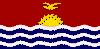 It consists of 33 islands. The three major island groups are the Gilbert, Phoenix, and Line islands (excluding the three Line Islands that are U.S. territories); Kiribati also includes Banaba Island, the former capital of the Gilbert and Ellice Islands colony. Area (land): 313 sq mi (811 sq km). Population (2002 est.): 90,600. Capital: Bairiki, on Tarawa atoll. The indigenous people are mostly Micronesians. Languages: English (official), Gilbertese. Religions: Roman Catholicism, Protestantism, Bahaʾi. Currency: Australian dollar. With the exception of Banaba (which is a coral island and higher in elevation), all the islands of Kiribati are low-lying coral atolls built on a submerged volcanic chain and encircled by reefs. Only about 20 of the islands are inhabited; more than 95% of the population of Kiribati live in the Gilbert Islands. The economy is based on subsistence farming and fishing. Kiribati is a republic with one legislative house; its head of state and government is the president. The islands were settled by Austronesian-speaking people before the 1st century AD. Fijians and Tongans arrived с the 14th century. In 1765 the British commodore John Bryon discovered the island of Nikunau; the first permanent European settlers arrived in 1837. In 1916 the Gilbert and Ellice Islands and Banaba became a crown colony of Britain; the Phoenix Islands joined the colony in 1937. Most of the Line Islands joined the colony in 1972, but in 1976 the Ellice Islands were separated to form the country of Tuvalu. The colony became self-governing in 1977, and in 1979 it became the Republic of Kiribati.
* * *
▪ 2009Area:811 sq km (313 sq mi)Population(2008 est.): 97,200Capital:Government offices on three islets of South TarawaHead of state and government:President Anote TongIn 2008 Kiribati confronted serious challenges to its long-term future from accelerating climate change, a prolonged drought, and rising sea levels, which some analysts predicted could leave the low-lying island country uninhabitable by the end of the century. Pres. Anote Tong, in New Zealand in June for World Environment Day, used the opportunity to express his fears that the drought—exacerbated by widespread erosion and the infiltration of salt water into freshwater sources—could force the evacuation of Kiribati even sooner and to secure a commitment from New Zealand to resettle Kiribati's population as it became necessary. He also procured assistance to expand the Marine Training Centre and thereby provide more skilled merchant marines, who in 2008 returned some 15% of Kiribati's national income. Workers from the islands were offered seasonal work in New Zealand horticultural and viticultural industries, and Australia proffered opportunities for Kiribas workers to take part in a parallel scheme to start later in the year.Ironically, the sea that threatened the country might also contain mineral wealth that was becoming increasingly sought after in a resource-hungry world, and mineral-exploration giants were offering Pacific islands significant sums for the right to prospect in these potentially mineral-rich zones. By 2008 Kiribati was working with specialists from the United Nations Environmental Programme on claims—under Article 76 of the UN Convention on the Law of the Sea—for recognition of a huge submerged continental shelf area beyond the country's 370-km (200-nautical-mile) exclusive economic zone.Cluny Macpherson▪ 2008Area:811 sq km (313 sq mi)Population(2007 est.): 95,500Capital:Government offices on three islets of South TarawaHead of state and government:President Anote TongKiribati's August 2007 election saw 148 candidates contest 44 parliamentary seats and pitted Pres. Anote Tong against his older brother and longtime rival, Harry Tong, the unofficial leader of the opposition. The current president, a London School of Economics-trained economist, was returned to power along with most of his cabinet.The country was experiencing increasing pressure from annual population growth rates of 2.25%, particularly on South Tarawa, where about half of the population resided. This growth generated economic and environmental challenges. Kiribati had a well-managed Revenue Equalization Reserve Fund, which invested in the global economy, but the fund faced declining returns as the impact of credit restrictions caused by loans in the American subprime mortgage market was felt. The government managed some 32 state-owned enterprises and generated some 77% of domestic employment but had recently underwritten a joint venture to build high-value fibreglass pleasure craft for the Australian market. This deal represented a departure from exports such as seaweed and copra.Growth also produced environmental problems in vulnerable coastal areas. Householders, despite government restrictions, collected annually some 70,000 cu m (about 2.47 million cu ft) of aggregates (sand, gravel, small rocks, and shells) from beaches for private use and to sell to generate income. The government, with funds and technical support from the EU, planned to begin a dredging operation to provide aggregates from locations in the lagoon that were less environmentally vulnerable.Cluny Macpherson▪ 2007Area:811 sq km (313 sq mi)Population(2006 est.): 93,600Capital:Government offices on three islets of South TarawaHead of state and government:President Anote TongKiribati was in the diplomatic spotlight in June 2006 as the annual meeting of the International Whaling Commission approached. The country indicated that it would vote for the resumption of sustainable whaling and found itself opposing other Pacific countries that had opted for the conservation of whales. Kiribati also opted to break away from the regional position (in which Pacific island countries negotiated as a group with the European Union) and to continue bilateral negotiations with the EU. By undermining regional solidarity in the run-up to Economic Partnership Agreement negotiations, Kiribati, the Federated States of Micronesia, and the Solomon Islands found themselves at odds with their neighbours.Pres. Anote Tong's government ordered the expulsion of the remaining four officials from the Chinese embassy in Tarawa. This was the last phase of the transfer of political allegiance from China to Taiwan, which had commenced in 2003, in return for significant support from Taipei for Kiribati's $59.7 million 2006 budget.Despite dependence on four commodities (copra, coconuts, seaweed, and fish), Kiribati was in a strong economic position as the Revenue Equalization Reserve Fund continued to perform well. The fund was established in 1956 with royalties from phosphate mining on Banaba (Ocean Island) and was considered one of the best in the region. Kiribati remained unique as the only net creditor country in the region.Cluny Macpherson▪ 2006Area:811 sq km (313 sq mi)Population(2005 est.): 95,300Capital:Government offices on three islets of South TarawaHead of state and government:President Anote TongIn 2005 Kiribati was in the diplomatic spotlight as it joined the International Whaling Commission, which continued to focus on the debate between whaling nations, especially Japan, and those that promoted bans on both commercial and scientific whaling (the latter of which was seen as a device for circumventing the commercial ban). With Japan accused of seeking to buy votes in the IWC with aid funds, the issue remained controversial for small Pacific Island countries.In May 2005 Taiwanese Pres. Chen Shui-bian visited Kiribati and other countries in the region with which Taipei had diplomatic relations. In 2003 Kiribati had shifted its formal recognition from Beijing to Taiwan. Public debate over the change continued in Kiribati. During Chen's visit the police banned demonstrations (both for and against the current arrangement). Taiwan also had a role in resolving difficulties in Nauru's phosphate-mining industry. As part of a regional aid contribution, Taipei agreed to meet the $3.5 million cost of repatriating 1,000 workers from Kiribati and Tuvalu who had been unpaid for a year and stranded on Nauru.To address urban overcrowding and public health issues on South Tarawa, the government of Pres. Anote Tong sought to decentralize some services to regional centres.Barrie Macdonald▪ 2005Area:811 sq km (313 sq mi)Population(2004 est.): 89,100Capital:Bairiki, on TarawaHead of state and government:President Anote TongRelations remained strained between Kiribati and China in 2004. After the newly elected government of Pres. Anote Tong recognized Taiwan in November 2003, China severed diplomatic links and dismantled its satellite-tracking station on South Tarawa Island. The switch of diplomatic allegiance was criticized by the parliamentary opposition led by Harry Tong, the president's brother. Taiwan had offered scholarships and technical assistance to Kiribati, together with aid for infrastructure projects and the development of sports facilities.The economy, which had traditionally relied heavily on investment income from funds accumulated during the life of the now-defunct phosphate industry and remittances from merchant seamen working overseas, suffered a decline in export revenue from fishing and coconut products (mostly copra) and from the licensing of foreign fishing fleets to work in the Kiribati exclusive economic zone.At the UN in September, President Tong urged other governments to support the Kyoto Protocol on climate change, emphasizing the risk to small island states of global warming and the consequent increased hurricane risk and rising sea levels. The government introduced legislation to end the investor passport scheme introduced by its predecessor. A number of airlines operating in the central Pacific combined to upgrade Cassidy Airfield on Christmas Island for emergency use after the closure of the former U.S. military airfield on Johnston Atoll.Barrie Macdonald▪ 2004Area:811 sq km (313 sq mi)Population(2003 est.): 87,900Capital:Bairiki, on TarawaHead of state and government:Presidents Teburoro Tito and, from July 10, Anote TongA period of political instability and a series of elections dominated Kiribati in 2003. Political parties followed tradition by reflecting personal political allegiance and local issues rather than philosophical differences or widespread popular support. Apart from personal and local issues, the main election debates were over the economy, the government's leasing of aircraft, and the presence of a Chinese spy satellite base on Tarawa Atoll.In November 2002 Pres. Teburoro Tito's Maneaba Te Mauri (MTM) party had been heavily defeated at the polls, but a subsequent split within the opposition Boutokaan Te Koaua (BTK) party helped him secure his third (and final, under the constitution) term in the March 2003 presidential elections. When the House of Assembly met, however, the government was brought down in a no-confidence vote, which led to the establishment of an interim administration under the Council of State. Another general election in May was followed by a remarkable presidential election on July 4. Harry Tong, a former leading opposition figure, represented the ruling MTM, while his younger brother, Anote, represented the opposition. Anote Tong was successful by a margin of about 1,100 votes (47.4–43.5%). The new government's recognition of Taiwan led China to withdraw diplomatic ties and close its satellite station and embassy. President Tong announced that Taiwan had promised development assistance of $A 10 million (about U.S.$7.2 million) a year.Barrie Macdonald▪ 2003Area:811 sq km (313 sq mi)Population(2002 est.): 90,600Capital:Bairiki, on TarawaHead of state and government:President Teburoro TitoPres. Teburoro Tito's Maneaban Te Mauri Party retained a comfortable majority in the House of Assembly in 2002. With general elections slated for December and the presidential election due in early 2003, the government made changes to the electoral laws in regard to bribery and allowing traditional gifts to be made and celebrations to occur. The government also pushed through controversial legislation that established a commission to hear complaints against the news media. Critics claimed that the measure was aimed at the newspaper owned by the main opposition leader, former president Ieremia Tabai.In his address in September at the World Summit on Sustainable Development in Johannesburg, S.Af., Tito suggested that international development plans focus on social and environmental issues as well as economic concerns. Kiribati, comprised of low-lying coral islands and atolls, was threatened by rising sea levels and increased cyclonic storms as a result of global warming.Kiribati's economy remained heavily dependent on revenue from a trust fund created with proceeds from phosphate mining, which was discontinued in 1979, and remittances from nationals working overseas. The government also received $A2.5 million (about $1.4 million) from the sale of passports and residence permits. In new ventures, trial pearl farms were funded, as were infrastructure and educational developments. A survey by the Asian Development Bank highlighted the poor living conditions in South Tarawa and concluded that at least half of the population was living in poverty.Barrie Macdonald▪ 2002Area:811 sq km (313 sq mi)Population(2001 est.): 94,100Capital:Bairiki, on TarawaHead of state and government:President Teburoro TitoIn Kiribati, with stability in domestic politics and the economy remaining largely dependent on foreign aid and trust investments derived from previous phosphate mining, the high points of 2001 had an international dimension. In October the government joined Australia in investigating the establishment of a processing centre for asylum-seeking refugees on Kanton (Canton), an island 1,900 km (about 1,200 mi) southeast of Tarawa. Kanton, a part of Kiribati formerly governed under a British-U.S. condominium, had been used for transpacific civil aviation from the 1930s and as a U.S. military base.During the year Kiribati opened its first overseas diplomatic mission (in Fiji), while the U.K. reopened its mission in Kiribati. Early in the year Kiribati hosted a meeting on the implications of global warming for itself and other low-lying atoll nations facing the possibility of land loss and an increased frequency of cyclonic storms. The country was also one of the signatories to the Waigani Convention—a 1995 Pacific Islands initiative banning the importation of radioactive waste and placing controls on the shipment of hazardous materials, which finally went into effect in late 2001. In a regional initiative Pres. Teburoro Tito announced plans for an airline with service links to neighbouring countries, including Nauru, the Marshall Islands, and Tuvalu.Barrie Macdonald▪ 2001Area:811 sq km (313 sq mi)Population(2000 est.): 92,000Capital:Bairiki, on TarawaHead of state and government:President Teburoro TitoIn October 2000, in anticipation of hosting the Pacific Islands Forum (formerly the South Pacific Forum), Kiribati completed construction of its new parliamentary complex. The Forum, a meeting of heads of government of 16 countries in the region, including Australia and New Zealand, adopted the Biketawa Declaration, which addressed issues of political instability in the region; established criteria of democratic government for membership in the Forum; and drew attention to the costs of poor governance and ethnic tension. Prompted by disturbances during the year in Solomon Islands and a civilian coup in Fiji, the Forum thus moved from its 30-year history of “the pacific way,” which involved decision making by consensus and the avoidance of conflict.On the economic front Kiribati continued to draw financial assistance from traditional donors—regional powerhouses Australia, New Zealand, and Japan—for a wide range of enterprises that included a rural solar electrification project. Japan also contributed $22 million for the four-year development of the port of Betio. Kiribati also signed an agreement that would allow Japan to build at Kiritimati (Christmas Island) a landing strip and related infrastructure for unmanned space shuttles that were being developed as part of a space transportation project.Barrie Macdonald▪ 2000Area:811 sq km (313 sq mi)Population(1999 est.): 85,500Capital:Bairiki, on TarawaHead of state and government:President Teburoro TitoIn September 1999 Kiribati joined the United Nations, and in November it joined the Food and Agriculture Organization. The government rejected South Pacific Forum proposals for a free-trade area in the region, preferring to develop bilateral arrangements.The 2000 budget approved expenditures of $A 63.6 million (about U.S. $41.3 million). Remittances from seamen employed overseas remained important in the economy and received a boost with agreements that gave the European wage rate to workers from Kiribati on German vessels. In February the headquarters island of Tarawa was declared a disaster area because of drought; overseas assistance was forthcoming, including a desalination plant provided by India. A multimillion-dollar aid loan from the Asian Development Bank was agreed upon for the upgrading of water and sewerage services on Tarawa.A member of the House of Assembly was jailed for four years and fined U.S. $94,000 for bribery and customs fraud—the first significant corruption conviction against a sitting representative.Kiribati persisted with its renaming of Caroline Island as Millennium Island, claiming that, as the International Date Line had been adjusted to place all Kiribati islands within the same time zone, this would be the first place in the world to view the new millennium.Barrie Macdonald▪ 1999Area: 811 sq km (313 sq mi)Population (1998 est.): 84,000Head of state and government: President Teburoro TitoIn September 1998, 191 candidates contested 42 seats in the House of Assembly. Because of a constitutional requirement that a candidate win 50% of the available votes in order to be elected, only 15 seats were decided in the first ballot. After the second round of voting, 25 legislators had been reelected and 11 of 18 opposition members had lost their seats. One woman, only the third since independence in 1979, was elected, as was former president Ieremia Tabai after an absence of almost a decade as secretary-general of the South Pacific Forum. The Maneaban te Mauri Party of Pres. Teburoro Tito claimed a majority in the new legislature. In presidential elections in November, sitting Pres. Teburoro Tito was successful, securing more than half of all votes cast.Kiribati persisted with its campaign to be recognized as the country that would first reach the new millennium, seeking international acceptance for the renaming of Caroline Island in the Phoenix group as Millennium Island. In adjusting the conventional International Date Line to ensure a single time zone for the entire country, Kiribati extended its boundaries to the east, which thus provided the basis for its millennium claims.Japan's National Space Development Agency began preparing plans for a rocket-monitoring station and landing facilities for unmanned space shuttles on Kiritimati (Christmas Island). Also on Kiritimati the U.K. and Kiribati began a study of the long-term effects of the nuclear testing on the island in the 1950s.BARRIE MACDONALD▪ 1998Area: 811 sq km (313 sq mi)Population (1997 est.): 82,400Head of state and government: President Teburoro TitoWith the government of Pres. Teburoro Tito remaining in firm control of domestic politics in Kiribati in 1997, the president himself adopted a high international profile. Following a visit to China in late 1996, where he signed a treaty promoting mutual respect and trade, Tito visited Rabi Island in Fiji to attend ceremonies marking the 50th anniversary of the resettlement of the Banaban people to Rabi following World War II. In December 1996 Tito also spoke at the opening of the seventh Nuclear Free and Independent Pacific Conference in Fiji, voicing his support for Fiji's call for a permanent and complete ban of nuclear testing worldwide.In August 1997 Kiribati and another Pacific nation, Tuvalu, signed a Treaty of Friendship, the purpose of which was to strengthen and improve relations.Kiribati continued to court controversy in 1997 over its 1995 act of moving the international date line far to the east, so that it went around Kiribati's Line Islands group. The move, which fulfilled one of Tito's campaign promises, was intended to enable Kiribati to become the first country to reach midnight on Dec. 31, 1999; consequently, elaborate plans to hold the world's first New Year's celebration on Jan. 1, 2000, were under way. Tonga, New Zealand, and Fiji, each arguing that "the party of the millennium" should be theirs, protested against Kiribati's tampering with the date line, but the Royal Greenwich Observatory in England, which created the international system of timekeeping, stated that Kiribati was within its rights when it made the change.BARRIE MACDONALD▪ 1997A republic in the western Pacific Ocean and member of the Commonwealth, Kiribati comprises the Gilbert Islands, Banaba (Ocean Island), the Line Islands, and the Phoenix Islands. Area: 811 sq km (313 sq mi). Pop. (1996 est.): 81,800. Cap.: Bairiki, on Tarawa. Monetary unit: Australian dollar, with (Oct. 11, 1996) a free rate of $A 1.26 to U.S. $1 ($A 1.99 = £ 1 sterling). President (beretitenti) in 1996, Teburoro Tito.Kiribati attracted international attention in 1996 over an earlier decision that established a single time zone for the country by, in effect, extending the International Date Line east of the Line Islands. The legislation sparked a Pacificwide debate over which country would first "see the Sun" in the new millennium—an event of significance for tourism.Kiribati projected a balanced budget in 1996 with expenditures at $A 51.5 million (an increase of 1.7%). A total of $A 13.6 million would be drawn from the Revenue Equalization Reserve Fund—a reserve established with phosphate royalties before the exhaustion of deposits at Banaba.(BARRIE MACDONALD)▪ 1996A republic in the western Pacific Ocean and member of the Commonwealth, Kiribati comprises the Gilbert Islands, Banaba (Ocean Island), the Line Islands, and the Phoenix Islands. Area: 811 sq km (313 sq mi). Pop. (1995 est.): 80,400. Cap.: Bairiki, on Tarawa. Monetary unit: Australian dollar, with (Oct. 6, 1995) a free rate of $A 1.31 to U.S. $1 ($A 2.08 = £ 1 sterling). President (beretitenti) in 1995, Teburoro Tito.In 1995 Pres. Teburoro Tito's new administration committed itself to the abolition of school fees for junior-high-school students, a significant increase in the price paid to producers for copra, and a substantial raise in public-sector salaries. Tito also rejected the privatization policies of his predecessors. The new government faced a constitutional crisis when the performance of the chief justice was publicly criticized and he was suspended from office by the president. Further court action saw the issue resolved, and the chief justice resigned.In March the leaders of a subregional grouping comprising Kiribati, the Marshall Islands, Nauru, and Tuvalu met for the first time to consider matters of common concern—especially the expansion of a regional air service, cooperation over fisheries, and the marketing of copra. Tito indicated that Kiribati wanted a larger share and higher returns from the tuna treaty between the U.S. and South Pacific countries. His government expressed concern to Japan over the shipment of plutonium through the region and severed diplomatic relations with France over the resumption of nuclear testing. (BARRIE MACDONALD)▪ 1995A republic in the western Pacific Ocean and member of the Commonwealth, Kiribati comprises the Gilbert Islands, Banaba (Ocean Island), the Line Islands, and the Phoenix Islands. Area: 811 sq km (313 sq mi). Pop. (1994 est.): 78,600. Cap.: Bairiki, on Tarawa. Monetary unit: Australian dollar, with (Oct. 7, 1994) a free rate of $A 1.35 to U.S. $1 ($A 2.15 = £ 1 sterling). Presidents (beretitenti) in 1994, Teatao Teannaki until May 24 and, from October 1, Teburoro Tito.In May 1994 the government of Pres. Teatao Teannaki lost office when it was defeated narrowly in a no-confidence vote in the national legislature over the alleged misuse of government funds by Teannaki and his ministers. In the subsequent general election in July, Teannaki's National Progressive Party (a loose alliance of politicians rather than a mass organization), which had ruled Kiribati since independence in 1979, lost its majority to the Maneaba Te Mauri Party, a coalition of former opposition parties that combined to fight the September presidential election. Kiribati's new president, Teburoro Tito, a former teacher and the son of one of Kiribati's preindependence union leaders and politicians, won more votes than his three opponents combined.The government proceeded during the year with a plan to privatize government-owned trading enterprises, including hotels and Kiritimati (Christmas Island) Marine Export Ltd., which sold fish and lobster to Hawaii. The government drew complaints from airlines when it closed its Bonriki International Airport for repairs for all except two half-days a week. Some politicians complained that the government had little control over the project, which was being undertaken by Chinese contractors as part of an aid project. (BARRIE MACDONALD)▪ 1994A republic in the western Pacific Ocean and member of the Commonwealth, Kiribati comprises the former Gilbert Islands, Banaba (Ocean Island), the Line Islands, and the Phoenix Islands. Area: 811 sq km (313 sq mi). Pop. (1993 est.): 76,900. Cap.: Bairiki, on Tarawa. Monetary unit: Australian dollar, with (Oct. 4, 1993) a free rate of $A 1.55 to U.S. $1 ($A 2.35 = £ 1 sterling). President (beretitenti) in 1993, Teatao Teannaki.Kiribati continued its efforts to strengthen the private sector in 1993, announcing plans to privatize hotels on South Tarawa and Kiritimati Atoll (Christmas Island), the national supply company (a major importer and distributor of building materials and other hardware), and the commercial marine venture on Kiritimati. The government also advanced its planning for accelerated development and resettlement on Kiritimati, which accounted for more than half of the country's land but only 5% of the population.Penalties on vessels encroaching into the Kiribati exclusive economic zone added substantially to fisheries-related revenue. A South Korean bunker vessel that was arrested twice in 1991 and declared forfeit by the courts was renamed Phoenix Islander and added to the Kiribati fleet. Another vessel was seized and released after a negotiated fine of $A 330,000 had been paid. Under the South Pacific Forum Fisheries Agency multilateral fishing treaty with the U.S., Kiribati received payments of $A 5.7 million.At a regional Asia-Pacific symposium on climate change, the representative from Kiribati issued a call for detailed studies on the implications of global warming for atoll populations. Planning was advanced for a national coordination centre for communications and disaster that would be built in Kiribati with assistance from Australia.(BARRIE MACDONALD)* * *
IntroductionKiribati, flag of island country in the central Pacific Ocean. The 33 islands of Kiribati, of which only 20 are inhabited, are scattered over a vast area of ocean. Kiribati extends 1,800 miles (2,900 km) eastward from the 16 Gilbert Islands, where the population is concentrated, to the Line Islands, of which 3 are inhabited. In between lie the islands of the Phoenix (Phoenix Islands) group, which have no permanent population. The capital and government centres are at Ambo, Bairiki, and Betio, all islets of South Tarawa in the northern Gilberts. Kiribati and Tuvalu were formerly joined as the Gilbert and Ellice Islands Colony. The name Kiribati is the local rendition of Gilberts in the Gilbertese, or I-Kiribati, language, which has 13 sounds; ti is pronounced /s/ or like the word see—thus Kiribati, pronounced “Ki-ri-bas.” Total land area 313 square miles (811 square km). Pop. (2005 prelim.) 92,533.Land (Kiribati)A few of the islands are compact with fringing reefs, but most are atolls. The largest atoll (and one of the largest in the world) is Kiritimati (Kiritimati Atoll) (Christmas) Atoll in the Line group, which has a land area of 150 square miles (388 square km) and accounts for almost half of the country's total area. Kiritimati was used for U.S. and British nuclear weapons testing in the 1960s; it now has a large coconut plantation and fish farms as well as several satellite telemetry stations. Banaba reaches 285 feet (87 metres) above sea level, the highest point in Kiribati. Its rich layer of phosphate was exhausted by mining from 1900 to 1979, and it is now sparsely inhabited. The rest of the atolls rise no higher than some 26 feet (8 metres), making them vulnerable to changes in ocean surface levels. By 1999 two unpopulated islets had been covered by the sea; the threat of rising sea levels, a theoretical result of global warming, would be disastrous for the islands of Kiribati. Average precipitation in the Gilbert group ranges from 120 inches (3,000 mm) in the north to 40 inches (1,000 mm) in the south, though all of the islands experience periodic droughts. Most rain falls in the season of westerly winds, from November through March; from April to October, northeast trade winds prevail. Temperatures are usually in the range of 80 to 90 °F (27 to 32 °C).Coconut palms (coconut palm) dominate the landscape on each island. Together with the products of the reef and the ocean, coconuts are the major contributors to village diet—not only the nuts themselves but also the sap. The gathered sap, or toddy, is used in cooking and as a sweet beverage; fermented, it becomes an intoxicating drink. breadfruit and pandanus also are grown. Cyrtosperma chamissonis, a coarse tarolike plant, can be cultivated in pits, but plants such as taro, bananas, and sweet potatoes are scarce. Pigs and chickens are raised.People (Kiribati)The people are Micronesian, and the vast majority speak Gilbertese (or I-Kiribati). English, which is the official language, is also widely spoken, especially on Tarawa. About half of the population is Roman Catholic, and most of the rest is Kiribati Protestant (Congregational). For many years the population of most islands has remained fairly static because of migration to the rapidly growing urban centres of South Tarawa, where more than two-fifths of the population lives. South Tarawa, including Betio, the port and commercial centre of Tarawa, has an extremely high population density. Most people live in single-story accommodations. The rural population of Kiribati lives in villages dominated by Western-style churches and large open-sided thatched meetinghouses. Houses of Western-style construction are seen on outer islands and are common on Tarawa.EconomyUntil 1979, when Banaba's deposit of phosphate rock was exhausted, Kiribati's economy depended heavily on the export of that mineral. Before the cessation of mining, a large reserve fund was accumulated; the interest now contributes to government revenue. Other revenue earners are copra, mostly produced in the village economy, and license fees from foreign fishing fleets, including a special tuna-fishing agreement with the European Union. Commercial seaweed farming has become an important economic activity.An Exclusive Economic Zone of 1,350,000 square miles (3,500,000 square km) is claimed. A small manufacturing sector produces clothing, furniture, and beverages for domestic consumption and sea salt for export. The country's proximity to the Equator makes it a desirable location for satellite telemetry and spacecraft-launching facilities; several national and transnational space authorities have built or have proposed building facilities on the islands or in surrounding waters. Such projects bring capital, additional employment, and infrastructure improvements, but Kiribati continues to depend on foreign aid for most capital and development expenditure. Food accounts for about one-third of all imports, most of which come from Australia and Fiji, and Japan and Thailand are the major export destinations. Although South Tarawa has an extensive wage economy, most of the people living on outer islands are subsistence farmers with small incomes from copra, fishing, or handicrafts. These are supplemented by remittances from relatives working elsewhere. Interisland shipping is provided by the government, and most islands are linked by a domestic air service. Tarawa and Kiritimati have major airports.Government and societyKiribati has a president elected by the populace from among three or four candidates chosen by and from members of the national legislature, the unicameral House of Assembly (Maneaba ni Maungatabu). The president can serve up to three terms of four years each, but terms may be cut short by a vote of the legislature. The House of Assembly has 42 members—40 elected; 1 appointed from the expatriate Banaban community on Rabi Island in Fiji; and the attorney general, who serves as an ex officio member—who serve four-year terms. The president chooses up to 10 cabinet ministers from the legislature, and they remain responsible to it. Local government is through elected island councils.Primary education is compulsory, and selected pupils attend government- or church-run secondary schools. Kiribati conducts its own technical and teacher training, and the University of the South Pacific operates a centre on Tarawa that offers degree and certificate programs, but other higher education opportunities must be pursued overseas. There are hospitals on Tarawa and Kiritimati and clinics on all of the inhabited islands.Cultural lifeKiribati society remains conservative and resistant to change; ties to family and traditional land remain strong, and conspicuous displays of individual achievement or wealth are discouraged. The building and racing of sailing canoes is a common pastime. Musical composition and dancing in customary styles are regarded as art forms and are the basis of widespread competition. Volleyball and football (soccer) are popular sports.History (Kiribati)The first settlers in the Gilbert Islands and Banaba came from Southeast Asia, by way of Micronesia, some 4,000 to 5,000 years ago. About the 14th century AD the southern islands received an influx of Samoans, and soon thereafter the islanders adopted a gerontocratic style of government (i.e., based on rule by elders). The Line and Phoenix islands had no prehistoric population.Spanish explorers sighted some of the islands in the 16th century, but most of Kiribati was not charted until the early 19th century, when first whalers and then coconut oil traders reached the islands. From the mid-19th century, Gilbert Islanders were recruited to work on plantations elsewhere in the region.The Gilbert Islands became a British (British Empire) protectorate in 1892, and Banaba was annexed in 1900 after the discovery of its rich phosphate deposits. Both were linked with the Ellice Islands (now Tuvalu) as the Gilbert and Ellice Islands Colony from 1916; the colony subsequently was extended to include most of the Phoenix and Line island groups and, for a time, Tokelau. Administration was through island governments, which sometimes became enmeshed in sectarian rivalries between Roman Catholics and Protestants. As a response to drought and perceived overpopulation in the 1930s, a resettlement plan was initiated for the Phoenix Islands; under a later plan, other islanders were resettled in the Solomon Islands.During World War II the islands were occupied by Japan, which was later ejected by Allied forces. The colony had few services until aid-funded development programs were introduced after the war. An elected House of Representatives was established in 1967. The subsequent emergence of ethnic tensions led to the division of the Gilbert Islands and the Ellice Islands into two territories in 1975–76. In 1971 the Banabans sued the British government for a greater share of royalties from phosphate mining and compensation for the island's environmental devastation. The trial ended inconclusively and without a court order to have the mining company restore the land, the outcome for which the Banabans had hoped. In 1981 the community agreed to Britain's offer of a one-time trust payment of $10 million (Australian) in return for the abandonment of further litigation. The Gilbert Islands achieved independence under the name Kiribati in 1979.After independence a high priority was given to economic development, especially the exploitation of marine resources and the use of the country's strategic position astride the Equator for space launch and tracking projects. Both Japan and China constructed Earth-satellite telemetry stations in the late 1990s, although China dismantled its facilities after Kiribati shifted its formal recognition of China to Taiwan in return for economic assistance in 2003. A commercial satellite-launch platform located on a converted oil-drilling rig east of Kiritimati began operation in the late 1990s. Kiribati belongs to the Pacific Islands Forum, the International Whaling Commission, the Commonwealth, and the United Nations.Additional ReadingTony Whincup, Nareau's Nation: A Portrait of the Gilbert Islands (1979), offers insights into modern life. Rosemary Grimble (ed.), Migrations, Myth, and Magic from the Gilbert Islands: Early Writings of Sir Arthur Grimble (2004; originally published 1972), gives an account of myth, legends, and traditions. Gerd Koch, The Material Culture of Kiribati (1986; originally published in German, 1965), is an anthropological study. Alaima Talu et al., Kiribati: Aspects of History (1979, reprinted 1984); and Peter McQuarrie, Conflict in Kiribati: A History of the Second World War (2000), include the perspective of Kiribati's indigenous people. Albert F. Ellis, Ocean Island and Nauru: Their Story (1935), is an account by a New Zealander and discoverer of phosphate in the islands. Barrie Macdonald, Cinderellas of the Empire: Towards a History of Kiribati and Tuvalu (2001), is comprehensive. A useful guide is Norman Douglas and Ngaire Douglas (eds.), Pacific Islands Yearbook, 17th ed. (1994).Sophie Foster* * *
Universalium. 2010.