- Antarctica
-
/ant ahrk"ti keuh, -ahr"ti-/, n.the continent surrounding the South Pole: almost entirely covered by an ice sheet. ab. 5,000,000 sq. mi. (12,950,000 sq. km). Also called Antarctic Continent.
* * *
Antarctica
Introduction Antarctica -
Background: Speculation over the existence of a "southern land" was not confirmed until the early 1820s when British and American commercial operators and British and Russian national expeditions began exploring the Antarctic Peninsula region and other areas south of the Antarctic Circle. Not until 1840 was it established that Antarctica was indeed a continent and not just a group of islands. Several exploration "firsts" were achieved in the early 20th century. Following World War II, there was an upsurge in scientific research on the continent. A number of countries have set up year-round research stations on Antarctica. Seven have made territorial claims, but no other country recognizes these claims. In order to form a legal framework for the activities of nations on the continent, an Antarctic Treaty was negotiated that neither denies nor gives recognition to existing territorial claims; signed in 1959, it entered into force in 1961. Geography Antarctica
Location: continent mostly south of the Antarctic Circle
Geographic coordinates: 90 00 S, 0 00 E
Map references: Antarctic Region
Area: total: 14 million sq km note: fifth-largest continent, following Asia, Africa, North America, and South America, but larger than Australia and the subcontinent of Europe land: 14 million sq km (280,000 sq km ice-free, 13.72 million sq km ice-covered) (est.)
Area - comparative: slightly less than 1.5 times the size of the US
Land boundaries: 0 km note: see entry on International disputes
Coastline: 17,968 km
Maritime claims: none; 20 of 27 Antarctic consultative nations have made no claims to Antarctic territory (although Russia and the US have reserved the right to do so) and do not recognize the claims of the other nations; also see the Disputes - international entry
Climate: severe low temperatures vary with latitude, elevation, and distance from the ocean; East Antarctica is colder than West Antarctica because of its higher elevation; Antarctic Peninsula has the most moderate climate; higher temperatures occur in January along the coast and average slightly below freezing
Terrain: about 98% thick continental ice sheet and 2% barren rock, with average elevations between 2,000 and 4,000 meters; mountain ranges up to nearly 5,000 meters; ice-free coastal areas include parts of southern Victoria Land, Wilkes Land, the Antarctic Peninsula area, and parts of Ross Island on McMurdo Sound; glaciers form ice shelves along about half of the coastline, and floating ice shelves constitute 11% of the area of the continent
Elevation extremes: lowest point: Bentley Subglacial Trench -2,555 m highest point: Vinson Massif 4,897 m note: the lowest known land point in Antarctica is hidden in the Bentley Subglacial Trench; at its surface is the deepest ice yet discovered and the world's lowest elevation not under seawater
Natural resources: iron ore, chromium, copper, gold, nickel, platinum and other minerals, and coal and hydrocarbons have been found in small uncommercial quantities; none presently exploited; krill, finfish, and crab have been taken by commercial fisheries
Land use: arable land: 0% permanent crops: 0% other: 100% (ice 98%, barren rock 2%) (1998 est.)
Irrigated land: 0 sq km (1998 est.)
Natural hazards: katabatic (gravity-driven) winds blow coastward from the high interior; frequent blizzards form near the foot of the plateau; cyclonic storms form over the ocean and move clockwise along the coast; volcanism on Deception Island and isolated areas of West Antarctica; other seismic activity rare and weak; large icebergs may calve from ice shelf Environment - current issues: in 1998, NASA satellite data showed that the antarctic ozone hole was the largest on record, covering 27 million square kilometers; researchers in 1997 found that increased ultraviolet light coming through the hole damages the DNA of icefish, an antarctic fish lacking hemoglobin; ozone depletion earlier was shown to harm one-celled antarctic marine plants; in 2002, significant areas of ice shelves disintegrated in response to regional warming
Geography - note: the coldest, windiest, highest (on average), and driest continent; during summer, more solar radiation reaches the surface at the South Pole than is received at the Equator in an equivalent period; mostly uninhabitable People Antarctica -
Population: no indigenous inhabitants, but there are seasonally staffed research stations note: approximately 27 nations, all signatory to the Antarctic Treaty, send personnel to perform seasonal (summer) and year-round research on the continent and in its surrounding oceans; the population of persons doing and supporting science on the continent and its nearby islands south of 60 degrees south latitude (the region covered by the Antarctic Treaty) varies from approximately 4,000 in summer to 1,000 in winter; in addition, approximately 1,000 personnel including ship's crew and scientists doing onboard research are present in the waters of the treaty region; summer (January) population - 3,687 total; Argentina 302, Australia 201, Belgium 13, Brazil 80, Bulgaria 16, Chile 352, China 70, Finland 11, France 100, Germany 51, India 60, Italy 106, Japan 136, South Korea 14, Netherlands 10, NZ 60, Norway 40, Peru 28, Poland 70, Russia 254, South Africa 80, Spain 43, Sweden 20, UK 192, US 1,378 (1998-99); winter (July) population - 964 total; Argentina 165, Australia 75, Brazil 12, Chile 129, China 33, France 33, Germany 9, India 25, Japan 40, South Korea 14, NZ 10, Poland 20, Russia 102, South Africa 10, UK 39, US 248 (1998-99); year- round stations - 42 total; Argentina 6, Australia 4, Brazil 1, Chile 4, China 2, Finland 1, France 1, Germany 1, India 1, Italy 1, Japan 1, South Korea 1, NZ 1, Norway 1, Poland 1, Russia 6, South Africa 1, Spain 1, Ukraine 1, UK 2, US 3, Uruguay 1 (1998-99); summer-only stations - 32 total; Argentina 3, Australia 4, Bulgaria 1, Chile 7, Germany 1, India 1, Japan 3, NZ 1, Peru 1, Russia 3, Sweden 2, UK 5 (1998-99); in addition, during the austral summer some nations have numerous occupied locations such as tent camps, summer-long temporary facilities, and mobile traverses in support of research (July 2002 est.)
Population growth rate: NA Government Antarctica -
Country name: conventional long form: none conventional short form: Antarctica
Government type: Antarctic Treaty Summary - the Antarctic Treaty, signed on 1 December 1959 and entered into force on 23 June 1961, establishes the legal framework for the management of Antarctica. The 24th Antarctic Treaty Consultative Meeting was held in Russia in July 2001. At the end of 2001, there were 45 treaty member nations: 27 consultative and 18 non- consultative. Consultative (voting) members include the seven nations that claim portions of Antarctica as national territory (some claims overlap) and 20 nonclaimant nations. The US and Russia have reserved the right to make claims. The US does not recognize the claims of others. Antarctica is administered through meetings of the consultative member nations. Decisions from these meetings are carried out by these member nations (within their areas) in accordance with their own national laws. The year in parentheses indicates when an acceding nation was voted to full consultative (voting) status, while no date indicates the country was an original 1959 treaty signatory. Claimant nations are - Argentina, Australia, Chile, France, New Zealand, Norway, and the UK. Nonclaimant consultative nations are - Belgium, Brazil (1983), Bulgaria (1998) China (1985), Ecuador (1990), Finland (1989), Germany (1981), India (1983), Italy (1987), Japan, South Korea (1989), Netherlands (1990), Peru (1989), Poland (1977), Russia, South Africa, Spain (1988), Sweden (1988), Uruguay (1985), and the US. Non-consultative (nonvoting) members, with year of accession in parentheses, are - Austria (1987), Canada (1988), Colombia (1989), Cuba (1984), Czech Republic (1993), Denmark (1965), Estonia (2001), Greece (1987), Guatemala (1991), Hungary (1984), North Korea (1987), Papua New Guinea (1981), Romania (1971), Slovakia (1993), Switzerland (1990), Turkey (1995), Ukraine (1992), and Venezuela (1999). Article 1 - area to be used for peaceful purposes only; military activity, such as weapons testing, is prohibited, but military personnel and equipment may be used for scientific research or any other peaceful purpose; Article 2 - freedom of scientific investigation and cooperation shall continue; Article 3 - free exchange of information and personnel, cooperation with the UN and other international agencies; Article 4 - does not recognize, dispute, or establish territorial claims and no new claims shall be asserted while the treaty is in force; Article 5 - prohibits nuclear explosions or disposal of radioactive wastes; Article 6 - includes under the treaty all land and ice shelves south of 60 degrees 00 minutes south and reserves high seas rights; Article 7 - treaty-state observers have free access, including aerial observation, to any area and may inspect all stations, installations, and equipment; advance notice of all expeditions and of the introduction of military personnel must be given; Article 8 - allows for jurisdiction over observers and scientists by their own states; Article 9 - frequent consultative meetings take place among member nations; Article 10 - treaty states will discourage activities by any country in Antarctica that are contrary to the treaty; Article 11 - disputes to be settled peacefully by the parties concerned or, ultimately, by the ICJ; Articles 12, 13, 14 - deal with upholding, interpreting, and amending the treaty among involved nations. Other agreements - some 200 recommendations adopted at treaty consultative meetings and ratified by governments include - Agreed Measures for Fauna and Flora (1964) which were later incorporated into the Environmental Protocol; Convention for the Conservation of Antarctic Seals (1972); Convention on the Conservation of Antarctic Marine Living Resources (1980); a mineral resources agreement was signed in 1988 but remains unratified; the Protocol on Environmental Protection to the Antarctic Treaty was signed 4 October 1991 and entered into force 14 January 1998; this agreement provides for the protection of the Antarctic environment through five specific annexes: 1) marine pollution, 2) fauna and flora, 3) environmental impact assessments, 4) waste management, and 5) protected area management; it prohibits all activities relating to mineral resources except scientific research.
Legal system: Antarctica is administered through meetings of the consultative member nations. Decisions from these meetings are carried out by these member nations (within their areas) in accordance with their own national laws. US law, including certain criminal offenses by or against US nationals, such as murder, may apply extra- territorially. Some US laws directly apply to Antarctica. For example, the Antarctic Conservation Act, 16 U.S.C. section 2401 et seq., provides civil and criminal penalties for the following activities, unless authorized by regulation of statute: the taking of native mammals or birds; the introduction of nonindigenous plants and animals; entry into specially protected areas; the discharge or disposal of pollutants; and the importation into the US of certain items from Antarctica. Violation of the Antarctic Conservation Act carries penalties of up to $10,000 in fines and one year in prison. The National Science Foundation and Department of Justice share enforcement responsibilities. Public Law 95-541, the US Antarctic Conservation Act of 1978, as amended in 1996, requires expeditions from the US to Antarctica to notify, in advance, the Office of Oceans and Polar Affairs, Room 5801, Department of State, Washington, DC 20520, which reports such plans to other nations as required by the Antarctic Treaty. For more information, contact Permit Office, Office of Polar Programs, National Science Foundation, Arlington, Virginia 22230; telephone: (703) 292-8030, or visit their website at www.nsf.gov. Economy Antarctica
Economy - overview: Fishing off the coast and tourism, both based abroad, account for the limited economic activity. Antarctic fisheries in 2000-01 (1 July-30 June) reported landing 112,934 metric tons. Unregulated fishing probably landed more fish than the regulated fishery, and allegedly illegal fishing in antarctic waters in 1998 resulted in the seizure (by France and Australia) of at least eight fishing ships. The Convention on the Conservation of Antarctic Marine Living Resources determines the recommended catch limits for marine species. A total of 12,248 tourists visited in the 2000-01 antarctic summer, down from the 14,762 who visited the previous year. Nearly all of them were passengers on 21 commercial (nongovernmental) ships and several yachts that made trips during the summer. Most tourist trips lasted approximately two weeks. Communications Antarctica - Telephones - main lines in use: 0 note: information for US bases only (2001) Telephones - mobile cellular: NA; Iridium system in use
Telephone system: general assessment: local systems at some research stations domestic: NA international: via satellite from some research stations Radio broadcast stations: AM NA, FM 2, shortwave 1 note: information for US bases only (2002)
Radios: NA Television broadcast stations: 1 (cable system with six channels; American Forces Antarctic Network- McMurdo) note: information for US bases only (2002)
Televisions: several hundred at McMurdo Station (US) note: information for US bases only (2001)
Internet country code: .aq Internet Service Providers (ISPs): NA Transportation Antarctica -
Ports and harbors: there are no developed ports and harbors in Antarctica; most coastal stations have offshore anchorages, and supplies are transferred from ship to shore by small boats, barges, and helicopters; a few stations have a basic wharf facility; US coastal stations include McMurdo (77 51 S, 166 40 E), Palmer (64 43 S, 64 03 W); government use only except by permit (see Permit Office under "Legal System"); all ships at port are subject to inspection in accordance with Article 7, Antarctic Treaty; offshore anchorage is sparse and intermittent
Airports: 30 (2001) note: 27 stations, operated by 16 national governments party to the Antarctic Treaty, have aircraft landing facilities for either helicopters and/or fixed-wing aircraft; commercial enterprises operate two additional aircraft landing facilities; helicopter pads are available at 27 stations; runways at 15 locations are gravel, sea-ice, blue-ice, or compacted snow suitable for landing wheeled, fixed- wing aircraft; of these, 1 is greater than 3 km in length, 6 are between 2 km and 3 km in length, 3 are between 1 km and 2 km in length, 3 are less than 1 km in length, and 2 are of unknown length; snow surface skiways, limited to use by ski-equipped, fixed-wing aircraft, are available at another 15 locations; of these, 4 are greater than 3 km in length, 3 are between 2 km and 3 km in length, 2 are between 1 km and 2 km in length, 2 are less than 1 km in length, and 4 are of unknown length; aircraft landing facilities generally subject to severe restrictions and limitations resulting from extreme seasonal and geographic conditions; aircraft landing facilities do not meet ICAO standards; advance approval from the respective governmental or nongovernmental operating organization required for landing; landed aircraft are subject to inspection in accordance with Article 7, Antarctic Treaty Airports - with unpaved runways: total: 19 over 3,047 m: 6 2,438 to 3,047 m: 3 914 to 1,523 m: 4 under 914 m: 5 (2001) 1,524 to 2,437 m: 1
Heliports: 27 stations have helicopter landing facilities (helipads) (2001) Military Antarctica -
Military - note: the Antarctic Treaty prohibits any measures of a military nature, such as the establishment of military bases and fortifications, the carrying out of military maneuvers, or the testing of any type of weapon; it permits the use of military personnel or equipment for scientific research or for any other peaceful purposes Transnational Issues Antarctica - Disputes - international: Antarctic Treaty freezes claims (see Antarctic Treaty Summary in Government type entry); sections (some overlapping) claimed by Argentina, Australia, Chile, France, NZ, Norway, and UK; the US and most other states do not recognize the territorial claims of other states and have made no claims themselves (the US and Russia reserve the right to do so); no claims have been made in the sector between 90 degrees west and 150 degrees west; several states with land claims in Antarctica have expressed their intention to submit data to the UN Commission on the Limits of the Continental Shelf to extend their continental shelf claims to adjoining undersea ridges* * *
Fifth largest continent on Earth.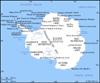 Antarctica lies concentrically about the South Pole, its landmass almost wholly covered by a vast ice sheet averaging 6,500 ft (2,000 m) thick. It is divided into two subcontinents: East Antarctica, consisting mainly of a high, ice-covered plateau, and West Antarctica, consisting largely of an archipelago of mountainous islands covered with ice. Its land area is about 5.5 million sq mi (14.2 million sq km). The southern portions of the Atlantic, Pacific, and Indian oceans surround it (see Antarctic regions). Antarctica would be circular except for the outflaring Antarctic Peninsula and two principal bays, the Ross Sea and the Weddell Sea. East and West Antarctica are separated by the long chain (1,900 mi [3,000 km]) of the Transantarctic Mountains. The ice sheet overlaying the continent represents about 90% of the world's glacial ice. By far the coldest continent, it has the world's lowest recorded temperature, -128.6 °F (-89.2 °C), measured in 1983. The climate supports only a small community of land plants, but the rich offshore food supply sustains penguins and immense seabird rookeries. There are no permanent human inhabitants. The Russian F.G. von Bellingshausen (b. 1778d. 1852), the Englishman Edward Bransfield (b. 1795?d. 1852), and the American Nathaniel Palmer (b. 1799d. 1877) all claimed first sightings of the continent in 1820. The period to с 1900 was dominated by the exploration of Antarctic and sub-Antarctic seas. The early 20th century, the "heroic era" of Antarctic exploration, produced expeditions deep into the interior by Robert Falcon Scott and later Ernest Shackleton. The South Pole was reached by Roald Amundsen in December 1911 and by Scott in January 1912. The first half of the 20th century was also Antarctica's colonial period. Seven nations claimed sectors of the continent, while many other nations carried out explorations. In the International Geophysical Year of 1957–58, 12 nations established over 50 stations on the continent for cooperative study. In 1961 the Antarctic Treaty, reserving Antarctica for free and nonpolitical scientific study, entered into full force. A 1991 agreement imposed a ban on mineral exploitation for 50 years.
* * *
▪ 2009Ice averaging roughly 2,160 m (7,085 ft) in thickness covers more than 98% of the continent of Antarctica, which has an area of 14 million sq km (5.4 million sq mi). There is no indigenous human population, and there is no land-based industry. Human activity consists mainly of scientific research. The 47-nation Antarctic Treaty is the managerial mechanism for the region south of latitude 60° S, which includes all of Antarctica. The treaty reserves the area for peaceful purposes, encourages cooperation in science, prescribes environmental protection, allows inspections to verify adherence, and defers the issue of territorial sovereignty.At the 31st Antarctic Treaty Consultative Meeting (ATCM) held in June 2008, representatives from more than 50 governments and international organizations focused on the environmental stewardship of Antarctica. The delegates designated southwestern Anvers Island and the adjacent Palmer Basin off the western coast of the Antarctica Peninsula as an Antarctic Specially Managed Area (an area where all activities were planned and coordinated to avoid possible conflicts, improve cooperation between parties, and minimize environmental impacts). They also designated Mt. Harding, Amanda Bay, and Marion Nunataks (mountains) as Antarctic Specially Protected Areas (ASPAs) and adopted revised management plans for 10 existing ASPAs. An environmental geographic framework that classified the continent into 21 different environments was adopted to help identify areas that could be designated as ASPAs. Delegates also considered tourism policy and maritime traffic-management issues, including new guidelines for landing at sites frequently visited by tourists.As part of the ATCM, the Committee for Environmental Protection held its 11th meeting. The committee's most significant discussions focused on the draft environmental evaluation that was prepared by China for the construction and operation of its new station, Dome A, in East Antarctica. Using information provided by the committee, the Chinese government released a final environmental evaluation in August. The committee also discussed and supported a recommendation by the Scientific Committee on Antarctic Research not to add the southern giant petrel to the list of specially protected species.During the 2007–08 austral summer, about 44,500 tourists traveled to Antarctica by ship, with about three-fourths of them landing in the Antarctic Treaty area. About 260 visitors participated in multiday land-based expeditions to the continental interior, and 270 passengers made overflights of Antarctica from South America. On Dec. 4, 2008, the MV Ushuaia, operated by the Argentine tour company Antarpply Expeditions, ran aground at the entrance of Wilhelmina Bay near Cape Anna with 82 passengers and 40 crew onboard. Although the passengers were not in immediate danger, they were evacuated the next day by the Chilean naval vessel Aquiles. The ship was freed on December 8, and after an inspection of its hull by Chilean navy divers showed that the ship was seaworthy, it sailed to the Shetland Islands.In December 2007 the Australian National Antarctic program landed a passenger jet for the first time on a runway that it had constructed on the surface of a glacier about 70 km (43 mi) from Casey Station. The runway, which could support the landing of large wheeled airplanes or smaller ski-equipped planes every 7 to 10 days, established an air link between Australia and Antarctica.Japan made the environmental cleanup of its Antarctic facilities a priority. After having removed 2,000 tons of garbage over the previous three years, expedition members discovered a landfill full of discarded vehicles, building materials, and old furniture. The entire cleanup was expected to take several years to complete.In October 2008 the Belgium Antarctic Research Expedition began the final phase of construction of its new station, Princess Elisabeth Antarctica. The first zero-emission research station, it was designed to minimize heating requirements, to make use of recycled water, and to operate on a combination of wind power and solar power.A biological survey conducted by British and German scientists revealed that the South Orkney Islands near the tip of the Antarctic Peninsula had greater biodiversity than even the Galapagos Islands. After combing land, sea, and shore, they cataloged more than 1,200 known and 5 new species, including sea urchins, free-swimming worms, crustaceans and mollusks, mites, and birds. British Antarctic Survey scientists used a camera-equipped remotely operated vehicle in the deep waters around the Antarctic Peninsula to obtain images of krill—the shrimplike crustacean that is a key element of the Antarctic food web—at depths down to 3,500 m (11,500 ft). Scientists had previously believed that the crustacean lived only in the top 150 m (490 ft) of the Southern Ocean. American researchers discovered freeze-dried fossils of moss as well as fossils of insects, diatoms, and tiny freshwater crustaceans in 14-million-year-old sediment in the McMurdo Dry Valleys. The fossils disappeared from the record at about 13.8 million years, and the researchers believed that this was an indication that Antarctica cooled at least 7.9 °C (14.2 °F) in about 200,000 years.In February 2008 a 400-sq-km (155-sq-mi) section of ice broke away from the Wilkins Ice Shelf on the west coast of the Antarctic Peninsula in a sudden collapse. As the 2008–09 austral summer began, satellite images showed that new rifts had formed in the ice shelf and that the disintegration had continued. Images from late November 2008 suggested that an ice bridge that had been preventing the remaining ice shelf from breaking away from the peninsula was threatening to collapse.American, British, Australian, German, and Japanese scientists began an extensive study of the Gamburtsev Subglacial Mountains in the interior of East Antarctica in October. Although the peaks of the mountains rose about 4,300 m (14,100 ft) above their surrounding terrain, they were buried under 4,000 m (13,100 ft) of ice. The region, which was the likely birthplace of the East Antarctic Ice Sheet, was believed to contain some of the oldest ice remaining on the continent. In an attempt to map these ancient mountains, the researchers used survey aircraft equipped with radar to record ice thickness and ice-sheet structure and other instruments to measure gravity and magnetism.An expedition of American and Australian scientists found evidence in the Transantarctic Mountains that supported the geologic theory that East Antarctica was connected to the western edge of North America 600 million to 800 million years ago as part of the supercontinent Rodinia. Their find consisted of a small boulder of coarse-grained granite that had a chemical composition similar to that of a unique belt of igneous rocks that extended across a part of Rodinia that includes present-day California.Winifred Reuning▪ 2008Ice averaging 2,160 m (7,085 ft) in thickness covers more than about 98% of the continent of Antarctica, which has an area of 14 million sq km (5.4 million sq mi). There is no indigenous human population, and there is no land-based industry. Human activity consists mainly of scientific research. The 46-nation Antarctic Treaty is the managerial mechanism for the region south of latitude 60° S, which includes all of Antarctica. The treaty reserves the area for peaceful purposes, encourages cooperation in science, prescribes environmental protection, allows inspections to verify adherence, and defers the issue of territorial sovereignty.On March 1, 2007, the International Polar Year (IPY) began with an official ceremony in Paris, coordinated with events in the United States (New York City and Anchorage, Alaska), Australia, Chile, India, and Japan. The IPY brought together polar experts from more than 60 countries to study the North and South poles in depth with attention to their role in global climate processes.Representatives from some 50 governments and international organizations met for the 30th Antarctic Treaty Consultative Meeting (ATCM) in New Delhi from April 30 to May 11. The delegates issued a resolution on long-term scientific monitoring and environmental observation. They also made recommendations to discourage Antarctic landings of tourist ships carrying more than 500 passengers, encouraged tour operators to coordinate their activities so that only one ship at a time would land at a particular site, with no more than 100 visitors in each excursion, and discouraged tourism that could contribute to long-term degradation of the environment.As part of the ATCM, the Committee for Environmental Protection held its 10th meeting from April 30 to May 4 and adopted a five-year work plan. The committee established an informal group to analyze new and revised Protected Area management plans. It also endorsed India's comprehensive environmental evaluation on the construction of a new station in Larsemann Hills as well as one other new Antarctic Specially Managed Area (ASMA), and it revised management plans for two Antarctic Specially Protected Areas (ASPAs) and one new Historic Site or Monument (HSM). Following the larger group's adoption of these plans, there were 6 ASMAs, 67 ASPAs, and 82 HSMs in Antarctica.During the 2006–07 austral summer, 37,506 tourists visited Antarctica, with more than 35,000 arriving by ship. Of these, nearly 25,000 landed in the Antarctic Treaty area, a 14% increase over 2005–06. Air/land-based and air/cruise-based tourism accounted for 1,082 visitors, and overflights of Antarctica included another 1,046. In November the Canadian-chartered tour ship Explorer struck ice near the South Shetland Islands and sank. The Norwegian tour ship Nordnorge rescued all 100 passengers and 54 crew and transported them to nearby Chilean and Uruguayan stations, but the incident raised more concerns concerning the potential damage that could result from increased tourism.To emphasize Antarctica's role in global climate and the effects of climate change, UN Secretary-General Ban Ki-moon visited Antarctica in November. Accompanied by an official Chilean delegation, Ban visited Chilean, Uruguayan, and South Korean stations on King George Island. This was first time that a UN secretary-general had visited Antarctica.National programs continued to improve operations and introduce innovations in Antarctica. In August the Chinese began a $13 million renovation project of one of its Antarctic stations, which was due to be completed by the end of the year. The renovations would make the station more environmentally friendly and energy-efficient; in addition, a new research building and a waste- and sewage-treatment facility would be erected. The Belgian program built a zero-emission station that would be powered by solar panels and wind turbines and would thus have minimal impact on the environment. The 700-sq-m (about 7,500-sq-ft) station was constructed in Belgium and transported to Queen Maud Land, East Antarctica, late in the year. The U.S. was scheduled to dedicate its new Amundsen-Scott South Pole Station in early January 2008. The Chilean government significantly increased funding for Antarctic research during 2007 to commemorate the 60th anniversary of Chile's first Antarctic expedition.In April the Argentine icebreaker Almirante Irízar caught fire off the Argentine coast north of the Antarctic Treaty area on its way back from Antarctica, where it supported the Argentine program. The crew and military personnel on board were rescued by a Panamanian tanker and Argentine and Uruguayan fishing vessels.A German-led international research expedition documented more than 1,000 species in the Weddell Sea, including 674 species of isopods. Over a three-year period, they collected samples of creatures living up to 6 km (3.7 mi) below the surface. Hundreds of the species cataloged had never before been seen. The team's findings surprised the researchers, who had expected to find a low-biodiversity pattern similar to that commonly found in the Arctic Ocean.Four new lakes were discovered underneath the Antarctic ice sheet. Reporting in Nature magazine, scientists indicated that understanding how the lakes interact with the ice sheet was critical to predicting climate change. They believed that the lakes affect how rapidly ice moves from the Antarctic interior to the coast.Using more than 1,000 images, American and British scientists completed the first high-definition map of Antarctica. With a resolution down to 15 m (1 m = about 3.28 ft), the map was 10 times more detailed than any previously made. The images came from the U.S. Landsat 7 satellite, which provided coverage to about 83° S. This created a “hole” in the data that was filled in with images from two other U.S. satellites. The Landsat Image Mosaic of Antarctica was available on a U.S. government Web site (http://lima.usgs.gov) and for use on Google Earth.The Antarctic Geological Drilling (ANDRILL) program—a multinational project involving more than 200 scientists, drillers, engineers, technicians, students, and educators from Germany, Italy, New Zealand, the U.K., and the U.S.—surpassed all expectations in its second season by drilling more than 1,100 m into the seafloor of McMurdo Sound. It was the second deepest rock core drilled in Antarctica, exceeded only by the 1,285 m recovered by the 2006 ANDRILL effort. These cores provided the world's scientists with more than 1 km (0.6 mi) of pristine rock core that recorded the history of climate and glacial fluctuations in Antarctica over the past 20 million years. ANDRILL was one of about 220 projects endorsed by the IPY.Winifred Reuning▪ 2007Ice averaging 2,160 m (7,085 ft) in thickness covers more than about 98% of the continent of Antarctica, which has an area of 14 million sq km (5.4 million sq mi). There is no indigenous human population, and there is no land-based industry. Human activity consists mainly of scientific research. The 45-nation Antarctic Treaty is the managerial mechanism for the region south of latitude 60° S, which includes all of Antarctica. The treaty reserves the area for peaceful purposes, encourages cooperation in science, prescribes environmental protection, allows inspections to verify adherence, and defers the issue of territorial sovereignty.Representatives from some 50 governments and international organizations met in Edinburgh during June 12–23, 2006, for the 29th Antarctic Treaty Consultative Meeting (ATCM). The delegates considered decisions on protected areas, monuments, and species (seals and petrels); new site guidelines for visitors to Antarctica; and new practical guidelines for ballast-water exchange by ships in the Southern Ocean. The representatives also adopted the Edinburgh Antarctic Declaration on the International Polar Year 2007–2008, announcing to the world the significance of the international scientific cooperative endeavours to be pursued during the International Polar Year. As part of the ATCM, the Committee on Environmental Protection also held its ninth meeting. The committee approved a new Antarctic Specially Managed Area to be located in Admiralty Bay, South Shetland Islands; discussed new marine protected areas; and submitted proposals for three new protected areas.With the number of tourists visiting Antarctica having quadrupled in the past decade, tourism was an important topic of discussion at the ATCM. During the 2005–06 austral summer, more than 29,500 tourists visited Antarctica by ship. Another 1,078 flew to and landed on the continent. These numbers, as well as an additional 1,165 tourists who participated in overflights of the continent, represented a 12% increase over the 2004–05 austral summer. All but three ships that sailed to Antarctica were operated by members of the International Association of Antarctic Tour Operators. These three ships and other non-IAATO air tours brought another 4,639 passengers to Antarctica.In January 2006, members of the Australian National Antarctic Program welcomed representatives of the Romanian Antarctic program to Law-Racovita Base, located in the Larsemann Hills, Princess Elizabeth Land, near Australia's Davis Station. The base, which was built by the Australians in 1986, was to be jointly occupied by the two programs.The Chilean government transferred ownership of Arturo Prat Station to the Punta Arenas regional government, which was expected to work with private institutions and the Instituto Antártico Chileno (the organization responsible for the Chilean Antarctic program) to improve management of science, tourism, educational activities, and logistics. Arturo Prat, the first Chilean Antarctic station, was operated from 1947 until 2004.In a paper published in the Journal of Geophysical Research Letters, Canadian scientist John Fyfe and others reported evidence that the Southern Ocean was getting warmer. Their findings showed that the Southern Ocean warmed twice as fast as the oceans worldwide and that increased emissions of greenhouse gases (particularly carbon dioxide) were directly contributing to this increase.At a workshop sponsored by UNESCO and the Scientific Committee on Antarctic Research, 163 scientists from 29 countries concluded that since 1990 sea level had risen about 3.2 mm (1 mm = about 0.04 in) per year, a rate about 1.7 mm per year faster than in the previous 90 years. Although about half of the rise could be accounted for by thermal expansion of the oceans, melting glaciers and ice sheets were also making significant contributions.Although scientists anticipated that the ozone hole over Antarctica (which occurs annually between September and November), might begin to decrease in size by 2010, the depletion in 2006 was record-setting. At its maximum on September 24, the 2006 ozone hole matched the area of the largest hole on record (29.5 million sq km [about 11.4 million sq mi], set on Sept. 9, 2000) and was the deepest ever recorded.The 10-nation European Project for Ice Coring in Antarctica completed drilling in East Antarctica in January 2006 and retrieved an ice core 2,774-m (1 m = about 3.28 ft) long. Comparing this core with ice cores drilled in Greenland, the researchers found a strong north-south link, highlighting the role of the “Atlantic conveyor belt” in the process of heat transfer. Although climate changes in the Northern Hemisphere were well documented, only recently had scientists been able to demonstrate similar Southern Hemisphere variations.In another ice-core investigation in Antarctica, researchers found evidence of heat-loving bacteria living in subglacial Lake Vostok. The presence in the ice-covered lake of these thermophilic bacteria, which had no contact with the atmosphere or sunlight, suggested that there might be hydrothermal vents on the lake floor. The ice cover on the subglacial lake had never been penetrated, but Russian scientists in 2006 resumed drilling and extended the core to a depth of 3,650 m. This drilling brought the core closer to the water surface, and it was hoped that the core would reveal more information about the nature of this hidden lake.U.S. scientists reported that they had found a 483-km (about 300-mi)-wide crater underneath the ice in Wilkes Land, East Antarctica. The location and size of the crater suggested that it had been created by a meteor impact. The newly identified crater was more than twice the size of the crater in Mexico's Yucatán Peninsula that was believed to mark the impact that ultimately led to the demise of the dinosaurs. Researchers speculated that the impact in Antarctica could have begun the breakup of the supercontinent Gondwanaland by creating a tectonic rift that pushed Australia northward.In early 2006 an American- Argentine research team recovered the well-preserved fossil skeleton of a juvenile plesiosaur—a marine reptile that swam the waters of the Southern Ocean roughly 70 million years ago. The fossil remains represented one of the most-complete plesiosaur skeletons ever found and was thought to be the best-articulated fossil skeleton ever recovered from Antarctica. The creature would have inhabited Antarctic waters during a period when the Earth and its oceans were far warmer than in modern times.Winifred Reuning▪ 2006Ice averaging 2,160 m (7,085 ft) in thickness covers more than about 98% of the continent of Antarctica, which has an area of 14 million sq km (5.4 million sq mi). There is no indigenous human population, and there is no land-based industry. Human activity consists mainly of scientific research. The 45-nation Antarctic Treaty is the managerial mechanism for the region south of latitude 60° S, which includes all of Antarctica. The treaty reserves the area for peaceful purposes, encourages cooperation in science, prescribes environmental protection, allows inspections to verify adherence, and defers the issue of territorial sovereignty.More than 300 representatives from over 50 governments and international organizations met in Stockholm in June 2005 for the 28th Antarctic Treaty Consultative Meeting (ATCM). The 28 consultative parties (voting members) approved Annex VI to the Protocol on Environmental Protection to the Antarctic Treaty. For almost 14 years the consultative parties had been negotiating the terms of this last piece of the Antarctic environmental regime. Annex VI dealt with “liability arising from environmental emergencies,” and once it entered into force, any Antarctic operator who failed to respond promptly and effectively to “environmental emergencies arising from its activities” would be liable for the costs incurred by another operator. The governments of all 28 consultative parties had to ratify the measure, however, before the annex would enter into force.Tourism in Antarctica, which had tripled in the past decade, was also discussed in Stockholm. During the 2004–05 austral summer, more than 27,000 tourists visited Antarctica by ship. Another 878 flew to Antarctica and landed on the continent. Working with the International Association of Antarctic Tour Operators, representatives of Australia, the U.K., and the U.S. proposed Site Guidelines for Visitors, which the consultative parties adopted. These guidelines provided recommendations for the most frequently visited sites, including guidance on how tour operators and guides should conduct site visits and take into account environmental sensitivities.On February 12 Norway's Queen Sonja officially opened the expanded Troll Station in Dronning Maud Land, East Antarctica. Troll Station, with its airfield, was managed by the Norwegian Polar Institute, which would conduct year-round research ranging from glacier studies to greenhouse-gas monitoring to meteorological observations. France and Italy in November completed winter operations at Concordia Station, located in East Antarctica on the polar plateau near Dome C—one of only three inland Antarctic stations and the first multinational station. A team of nine technical staff and four scientists planned to monitor the new structure and conduct research in astronomy, glaciology, atmospheric chemistry, earth sciences, microbiology, and remote medicine.By February the main station modules had been completed on the U.S. Amundsen-Scott South Pole Station at the geographic South Pole. Later in the year the communications facility was moved to the new station. The new station was scheduled to be dedicated in January 2007. The old station's geodesic dome would be dismantled and removed from Antarctica in accordance with environmental regulations. The British Antarctic Survey (BAS) announced the selection of a design for the Halley Research Station on the Brunt Ice Shelf in Coats Land. The winning design by Faber Maunsell and Hugh Broughton Architects was one of 86 schemes submitted. The modular station would be built on ski-based jackable legs in order to avoid burial by snow. The structure was devised to be towable so that the modules could be relocated inland periodically as the ice shelf flowed toward the sea.Polar researchers throughout the world began preparations for the 2007–08 International Polar Year (IPY). Under the auspices of the International Council for Science and the World Meteorological Organization, the IPY science planning group published the IPY Science Plan and Implementation Strategy, a document that included input from 40 government and nongovernmental organizations and 32 national IPY planning committees. A program office was established in December 2004 at the BAS, and in May 2005 David Carlson of the U.S. National Center for Atmospheric Research in Boulder, Colo., was named director.In November 2004 the iceberg B-15A began to drift away from Ross Island along the coast of Victoria Land. B-15A—which was 115 km long (1 km = about 0.62 mi) and had an area of more than 2,500 sq km (about 965 sq mi)—had been grounded for nearly five years in McMurdo Sound. It disrupted ocean currents, wind circulation, and supply operations to the U.S. and New Zealand research stations located on Ross Island, caused sea ice in McMurdo Sound to reach record thicknesses, and disturbed the breeding habits of the region's Adélie penguin population. Scientists forecast that the iceberg would collide with the Drygalski ice tongue, a 20-km-wide ice projection that extended into McMurdo Sound. Although some predicted the “collision of the century,” B-15A did only a small amount of damage to the ice tongue before breaking up in November 2005.By comparing the genetic code retrieved from 6,000-year-old remains of Adélie penguins with that of modern Adélies living at the same site as their ancestors, a team of researchers from Italy, New Zealand, and the U.S. showed that microevolution—the process of evolutionary change at or below the species level—had occurred in the population. The alleles (slight variations in the genetic coding) from ancient birds differed in several significant ways from those in the modern populations. The data also suggested that the remarkable lack of genetic differentiation between current Adélie populations around Antarctica might have been prompted by changes in migration patterns caused by giant icebergs similar to B-15A. Previous studies had shown genetic similarities across modern Adélie colonies, despite each individual bird's natural instinct to return to its natal location to breed, a behaviour that would be expected over time to promote genetic differences between colonies.Scientists from the BAS and the U.S. Geological Survey found that over the last 61 years, 87% of 244 marine glacier fronts in the Antarctic Peninsula had retreated and that this glacial retreat was moving progressively south. Although there was evidence in 2005 that atmospheric warming in the peninsula region was driving the retreat, the researchers' observations suggested that other forces were working to accelerate the process. The scientists found that temperatures had increased in that area of Antarctica by as much as 2 °C (3.6 °F) since the 1950s. These increased temperatures were bringing about the collapse of ice shelves along the peninsula, and the research teams believed that the loss of the ice shelves was accelerating the retreat and contributing significantly to a rise in sea level.The European Project for Ice Coring (EPICA), a consortium of 10 European countries, retrieved a 3,270.2-m (about 10,700-ft) ice core at Concordia Station, Dome C. Covering some 900,000 years, the core was composed of the oldest ice ever retrieved and contained an equally long, uninterrupted record of Antarctic climate. Although EPICA scientists had only begun to study this core, their analysis had already demonstrated that the four earliest interglacials (warmer periods between cold glacial periods) were cooler but lasted longer than the more recent interglacials.Winifred Reuning▪ 2005Ice averaging 2,160 m (7,085 ft) in thickness covers more than about 98% of the continent of Antarctica, which has an area of 14 million sq km (5.4 million sq mi). There is no indigenous human population, and there is no land-based industry. Human activity consists mainly of scientific research. The 45-nation Antarctic Treaty is the managerial mechanism for the region south of latitude 60° S, which includes all of Antarctica. The treaty reserves the area for peaceful purposes, encourages cooperation in science, prescribes environmental protection, allows inspections to verify adherence, and defers the issue of territorial sovereignty.The Antarctic Treaty system, after 43 years without an executive secretary, appointed its first, Jan Huber of The Netherlands, who in September 2004 took up his position in Buenos Aires, Arg. The growth in consultative (voting) nations from 12 to 27 had made a secretariat essential to handle business and to improve public access to documents. Ukraine was admitted as the 28th consultative Antarctic Treaty country. Ukraine in 1992 had acceded to the treaty and in 1996 had begun doing research in Antarctica—a requirement for consultative status. Treaty representatives worked on measures regarding tourism and other nongovernmental activities, management plans for specially protected areas, and a liability regime related to the environment. In addition to the consultative nations, 17 nations were acceding, or nonvoting, parties.Unprecedented construction and upgrading of research facilities in the heart of the Antarctic interior—on the vast East Antarctic Ice Sheet, a desolate region as large as the continental U.S.—was under way in 2004. China started on a year-round research station at Dome A, making a traverse there from the coast to take samples and set up a weather monitor. Dome A, at more than 4,000 m (1 m = about 3.3 ft) elevation, was the highest, driest, and coldest spot on the continent. The new station, which was scheduled to be completed by 2010, would support astrophysics, upper-atmosphere physics, ice coring, and drilling through the underlying ice sheet to study the Gamburtsev Mountains, the world's least-explored range.Some 1,370 km (1 km = about 0.62 mi) from Dome A, France and Italy in early 2005 were to begin year-round use of their new station at Dome C, Concordia, which was 3,233 m above sea level and had been in summer use since 1996. Ice coring and astronomy were to be the science focus. At the geographic South Pole, the U.S. Amundsen-Scott research facility opened portions of a new, larger replacement station (to be finished by early 2007) to support increased astrophysics and other sciences.Antarctic tourism in 2004 recovered from the post-2001 decline. The International Association of Antarctica Tour Operators reported that a record 19,771 tourists landed in the Antarctic in the 2003–04 austral summer on privately organized expeditions—most aboard commercial ships, some on chartered or private yachts. An additional 7,766 tourists entered the Antarctic on ships and planes that did not land. More than a third of the travelers were from the U.S.; most of the others were from Germany, the U.K., Australia, Canada, Japan, and Switzerland. This marked a significant rise in Antarctic tourism beyond the pre-2001 peak of 13,826 landed tourists in the 1999–2000 season.Fossil remains of two dinosaurs previously unknown to science were found in Antarctica. One specimen, discovered by American and Argentine scientists on James Ross Island, was a carnivore related to the tyrannosaur and the velociraptor. The remains included fragments of an upper jaw, teeth, and bones from the animal's lower legs and feet. The creature, a running dinosaur roughly 1.8–2.4 m tall, likely inhabited the northern Antarctic Peninsula during the Mesozoic Era, 248 million to 65 million years ago, when the climate and terrain were similar to the modern Pacific Northwest. American paleontologists found the pelvis of a primitive sauropod, a four-legged plant-eating dinosaur, on Mt. Kirkpatrick. The 3,900-m mountaintop had been a soft riverbed before millions of years of tectonic activity elevated it skyward. The pelvis was one metre across, and field analysis suggested that the as-yet-unnamed creature stood 1.8–2.1 m tall, was perhaps 9 m long, and lived about 200 million years ago.Poaching of the Patagonian toothfish (usually marketed as Chilean sea bass) was a priority topic at the annual summit of the Commission for the Conservation of Antarctic Marine Living Resources, held in Hobart, Australia, in late October–early November. The 24-member commission said that illegal, unregulated, and unreported fishing for Patagonian toothfish was a serious issue and that the group would monitor global toothfish trade and implement measures to reduce the incidental capture of seabirds. Enforcement action would include development of a satellite vessel-monitoring system.A ball-shaped robot explorer survived a 70-km surface passage across the Antarctic ice plateau, powered only by the wind. The “tumbleweed rover” started from the South Pole on January 24 and finished its roll eight days later. The device, which was about two metres in diameter, relayed its position, air temperature, pressure, humidity, and light intensity to a ground station via satellite. The test confirmed the rover's durability in extreme cold, which bode well for possible use in exploring Mars and other planets. The ball reached 16 km/hr but averaged 1.3 km/hr. Such speed was unattainable in rovers such as Spirit and Opportunity that operated on Mars.Data from U.S. satellites and a Chilean P-3 airplane showed that glaciers in West Antarctica were shrinking substantially faster than in the 1990s. The glaciers were putting 60% more ice into the Amundsen Sea than they accumulated from inland snowfall. The loss corresponded to an annual sea-level rise of 0.2 mm (1 mm = about 0.04 in), or 10% of the total global increase of 1.8 mm per year. Ice shelves in the Amundsen Sea appeared to be thinning, offering less resistance to the glaciers that formed them. The earth under the ice was found to be farther below sea level than had been assumed, so the ice was thicker than once thought, increasing the amount of ice each glacier could discharge into the ocean as its speed increased. The observed increases in velocities and thinning applied to a short period, so it was too early to tell if the accelerated thinning was part of a natural cycle or a longer-term change that could lead to a rise in sea level of as much as one metre. American and British scientists went to the area in late 2004 to make more detailed measurements.Guy G. Guthridge▪ 2004Ice averaging 2,160 m (7,085 ft) in thickness covers more than about 98% of the continent of Antarctica, which has an area of 14 million sq km (5.4 million sq mi). There is no indigenous human population, and there is no land-based industry. Human activity consists mainly of scientific research. The 45-nation Antarctic Treaty is the managerial mechanism for the region south of latitude 60° S, which includes all of Antarctica. The treaty reserves the area for peaceful purposes, encourages cooperation in science, prescribes environmental protection, allows inspections to verify adherence, and defers the issue of territorial sovereignty.In 2003 representatives of the Antarctic Treaty nations finally reached consensus on creating a permanent secretariat in Argentina. The measure was to take legal effect after all the parties ratified it. Because of the immediate need, the representatives agreed to get the secretariat working, using voluntary contributions after the selection of an executive secretary in 2004. Antarctic Treaty membership had grown from the original 12 nations to 45, and Malaysia expressed interest in achieving membership and sent investigators to Antarctica and observers to the 2003 consultative meeting, which was held June 9–20 in Madrid.The International Association of Antarctica Tour Operators reported that 13,571 tourists landed in the Antarctic in the 2002–03 summer on privately organized expeditions—most of them aboard commercial ships. Four nations—the U.S., Germany, Great Britain, and Australia—accounted for 73% of the travelers. This was a big increase over the 2001–02 season, which had had 11,588 tourists. The association expected tourism to increase again in 2003–04.In August an Australian military ship, after a 21-day chase, seized a Uruguayan-flagged boat on suspicion of poaching Patagonian toothfish (usually marketed as Chilean sea bass), which were protected in Antarctic waters by an international convention. Australian customs officials said that the boat was carrying 85 metric tons of the fish, which can grow to 2.2 m (7 ft) in length. The crew members were taken to Fremantle, Australia, where they faced fines and jail. Harvesting the fish remained legal under a permit system, but illegal, unreported fishing was thought to exceed the allowed limit severalfold and to threaten depletion of the stock in a few years if it was not stopped.The ozone hole covered much of Antarctica (and beyond) in the austral spring of 2003 and thus permitted ultraviolet radiation from the Sun to reach the surface in increased amounts. At 28.75 million sq km (about 11.1 million sq mi), the 2003 ozone hole was the second largest on record. The World Bank reported that global consumption of chlorinated fluorocarbons had dropped from 1,100,000 tons in 1986 to 150,000 tons in 1999. The international decision to cut the production of man-made chemicals that cause the ozone hole and lesser stratospheric ozone depletions worldwide had been made in 1987, when stratospheric chemists based at McMurdo Sound showed that the chemicals caused the ozone hole. The Bank said that without the changes dictated by the Montreal Protocol on Substances That Deplete the Ozone Layer (1987), consumption would have reached 3,000,000 tons by 2010.Scientists from Canada and the U.S. reported that their modeling studies found the Antarctic ozone hole to be responsible for the observed spring and summertime warming in the Southern Hemisphere over the past 40 years. The work helped to quantify the possible influence of the stratosphere (where the ozone hole occurs) on weather and climate. Increased circumpolar westerly winds also were blamed on the ozone hole. The scientists said that their work showed that human emissions of ozone-depleting gases had affected surface climate over the past few decades.According to a 2003 report based on a study of rock samples collected at Graphite Peak, the collision of a meteorite with the Earth was the cause of a global mass extinction 251 million years ago that exterminated more than 90% of the world's living things. The event was the biggest of Earth's so-called Big Five mass extinctions documented in the geologic record. The finding was based on samples collected in the Antarctic in the mid-1990s, and some scientists considered it controversial because they believed that weathering during the 251 million years since the meteorite struck would have made the rock samples unreliable. Scientists returned to the Antarctic in late 2003 to search for more samples that might help resolve the criticism.Australian researchers studying chemical evidence from ice cores taken at Law Dome reported that Antarctic sea ice, which was stable from 1840 to 1950, had decreased sharply in area since then. The decline of about 20% was not uniform, and the data were focused on the area of the Southern Ocean south of Australia, but the investigators said that their findings lengthened the history represented by the short period that had been monitored by satellite imagers and strongly suggested that the total sea-ice extent around Antarctica had been in decline since the 1950s.Argentine and British scientists published a report in 2003 in which they suggested that the Larsen Ice Shelf on the east coast of the Antarctic Peninsula, which had lost massive sections in 1995 and 2002, was a model for what could happen to larger ice shelves farther south. Earlier work had indicated that regional warming and surface melting over the past several decades were the main causes; the new report gave more weight to ocean warming. A report by American and British investigators on the complex science of ice dynamics found that “a major West Antarctic ice stream discharges by sudden and brief periods of very rapid motion paced by oceanic tidal oscillations of about 1 metre” per hour.Ancient Antarctic life was the subject of two unusual studies reported in 2003. According to a report in the New York Times, Lake Vida in the McMurdo Dry Valleys, which was covered by 18.3 m (about 60 ft) of ice, yielded bacteria that froze at about the time that Rome was founded and were successfully brought back to life. Scientists reported in Nature magazine that they had discovered the fossil of a fly 500 km (about 310 mi) from the South Pole, which went against the long-held belief that these insects never inhabited the continent. The fly had lived there between 3 million and 17 million years ago.Guy G. Guthridge▪ 2003Ice averaging 2,160 m (7,085 ft) in thickness covers more than about 98% of the continent of Antarctica, which has an area of 14 million sq km (5.4 million sq mi). There is no indigenous human population, and there is no land-based industry. Human activity consists mainly of scientific research. The 45-nation Antarctic Treaty is the managerial mechanism for the region south of latitude 60° S, which includes all of Antarctica. The treaty reserves the area for peaceful purposes, encourages cooperation in science, prescribes environmental protection, allows inspections to verify adherence, and defers the issue of territorial sovereignty.Antarctica's Larsen B ice shelf collapsed in February 2002. The shelf, 3,265 sq km (1,260 sq mi—about the size of Rhode Island) in size, had existed as long as 12,000 years ago. The collapse was caused by water from surface melting that ran down into crevasses, refroze, and wedged the shelf into pieces. The surface melting had increased because in the last 50 years the Antarctic Peninsula region, where the ice shelf had been, had warmed by 2.5 °C (4.5 °F). Some researchers, however, saw little evidence that global warming had caused this local rise in temperature, while others linked it at least partially to human-induced worldwide climate change. The collapse did not raise the sea level, since the shelf, 200 m (650 ft) thick before its collapse, had already been floating on the ocean. The collapse took just 35 days. (See Map—>.)Just two months later, two huge icebergs calved from the Ross Ice Shelf, returning the shelf's edge to its position in the early 1900s. The larger of the two icebergs, called C-19 and measuring some 5,200 sq km (about 2,000 sq mi) in area, was still in the western Ross Sea in late 2002, but the other had moved north and was breaking up.While the iceberg calvings seemed to suggest warming, scientists reported in May that Antarctica as a whole had been cooling over the past 35 years. The scientists had studied data from weather stations across the continent and acknowledged that the Antarctic Peninsula was warming but said that the continent overall was cooling. This cooling was unique among the Earth's continents and contrasted with the global average increase in air temperature of 0.6 °C (1.1 °F) during the 20th century. The finding also seemed to contradict the generally accepted prediction that polar regions would respond first and most rapidly to an increase in global temperature.The Patagonian toothfish (usually marketed as Chilean sea bass) continued to be caught illegally. A French patrol boat seized the Spanish longliner Eternal in the Southern Ocean in July; the fishing boat had been a target of French and Australian authorities for three years. The fine was expected to be €150,000 (about $150,000) for the ship's failure to declare its presence in a French EEZ (exclusive economic zone) and €75,000 for every metric ton of fish on board. Earlier, an Australian navy ship had seized the Russian-flagged longliner Lena. The arrests were said to underscore the failure of diplomatic efforts to halt the pirate trade, which ran to $90 million annually. Australia in November dropped a bid to have the Convention on International Trade in Endangered Species declare the fish endangered after the 160-member organization agreed to monitor catches in cooperation with the 24-member-state Commission for the Conservation of Antarctic Marine Living Resources. Marine conservationists said the Patagonian toothfish could become commercially extinct by 2007 because of illegal overfishing.Intense commercial squid fishing was blamed for a die-off of penguins in the Falkland Islands/Islas Malvinas, where the population of the birds was said to have crashed from six million to one million in recent years. The penguins died of starvation.Japanese whaling continued to generate controversy. An Australian Antarctic vessel found three Japanese ships off the West Ice Shelf on New Year's Day and asked them to leave. Japan's whaling under its self-issued “scientific permit” provided for it to take up to 440 minke whales annually, but Australian law forbade the killing of whales. A U.S. recommendation at a late-2001 meeting of the International Whaling Commission resulted in a resolution expressing concern that the minke whale population may have declined over the past decade to less than half the 1990 estimate of 760,000. The commission urged Japan to halt its take until its scientific committee could report impacts.The Antarctic ozone hole in September 2002 was much smaller than in 2000 and in 2001, and it was split in two. Peculiar stratospheric weather was said to be the cause, so available evidence was not conclusive that the ozone layer was yet recovering. Rather, higher- than-normal temperatures around the polar vortex that forms annually over Antarctica suppressed the usual formation of polar stratospheric clouds, where chlorine and bromine from man-made chemicals destroy the ozone.Ice believed to be 530,000 years old was drilled from deep in the East Antarctic ice sheet by the 10-nation European Project for Ice Coring in Antarctica.Modernization of the U.S. research station at the South Pole continued with completion of the first of several new buildings in late 2002. The National Science Foundation in August approved a $17 million microwave telescope for the station, offering a novel approach to mapping the distribution of matter in the universe. The 8-m (315-in) scope would join other astronomical instruments that take advantage of the extremely clear and dry atmosphere at the site.Tourism declined slightly in 2001–02, with 11,588 tourists landing in the Antarctic on privately organized expeditions. Indonesian scientists in March reached Antarctica for the first time in what was hoped to be the beginning of a polar program for that country. Malaysian scientists were guests of Australia on a similar voyage. A Russian expedition led by State Duma Deputy Chairman Artur Chilingarov flew to the South Pole in January, but its plane broke down, and the U.S. Antarctic Program, which operated a research station there, flew the chairman out of Antarctica. Britain's Princess Anne visited U.S. and New Zealand stations on Ross Island to commemorate the 100th anniversary of Robert Scott's first Antarctic expedition, part of an international appeal by the Antarctic Heritage Trust to raise funds to restore “heroic age” explorers' huts.Guy G. Guthridge▪ 2002Ice averaging 2,160 m (7,085 ft) in thickness covers more than about 98% of the continent of Antarctica, which has an area of 14 million sq km (5.4 million sq mi). There is no indigenous human population, and there is no land-based industry. Human activity consists mainly of scientific research. The 45-nation Antarctic Treaty is the managerial mechanism for the region south of latitude 60° S, which includes all of Antarctica. The treaty reserves the area for peaceful purposes, encourages cooperation in science, prescribes environmental protection, allows inspections to verify adherence, and defers the issue of territorial sovereignty.Conferences in Australia and the U.K. in 2001 commemorated the 40th anniversary of the Antarctic Treaty. The treaty, which entered into force on June 23, 1961, with 12 member nations, in late 2001 had 45 signatories, including Estonia, which joined in 2001. Of the 45 nations, 27 pursued programs of Antarctic scientific research. Some 8,000 scientists and supporting personnel in these national programs were in Antarctica and aboard ship in the adjacent Southern Ocean. They operated 38 year-round stations and additional temporary research camps. The austral summer continental population peaked at around 4,000; the isolated wintering crews in 2001 numbered about 1,000. In an unprecedented winter rescue mission, a Canadian aircraft landed at the U.S. Amundsen-Scott research station in April to evacuate Ronald Shemenski, who was seriously ill, and to deliver a replacement physician.In September, Russian Prime Minister Mikhail Kasyanov called for an assessment of the country's polar research—apparently shelving a decision whether to invest more in the program or shut it down. The Soviet Union was one of the original 12 members of the Antarctic Treaty, and Western observers doubted a shutdown. The Czech Republic announced that it would establish its first science program in Antarctica, relying on Poland for help in building a station. Chile said that by 2003–04 it would scale up Antarctic tourism by expanding its landing strip on King George Island and would expand research, transferring the Chilean polar institute from Santiago to the University of Magallanes in the country's far south.France and Italy continued to build a new research station, Concordia, on Dome C, far inland on the continental ice sheet at an altitude of 3,200 m (1 m = 3.28 ft). The site was regarded as exceptionally clear for astronomy because of its high altitude, absence of humidity, and mild winds. The station was to be ready in 2003. Science already under way included ice-core drilling to 1,458 m by an international team funded by the European Union; the goal of 3,250 m in two more drilling seasons would enable study of the evolution of climate back to 500,000 BP. At the British Antarctic Survey station Rothera, fire destroyed the biology laboratory in September; a replacement was planned.Tourism decreased from the 1999–2000 season, which had had 14,762 tourists, of whom 14,402 were shipborne. For the period November 2000 to March 2001, 12,248 persons traveled to the Antarctic on privately organized expeditions, comprising 11,997 passengers aboard 21 commercial vessels, 112 persons on chartered yachts, and 139 land-based visitors. American, German, and British visitors accounted for over two-thirds of the tourists.The krill catch in the Southern Ocean around Antarctica in the 2000–01 season was 98,209 metric tons, down slightly from the previous season's 101,286 metric tons. Catches of other species (finfish, sharks and rays, crustaceans, and squid) totaled 14,725 metric tons. Of this, the Patagonian toothfish and the Antarctic toothfish totaled 12,733 and 626 metric tons, respectively. Illegal, unreported, and unregulated fishing took, by one estimate, 8,376 metric tons of the two toothfish species—nearing the amount of the legal take and up a thousand metric tons from the previous year.Scientists found that the eastern Pacific Ocean warming known as El Niño and its counterpart, La Niña, appeared to be behind the periodic advance and retreat of Antarctic sea ice. The finding had implications for global climate because sea ice reflects solar energy; when there is less sea ice, the ocean absorbs the sun's heat and warming is amplified. French researchers linked a 50% reduction in some emperor penguin numbers to reduced sea ice in the 1970s, calling their find the first identification of consequences of major oceanic changes in an Antarctic large predator.American cosmologists released new findings based on data collected from a ground-based instrument operating at the South Pole and a high-altitude balloon. The data provided the strongest evidence to date for the theory of inflation, the leading model for the formation of the universe, and supported the model that the universe experienced a tremendous spurt of growth shortly after the big bang. Another U.S. observatory, with 677 photodetectors buried deep in ice beneath the South Pole to create one of the world's largest particle detectors, became the first in the world to detect high-energy neutrinos, subatomic particles created by cataclysmic collisions.An iceberg designated B-15A, which had calved from the Ross Ice Shelf in early 2000, drifted to the western Ross Sea, where it went aground, enabling a buildup of sea ice between it and Victoria Land that could jeopardize ship access to the U.S.'s McMurdo station, Antarctica's largest settlement, and threatened penguin populations that depend on open water for food. The Russian icebreaker Kapitan Khlebnikov entered the Bay of Whales, where the berg had calved, establishing a record southern latitude for a surface ship of 78° 37′ S. Satellite data showed that 31 cu km (7.4 cu mi) of ice was lost from the fast-flowing Pine Island Glacier, which demonstrated that this part of the Antarctic ice sheet was thinning and suggesting that Pine Island Glacier would be lost to the ocean within a few hundred years. Another satellite image revealed a crack 25 km (15.5 mi) long, which stretched more than two-thirds across the glacier. The crack had formed in less than five weeks, which led to the prediction that an iceberg might calve within 18 months.An ice core from Siple Dome revealed the largest and most abrupt warming spike yet found in the Southern Hemisphere and provided evidence that climate change can be dramatically fast. The 4.5 °C (18 °F) hike over a few decades had come as the last ice age began to wane 19,000 years ago. The timing of the warming correlated with an abrupt sea-level rise and belied previous evidence that Antarctic warming events were much more gradual than Northern Hemisphere events.Sir Peter Maxwell Davies's Antarctic Symphony, composed on a commission by the British Antarctic Survey after the British composer's visit south in 1997, was played for the first time by the Philharmonia Orchestra at the Royal Festival Hall in London on May 6. In addition to classical instruments, the score required pebbles, tuned brandy glasses (with water), a biscuit tin (filled with broken glass), and a plastic soap dish scraped across a tam tam. Inspiration for the work included sounds of ice breaking, the silence of the continent, and the lament of the wind.Guy G. Guthridge▪ 2001Ice averaging 2,160 m (7,085 ft) in thickness covers more than about 98% of the continent of Antarctica, which has an area of 14 million sq km (5.4 million sq mi). There is no indigenous human population, and there is no land-based industry. Human activity consists mainly of scientific research. The 44-nation Antarctic Treaty is the managerial mechanism for the region south of latitude 60° S, which includes all of Antarctica. The treaty reserves the area for peaceful purposes, encourages cooperation in science, prescribes environmental protection, allows inspections to verify adherence, and defers the issue of territorial sovereignty.The ocean around Antarctica experienced its fifth year of widespread poaching of Patagonian toothfish in 2000. The international Commission for the Conservation of Antarctic Marine Living Resources said that illegal, unregulated, and unreported fishers took 6,546 metric tons of the fish, while others said that this amount was a large underestimate because 9,000 metric tons of the fish, worth $45 million, passed through Port Louis, Mauritius, during the first nine months of 2000. (Legal fishers took 25,994 metric tons.) The species was sometimes marketed as deep sea bass or Chilean sea bass. (See also Agriculture and Fisheries: Fisheries (Agriculture and Food Supplies ).)Efforts to stop the illegal fishing included an attempt to end Port Louis's reputation as the main pirate port. The Antarctic Commission set up a paper trail, tracing catches from hook to market, that was claimed to be the most restrictive ever imposed to protect a high seas fishery. The illegal activity also had a high human cost; the Spanish-registered pirate fishing vessel Amur foundered on October 9 during severe weather, drowning 14 of the crew of 40; in two years an estimated 61 people had died in three vessels that sank while pursuing toothfish illegally.An estimated 68,000 seabirds died trying to feed on bait hanging from longline hooks set out by the illegal fishers. This was an unsustainable mortality for the albatross, giant petrels, and white-chinned petrels that breed in the area.Antarctic Treaty negotiators worked toward ensuring that polluters paid for environmental damage in Antarctica. Liability, which some saw as a missing link in the protection of Antarctica, had been set aside as too difficult when the treaty nations approved the landmark Protocol on Environmental Protection in 1991. While environmental accidents in Antarctica were infrequent, a large fuel spill had occurred in 1989 when the Argentine ship Bahía Paraíso ran aground, losing some 600,000 litres (about 160,000 gal) of fuel, of which only about two-thirds was recovered. Further progress on liability awaited an Antarctic Treaty consultative meeting planned for St. Petersburg in 2001.Tourism increased, with 13,193 people visiting Antarctica in the 1999–2000 Antarctic summer, compared with 10,013 the previous season and 9,604 the year before. Most visitors were seaborne, arriving in 24 ships that made 143 voyages. U.S. citizens accounted for more than half of the visitors, according to the International Association of Antarctica Tour Operators and the U.S. National Science Foundation.Sir Ernest Shackleton's historic 1916 crossing of the South Atlantic island of South Georgia was retraced twice in 2000. Three mountaineers completed the journey over three days in mid-April following a six-day trek by the Shackleton 2000 expedition after its reenactment of Shackleton's open-boat journey from the Antarctic Peninsula to South Georgia.A boom in prices for Antarctic memorabilia was confirmed at an April auction with a record £93,950 (about $148,000) paid for a single item—the 1912 journal of surgeon Murray Levick, a member of Capt. Robert Scott's stranded party. The auction included a copy of Aurora Australis, the hand-published book of articles, poems, and sketches that Shackleton's British Antarctic Expedition produced at Cape Evans in 1908. A private buyer paid £37,600 (about $59,000).American scientists comparing modern and historic weather data found that Scott's party may have perished from unusually extreme cold during its attempted return from the South Pole in 1912. Scott wrote in his final message to the public that “our wreck is certainly due to this sudden advent of severe weather.” Speculation about the reasons for the failure had varied, and such causes as the party's reliance on ponies, poor diet, and unfamiliarity with skis had been considered.The first evidence of life in Lake Vostok, 3,600 m (11,800 ft) below the East Antarctic Ice Sheet, was claimed on the basis of two investigations of ice cores from 120 m (395 ft) above the suspected water level. The studies suggested that despite the fact that it had been isolated from the atmosphere for hundreds of thousands of years, the lake could support a microbial population. On the basis of these findings, published in Science, researchers believed that microbes could thrive in other hostile places in the solar system. They determined that Lake Vostok is a terrestrial analogue to Europa, a frozen moon of Jupiter. (See Mathematics and Physical Sciences: Space Exploration (Mathematics and Physical Sciences ).) A separate study also found live bacteria in snow at the South Pole, a discovery that confirmed that life on Earth persisted in the most hostile of climates.University of Florida geologists revealed evidence that the Antarctic Ice Sheet was massively unstable as recently as the last glacial advance in North America, which occurred about 20,000 years ago. Sediments from southern Atlantic Ocean bottom sites contained large grains of Antarctic quartz and other fragments that icebergs had transported north. The study, published in Science, was believed to demonstrate for the first time that instability in parts of that ice sheet coincided with warming in the Northern Hemisphere.Circumpolar ballooning experiments of the 1990s yielded their biggest payoff yet in 2000: evidence that the universe is geometrically flat. Images collected above Antarctica in 1998 by an ultrasensitive telescope aboard a balloon at the edge of the atmosphere appeared in the journal Nature in 2000. The journal said of its cover feature, “Columbus may have proved the Earth is round, but cosmologists have had the last word: the universe is flat.” The evidence was shown in a map of tiny variations in cosmic microwave background radiation—ancient radiation that remained after the Big Bang. The variations revealed that this violent expansion flattened the geometry of space.Guy G. Guthridge▪ 2000Ice averaging 2,160 m (7,085 ft) in thickness covers more than about 98% of the continent of Antarctica, which has an area of 14 million sq km (5.4 million sq mi). There is no indigenous human population, and there is no land-based industry. Human activity consists mainly of scientific research. The 44-nation Antarctic Treaty is the managerial mechanism for the region south of latitude 60° S, which includes all of Antarctica. The treaty reserves the area for peaceful purposes, encourages cooperation in science, prescribes environmental protection, allows inspections to verify adherence, and defers the issue of territorial sovereignty.In 1999 Venezuela acceded to the Antarctic Treaty, bringing to 44 the number of nations that agreed to use the region south of 60° S latitude for peaceful purposes only. Twenty-seven of these nations performed scientific research in the Antarctic in 1999 and thus had voting status at that year's consultative meeting, the 23rd since the treaty entered into force in 1961. The meeting improved environmental assessment and protection measures, considered ways to improve shipping safety, and urged nonconsultative nations that send expeditions to adhere to the treaty's new (1998) Protocol on Environmental Protection.The meeting also passed a resolution to support control of illegal, unreported, and unregulated fishing in Antarctic waters. Scientists estimated that unregulated fishing landed five to six times more Patagonian toothfish than the regulated fishery and would likely affect the sustainability of the stock. The fish, marketed as Chilean sea bass, grow extremely slowly; they live more than 50 years and reach 1.8 m (6 ft) in length. Member nations of the Antarctic Marine Living Resources Convention in 1998 had implemented ways to combat unregulated fishing, including satellite-linked vessel monitoring and vessel registry and marking, and in 1999 they worked on measures to control trade of fish caught illegally. Legal fisheries in Antarctic waters reported that during the 1998–99 year (July 1 to June 30) they landed 119,898 metric tons, of which 85% was krill (Euphasia superba) and 14% was the Patagonian toothfish.Tourism figures rose again, with 10,013 persons visiting during the 1998–99 Antarctic summer, compared with 9,604 the previous year. Most visits were seaborne by 16 ships and several yachts, which made a total of 116 voyages. Nearly 16,000 tourists were expected during the 1999–2000 season, with at least part of the increase attributed to welcoming the new millennium in Antarctica. The U.S. Naval Observatory in Washington, D.C., calculated that the first sunrise of 2000 over land would take place at Dibble Glacier, Antarctica.At the geographic South Pole at 90° S latitude in the interior of Antarctica, construction continued, summer and winter, on buildings to replace aging research facilities that the U.S. National Science Foundation installed in 1975. The new station was to be ready in 2005 and would support mainly astrophysics. Some scientists proposed reassembling the famous central structure of the retiring station—a geodesic dome—as a polar museum at Ohio State University. Wide press attention was given to the station's physician, who showed symptoms of breast cancer during the eight-month winter isolation. In October 1999 she was evacuated to a hospital in the United States.Water discovered deep under the thick ice of East Antarctica was the subject of scientific interest because it could harbour life forms that had been isolated for as long as a million years. The body of water, the size and depth of Lake Ontario, was called Lake Vostok. Ice-core drilling for climate studies, which penetrated within 120 m (394 ft) of the lake, was stopped so researchers could figure out how to sample the lake without contaminating it. NASA said Lake Vostok could serve as a test bed for future exploration of Jupiter's moon Europa, thought to have an ice-covered ocean similar to the Antarctic feature.U.S. Pres. Bill Clinton, while in Christchurch, N.Z., after having attended an economics meeting, announced the release of previously classified satellite photographs of Antarctica's McMurdo Dry Valleys. Seven images made in 1975 and 1980 offered sufficiently good resolution and digital elevation data to track, for example, the rise of glacier-fed lakes, indicating climate change.During a cruise aboard the research icebreaker Nathaniel B. Palmer, Joseph Eastman of Ohio University netted four species of fish previously unknown to science. The waters appeared to have been the site of geologically recent “adaptive radiation” as a single stock of fish evolved to fill ecological niches that unrelated species would otherwise occupy. This was the only known example of an adaptive radiation in marine fish. In October NASA announced the first high-resolution map of Antarctica compiled from images taken in 1997 by Radarsat, a Canadian satellite.The first evidence of large volcanic eruptions that shook Antarctica about 25 million years ago was discovered in rock cores retrieved from the seabed as part of an ocean-floor drilling project. One eruption was several times larger than that of Mt. St. Helens (in Washington state) in 1980. The evidence was gathered in the Cape Roberts Project, involving scientists from Australia, Britain, Germany, Italy, New Zealand, and the United States. The evidence consisted of layers of volcanic debris that were erupted explosively into the atmosphere and then settled into the ocean onto the seafloor. The thickness and coarseness of the debris indicated a large eruption that reached into the stratosphere. The discovery demonstrated a far more spectacular history of volcanic activity than was previously suspected for the Ross Sea region of Antarctica.An iceberg remnant that had broken off the Thwaites Ice Tongue in the early 1990s entered shipping channels south of South America in 1999. The berg, B-10A, was 39 × 77 km (24 × 48 statute miles). A U.S. Antarctic research ship circumnavigated the iceberg, photographing it, plotting its shape with radar, and collecting blue-ice fragments for study.New evidence was found that the renewal of deep waters by sinking surface water near Antarctica had slowed to only one-third its flow of a century or two earlier. Science magazine said this huge, climate-altering change—if it was real—would greatly complicate attempts to understand how the ocean and climate were responding to another big influence on climate—the buildup of greenhouse gases in the atmosphere.Guy G. Guthridge▪ 1999Ice averaging 2,160 m (7,085 ft) in thickness covers about 98% of the continent of Antarctica, which has an area of 14 million sq km (5.4 million sq mi). There is no indigenous human population, and there is no land-based industry. Human activity consists mainly of scientific research. The 43-nation Antarctic Treaty is the managerial mechanism for the region south of latitude 60° S, which includes all of Antarctica. The treaty reserves the area for peaceful purposes, encourages cooperation in science, prescribes environmental protection, allows inspections to verify adherence, and defers the issue of territorial sovereignty.A historic new agreement, the Protocol on Environmental Protection to the Antarctic Treaty, entered into force on Jan. 14, 1998, after its ratification by the 26 Antarctic Treaty consultative (voting) nations. The protocol, which had been drafted in 1991, strengthened the original (1959) Antarctic Treaty, which designated Antarctica as a natural reserve devoted to peace and science. A widely noted feature of the protocol was its prohibition of mining and other activities relating to mineral resources, except for scientific research. More generally, it committed researchers to environmental impact assessments for both governmental and private proposed activities. It increased protection of plants and animals and their ecosystems throughout the region, and it designated certain areas for even more stringent protection. It prohibited or limited disposal of waste and discharge of pollutants. The protocol gave priority to scientific research, acknowledging the unique opportunities that Antarctica offered for understanding regional and global processes. Research groups had to make joint plans to respond to environmental emergencies, and compliance provisions included compulsory dispute settlement between member nations.Fisheries in Antarctic waters reported that during the 1997-98 year (July 1-June 30) they landed 92,456 metric tons, of which 87% was krill (Euphasia superba) and 12% was the Patagonian toothfish (Dissostichus eleginoides). The highly marketable toothfish is an extremely slow-growing species that can live for more than 50 years and reach 2 m (6 ft) in length. The catch was about the same as reported the previous year. Japan and Poland led in the krill catch, and Chile, Australia, France, and South Africa caught the most Patagonian toothfish.A major concern in recent years had been the high catch of the Patagonian toothfish, over and above the official numbers, that had taken place without regard to fishing regulations. Scientists estimated that during the 1997-98 season this unregulated fishing landed five to six times more than the regulated fishery and would likely affect the sustainability of the toothfish stock. The concern also extended to the correspondingly higher incidental mortality of seabirds caused by longline fishing. Allegedly illegal fishing in Antarctic waters in 1998 resulted in the seizure (by France and Australia) of at least eight fishing ships. Member nations of the Convention on the Regulation of Antarctic Mineral Resource Activities in mid-1998 were considering methods to combat unregulated fishing, including use of satellite-linked vessel monitoring, a vessel registry, improved controls over national fishing vessels, improved controls on fish landings and sales, and sanctions to prevent trade in fish harvested in an unregulated way.Tourism in Antarctica rose substantially. A total of 9,604 tourists visited in the 1997-98 summer, up from more than 7,300 the previous year. Nearly all were passengers on 13 commercial ships that made 92 trips. About 200, however, arrived on yachts or commercial aircraft. The U.S. was the country of origin of 43% of the year's shipborne tourists. Germany, Australia, the U.K., Japan, and Switzerland also contributed significant numbers. The Antarctic Peninsula (Antarctica's northernmost region) was the most popular destination, but two tour ship visits were made to McMurdo, a U.S. research station that, at latitude 78° S, was Antarctica's southernmost port.The U.S. Navy in late 1998 began its last season of Antarctic operations. The withdrawal would close a 160-year history that began in the late 1830s with the navy's U.S. Exploring Expedition, which proved Antarctica a continent. The Air National Guard took over navy flying, and private firms were given other responsibilities that the navy had performed in recent decades to support research sponsored by the National Science Foundation.Science continued as Antarctica's main endeavour in 1998. Much of the research was performed to understand the continent and its role in world processes, especially climate change. Because of the extremely cold and dry atmosphere over interior Antarctica, astronomy and astrophysics flourished, particularly at the geographic South Pole, where the U.S. operated a year-round station. In all, 18 nations operated 36 year-round research stations. They and nine others, all Antarctic Treaty members, operated numerous additional summer research sites on the continent.On Vega Island off the Antarctic Peninsula, Argentine and U.S. scientists found a fossil tooth of the first duck-billed dinosaur, or hadrosaur, to be discovered outside the Americas. The tooth was in sands 65 million-70 million years old, from the Cretaceous Period. The find provided additional support for the existence of a land bridge between South America and Antarctica at that time. Scientists believed that dinosaurs and probably marsupial mammals used the bridge to disperse from the Americas to Australia via Antarctica. The hadrosaur discovery implied that Antarctica had a much different climate at that time, one that would support a robust ecosystem that provided vegetation to support these large plant eaters.In another find nearby, an ancient type of marine community typical of 450 million years ago resurfaced in fossils of near-modern age—fossil communities only 40 million years old dominated by brittle stars and sea lilies (marine invertebrates similar to starfish). As Antarctica entered its current deep freeze, scientists believed, cooling ocean temperatures suppressed predation and increased nutrient upwelling in the ocean surrounding the continent, which allowed the ancient creatures to reestablish themselves. The discovery revealed the impact global climate change can have on marine life.The Antarctic ozone hole was the largest ever in 1998, extending over an area nearly twice the size of the continent and extending higher above the Earth's surface than had previously been measured. A deep winter chill in the stratosphere, rather than increased manmade chlorofluorocarbons (CFCs), got the blame; the cold increased the amount of clouds on whose surfaces CFCs destroy ozone. Scientists revised their estimate of the beginning of ozone recovery to 2015 for lower latitudes, but they said that the effect of greenhouse gases, which ironically chill the high stratosphere even while warming the lower atmosphere, would keep the Antarctic ozone hole as extensive as ever.The West Antarctic Ice Sheet, which if it melted would raise sea level some 5.5 m (18 ft), provided unsettling news in 1998. Researchers sifting through mud drilled from underneath it reported that it had disintegrated to next to nothing at least once in the last 1.3 million years. In addition, space radar images hinted that Pine Island Glacier, a major ice outlet, was retreating inland by more than 1 km (0.62 mi) a year, a rate that most models indicated would speed up if it continued. Collapse of the entire sheet could happen within two centuries, raising sea level at an alarming rate for the world's coastal areas. Other models suggested a slower collapse, in 4,000-7,000 years.GUY G. GUTHRIDGE▪ 1998Ice averaging 2,160 m (7,087 ft) in thickness covers 98% of the continent of Antarctica, which has an area of 14 million sq km (5.4 million sq mi). There is no indigenous human population. Human activity consists mainly of scientific research at approximately 40 year-round stations and additional summer-only camps; the population is about 4,100 in summer and 1,000 in winter. In addition, several thousand tourists (most of them ship-based) visit Antarctica annually in summer. The 42-nation Antarctic Treaty, which is the managerial mechanism for the region south of latitude 60° S, reserves the area for peaceful purposes, encourages scientific cooperation, prescribes environmental protection measures, allows inspections to verify adherence, and defers the issue of territorial sovereignty.The debate over how quickly the Antarctic ice sheet could melt reached beyond the science community in 1997 when a Popular Science cover story in February examined findings by glacial "dynamicists" (researchers who think Antarctica's ice sheet may have receded as recently as 3 million years ago) and "stablists" (those who believe the ice sheet has been stable for the last 10 million to 15 million years). The scientific debate was important because agreement on a clear picture of the past could help to cast a more accurate vision of Earth's future. The debate was also significant because 90% of the world's ice is on Antarctica, and if all this ice were to melt, the worldwide sea level would rise some 60 m (200 ft). The dynamicists, led by Peter Webb of Ohio State University and David Harwood of the University of Nebraska, reported that they had found sediments in the Transantarctic Mountains containing marine microfossils only three million years old, which suggested that the climate at that time may have been warm enough to melt the eastern part of Antarctica's ice sheet and enable ocean water to flood Antarctica's subglacial basins. If the eastern ice sheet shrank significantly then, another big thaw would be possible if Antarctica's temperature rose a similar amount. The stablists collected rock and ash samples from the same sedimentary layer studied by the dynamicists and found no sign of wetting or erosion, which suggested that the layers were not disturbed by a receding ice sheet as recently as three million years ago. The stablists theorized that the fossils might have blown in. It was believed that further research, including a large, six-nation drilling project at Cape Roberts that began in October 1997, might shed light on the answer to one of Antarctica's most perplexing questions.Meanwhile, the West Antarctic Ice Sheet, which would raise sea level 6 m (20 ft) if it were to collapse, was the subject of scrutiny. The ice in West Antarctica is unstable because it is situated on land below sea level; when glaciologists went to Antarctica, they found ice streams in the process of collapse. Climatologist Peter deMenocal told Time magazine in April, "When I began my Ph.D. in 1986, the conventional wisdom was that it took 1,000 years to end an ice age; in '91 that figure was lowered to 100 years, and then just two years later Richard Alley at Penn State published a paper about climate changing in two to five years." Robert Bindschadler of NASA said he suspected that West Antarctic ice had been collapsing for thousands of years and final collapse might not occur for a couple of thousand more, but there was no guarantee the collapse would be orderly and predictable. In late 1997 a large research camp at Siple Dome in West Antarctica was continuing investigations of the ice sheet's behaviour.At sea, ships and oceanographers of seven nations measured the potentially enormous climatic role of carbon and other biogenic elements within the Southern Ocean and between the ocean, the atmosphere, and the seafloor. The region had been deemed a source of carbon dioxide (a gas thought to contribute to the greenhouse effect), which would mean that the Southern Ocean contributed to global warming. The new cruises showed instead that the Southern Ocean seemed to be absorbing about 200 million to 400 million tons of carbon per year. It appeared likely that this represented a change in the behaviour of the ocean and not just a better data set. The oceanographers found that movement of carbon between the Southern Ocean and the atmosphere was highly susceptible to perturbation and was less well understood than fluxes in less-remote areas. The international program, called the Southern Ocean Joint Global Ocean Flux Study, was expected to continue most of the decade.More evidence was found that Antarctic plants and animals, always thought of as hardy survivors because of the harsh climate, are susceptible to human-caused change. Biologists found the first direct evidence that abnormally high levels of ultraviolet rays, which penetrate the protective ozone layer during the period of Antarctica's infamous ozone hole, cause damage to the DNA of higher animals. Kirk Malloy and William Detrich, both of Northeastern University, Boston, found extensive DNA lesions in the eggs and larvae of icefish—Antarctic fish that lack hemoglobin. Meanwhile, up to two-thirds of emperor and Adélie penguins in rookeries near Australia's Mawson research station were found to have a poultry virus, probably caused by human disposal of poultry products. Penguins at a remote site were free of the virus. The virus also could have been spread by movement of people carrying it on footwear, clothing, equipment, and vehicles.An estimated 7,322 shipborne tourists visited Antarctica in the 1996-97 summer, down from the 9,212 of the previous year. The International Association of Antarctica Tour Operators, however, projected that the annual number would exceed 10,000 in 1997-98 and future years. Perhaps 100 tourists landed by airplane, and additional sightseers were aboard commercial flights that did not land in the Antarctic. Forty-eight percent of the shipborne tourists were from the United States. Germany, Great Britain, Japan, and Australia also contributed significant numbers. The Antarctic Peninsula was the most popular destination, with Cuverville Island the most visited spot.It was reported that a vast iceberg that could supply a fifth of the world's drinking water for a year had broken off East Antarctica and begun a 10-year drift to the north. Neal Young, an Australian glaciologist, said the berg covered more than 3,000 sq km (1,160 sq mi) when it calved from the West Ice Shelf in May 1996. It broke into five or six bergs, the biggest of which was an estimated 300 m (985 ft) deep and was grounded off the coast north of Australia's Davis Station. The total amount of ice involved was equivalent to about a third of all the ice Antarctica dumps into the sea each year.GUY G. GUTHRIDGEThis article updates Antarctica.This article updates Antarctica.▪ 1997Antarctica, as defined by the 42-nation Antarctic Treaty that entered into effect in 1961, comprises all lands and waters south of latitude 60° S. The land area is about 14.2 million sq km (5.3 million sq mi), principally the Antarctic continent itself and adjoining islands. Ice averaging 2,160 m (7,085 ft) in thickness covers 98% of the continent. There is no capital or permanent human habitation; scientific and support personnel, housed in some 40 year-round scientific stations, number about 4,100 in summer and about 1,000 in winter. Antarctica is effectively internationalized by the Antarctic Treaty, which places the territorial claims of seven countries (Argentina, Australia, Chile, France, New Zealand, Norway, and the United Kingdom) in abeyance for the duration of the treaty. The treaty also provides managerial mechanisms for regulating international affairs, scientific activity, environmental protection, and formal inspections to verify compliance.Meteorites collected in Antarctica and studied separately by two research teams yielded evidence that primitive life may once have existed on Mars. U.S. investigators announced their findings in August and based them on the study of a meteorite found in 1984 in the Allan Hills area of Antarctica. The meteorite had formed on Mars approximately 4.5 billion years ago, and an impact 16 million years ago knocked it into space, where it wandered until it crashed into the Antarctic ice sheet 13,000 years ago. In October a U.K. team that had used different study methods and another Mars meteorite—found in 1979 in the Elephant Moraine region of Antarctica—announced additional evidence that pointed to the possibility of primitive life's having existed on ancient Mars. The Elephant Moraine rock, which formed an estimated 175 million-180 million years ago and was blasted off Mars some 600,000 years ago, is much younger than the ore found in the Allan Hills. If these findings were confirmed, they would mean that life could have existed on Mars as recently as 600,000 years ago. "Geologically speaking, this is sufficiently recent for there to be a good chance that life might still exist in protected areas on our planetary neighbour," the U.K. team concluded.These two 1996 reports highlighted the value of the study of meteorites in enabling scientists to learn about the solar system. Half the world's known meteorites had been found in the past 25 years through systematic searches on Antarctic ice fields. Six of the world's 12 meteorites known to have come from Mars and 10 of the 12 meteorites from the Moon were collected in Antarctica.Antarctica's ozone hole appeared headed for another record season; in November it was nearly as big as the U.S. and Canada put together. Of greater import, however, assessments published in 1996 showed that the hole would soon cease to exist because controls had been imposed on industrial production and the use of chemicals that destroy stratospheric ozone. The atmospheric abundance of one of those chemicals, chlorine, peaked in 1994 and was still on the way down in 1996, and a computer model showed that the ozone layer could begin recovering by the end of the 1990s. According to Charles Jackman of the NASA Goddard Space Flight Center, ozone should begin recovering by 2000 and return to 1979 levels—the year the Antarctic ozone hole became obvious—by about 2050. This prediction would hold, however, only if the chlorine controls were maintained.Research in 1996 continued to point to Antarctica's complex involvement in global climate change. Confirmation by several research teams of ancient sea-level fluctuations led to increased attention to ice sheets, the only mechanism researchers believed could have caused the biggest of the swings. Though such sheets seemed unlikely to have existed in the warm climate that prevailed before about 50 million years ago, Princeton University scientists examined deep-sea sediment records and concluded that there may have been an Antarctic ice sheet despite overall climatic warmth. In addition, California Institute of Technology investigators working with scientists from Taiwan showed that high dust concentrations in ice cores from Greenland and Antarctica during the last glacial maximum (18,000 years ago) indicate that the tropics could have been much cooler than other data suggest, also supporting the existence of polar ice sheets. British Antarctic Survey scientists concluded that the large-scale retreat of Antarctic Peninsula ice shelves during the past 50 years was a sensitive indicator of climate change, but they said that the retreat may have resulted from only regional, rather than global, warming and that larger ice shelves farther south were not immediately threatened.In mid-January a brief near-freezing rain broke a 24-year drought at McMurdo, a U.S. research station in Antarctica, one of the world's driest regions. Meteorologists theorized that a patch of calm air over McMurdo Sound warmed snow that blew in from the ocean, turning it to rain. Temperatures at McMurdo, 1,350 km (840 mi) from the South Pole, can reach above freezing in January, the height of summer.Tourism increased again in the 1995-96 Antarctic summer, continuing a trend that began in 1990. Shipborne tourists numbered an estimated 9,212. Perhaps 100 tourists landed by airplane, and additional sightseers were aboard commercial flights that did not land in Antarctica. Of the shipborne tourists, 37% were from the United States. Germany, the U.K., Japan, and Australia also contributed significant numbers.Fisheries in Antarctic waters during the 1995-96 reporting year (July 1 to June 30) landed 104,498 metric tons, of which 91% was krill (Euphausia superba). Of the 10 nations that participated, Japan led with more than half the catch; the other substantial fishers were Poland and Ukraine. This catch continued the modest annual increases since 1993, but it was well below the haul for the years up through 1990-91, when the breakup of the Soviet Union resulted in the disbanding of its subsidized long-distance fleet.Bill Green, a geochemist at Miami University, Oxford, Ohio, won the John Burroughs Medal for his book Water, Ice, & Stone: Science and Memory on the Antarctic Lakes. Three European scientists—Willi Dansgaard of the University of Copenhagen, Claude Lorius of the French Institute of Polar Research, and Hans Oeschger of the University of Bern, Switz.—won 1996's prestigious Tyler Prize for Environmental Achievement for their pioneering analyses of climate change recorded in the ice sheets of Greenland and Antarctica.The U.S. National Science and Technology Council, chaired by Pres. Bill Clinton, determined in an April report that the nation should continue its "active and influential presence in Antarctica, including year-round operation of South Pole Station." The report responded to a congressional request for a review of the cost and benefit of the U.S. Antarctic Research Program (administered by the National Science Foundation) and of post-Cold War Antarctic policy. In another decision, President Clinton in October signed into law the Antarctic Science, Tourism, and Conservation Act of 1996, which authorized the U.S. to ratify the 1991 Protocol on Environmental Protection to the Antarctic Treaty. (GUY G. GUTHRIDGE)This article updates Antarctica.▪ 1996Antarctica, as defined by the 42-nation Antarctic Treaty that entered into effect in 1961, comprises all lands and waters south of latitude 60° S. The land area is about 14.2 million sq km (5.3 million sq mi), principally the Antarctic continent itself and adjoining islands. There is no capital or permanent human habitation; scientific and support personnel, housed in some 40 year-round scientific stations, number about 4,100 in summer and about 1,000 in winter. Antarctica is effectively internationalized by the Antarctic Treaty, which places the territorial claims of seven countries (Argentina, Australia, Chile, France, New Zealand, Norway, and the United Kingdom) in abeyance for the duration of the treaty. The treaty also provides managerial mechanisms for regulating international affairs, scientific activity, environmental protection, and formal inspections to verify compliance.In September 1995 ice-core drillers at Russia's Vostok Station, atop the great ice sheet in the interior of East Antarctica, passed 3,100 m (10,170 ft)—the world's deepest ice core and a depth at which the ice is about 300,000 years old. The core would reveal greater ages than other deep ice cores, including that drilled from the Greenland ice sheet in 1992. Russian, U.S., and French analysis of the Vostok cores over a decade had yielded unique information about environmental and climatic changes over the last interglacial period. For example, air bubbles trapped in the ice confirmed that levels of carbon dioxide and methane were higher between glacial periods than during them. The coring was particularly gratifying for Vostok, which had had to be closed for the 1994 winter owing to the inability to deliver fuel there from a coastal depot. The 1994 closure had been the station's first since its establishment in 1957.Fossils of a gigantic mollusk and an oversized relative of the armadillo were discovered on Seymour Island near the Antarctic Peninsula. The two creatures joined fossils of 800 different species collected from the island, a treasure trove of fossils that piled up almost continuously between 80 million and 37 million years ago. The new mollusk specimen resembles a fire hose curled back on itself like a giant paper clip; it became extinct about 65 million years ago. Called Diplomoceras maximum, it was the most complete example of this species known, according to William Zinsmeister, paleontologist at Purdue University, West Lafayette, Ind. The armadillo pieces were from an automobile-sized armoured creature that lived some 20 million years after the mollusk, when the Antarctic Peninsula had a temperate climate like that now in the U.S. Pacific Northwest. Remains had been found in North and South America, though never before this far south. Patagonia was connected to the Antarctic Peninsula at that time yet somehow cut off biologically from the rest of South America.The ozone hole covered an area twice the size of Europe in the Antarctic spring of 1995, but research indicated that worldwide levels of an ozone-depleting chemical were falling. This was the first decrease ever measured of a substance restricted by the Montreal Protocol, an international treaty limiting the production of ozone depleters. Concentrations of methyl chloroform had decreased 2% a year since mid-1990. Until then levels had increased 4% a year since 1978. Time magazine in October credited the ozone hole with creating the sense of urgency that stimulated the 1987 Montreal accord and called the protocol a precedent that showed how quickly nations can act when they finally recognize a disaster. The World Meteorological Organization, a UN body, said the curb on harmful emissions should start recovery of the ozone layer by the mid-21st century.British investigators dated ice back more than eight million years in an area of the Transantarctic Mountains where earlier glaciologists had estimated the ice to be no more than three million years old. The glaciologists had contended that the ice formed immediately after warmer weather swept the prehistoric earth. While ice-sheet history remained controversial, the new research suggested that the risk of melting the polar caps through global warming might be less acute than previously thought. The discovery was made possible by the presence of a thin film of volcanic ash dating back 8.1 million years.A Norwegian study warned, however, that sea ice around Antarctica and the Arctic was melting more quickly than in earlier decades. Data from microwave sensors on satellites were used to compare the extent of sea ice melt between 1978 and 1994 and showed a statistically significant decline in Antarctic sea ice of 1.4% per decade and accelerated melting of Arctic sea ice from 2.5% per decade to 4.3%. The report was important because sea ice change had been predicted to be one of the first signs of global warming.Past and present Antarctic explorers met in January in Wellington, N.Z., to toast the centenary of the first Antarctic landing. Four New Zealanders had been among a Norwegian expedition that in 1895 was the first to set foot on Antarctica, at Cape Adare near the entrance to the Ross Sea. Another reminder of the newness of Antarctic exploration came in the form of new statistics on the length and proportions of coastline types and the total area of Antarctica. The refined measurements were possible because of improved mapping and completion of a digital database of Antarctic maps and satellite images. A particularly significant change was in the amount of ice-free ground, which was only about one-seventh of the 2-3% of Antarctica's total area often quoted from previous studies.Four live broadcasts from Antarctica to U.S. public television stations marked the continent's first use of live TV for education and the first live broadcast ever from the geographic South Pole. The shows included on-the-air questions and answers between students at schools and studios in the U.S. and scientists in Antarctica. Although scientists routinely had Internet and telephone access to and from Antarctica, transmission of TV signals was made difficult by the region's high latitudes, because most communications satellites orbit Earth over the Equator.Meanwhile, tourism remained the fastest-growing portion of the Antarctic economy, with nearly 8,000 visitors to the Antarctic in 1995. The number of tourists in a typical year exceeded the number of scientists and support staff, but the visits usually were short, and person-days spent by tourists still represented less than 1% of human activity in the Antarctic.Astronomical and astrophysical projects continued to increase their role at the U.S. research station at the South Pole with the installation of a 1.7-m (5.5-ft) telescope for viewing celestial objects at submillimetre wavelengths. The telescope, which joined others at the site for different wavelengths, was surveying the southern galactic plane, giant molecular clouds, and the Large Magellanic Cloud. Astronomers valued the site because its clear, dry, dark atmosphere enabled detection, at some wavelengths, that rivaled the clarity of space. The South Pole also was the site of photosensors buried in the highly transparent ice sheet. The sensors were intended to record the presence of extremely high-energy particles called neutrinos that pass through the Earth before colliding, occasionally, with ice molecules to create a flash of light. The hoped-for result, finding the source of the neutrinos, would help to elucidate the early history of the universe. (GUY G. GUTHRIDGE)This updates the article Antarctica.▪ 1995Antarctica, as defined by the 42-nation Antarctic Treaty that entered into effect in 1961, comprises all lands and waters south of latitude 60° S. The land area is about 14.2 million sq km (5.3 million sq mi), principally the Antarctic continent itself and adjoining islands. There is no capital or permanent human habitation; scientific and support personnel, housed in some 40 year-round scientific stations, number about 4,100 in summer and about 1,000 in winter. Antarctica is effectively internationalized by the Antarctic Treaty, which places the territorial claims of seven countries (Argentina, Australia, Chile, France, New Zealand, Norway, and the United Kingdom) in abeyance for the duration of the treaty. The treaty also provides managerial mechanisms for regulating international affairs, scientific activity, environmental protection, and formal inspections to verify compliance.The ozone hole in the stratosphere over Antarctica surprised scientists in 1994 by staying nearly as deep and wide as it had ever been. Ozone levels over South Pole Station dropped to 102 Dobson units in early October 1994, compared with 105 in 1992 and 108 in 1991. The average value before the ozone hole developed had been about 280 Dobson units.The all-time record of 91 Dobson units was set on Oct. 12, 1993. In the journal Geophysical Research Letters, chemist D.J. Hofmann stated that the main reasons for this lowest-ever value were increased amounts of chlorine in the stratosphere, the prolonged presence of polar stratospheric clouds caused by unusually low temperatures, and sulfate aerosol from the 1991 eruption of Mt. Pinatubo in the Philippines. The aerosol had enlarged the ozone hole by providing surfaces for chlorine and bromine from industrial sources to react with ozone and destroy it. The investigators had expected something of a recovery in 1994 because most of the 20 million tons of Pinatubo debris had by then dropped out of the stratosphere.Reporting 1994's bad news, Science magazine noted the discouraging possibility that the hole was being deepened and enlarged by the steady increase in the stratosphere of chlorine and bromine from synthetic chemicals. International controls on chlorofluorocarbons and bromine compounds were expected to halt their increases in the stratosphere by 1998, but in recent years chlorine levels had been rising by about 2% annually. These increases could extend the period of ozone destruction.One argument regarding the ozone hole was that it occurred naturally in earlier decades of this century. If correct, this argument could relieve synthetic chemicals of their responsibility for the hole. A 1990 French report had said that spectrographic plates of the sky, the Moon, and two stars taken at the French Antarctic station suggested that ozone values were low in 1958, well before there were significant chlorofluorocarbon emissions. In 1994, however, a Goddard Space Flight Center scientist, Paul A. Newman, published a paper stating that there was no credible evidence for a 1958 Antarctic ozone hole. He said that the data on the French plates reflected "a large instrumental bias" and were inconsistent with other observations. This finding reinforced the increasingly widespread acknowledgment that synthetic chemicals cause the ozone hole.Antarctic oceanographers made several noteworthy research cruises in 1994. The U.S. Coast Guard icebreaker Polar Sea on February 5 reached a new southernmost point on Earth accessible by surface ship—just 690.1 nautical miles from the South Pole—at the Ross Ice Shelf near Roosevelt Island. In 1987 an iceberg had broken away from the shelf's former Bay of Whales area, leaving a more southerly bay than Gould Bay on the Filchner Ice Shelf, the previous record holder.The U.S. National Science Foundation's research icebreaker Nathaniel B. Palmer completed a winter cruise far into the Amundsen and Bellingshausen seas, the first since a Belgian expedition in the late 1800s; the ship managed to get into and out of Pine Island Bay, a place where few ships had been. The Nathaniel B. Palmer also spent two months in the central part of the seasonal ice pack in the Weddell Sea, studying winter heat flux. Water from the region plays a critical role in maintaining the character of deep water worldwide.A huge wave caused by a glacier that was breaking apart severely damaged a new airstrip that was near completion at Dumont d'Urville, the French Antarctic station. The wave tore off a quarter of the runway and damaged a hangar. Then a storm removed all the gravel from the rest of the runway. France then decided that it would not rebuild the strip, dropping the project "because of the difficulty of maintaining it permanently and out of concern to protect the Antarctic environment." France agreed on a plan to stage Antarctic air operations out of Christchurch, N.Z., where U.S. Antarctic air operations also originated.Vostok, Russia's Antarctic interior station, was closed for the Antarctic winter of 1994, breaking a record of continuous year-round operation that had lasted since 1957. The shutdown was necessary because tractor trains from the coast were not able to deliver enough fuel. The 1994 crew, already in Antarctica when the decision was made, wintered instead at Mirnyy, a coastal station, doing alternative research and readying the tractors for an October start. A ski-equipped U.S. LC-130 airplane flew Vostok's 1993-94 summer team to McMurdo, a U.S. station, to meet a Russian ship, and Americans were planning flights to help their Russian colleagues reopen Vostok. Vostok's research had included recording the world's lowest surface temperature, and the station supported deep ice-coring projects of great scientific importance.Despite the vital importance of airplanes in much Antarctic research, few runways existed in Antarctica. The U.S. Antarctic Program, alone of the nations that operated in Antarctica, had large ski-equipped planes (C-130s), but it continued to depend on wheeled planes, particularly C-141s and C-5s, for intercontinental transport. Thus, completion in 1994 of a runway on glacier ice near McMurdo for wheeled planes was thought a significant achievement. The runway required years of grooming before the snow surface was hard enough to support the loads imposed by high-pressure airplane tires. Called Pegasus, the runway enabled larger loads to be flown between New Zealand and Antarctica and permitted winter operations.In other developments, the discovery of the first dinosaur fossils from the Antarctic mainland was reported by William R. Hammer. The fossils, from a group of carnivorous bipeds called theropods, suggested that a mild climate existed at high latitudes during the Early Jurassic Period, nearly 200 million years ago. The find also revealed that dinosaurs lived on all the continents.A total of 8,034 tourists from 42 countries visited Antarctica on 64 cruises by 10 ships during the 1993-94 summer season. Port Lockroy, the most popular destination, received 4,274 visitors. At least 42% of the tourists were American, 17% German, and 9% British.Scientists continued to document and confirm the warming taking place in the Antarctic Peninsula region. The growing season was two weeks longer than it had been in 1964, according to the British Antarctic Survey. Average summer temperatures had risen 2° C (3.6° F), and one of Antarctica's two species of flowering plants increased on three islands from 700 in 1964 to 17,500 in 1990; the other species increased from 60 to 380. The Larsen Ice Shelf, on the east coast of the peninsula, had lost more than 30% of its area since 1975, and recession of up to 2.5 km (1.5 mi) per year continued in some places. (GUY G. GUTHRIDGE)This updates the article Antarctica.▪ 1994Some 4,000 scientists and other personnel from two dozen nations continued to do research aimed at understanding the Antarctic and its involvement in global environmental change. They and some 6,500 tourists and adventurers were the only human visitors to the region, which comprises 9% of the Earth's land area and 8% of its oceans.The 40 Antarctic Treaty nations met in Italy in November 1992—the latest of numerous consultative meetings held since the treaty entered into force in 1961. Delegates adopted recommendations about strengthening plans for specially protected areas, increasing Antarctic global change research, and increasing environmental monitoring and international data management. By October 1993 most of the treaty adherents, including all 26 consultative parties, had signed a comprehensive Protocol on Environmental Protection, drafted in Madrid in 1991. One nation, Spain, had ratified the protocol, but several nations were not expected to ratify until 1994. The U.S. Senate approved ratification in October 1992, and implementing legislation was still to be adopted. The protocol strengthened environmental protection measures and banned mining in Antarctica.A U.S. court decision in January applied the National Environmental Policy Act (NEPA) to federal activities in Antarctica. NEPA had earlier applied only domestically, while Executive Order 12114 covered the environmental aspects of U.S. activities overseas. The Department of Justice decided "not to challenge the court's precise holding" but said that "the Administration does not embrace language in the opinion which may be interpreted to extend beyond this"; overseas federal activities in places other than Antarctica were still considered covered by the executive order, not NEPA.Specialists from Argentina and The Netherlands removed the remaining fuel and lubricants from the wrecked Argentine ship Bahía Paraíso. The ship had struck a rock in January 1989 and sunk a kilometre and a half from Palmer Station, a U.S. research facility, resulting in Antarctica's largest oil spill and causing considerable animal and plant mortality. The complex oil-removal project, which involved, among other operations, 167 dives, extracted 148,390 litres (39,200 gal) from the ship's tanks and engines. The hulk, no longer considered a significant environmental threat, was expected to be left where it was. The copious biota that live and breed around Palmer Station and the wreck site had been studied intensively over the past quarter century, and the U.S. National Science Foundation in 1992 declared the area a long-term ecological research site, one of only 18 worldwide. Scientists who examined the area two years after the wreck found some effects remaining from the initial spillage of fuel, but said the volatility of the fluid, the amount spilled (640,000 litres—170,000 gal), and the dynamic weather and current conditions tended to minimize long-term contamination.Among the most widely reported scientific findings from Antarctica was the current status of the ozone hole. In October 1993 several research stations in Antarctica reported the lowest stratospheric ozone levels ever measured anywhere above Earth. Chlorine from chlorofluorocarbons (CFCs), man-made compounds, was considered the major cause of stratospheric ozone depletion, although a laboratory experiment in 1993 indicated that bromine (also from industrial sources) might be responsible for up to 30% of the Antarctic ozone loss. A natural cause of the ozone hole—chlorine from volcanoes, particularly Mt. Erebus in Antarctica—had been suggested, but most scientists denied that volcanic chlorine could be a cause, because it combines with other elements in the lower atmosphere. Sulfur dioxide injected into the stratosphere by the 1991 eruption of Mt. Pinatubo in the Philippines, however, may have increased the chemical effectiveness in destroying ozone of chlorine and bromine already present, reducing ozone levels worldwide.The ozone hole allows harmfully high levels of ultraviolet rays (UV) from the Sun to reach the Earth's surface. Ocean biologists working in Antarctica estimated that the increased UV reduces the productivity of marine phytoplankton in the marginal ice zone by about seven million tons of carbon a year, or about 2% of the total. Phytoplankton are tiny plants at the base of the Antarctic Ocean food chain. Scientists did not yet know if the populations of krill and other Antarctic sea life had been affected by the reduced phytoplankton.U.S. researchers at the geographic South Pole announced in June the discovery of evidence of cosmic structures that formed just one million years after the universe began. Using two specially designed radio telescopes and taking advantage of the extremely dry and cold—and therefore clear—air over the Antarctic interior, they detected small temperature fluctuations in microwave radiation left over after the Big Bang.On Vega Island, near the Antarctic Peninsula, Argentine and U.S. paleontologists discovered bird fossils that shed light on how birds were evolving 65 million-70 million years ago. The fossils suggested a creature with the body of a shore bird and the head of a duck. The bird lived at a key time in avian evolution, when primitive birds were being replaced by modern, toothless types. The discovery figured in one of the hottest debates in paleontology: the cause of the mass extinctions at the end of the Cretaceous. "You can't find this great horizon of death in Antarctica," one geologist said. "The rock record across the Antarctic Cretaceous-Tertiary boundary is among the best in the world—it's incredibly fossiliferous—but we don't see an abrupt extinction of life at that time." The bird and other recent fossil finds indicated that the polar regions had a much more important role in evolution than was generally thought.The worldwide search for hard clues to climatic warming produced interesting recent results in and near Antarctica, although most were too localized for extrapolation to the global situation. British scientists reported that South Georgia's smaller land glaciers had been receding since the 1930s, and its larger valley and tidewater glaciers since the 1970s; the climate in this area had been warming since the 1950s. The Wordie Ice Shelf, on the west coast of the Antarctic Peninsula, had been retreating steadily since the mid-1960s and had had a big breakout in 1988-89; higher mean annual temperatures in the area were the probable cause. New Zealand scientists reported a dramatic increase since 1980 in the number of Adélie penguins in the Ross Sea region, probably a result of a recent warming of the Ross Sea climate. A Russian scientist suggested that monthly changes in the thickness and area of Antarctic sea ice accounted for a possible 3° C (5.4° F) increase in planetary mean air temperature. A U.S.-led team analyzed the works of many investigators to come up with a new estimate of Antarctica's "mass balance"—the difference between its receipt of freshwater (as snow and ice) and discharge (as iceberg calving and melting); they found a negative mass balance, or net loss, of 469 trillion tons per year. The new estimate departed from earlier calculations that indicated Antarctica was in mass balance. The net discharge might solve the mystery of an unattributed rise in the global sea level of 0.45 mm (0.02 in) per year.Global questions aside, one of Antarctica's glacial recessions left a poignant postscript to a 1940-41 U.S. expedition that occupied Stonington Island just off the west coast of the Antarctic Peninsula. Then, as reported in the March 1993 National Geographic, a glacier bridged the small strait between the island and the shore, giving the expedition's Curtis-Wright Condor biplane the only route from the ship to a skiway behind the station. Called East Base and not occupied since 1948, the station had the oldest U.S. structures in Antarctica, and the Antarctic Treaty nations in 1989 declared it a historic site. When crews returned to make a small museum in one of the buildings, the glacial ramp—so critical to the 1940 expedition—was gone, replaced by open water and an ice cliff. (GUY G. GUTHRIDGE)This updates the article Antarctica.* * *
Introductionfifth in size among the world's continents. Its landmass is almost wholly covered by a vast ice sheet.Lying almost concentrically around the South Pole, Antarctica—the name of which means “opposite to the Arctic”—is the southernmost continent, a circumstance that has had momentous consequences for all aspects of its character. It covers about 5.5 million square miles (14.2 million square km), and would be essentially circular except for the outflaring Antarctic Peninsula, which reaches toward the southern tip of South America (some 600 miles [970 km] away), and for two principal embayments, the Ross Sea and the Weddell Sea. These deep embayments of the southernmost Pacific and Atlantic oceans make the continent somewhat pear-shaped, dividing it into two unequal-sized parts. The larger is generally known as East Antarctica because most of it lies in east longitudes. The smaller, wholly in west longitudes, is generally called West Antarctica. East and West Antarctica are separated by the 1,900-mile-long Transantarctic Mountains. Whereas East Antarctica consists largely of a high, ice-covered plateau, West Antarctica consists of an archipelago of mountainous islands covered and bonded together by ice.The continental ice sheet contains approximately 7 million cubic miles (29 million cubic km) of ice, representing about 90 percent of the world's total. The average thickness is about 1.5 miles (2.45 km). Many parts of the Ross and Weddell seas are covered by ice shelves, or ice sheets floating on the sea. These shelves—the Ross Ice Shelf and the Filchner-Ronne Ice Shelf—together with other shelves around the continental margins, constitute about 10 percent of the area of Antarctic ice. Around the Antarctic coast, shelves, glaciers, and ice sheets continually “calve,” or discharge, icebergs into the seas.Because of this vast ice, the continent supports only a primitive indigenous population of cold-adapted land plants and animals. The surrounding sea is as rich in life as the land is barren. With the decline of whaling and sealing, the only economic base in the past, Antarctica now principally exports the results of scientific investigations that lead to a better understanding of the total world environment. The present scale of scientific investigation of Antarctica began with the International Geophysical Year (IGY) in 1957–58. Although early explorations were nationalistic, leading to territorial claims, modern ones have come under the international aegis of the Antarctic Treaty. This treaty, which was an unprecedented landmark in diplomacy when it was signed in 1959 by 12 nations, preserves the continent for nonmilitary scientific pursuits.Antarctica, the most remote and inaccessible continent, is no longer as unknown as it was at the start of IGY. All its mountain regions have been mapped and visited by geologists, geophysicists, glaciologists, and biologists. Some mapping data are now obtained by satellite rather than by observers on the surface. Many hidden ranges and peaks are known from geophysical soundings of the Antarctic ice sheets. By using radio-echo sounding instruments, systematic aerial surveys of the ice-buried terrains can be made.The ice-choked and stormy seas around Antarctica long hindered exploration by wooden-hulled ships. No lands break the relentless force of the prevailing west winds as they race clockwise around the continent, dragging westerly ocean currents along beneath. The southernmost parts of the Atlantic, Pacific, and Indian oceans converge into a cold, oceanic water mass with singularly unique biologic and physical characteristics. Early penetration of this Southern (or Antarctic) Ocean, as it has been called, in the search for fur seals led in 1820 to the discovery of the continent. Icebreakers and aircraft now make access relatively easy, although still not without hazard in stormy conditions. Many tourists have visited Antarctica, and it seems likely that, at least in the short run, scenic resources have greater potential for economic development than do mineral and biological resources.The term Antarctic regions refers to all areas—oceanic, island, and continental—lying in the cold Antarctic climatic zone south of the Antarctic Convergence, an important boundary with little seasonal variability, where warm subtropical waters meet and mix with cold polar waters. For legal purposes of the Antarctic Treaty, the arbitrary boundary of latitude 60° S is used. The familiar map boundaries of the continent known as Antarctica, defined as the South Polar landmass and all its nonfloating grounded ice, are subject to change with future changes of climate. The continent was ice-free during most of its lengthy geologic history, and there is no reason to believe it will not become so again in the probably distant future.Physical geographyThe landGeologic recordThe geologic evolution of Antarctica has followed a course similar to that of the other southern continents. The earliest chapters in Antarctica's rather fragmentary record extend far back, perhaps as much as 3 billion years, into early Precambrian time. Similarity in patterns of crustal and biological evolution in the southern continents can be traced back some 150 million years, and evolutionary courses began to diverge conspicuously by about 70 million years ago, or the early Cenozoic Era. Plant and animal migration routes that apparently had interconnected all the southern continents were largely cut off by the outset of the Cenozoic. Antarctica became isolated at a time when land mammals diversified and flourished elsewhere, populating all the other continents of the world. Antarctica had long been thought to be a migratory path for marsupials moving between southern continents in early Cenozoic time. But documentation for the theory was not discovered until 1982, when the first mammal remains, a marsupial fossil, were found on Seymour Island in the Weddell Sea. The subsequent growth of Antarctica's ice sheets cut off any further migrations by land animals.Now bathed by polar ice, Antarctica has abundant fossil evidence that its climate and terrain at one time supported far more populous flora and fauna than today's few seedless plants and primitive insects. Much of Antarctica was densely forested (forest) in Mesozoic (Mesozoic Era) times (251 to 65.5 million years ago), dominated by southern conifers of podocarps and araucarias, with undergrowth of rain-forest-type ferns. Angiosperm trees, particularly the southern beech, Nothofagus, appeared during the Cretaceous Period (145.5 to roughly 65.5 million years ago) and lingered in places until Pliocene time (5.3 to 1.8 million years ago) as Antarctica drifted poleward, cooled, and became glaciated. Remains of luxuriant extinct floras, as well as fossils of Mesozoic reptiles, dinosaurs, and amphibians, have been discovered, and these compare so closely to those of other southern continents that many geologists have postulated former contiguity of these lands in a single, giant continent called Gondwana. Continental stratigraphic evidence and the dating of seafloors seem to indicate that the supercontinent broke apart along Jurassic rift faults 180 to 160 million years ago, and fragments such as Africa and Australia separated from Antarctica in Jurassic to Cretaceous and early Cenozoic times. Early stages of rifting were marked by immense outpourings of plateau lavas (Kirkpatrick Basalt, on Mount Kirkpatrick) and by related sill intrusions (Ferrar Dolerites) across Antarctica, including one of the world's largest layered gabbroic igneous complexes, the Dufek intrusion, in the Pensacola Mountains.Modern theory ties mobile zones to the interaction and jostling of immense crustal plates (see plate tectonics). Modern plate boundaries may be far different from ancient ones presumably marked by old fold belts. Ancient Antarctic mobile belts, such as are followed by today's Transantarctic Mountains, terminate at continental margins abruptly, as if sliced off, and seemingly reappear in other lands across young ocean basins. Much research has been concentrated on attempting to match intercontinentally the detailed structure of opposed coasts, such as between Antarctica and Australia, in an effort to learn whether they had been actually connected before the latest cycle of crustal spreading from intervening mid-oceanic ridges. Similarities between ancient mobile belts now suggest to some geologists that Antarctica may even have been connected to southwestern North America more than 600 million years ago, in late Precambrian time.Structural frameworkMost of the Antarctic geologic record lies hidden beneath the vast regions of snow and ice that make up more than 95 percent of the continent's surface terrain. No one knows what important segments of the record lie concealed in buried ranges such as the Gamburtsev Mountains, the topography of which has been mapped only by seismic reflections through the great East Antarctic Ice Sheet. The extraordinarily thick cover, the extremely difficult working conditions, and the tremendous expense of mounting expeditions into remote areas have long held geologic knowledge of Antarctica far behind that of other continents. Great advances by geologists of many Antarctic Treaty nations, however, have yielded geologic maps of at least reconnaissance scale for virtually all exposed mountain areas.From results mainly of British expeditions early in the 20th century, the concept arose that Antarctica is made up of two structural provinces—a long, stable Precambrian shield in East Antarctica and a much younger Mesozoic and Cenozoic mobile belt in West Antarctica—separated by the fault-block belt, or horst, of the Transantarctic Mountains. East and West Antarctica have come to be known respectively as the Gondwana and Andean provinces, indicating general affinities of each sector with other regions—that is, the east seems to have affinity with the Gondwana region of peninsular India, and the west seems to represent a southerly continuation of the South American Andes. As new expeditions study and restudy each range in ever-increasing detail, concepts of the geologic structure are continually modified. Antarctica's structural record is now known to be more complex than that implied in the past.The average thickness of the terrestrial crust for both East and West Antarctica approximates that of other continents. Although it has been postulated that West Antarctica might be an oceanic island archipelago if the ice were to melt, its crustal thickness of about 20 miles indicates an absence of oceanic structure. This thickness is similar to that of coastal parts of other continents. The crust thickens sharply along the Transantarctic Mountains front, possibly a deep crustal fault system, and averages about 25 miles thick in East Antarctica. Significant earthquakes are not recorded along this or other known faults in Antarctica, the most seismically quiet of all continents, in which mostly minor activity is associated with surrounding oceanic ridges or volcanoes. However, the occurrence of one unusually large earthquake of magnitude 6.4 in the Bellingshausen Sea in 1977 suggests that the Antarctic Plate may have greater seismicity than generally believed.The ancient crust of Antarctica must have been highly mobile and the configuration of the continent many hundreds of millions of years ago in the Precambrian far different from today's. Ancient marine and lake basins were filled with a variety of sedimentary and volcanic debris eroded from primeval lands. During mountain-building episodes these materials were complexly deformed and recrystallized deep within the crust to form, particularly in East Antarctica, great crystalline-rock complexes. At the surface, rocks were uplifted and mountains were carved by erosion as sediments filled new basins and new folds of the Earth's crust were formed. Again and again this cycle was repeated during the evolution of Antarctica. Mobility ceased approximately 400 million years ago in the Transantarctic Mountains. Between that time, in the Devonian Period (416 million to 359.2 million years ago), and the middle part of the Jurassic Period (about 160 million years ago), a series of mainly quartzose sediments was laid down in ancient lakes and shallow seas in the sites of former mountain chains that had been carved away by erosion. Known as the Beacon Sandstone, this formation of platform sediments contains a rich record of extinct Antarctic life-forms, including freshwater fish fossils in Devonian-age rocks; ancient, temperate forests of trees known as Glossopteris in coal deposits of Permian age (about 245 to 286 million years old) and as Dicroidium in Triassic-age coals (those roughly 208 to 245 million years old); and large reptiles, such as Lystrosaurus, and amphibians in Triassic-age rocks. In 1990–91 the first dinosaur fossils were found in the Transantarctic Mountains near the South Pole; they resembled those of early Jurassic age known from China, and, together with associated plant fossils, they suggest the presence of mild climates at this time in Antarctica when this part of the continent is believed to have been at a latitude of about 65° S.Tillites—rocks deposited by ancient glaciers—underlie Permian-age coal beds in numerous places in Antarctica just as they do in the other southern, including now tropical, continents. The widespread occurrence of glacial erratics, containing microfossils of Cretaceous and Cenozoic age, is an indication of the presence of rocks that are younger than the Beacon Sandstone lying underneath ice sheets near the Transantarctic Mountains. The youngest mountain chain in Antarctica is the southward extension of the Andes Mountains of South America that makes up the Antarctic Peninsula, Ellsworth Land, and part of Marie Byrd Land.There are two faces of the present-day continent of Antarctica. One, seen visually, consists of the exposed rock and ice-surface terrain. The other, seen only indirectly by seismic or other remote-sensing techniques, consists of the ice-buried bedrock surface. Both evolved through long and slow geologic processes.Effects of glacial erosion and deposition dominate everywhere in Antarctica, and erosional effects of running water are relatively minor. Yet, on warm summer days, rare and short-lived streams of glacial meltwater do locally exist. The evanescent Onyx River, for example, flows from Lower Wright Glacier terminus to empty into the nondrained basin of Lake Vanda near McMurdo Sound. Glacially sculptured landforms now predominate, as they must have some 300 million years ago, in an earlier period of continental glaciation of all of Gondwana.Antarctica, with an average elevation of about 7,200 feet (2,200 metres) above sea level, is the world's highest continent. (Asia, the next, averages about 3,000 feet.) The vast ice sheets of East Antarctica reach heights of 11,500 feet or more in four main centres: Dome A (Argus) at 81° S, 77° E; Dome C at 75° S, 125° E; Dome Fuji at 77° S, 40° E; and Vostok station at 77° S, 104° E. Without its ice, however, Antarctica would probably average little more than about 1,500 feet. It would then consist of a far smaller continent (East Antarctica) and a nearby island archipelago. A vast lowland plain between 90° E and 150° E (today's Polar and Wilkes subglacial basins) would be fringed by the ranges of the Transantarctic Mountains and of the Gamburtsev Mountains, 6,500 to 13,000 feet high. The rest might be a hilly to mountainous terrain. Relief in general would be great, with elevations ranging from 16,066 feet (4,897 metres) at Vinson Massif in the Sentinel Range, the highest point in Antarctica, to more than 8,200 feet below sea level in an adjoining marine trough to the west (Bentley Subglacial Trench). Areas that are now called “lands,” including most of Ellsworth Land and Marie Byrd Land, would be beneath the sea.Ice-scarred volcanoes (volcano), many still active, dot western Ellsworth Land, Marie Byrd Land, and sections of the coasts of the Antarctic Peninsula and Victoria Land, but principal activity is concentrated in the volcanic Scotia Arc. Only one volcano, Gaussberg (90° E), occurs along the entire coast of East Antarctica. Long dormant, Mount Erebus, on Ross Island, showed increased activity from the mid-1970s. Lava lakes have occasionally filled, but not overspilled, its crater, but the volcano's activity has been closely monitored because Antarctica's largest station (McMurdo Station, U.S.) lies on its lower flank. One of several violent eruptions of Deception Island, a volcanic caldera, in 1967–70 destroyed nearby British and Chilean stations. Whereas volcanoes of the Antarctic Peninsula and Scotia Arc are mineralogically similar to the volcanoes typical of the Pacific Ocean rim, the others in Antarctica are chemically like those of volcanoes along the East African Rift Valley.The unique weather and climate of Antarctica provide the basis for its familiar appellations—Home of the Blizzard and White Desert. By far the coldest continent, Antarctica has winter temperatures that range from −128.6° F (−89.2° C), the world's lowest recorded temperature, measured at Vostok Station (Russia) on July 21, 1983, on the high inland ice sheet to −76° F (−60° C) near sea level. Temperatures vary greatly from place to place, but direct measurements in most places are generally available only for summertime. Only at fixed stations operated since the IGY have year-round measurements been made. Winter temperatures rarely reach as high as 52° F (11° C) on the northern Antarctic Peninsula, which, because of its maritime influences, is the warmest part of the continent. Mean temperatures of the coldest months are −4° to −22° F (−20° to −30° C) on the coast and −40° to −94° F (−40° to −70° C) in the interior, the coldest period on the polar plateau being usually in late August just before the return of the sun. Whereas midsummer temperatures may reach as high as 59° F (15° C) on the Antarctic Peninsula, those elsewhere are usually much lower, ranging from a mean of about 32° F (0° C) on the coast to between −4° and −31° F (−20° and −35° C) in the interior. These temperatures are far lower than those of the Arctic, where monthly means range only from about 32° F in summer to −31° F in winter.International concern is increasing over the possibility of global warming (an amplification of Earth's greenhouse effect). The glaciers and ice sheets of Antarctica may document such change. Some investigators have reported recent disintegration of some of Antarctica's ice shelves, but others have found no long-term consistent change in other places.wind chill—the cooling power of wind on exposed surfaces—is the major debilitating weather factor of Antarctic expeditions. Fierce winds characterize most coastal regions, particularly of East Antarctica, where cold, dense air flows down the steep slopes off interior highlands. Known as katabatic winds (katabatic wind), they are a surface flow that may be smooth if of low velocity but that may also become greatly turbulent, sweeping high any loose snow, if a critical velocity is surpassed. This turbulent air may appear suddenly and is responsible for the brief and localized Antarctic “blizzards” during which no snow actually falls and skies above are clear. During one winter at Mirnyy Station, gusts reached more than 110 miles per hour on seven occasions. At Commonwealth Bay on the Adélie Coast the wind speed averaged 45 miles per hour (20 metres per second). Gusts estimated at between 140 and 155 miles per hour on Dec. 9, 1960, destroyed a Beaver aircraft at Mawson Station on the Mac. Robertson Land coast. Winds on the polar plateau are usually light, with monthly mean velocities at the South Pole ranging from about 9 miles per hour (4 metres per second) in December (summer) to 17 miles per hour (8 metres per second) in June and July (winter).The Antarctic atmosphere, because of its low temperature, contains only about one-tenth of the water-vapour (humidity) concentration found in temperate latitudes. This atmospheric water largely comes from ice-free regions of the southern oceans and is transported in the troposphere into Antarctica mostly in the 140° sector (80° E to 140° W) from Wilkes Land to Marie Byrd Land. Most of this water precipitates as snow along the continental margin. Rainfalls are almost unknown. Despite the tremendous volume of potential water stored as ice, Antarctica must be considered one of the world's great deserts; the average precipitation (water equivalent) is only about 2 inches (50 mm) per year over the polar plateau, though considerably more, perhaps 10 times as much, falls in the coastal belt. Lacking a heavy and protective water-vapour-rich atmospheric layer, which in other areas absorbs and reradiates to Earth long-wave radiation, the Antarctic surface readily loses heat energy into space.Many factors determine Antarctica's climate, but the primary one is the geometry of the Sun-Earth relationship. The 23.5° axial tilt of the Earth to its annual plane of orbit, or ecliptic, around the Sun results in long winter nights and long summer days alternating between both polar regions and causing seasonal variations in climate. On midwinter day, about June 21, the Sun's rays reach to only 23.5° (not exact, because of refraction) from the South Pole along the latitude of 66.5° S, a line familiarly known as the Antarctic Circle. Although “night” theoretically is six months long at the geographic pole, one month of this actually is a twilight period. Only a few coastal fringes lie north of the Antarctic Circle. The amount of incoming solar radiation, and thus heat, depends additionally on the incident angle of the rays and therefore decreases inversely with latitude to reach a minimum at the geographic poles. These and other factors are essentially the same for both polar regions. The reason for their great climatic difference primarily lies in their reverse distributions of land and sea: the Arctic is an ocean surrounded by land, while Antarctica is a continent surrounded by ocean. The Arctic Ocean, a climate-ameliorating heat source, has no counterpart at the South Pole, the great elevation and perpetually reflective snow cover of which instead intensify its polar climate. Moreover, during Antarctic winters, freezing of the surrounding sea effectively more than doubles the size of the continent and removes the oceanic heat source to nearly 1,800 miles from the central polar plateau.Outgoing terrestrial radiation greatly exceeds absorbed incoming solar radiation. This loss results in strong surface cooling, giving rise to the characteristic Antarctic temperature inversions in which temperature increases from the surface upward to about 1,000 feet above the surface. About 90 percent of the loss is replaced by atmospheric heat from lower latitudes, and the remainder by latent heat of water-vapour condensation.Great cyclonic storms circle Antarctica in endless west-to-east procession, exchanging atmospheric heat to the continent from sources in the southern Atlantic, Pacific, and Indian oceans. Moist maritime air interacting with cold polar air makes the Antarctic Ocean in the vicinity of the Polar Front one of the world's stormiest. Few storms bring snowfalls to interior regions. With few reporting stations, weather prediction has been exceedingly difficult but is now greatly aided by satellite imagery.A major focus of upper atmospheric research in Antarctica is to understand the processes leading to the annual springtime depletion in stratospheric ozone—the “ozone hole.” Ozone depletion has been steadily increasing since it was first detected in 1977. Ozone is destroyed as the result of chemical reactions on the surfaces of particles in polar stratospheric clouds (PSCs). These clouds are isolated within an atmospheric circulation pattern known as the “polar vortex,” which develops during the long, cold Antarctic winter. The chemical reactions take place with the arrival of sunlight in spring and are facilitated by the presence of halogens (halogen element) (chlorine and fluorine), which are mostly products of human activity. This process of ozone destruction, which also occurs to a lesser extent in the Arctic, increases the amount of ultraviolet-B radiation reaching Earth's surface, a type of radiation shown to impair photosynthesis in plants, cause an increase in skin cancer in humans, and damage DNA molecules in living things.Antarctica, and particularly the South Pole, attracts much interest in astronomical and astrophysical studies as well as research on the interactions between the Sun and the upper atmosphere of Earth. The South Pole is a unique astronomical location (a station from which the Sun can be viewed continuously in summer) sitting at a high geomagnetic latitude with unequaled atmospheric clarity. It possesses a thick section of pure material (ice) that can be used as a cosmic particle detector. Automatic geophysical observatories on the high polar plateau now record information on the polar ionosphere and magnetosphere, providing data that are critical to an understanding of Earth's response to solar activity.The Center for Astrophysical Research in Antarctica (CARA) is a joint project facilitated by the United States and Germany with collaborators in other countries. CARA supports a submillimetre-wave telescope, several other telescopes, and a program to measure the properties of relict radiation left over from the big bang—useful in testing cosmological models.One of the most unique astrophysical observatories on Earth is AMANDA, the Antarctic Muon and Neutrino Detector Array. This involves an array of hundreds of optical devices set at depths of up to 1.2 miles (2 km) in the ice below the South Pole. It is essentially a telescope built within the ice sheet to detect high-energy neutrinos that pass through the Earth from distant sources.Glaciers and seasAntarctica provides the best available picture of the probable appearance 20,000 years ago of northern North America under the great Laurentide Ice Sheet. Mountain glaciers, which formed on such highlands as the Sentinel Range perhaps as early as 50 million years ago, advanced down valleys to calve into the sea. Fringing ice shelves were built and later became grounded as glaciation intensified. Local ice caps developed, covering West Antarctic island groups as well as the mountain ranges of East Antarctica. The ice caps eventually coalesced into great ice sheets that tied together West and East Antarctica into the single continent that is known today. Except for a possible major deglaciation as recently as 3 million years ago, the continent has been largely covered by ice since the first glaciers appeared.Causal factors leading to the birth and development of these continental ice sheets and then to their decay and death are, nevertheless, still poorly understood. The factors are complexly interrelated. Moreover, once developed, ice sheets tend to form independent climatic patterns and thus to be self-perpetuating and eventually perhaps even self-destructing. Cold air masses draining off Antarctic lands, for example, cool and freeze surrounding oceans in winter to form an ice pack, which reduces solar energy input by increasing reflectivity and makes interior continental regions even more remote from sources of open oceanic heat and moisture. The East Antarctic Ice Sheet has grown to such great elevation and extent that little atmospheric moisture now nourishes its central part.The volume of South Polar ice must have fluctuated greatly at times since the birth of the ice sheets. Glacial erratics and glacially striated rocks on mountain summits now high above current ice-sheet levels testify to an overriding by ice at much higher levels. General lowering of levels caused some former glaciers flowing from the polar region through the Transantarctic Mountains to recede and nearly vanish, producing such spectacular “dry valleys” as the Wright, Taylor, and Victoria valleys near McMurdo Sound. Doubt has been shed on the common belief that Antarctic ice has continuously persisted since its origin by the discovery reported in 1983 of Cenozoic marine diatoms (diatom)—believed to date from the Pliocene Epoch—in glacial till of the Beardmore Glacier area. The diatoms are believed to have been scoured from young sedimentary deposits of basins in East Antarctica and incorporated into deposits of glaciers moving through the Transantarctic Mountains. If so, Antarctica may have been free or nearly free of ice as recently as about 3 million years ago, when the diatom-bearing beds were deposited in a marine seaway; and the Antarctic Ice Sheet may have undergone deglaciations perhaps similar to those that occurred later during interglacial stages in the Northern Hemisphere. Evidence of former higher sea levels found in many areas of the Earth seems to support the hypothesis that such deglaciation occurred. If Antarctica's ice were to melt today, for example, global sea levels would probably rise about 150 to 200 feet.The Antarctic Ice Sheet seems to be approximately in a state of equilibrium, neither increasing nor decreasing significantly according to the best estimates. Snow precipitation is offset mainly by continental ice moving seaward by three mechanisms—ice-shelf flow, ice-stream flow, and sheet flow. The greatest volume loss is by calving from shelves, particularly the Ross, Ronne, Filchner, and Amery ice shelves. Much loss also occurs by bottom melting, but this is partly compensated by a gain in mass by accretion of frozen seawater. The quantitative pattern and the balance between gain and loss are known to be different at different ice shelves, but melting probably predominates. The smaller ice shelves in the Antarctic Peninsula are currently retreating, breaking up into vast fields of icebergs, likely due to rising temperature and surface melting.The West Antarctic Ice Sheet (WAIS) has been the subject of much recent research because it may be unstable. The Ross Ice Shelf is largely fed by huge ice streams descending from theWAIS along the Siple Coast. These ice streams have shown major changes—acceleration, deceleration, thickening, and thinning—in the last century or so. These alterations have affected the grounding line, where grounded glaciers lift off their beds to form ice shelves or floating glacier tongues. Changes to the grounding line may eventually transform the WAIS proper, potentially leading to removal of this ice sheet and causing a major rise in global sea level. Although the possibility of all this happening in the next 100 years is remote, major modifications in the WAIS in the 21st century are not impossible and could have worldwide effects.These ice sheets also provide unique records of past climates from atmospheric, volcanic, and cosmic fallout; precipitation amounts and chemistry; temperatures; and even samples of past atmospheres. Thus ice-core drilling, and the subsequent analysis of these cores, has provided new information on the processes that cause climate to change. A deep coring hole at the Russian station Vostok brought up a climate and fallout history extending back more than 400,000 years. Although near the bottom, drilling has stopped because a huge freshwater lake lies between the ice and the bed at this location. Lake Vostok has probably been isolated from the atmosphere for tens of millions of years, leading to speculation of what sort of life may have evolved in this unusual setting. Research is being conducted on how to answer this question without contaminating the water body. Lake Vostok has also attracted the attention of the planetary science community, because it is a possible test site for future study of Jupiter's moon Ganymede. Ganymede possesses a layer of liquid water beneath a thick ice cover and thus has a potential for harbouring life.Thousands of meteorites (meteorite) have been discovered on “blue ice” areas of the ice sheets. Only five fragments had been found by 1969, but since then more than 9,800 have been recovered, mainly by Japanese and American scientists. Most specimens appear to have landed on Antarctic ice sheets between about 700,000 and 10,000 years ago. They were carried to blue ice areas near mountains where the ancient ice ablated and meteorites became concentrated on the surface. Most meteorites are believed to be from asteroids and a few from comets, but some are now known to be of lunar (Moon) origin. Other meteorites of a rare class called shergottites had a similar origin from Mars. One of these Martian shergottites has minute structures and a chemical composition that some workers have suggested is evidence for life, though this claim is very controversial.The surrounding seas (Southern Ocean)The seas around Antarctica have often been likened to the moat around a fortress. The turbulent “ roaring forties” and “Furious Fifties” lie in a circumpolar storm track and a westerly oceanic current zone commonly called the West Wind Drift, or Circumpolar Current (Antarctic Circumpolar Current). Warm, subtropical surface currents in the Atlantic, Pacific, and Indian oceans move southward in the western parts of these waters and then turn eastward upon meeting the Circumpolar Current. The warm water meets and partly mixes with cold Antarctic water, called the Antarctic Surface Water, to form a mass with intermediate characteristics called Subantarctic Surface Water. Mixing occurs in a shallow but broad zone of approximately 10° latitude lying south of the Subtropical Convergence (at about 40° S) and north of the Antarctic Convergence (between about 50° and 60° S). The Subtropical Convergence generally defines the northern limits of a water mass having so many unique physical and biological characteristics that it is often given a separate name, the Antarctic, or sometimes the Southern, Ocean; it contains about 10 percent of the global ocean volume.The two convergences are well defined and important oceanic boundary zones that profoundly affect climates, marine life, bottom sedimentation, and ice-pack and iceberg drift. They are easily identified by rapid changes in temperature and salinity. Antarctic waters are less saline than tropical waters because of their lower temperatures and lesser evaporational concentration of dissolved salts. When surface waters move southward from the Subtropical Convergence zone into the subantarctic climatic belt, their temperatures drop by as much as about 9° to 16° F (5° to 9° C). Across the Antarctic Convergence, from the subantarctic into the Antarctic climatic zone, surface-water temperature drops further.Whereas the pattern of surface currents, controlled largely by the Earth's rotation, winds, water-density differences, and the geometry of basins, is relatively well understood, that of deeper water masses is more complex and less well known. North-flowing Antarctic Surface Water sinks to about 3,000 feet beneath warmer Subantarctic Surface Water along the Antarctic Convergence to become the Subantarctic Intermediate Water. This water mass, as well as the cold Antarctic Bottom Water, spreads far north beyond the Equator to exchange with waters of the Northern Hemisphere. The movement of the Antarctic Bottom Water is identifiable in the Atlantic as far north as the Bermuda Rise. Currents near the continent result in a circumferential belt of surface-water divergence accompanied by upwelling of deeper water masses.Two forms of floating ice masses build out around the continent: (1) glacier-fed semipermanent ice shelves, some of enormous size, such as the Ross ice shelf, and (2) an annually frozen and melted ice pack (pack ice) that in winter reaches to about 56° S in the Atlantic and 64° S in the Pacific. Antarctica has been called the pulsating continent because of the annual buildup and retreat of its secondary ice-fronted coastline. Pushed by winds and currents, the ice pack is in continual motion. This movement is westward in the coastal belt of the East Wind Drift at the continent edge and eastward (farther north) at the belt of the West Wind Drift. Icebergs (iceberg)—calved fragments of glaciers and ice shelves—reach a northern limit at about the Subtropical Convergence. With an annual areal variation about six times as great as that for the Arctic ice pack, the Antarctic pack doubtless plays a far greater role in varying heat exchange between ocean and atmosphere and thus probably in altering global weather patterns. Long-term synoptic studies, now aided by satellite imagery, show long-period thinning in the Antarctic ice-pack regimen possibly related to global climate changes (climate change).As part of the Deep Sea Drilling Project conducted from 1968 to 1983 by the U.S. government, the drilling ship Glomar Challenger undertook several cruises of Antarctic and subantarctic waters to gather and study materials on and below the ocean floor. Expeditions included one between Australia and the Ross Sea (1972–73); one in the area south of New Zealand (1973); one from southern Chile to the Bellingshausen Sea (1974); and two in the Drake Passage and Falkland Islands area (1974 and 1979–80). Among the ship's most significant findings were hydrocarbons discovered in Tertiary sediments (those 2.58 to 65.5 million years old) in the Ross Sea and rocks carried by icebergs from Antarctica found in late Oligocene sediments (those roughly 23.7 to 36.6 million years old) at numerous locations. Researchers inferred from these ice-borne debris that Antarctica was glaciated at least 25 million years ago.Internationally funded drilling operations began in 1985 with the Ocean Drilling Program, using the new drilling vessel JOIDES Resolution to expand earlier Glomar Challenger studies. Studies in the Weddell Sea (1986–87) suggested that surface waters were warm during Late Cretaceous to early Cenozoic time and that the West Antarctic Ice Sheet did not form until about 10 million to 5 million years ago, which is much later than inferred from evidence on the continent itself. Drilling of the Kerguelen Plateau near the Amery Ice Shelf (1987–88) entailed the study of the rifting history of the Indian-Australian Plate from East Antarctica and revealed that this submerged plateau—the world's largest such feature—is of oceanic origin and not a continental fragment, as had been previously thought.plant lifeThe cold desert climate of Antarctica supports only an impoverished community of cold-tolerant land plants that are capable of surviving lengthy winter periods of total or near-total darkness during which photosynthesis cannot take place. Growth must occur in short summer bursts lasting only a few days, a few weeks, or a month or two, depending upon such diverse factors as latitude, seasonal snowpacks, elevation, topographic orientation, wind, and moisture, in both the substrate and the atmosphere. Moisture is the most important single variable and is provided mainly by atmospheric water vapour and by local melt supplies from fallen snow, drift snow, and permafrost. Stream runoff is exceedingly rare. Extreme cold, high winds, and aridity inhibit growth even in summer in most areas. There are, however, certain areas at high latitude and high elevation that have local microclimates (microclimate) formed by differential solar heating of dark surfaces, and these areas are able to support life. The importance of such microclimates was demonstrated by the second Byrd Antarctic Expedition (1933–35), which found that lichens (lichen) in Marie Byrd Land grow preferentially on darker-coloured heat-absorbing rock.Antarctic plants total about 800 species, of which 350 are lichens. Lichens, although slow-growing, are particularly well adapted to Antarctic survival. They can endure lengthy high-stress periods in dormancy and almost instantly become photosynthetic when conditions improve. Bryophytes (mosses and liverworts), totaling about 100 species, predominate in maritime regions, but mosses can grow nearly everywhere that lichens grow. Liverworts are reported only from coastal and maritime regions. Numerous species of molds, yeasts, and other fungi, as well as freshwater algae and bacteria, complete the listing of Antarctic plants. These forms are extremely widespread and are reported as far as latitude 87° S. In addition, Antarctic seas are highly productive in plankton plant life, particularly in near-shore, nutrient-rich zones of upwelling. Diatoms, a type of algae, are especially abundant.Although soils are essentially not of humic type, they commonly are not sterile either, in that they may contain such microorganisms as bacteria or a variety of blue-green algae. The blue-green algae Nostoc locally contribute minor organic compounds to soils.Today's barren Antarctic landscape little resembles ancient Paleozoic and Mesozoic ones with their far greater floral displays. Antarctic glaciation, probably beginning 50 million years ago, forced the northward migration of all vascular plants (ferns, conifers, and flowering plants). Only nonwoody forms have again populated subantarctic regions and have scarcely repenetrated the Antarctic zone.Unlike Antarctica, lying south of the Antarctic Convergence, the islands north of the Convergence in the subantarctic botanical zone—including the South Georgia, Crozet, Kerguelen, and Macquarie islands—are characterized by an abundance of vascular plants of many species, at least 50 being identified on South Georgia alone. Whereas plants reproducing by spores are characteristic of Antarctica, seed plants chiefly characterize subantarctic regions.Humans have greatly influenced the natural ecosystem in many Antarctic and subantarctic regions. Alien species of vascular plants near whaling stations have been introduced, and doubtless many alien microorganisms exist near all Antarctic stations. Alien herbivores, chiefly sheep and rabbits, have decimated plant communities on many subantarctic islands. Rabbits have exterminated the native cabbage Pringlea antiscorbutica over wide areas on Kerguelen, and sheep have decimated tussock communities on South Georgia. Increasing numbers of tourists will have an impact on Antarctica's fragile ecosystem.animal lifeLand faunaThe native land fauna is wholly invertebrate. Apparently climatically less tolerant and less easily dispersed, the fauna follows plant colonization of newly deglaciated regions and therefore is not as widely distributed. The Antarctic microfauna includes heliozoans, rotifers, tardigrades, nematodes, and ciliate protozoans. The protozoans dominate soil and freshwater communities. The terrestrial macrofauna consists entirely of arthropods, many species being parasitic on birds and seals. The principal arthropod groups represented include Acarina (mites), Mallophaga (biting lice), Collembola (springtails), Anoplura (sucking lice), Diptera (midges), and Siphonaptera (fleas). Two species of beetles, probably alien, are known from islands near the Antarctic Peninsula. The dominant free-living forms, mites and springtails, live under stones and are associated with spore-reproducing plants.Birds (bird)About 45 species of birds live south of the Antarctic Convergence, but only three—the emperor penguin (see photograph—>), Antarctic petrel, and South Polar (McCormick's) skua—breed exclusively on the continent or on nearby islands. An absence of mammalian land predators and the rich offshore food supply make Antarctic coasts a haven for immense seabird rookeries. Penguins (penguin) (see photograph—>), of the order Sphenisciformes, symbolize this polar region, though they live on seacoasts throughout the Southern Hemisphere. Of the 18 living species (of which two may be only subspecies), only the Adélie and emperor live along the Antarctic coastline. The habitats of five other polar species—king, chinstrap, gentoo, rockhopper, and macaroni—extend only as far south as the northern Antarctic Peninsula and subantarctic islands. The evolution of these flightless birds has been traced to the late Eocene Epoch, about 40 million years ago, using fossils found on Seymour Island, off the northern tip of the Antarctic Peninsula, and at a few other places. The largest modern penguin, the emperor, standing between three and four feet in height, would be dwarfed by some of its extinct New Zealand and Seymour Island relatives, the fossil bones of which indicate that they reached heights up to five feet seven inches. Some authorities believe that penguins may have a shared ancestry with other birds of Antarctica, capable of flight, from the order Procellariiformes. Birds of that order, mainly species of petrels but also a few of albatrosses, make up more than half of the Antarctic and subantarctic breeding species. Other birds of the region include species of cormorants, pintails, gulls, terns, sheathbills, and pipits.Banding and recovery studies show that some Antarctic birds travel (migration) throughout the world. Rare sightings of skuas and petrels far in the continental interior, even near the South Pole, suggest that these powerful birds may occasionally cross the continent. Experiments show that Antarctic birds, including the flightless penguin, have strong homing instincts and excellent navigational capability; they apparently have a highly developed sun-azimuth orientation system and biological clock mechanism that functions even with the sun remaining continuously high. Adélie penguins released as far as 1,900 miles from their nests, for example, are known to have returned within a year.Feeding (feeding behaviour) habits vary widely from species to species. Most depend on the abundantly provisioned larder of the sea. The seabirds feed mainly on crustacea, fish, and squid, mostly at the surface or, in the case of cormorants and penguins, at depths of up to about 150 feet. Shorebirds forage for mollusks, echinoderms, and littoral crustacea. Sheathbills, the southern black-backed gull, giant petrels, and skuas feed occasionally, as allowed, on other birds' unguarded eggs. The voracious skua and giant petrel are even known to attack the young or weak of other species, particularly penguins.Dependent upon seafood, most birds leave the continent each autumn and follow Antarctica's “secondary” coastline as the ice pack builds northward. The emperor penguins, however, are the exception and remain behind as solitary guardians (other than humans) of the continent through the long winter night. The emperors, once thought rare, are now estimated to number more than one million in about 25 known colonies.Sea lifeThe prolific zooplankton of Antarctic waters feed on the copious phytoplankton and, in turn, form the basic diet of whales, seals, fish, squid, and seabirds. The Antarctic waters, because of their upwelled nutrients, are more than seven times as productive as subantarctic waters. The most important organism in the higher food chain is the small, shrimplike krill, Euphausia superba, only an inch or two in length when mature. But for their habit of congregating in vast, dense schools, they would have little food value for the large whales and seals. Their densities are great, however, and a whale, with built-in nets of baleen (baleen whale) and hairlike fibres, can strain out meals of a ton or more in a few minutes. During the three to four months spent in Antarctic waters, the original population of baleen whales alone could consume an estimated 150 million tons of krill. Animals on the sea bottom of the nearshore zone include the sessile hydrozoans, corals, sponges, and bryozoans, as well as the foraging, crablike pycnogonids and isopods, the annelid worm polychaeta, echinoids, starfish, and a variety of crustaceans and mollusks. Winter and anchor ice, however, keep the sublittoral zone relatively barren to about 50 feet in depth.Of the nearly 20,000 kinds of modern fish, no more than about 100 are known from seas south of the Antarctic Convergence. Nearly three-fourths of the 90 or so sea-bottom species belong to the superfamily Notothenioidea, the Antarctic perches. At sea bottom there are also the Zoarcidae, or eel-pouts; the Liparidae, or sea snails; the Macrouridae, or rat-tailed fishes; and the Gadidae, or codlike fishes. Rare nonbony types in the Antarctic zone include hagfish and skates. Many species of deep-sea fish are known south of the Antarctic Convergence, but only three, a barracuda and two lantern fishes, seem to be confined to this zone. Antarctic fishes are well adapted to the cold waters; the bottom fish are highly endemic, 90 percent of the species being found nowhere else. This supports other biological and geologic evidence that Antarctica has been isolated for a very long time.Antarctic native mammals (mammal) are all marine and include seals (seal) (pinnipeds), porpoises, dolphins, and whales (cetaceans). Only one otariid, or fur seal, breeds south of the Antarctic Convergence; four species of phocids, or true seals—the gregarious Weddell seal, the ubiquitous crabeater seal, the solitary and aggressively carnivorous leopard seal, and the rarely seen Ross seal—breed almost exclusively in the Antarctic zone, and another, the southern elephant seal, breeds near the Convergence at South Georgia, Kerguelen, and Macquarie islands. The sea lion, an otariid, is plentiful in the Falkland Islands but probably never ventures into the cold Antarctic waters. The fur seal and the elephant seal are now regenerating after near extinction. Weddell seals are thought to number about 500,000, the crabeater about 5,000,000 to 6,000,000, and the Ross seals about 50,000. Weddell seals are unique in being able to survive under fast ice, even in winter, by maintaining open breathing holes with their teeth. The leopard seal, armed with powerful jaws and huge canines, is one of the few predators of adult penguins. A number of mummified seal carcasses, chiefly crabeaters, have been found at distances of nearly 30 miles from the sea and elevations up to about 3,000 feet in the McMurdo dry valleys. Finding no food in such inland wanderings, the crabeaters eventually died, and their leathery carcasses were preserved by the coldness and aridity of the climate.Whales (whale) and their cetacean relatives, porpoises and dolphins, range widely from Arctic to Antarctic waters and are found in all oceans and seas. A number of species range to, but generally not across, the Antarctic Convergence and so are considered only peripheral Antarctic types. Among the fish- and squid-eating toothed whales, or odontocetes, are a few peripheral Antarctic porpoises and dolphins and the pilot whale. More typical of Antarctic waters are the killer whale, sperm whale, and rare bottle-nosed, or beaked, whale. Seven species of baleen, or whalebone, whales also inhabit Antarctic waters, subsisting on the plentiful krill; these include the southern right whale, the humpback whale, and four kinds of rorqual—the blue whale, fin whale, sei whale, and lesser rorqual, or minke. The pygmy right whale is endemic to Antarctic and subantarctic waters. The killer whale, one of the most intelligent of marine animals, hunts in packs and feeds on larger animals, such as fish, penguins and other aquatic birds, seals, dolphins, and other whales. Despite its name, there have been no authenticated accounts of attacks on humans near Antarctica. Excessive slaughter in the past has drastically decimated stocks of the larger whales, particularly the giant blue whales. Near extinction, the blue whales have been protected by international agreement.Alien mammals that now reside semipermanently in Antarctic and subantarctic regions include sheep, rabbits, dogs, cats, rats, mice, and human beings. Effects on local ecosystems are great, from pollution of station areas by human wastes to erosion from overgrazing by sheep and to decimation of bird populations by dogs and cats and of whale and fur-seal stocks by humans. Even so, Antarctica remains by far the least contaminated land on Earth. Under the Antarctic Treaty, it is designated as a special conservation area, and many former human activities have been prohibited in an attempt to preserve the natural ecological system of the unique environment.Economic resourcesExploration for resourcesAntarctica, it has been suggested, may have become a continent for science because it was useful for nothing else. Certainly, the great success of the Antarctic Treaty and of the political experiment in international cooperation is in no small way attributable to the fact that exploitable mineral resources have not been found. Articles of the original treaty (signed in 1959; entered into force in 1961) did not exclude economic activities, but neither did they set up jurisdictional procedures in the event that any were undertaken (see below History (Antarctica)).Increasing economic pressures have forced mineral and petroleum exploration into more and more remote regions as resources have gradually become depleted in other, more accessible lands. It is likely that market and technological conditions will make it economically feasible to carry the search to Antarctica and its continental shelves. The political volatility of the resource question, especially the problems of rights of ownership and development, has prompted proposals that range from sharing any found mineral wealth equally among nations to establishing the continent as a world park.Most early Antarctic expeditions through the 19th century were directly or indirectly of economic incentive. For some, it was the search for new trading routes; for others, it meant the opening of new fur-sealing grounds; still others saw a possibility of mineral riches. The exploitation of natural resources has centred in the subantarctic and Antarctic seas, and virtually none has yet occurred on the continent. In one analysis of resource potentials, “Antarctic natural resources” were defined as “any natural materials or characteristics (in the Antarctic region) of significance to man.” By this broad definition, the term includes not only biological and mineral resources but also the land itself, water, ice, climate, and space for living and working, recreation, and storage. “Economic” resources are those that can be used or exported at a cost that is less than their value. Any attempted appraisal must therefore be continually reevaluated in terms of current market values, logistical costs, and technological developments. Few known Antarctic resources have any economic importance in terms of present-day estimates of these factors. The factors are complexly interrelated and difficult to assess for the present, let alone the future. For example, technological advances that could allow development in Antarctica might instead allow development of what are considered marginally economic resources in other regions. Moreover, by the time it might become feasible to develop an Antarctic resource, such as petroleum, other suppliers for the market might be found, such as, in this case, fusion reactors or solar or geothermal energy, which would greatly change cost factors.Mineral (mineral deposit) resourcesThe geology of Antarctica is known sufficiently well to allow rather certain prediction of the existence of a variety of mineral deposits, some probably large. The fact that none of significant size, besides coal in the Transantarctic Mountains and iron near the Prince Charles Mountains of East Antarctica, is known to exist is largely the result of inadequate sampling. With the amount of ice-free terrain in Antarctica estimated at somewhere between 1 and 5 percent, the probability is practically nonexistent that a potential ore body would be exposed. Moreover, whereas generations of prospectors have combed temperate and even Arctic mountains, Antarctic mountains have been visited mostly by reconnaissance parties on scientific missions since the IGY.The high degree of certainty that mineral deposits do exist is based on the close geologic similarities that have been observed between areas of Antarctica and of mineral-rich provinces of South America, South Africa, and Australia and on the consensus that has been reached on the configuration of the Gondwanaland (Gondwana) landmass during Mesozoic times. The gold-producing Witwatersrand beds of South Africa may correspond to the terranes of western Queen Maud Land. The young mountain belt of the copper-rich South American Andes continues southward, looping through the Scotia Arc into the Antarctic Peninsula and probably beyond into Ellsworth Land. The mostly ice-covered areas of Wilkes Land may parallel the gold-producing greenstone belts and platinum-bearing intrusions of southwestern Australia. The Dufek intrusion, an immense layered gabbroic complex in the northern Pensacola Mountains, is geologically similar to, though much younger than, the Bushveld complex of South Africa, which is a leading producer of platinum-group metals, chromium, and other resources. Mineral occurrences have been found in some of these Antarctic areas, including antimony, chromium, copper, gold, lead, molybdenum, tin, uranium, and zinc. None approaches a grade or size warranting economic interest. Also noneconomic are the very large deposits of coal and sedimentary iron. Because of the high costs of polar operations, few conceivable resources—excepting those with high unit value such as platinum, gold, and perhaps diamonds—have any likelihood for exploitation.Offshore resources of petroleum, however, are a different matter. The finding of gaseous hydrocarbons in cores drilled in the Ross Sea by the Glomar Challenger in 1973 aroused considerable international interest. Cruises of the U.S. research vessel Eltanin had by then made a number of reconnaissance geophysical studies investigating the nature of the Antarctic continental margin. Since the late 1970s oceanographic research ships of many nations, including those of France, Germany (West Germany until 1990), Japan, and the United States, have undertaken detailed studies of the structure of the continental margin, using the sophisticated geophysical techniques of seismic reflection and gravity and magnetic surveys. Thicknesses of sedimentary rock needed for sizable petroleum accumulations may occur in continental-margin areas of the Ross, Amundsen, Bellingshausen, and Weddell seas and perhaps near the Amery Ice Shelf; and some may also exist in inland basins covered by continental ice, particularly in West Antarctica. It seems unlikely, however, that fields of a size needed for exploitation are present. If they should be found, any petroleum extraction would be difficult but not impossible in the offshore areas, as technologies have been developed for drilling for and recovering petroleum in Arctic regions. Drill ships and platforms would be more severely affected by iceberg drift and moving ice packs than in the Arctic. Icebergs are commonly far larger than those in the Arctic and have deeper keels; they scour the seafloor at deeper levels and would be more likely to damage seafloor installations such as wellheads, pipelines, and mooring systems. These problems, though great, are far fewer than those that would be encountered in developing inland mineral resources of any kind. Thus, although petroleum is generally considered to be the most likely prospect for exploitation in Antarctica, there is little potential for its development before reserves are consumed from more accessible areas throughout the world. Even if accidentally found through scientific studies, mineral resources cannot now be commercially explored or exploited under a 1991 agreement by the United States and other Antarctic Treaty nations (see below History (Antarctica)).Biological resourcesResources of the sea first attracted people to Antarctica and provided the only basis for commercial activity in this region for many years. Commercial fur sealing began about 1766 in the Falkland Islands and rapidly spread to all subantarctic islands in the zeal to supply the wealthy markets of Europe and China. Immense profits were made, but the toll was equally immense. Early accounts relate that millions of skins were taken from the Falklands during the mid-1780s. Within a century, however, the herds of fur seals had disappeared. Elephant seals were then hunted for their oil, and, as their numbers dwindled, the sealers turned to whaling. During the 20th century herds of some whale species (notably blue, fin, and sei) were largely driven from Antarctic waters, but commercial whaling was not effectively curtailed until catch quotas were imposed in the 1970s and 1980s. Populations of many species of seals and whales have been regenerating. In 1994 the 40-nation International Whaling Commission permanently banned whaling in all waters south of Australia, Africa, and South America, a ruling that assures population increases and creates an immense sanctuary covering nearly one-fourth of the world's oceans.commercial fishing, although little developed before 1970, has been rising in significance since then, especially with the increased use of factory ships, which can catch and process large quantities of fish. Catches of one species of Antarctic cod (Notothenia rossii) have been as high as 400,000 tons, prompting concerns about overfishing in Antarctic waters. Fishing for Antarctic krill, which live in almost unfathomable abundance in the nutrient-rich polar waters, has shown only minor commercial activity.Other resourcesA rich imagination can see many possible uses of Antarctica and its materials. The continental ice sheet contains nearly 90 percent of the world's glacial ice—a huge potential supply of fresh water—but any economic value is precluded by delivery costs. Antarctica has been proposed as a long-term deep-freeze storage site for grain and other foods, but calculations show that such usage cannot be economic, because of excessive shipping, handling, and investment costs. The Antarctic Treaty prevents the continent from being used as a site for radioactive-waste disposal and storage. Antarctica and its nearby islands could play an important role in wartime, particularly in the Scotia Sea region and Drake Passage, for control of interocean shipping. In 1940–41, for example, German commerce raiders made considerable use of Kerguelen Island for this purpose. The Antarctic Treaty rules out military use, however, and the increasing capability of long-range aircraft, rocketry, and satellite surveillance and reentry decreases the possible military importance of Antarctica.Antarctica contains abundant scenic resources, and these have been increasingly exploited since the late 1950s. The tourist industry began in a modest way in January and February 1958, with tours to the Antarctic Peninsula area arranged by the Argentine Naval Transport Command. Since January 1966, yearly tourist ships have plied Antarctic coastal waters, stopping here and there for visits at scientific stations and at penguin rookeries. The number of visits by cruise ships has increased, and in the mid-1970s sightseeing flights by commercial airliners were inaugurated. Tourist overflights lost popularity, however, after the November 1979 crash of a New Zealand airliner into Mount Erebus (Ross Island), with the loss of all 257 passengers and crew. The 1990–91 summer season alone saw more than 4,800 tourist visitors. Some 40,000 tourists had visited Antarctica by the mid-1990s, principally by tour boats to the northern Antarctic Peninsula. A handful of more adventurous tourists have ventured into or across the continental interior by ski, dog team, or private aircraft.Polar visionaries once imagined an all-weather landing strip for wheeled jet aircraft at Marble Point near McMurdo Sound; one or more hotels nearby, perhaps in one of the McMurdo dry valleys and served by helicopter from the jet runway; and possibly even a centre for skiing and mountaineering. With such facilities, they believed, greatly increased numbers of tourists could be brought to the continent. New technologies for landing large wheeled aircraft on inland ice sheets have opened possibilities for tourist facilities in many parts of Antarctica. Permanent accommodations for tourists ashore seem inevitable, especially in the Antarctic Peninsula. The flourishing tourist industry, however, has few controls under present Antarctic Treaty regulations. Parties to the treaty are studying effects of tourism in order to provide regulations for ensuring protection of Antarctica's highly sensitive ecosystem. Safeguarding penguin rookeries that particularly attract tourist photographers is of special concern. Problems created by the increasing tourism include sewage and waste disposal, the need for search and rescue facilities (a few tourist ships have gone aground or have been trapped in ice, requiring help), and a system for handling the civil and criminal cases that will inevitably arise.HistoryA great many nations, large and small, played important roles in the discovery and exploration of Antarctica. Who first saw the continent is controversial. The Russian expedition leader Fabian Gottlieb von Bellingshausen (Bellingshausen, Fabian Gottlieb von), the Englishman Edward Bransfield (Bransfield, Edward), and the American Nathaniel Palmer (Palmer, Nathaniel) all claim first sightings in 1820: Bellingshausen sighted a shelf edge of continental ice on January 20; two days later Bransfield caught sight of land that the British later considered to be a mainland part of the Antarctic Peninsula; and on November 18 Palmer unequivocally saw the mainland-peninsula side of Orleans Strait.About AD 650, however, long before European geographers of the Middle Ages and the Renaissance were to conjecture about the mythical Terra Australis, Maori legend tells of a New Zealand Polynesian war canoe, under the command of one Ui-te-Rangiora, that sailed at least as far south as the frozen ocean. The legendary vast size of the continent shrank to nearly its present one when in 1772–75 the Englishman James Cook (Cook, James) circumnavigated the globe in high southern latitude, proving that Terra Australis, if it existed at all, lay somewhere beyond the ice packs that he discovered between about 60° and 70° S.Early scientific progressThe period from the 1760s to about 1900 was one dominated by exploitation of Antarctic and subantarctic seas, particularly along Scotia Ridge. Sealing vessels of many nations, principally American and British but including Argentine, Australian, South African, New Zealand, German, and Norwegian, participated in hunting that eventually led to near extinction of the southern fur seal. Many also hunted whales, and the less profitable whaling industry climaxed following World War I after the decline of sealing. Among the few geographic and scientific expeditions that stand out during this period are those of Bellingshausen, commanding the Russian ships Vostok and Mirny, in the first close-in circumnavigation of Antarctica in 1819–21; Bransfield, on a British expedition charting part of the Antarctic Peninsula in 1819–20; Dumont d'Urville (Dumont d'Urville, Jules-Sébastien-César), on a French expedition in 1837–40, when Adélie Land was discovered and claimed for France; Charles Wilkes (Wilkes, Charles), on a U.S. naval expedition in 1838–42 that explored a large section of the East Antarctic coast; and James Clark Ross (Ross, Sir James Clark), on a British expedition in 1839–43 that discovered the Ross Sea and Ross Ice Barrier (now called Ross Ice Shelf) as well as the coast of Victoria Land.The “heroic era” of explorationDuring the first two decades of the 20th century, commonly called the “heroic era” of Antarctic exploration, great advances were made in not only geographic but also scientific knowledge of the continent. The Englishmen Robert F. Scott (Scott, Robert Falcon) and Ernest Henry Shackleton (Shackleton, Sir Ernest Henry) led three expeditions between 1901 and 1913, pioneering routes into the interior and making important geologic, glaciological, and meteorologic discoveries that provided a firm foundation for present-day scientific programs. This era was preceded by two events that proved the feasibility of Antarctic overwintering: (1) the Belgian ship Belgica, under command of Adrien de Gerlache (Gerlache de Gomery, Adrien-Victor-Joseph, baron de), became the first vessel to winter in Antarctic waters when, from March 1898 to March 1899, it was trapped and drifted in pack ice of the Bellingshausen Sea, and (2) a scientific party under Carsten E. Borchgrevink spent the next winter camped at Cape Adare, for the first planned overwintering on the continent.Sledge probes deep into the interior were made by Scott on the British National Antarctic Discovery Expedition (1901–04) and by Shackleton on the British Antarctic Nimrod Expedition (1907–09) from base camps on Ross Island. New southing records were set by Scott, in company with Shackleton and E.A. Wilson, who reached 82°17′ S on Ross Ice Shelf on Dec. 30, 1902, and by Shackleton in a party of five, which reached 88°23′ S, a point about 97 nautical miles from the pole, on Jan. 9, 1909. The aerial age in Antarctica was presaged by Scott in 1902, who went aloft in a captive balloon for aerial reconnaissance, and the mechanical age by Shackleton in 1908, who used an automobile at Cape Royds, Ross Island. The experimental use of hardy Manchurian ponies and the pioneering of a route up the great Beardmore Glacier to the polar plateau by Shackleton paved the way for the epic sledging trip of Scott in 1911–12 to the South Pole.Discovery of the Antarctic polesNational and personal prestige in attaining the Earth's poles, as well as territorial acquisition and scientific inquiry, provided strong motivation for polar exploration in the early 1900s. The south magnetic pole, the point of vertical orientation of a magnetic dip needle, which was predicted by the German physicist Carl Friedrich Gauss to lie at 66° S, 146° E, inspired the unsuccessful quest, about 1840, of the seafarers Wilkes, d'Urville, and Ross (Ross had earlier discovered the north magnetic pole). The point was later reached, on Jan. 16, 1909, at 72°25′ S, 155°16′ E, on the high ice plateau of Victoria Land by T.W.E. David (David, Sir T W Edgeworth) and Douglas Mawson (Mawson, Sir Douglas) on a sledge journey from Cape Royds. The pole has migrated more than 550 miles since then to its present location near the Adélie Land coast. The South Pole of the Earth's rotation was the unattained goal of Shackleton in 1908–09 but was eventually reached on Dec. 14, 1911, by Roald Amundsen (Amundsen, Roald) of the Norwegian Antarctic Expedition of 1910–12 and, a month later, on Jan. 17, 1912, by Scott of the British Antarctic Terra Nova Expedition of 1910–13. Whereas Amundsen's party of skiers and dog teams, using the Axel Heiberg Glacier route, arrived back at Framheim Station at Bay of Whales with little difficulty, Scott's man-hauling polar party—Scott, E.A. Wilson, H.R. Bowers, L.E.G. Oates, and Edgar Evans—using the Beardmore Glacier route, perished on the Ross Ice Shelf.Two other related discoveries were accomplished during the IGY. The south geomagnetic pole, the theoretical pole of the Earth's magnetic field, on the East Antarctic Ice Sheet at 78°28′ S, 106°48′ E, was reached by a Soviet IGY tractor traverse on Dec. 16, 1957. The pole of relative inaccessibility, the point most remote from all coasts, at 82°06′ S, 54°58′ E, was reached by a Soviet IGY tractor traverse on Dec. 14, 1958.After Amundsen and Scott attained the South Pole, the idea that particularly haunted people's minds was that of an overland crossing of the continent. Conceived earlier by the Scotsman W.S. Bruce and the German Wilhelm Filchner to test the thought that a channel might exist connecting the Ross and Weddell seas, a trans-Antarctic expedition was finally organized in 1914 by Shackleton. His ship, the Endurance, was caught and crushed, however, in pack ice of the Weddell Sea, thus aborting one of the most ambitious polar expeditions theretofore planned. The idea lay dormant for several decades and came to fruition during IGY with the British Commonwealth Trans-Antarctic Expedition led by Vivian Fuchs (Fuchs, Sir Vivian Ernest). Using tracked vehicles and aided by aerial flights, the party left Shackleton Base on Filchner Ice Shelf on Nov. 24, 1957, and by way of the South Pole reached the New Zealand Scott Base on Ross Island on March 2, 1958. The continent was again crossed (1979–81) as part of the British Transglobe Expedition that undertook the first polar circumnavigation of the Earth. Antarctica again was crossed in 1989–90, on a 3,741-mile trek by ski and dog team, supported by aircraft, on the privately financed international Trans-Antarctica Expedition led by the American Will Steger.From World War I to IGYTechnological advancements in explorationThe period between World Wars I and II marks the beginning of the mechanical, particularly the aerial, age of Antarctic exploration. Wartime developments in aircraft, aerial cameras, radios, and motor transport were adapted for polar operation. On Nov. 16, 1928, the first heavier-than-air flight in Antarctica was made by the Alaskan bush pilot C.B. Eielson and George Hubert Wilkins (Wilkins, Sir George Hubert) in a wheel-equipped Lockheed Vega monoplane. This flight was quickly followed by the better-equipped, aircraft-supported expeditions of the American naval officer Richard E. Byrd (Byrd, Richard E.) (1928–30, 1933–35, 1939–41, and 1946–47), in which progressively greater use was made of ski-planes and aerial photography. Byrd, on Nov. 29, 1929, was first to fly over the South Pole (after having flown over the North Pole in 1926). His fourth expedition, called “Operation High Jump,” in the summer of 1946–47, was the most massive sea and air exploratory assault theretofore attempted in Antarctica and involved 13 ships, including two seaplane tenders and an aircraft carrier, and a total of 25 airplanes. Ship-based aircraft returned with 49,000 photographs that, together with those taken by land-based aircraft, covered about 60 percent of the Antarctic coast, nearly one-fourth of which had been previously unseen. Innovations by Byrd included the use of an autogiro in 1933–34 and six helicopters in 1946–47. Meanwhile, the courageous flight of Lincoln Ellsworth (Ellsworth, Lincoln), an American, and Herbert Hollick-Kenyon, a Canadian pilot, across uncharted lands and icefields on the first aerial crossing of the continent from Nov. 23 to Dec. 5, 1935, clearly demonstrated the feasibility of aircraft landings and takeoffs for inland exploration. These early aerial operations and the extensive use of ship-based seaplanes in Norwegian explorations of coastal Queen Maud Land during the 1930s were forerunners of present-day aerial programs.National rivalries and claimsThe early discoveries led to a few controversies not only for territorial claims but also in geographic nomenclature. The struggle for national influence was especially acute in the slender peninsular landmass south of Scotia Sea that became known as O'Higgins Land (Antarctic Peninsula) (Tierra O'Higgins) to Chileans and San Martin Land (Tierra San Martín) to Argentines, named for national heroes who helped in gaining independence from Spain. To the English it was known as Graham Land, for a former first lord of the admiralty, and to Americans as Palmer Peninsula, for the sealer and explorer Nathaniel Palmer. By international agreement, the region is now known simply as the Antarctic Peninsula, Graham Land its northern half and Palmer Land its southern half.The first half of the 20th century is the colonial period in the history of Antarctica. Between 1908 and 1942, seven nations decreed sovereignty over pie-shaped sectors of the continent. Many nations—including the United States, the Soviet Union, Japan, Sweden, Belgium, and Germany—carried out Antarctic exploration without lodging formal territorial claims, even though claims may have been announced by some of their exploratory parties. The U.S. government, for example, has never taken up the claims made in 1929 by Richard Byrd's expedition in the Ford Ranges of Marie Byrd Land (an area presently unclaimed), nor those made by Lincoln Ellsworth on aerial landings on Nov. 23, 1935, in Ellsworth Land (an area now claimed by Chile) and on Jan. 11, 1939, in the American Highland near the Amery Ice Shelf of East Antarctica (an area now claimed by Australia). The German Antarctic Expedition of 1939 aerially photographed an extensive segment of Princess Astrid and Princess Martha coasts of western Queen Maud Land and, dropping metal swastikas over the region, claimed it for the Hitler government (the area is now claimed by Norway). Other claims were transferred, such as that made in 1841 by James Ross, who, after discovering and naming the coastal Ross Sea region after Queen Victoria, claimed it for the British crown; the area was later transferred to, and is now claimed by, New Zealand.After the French claim of Adélie Land (Adélie Coast) caused Americans to demand retaliatory action, the United States' official position was announced in 1924 by Secretary of State Charles Evans Hughes:It is the opinion of this Department that the discovery of lands unknown to civilization, even when coupled with a formal taking of possession, does not support a valid claim of sovereignty, unless the discovery is followed by an actual settlement of the discovered country.This policy has been reiterated many times since.Few combative activities have marred the history of Antarctica. World War II brushed the continent lightly, only in that its nearby seas were used by Nazi commerce raiders. The threat of increased activity, however, prompted British warships to keep the northern Antarctic Peninsula under surveillance. On one visit to Deception Island in January 1943, it was discovered that Argentine visitors had been there the year before, leaving a brass cylinder with notice of claim to the peninsular region. The British obliterated the Argentine signs, hoisted the Union Jack, posted a notice of crown ownership, and returned the cylinder to the Argentine government. Reaction was swift. In London, growing concern that the territory might possibly be lost and that a pro-German Argentine government might control both sides of the vital Drake Passage linking Atlantic and Pacific sea routes resulted in a secret military plan, code-named “Operation Tabarin,” to establish a base on Deception Island for closer watch. When the British returned to the island in February 1944, they found their earlier sign gone and an Argentine flag painted in its place. This they soon replaced with their own flag, and their base was established to back up the British claims to the region. Several other stations were built, and, with the conclusion of the war, the United Kingdom decided to maintain a continued presence in Antarctica.Argentina and Chile both were stimulated to increase activities to back up their claims to the Antarctic Peninsula as a result of the British occupancy. (Chile had expressed a claim in 1940.) The Argentines had maintained a weather station in the South Orkney Islands continuously since 1903, and after 1947 they and the Chileans constructed bases at several sites. With the coming of the U.S. Ronne Antarctic Research Expedition (RARE) in 1947–48 to the old U.S. Antarctic Service East Base camp on Marguerite Bay, the peninsula protagonists—British, Argentine, and Chilean—became concerned that the United States might rejuvenate its claims. Any antagonism was soon overcome, and the Americans and British joined forces for an arduous sledging journey down the east side of the peninsula.Military violence has flared on two occasions in the region and in both instances has involved Argentina and the United Kingdom. The first incident took place in 1952, when Argentine navy small-arms fire chased a British meteorologic party that had landed at Hope Bay (at the northern end of the Antarctic Peninsula) back to its ship. The matter was resolved when the Argentine government agreed not to interfere with the party. The second, much more serious confrontation took place in 1982 in the Falkland Islands (Falkland Islands War), a British colony that is also claimed by Argentina (called the Islas Malvinas by the Argentines). Argentine forces invaded the Falklands and South Georgia Island in early April. The British responded by sending a military task force, reoccupying the islands, and forcing the Argentines to surrender on June 14.By the mid-1950s, many nations had active Antarctic interests, some commercial and some scientific but generally political. In 1947–48 Australia had established stations on Heard and Macquarie islands and in 1954 built Mawson Station on the mainland coast of Mac. Robertson Land as a basis for its vast territorial claim. South Africans raised their flag over Prince Edward and Marion islands. France established permanent bases by 1953 in the Kerguelen and Crozet islands and surveyed much of the Adélie Land coast. In 1955, with icebreaker aid, Argentina established General Belgrano Station on the Filchner Ice Shelf. A profusion of British, Chilean, and Argentine bases had been built in such proximity to one another on the peninsula and nearby islands that their purpose seemed more for intelligence activities than for science. The international Norwegian-British-Swedish Expedition of 1949–52 carried out extensive explorations from Maudheim Base on the Queen Maud Land coast in the territory claimed in 1939 by Norway. The United States had shown little interest in Antarctica since the Ronne expedition and the U.S. naval “Operation Windmill,” both in 1947–48 (the latter expedition was to obtain ground checks on the aerial photography of the previous season's “Operation High Jump”), but it continued its policy of nonrecognition of any claims. The Soviet Union had shown little interest, other than whaling, in Antarctica since Bellingshausen's pioneer voyage. On June 7, 1950, however, the Soviet government sent a memorandum to other interested governments intimating that it could not recognize any decisions on the regime for Antarctica taken without its participation. Such was the political climate on the continent during the organizational years for the coming International Geophysical Year of 1957–58.IGY and the Antarctic TreatyThe importance of coordinating polar science efforts was recognized in 1879 by the International Polar Commission meeting in Hamburg, Ger., and thus the 11 participating nations organized the First International Polar Year of 1882–83. Most work was planned for the better-known Arctic, and, of the four geomagnetic and meteorologic stations scheduled for Antarctic regions, only the German station on South Georgia materialized. The decision was made at that time to organize similar programs every 50 years. In 1932–33 the Second International Polar Year took place, with 34 nations participating, but no expeditions were mounted to Antarctica.The development of IGYThe idea for more frequent programs was born in 1950, when it was proposed that scientists take advantage of increasing technological developments, interest in polar regions, and, not the least, the maximum sunspot activity expected in 1957–58. (The earlier, second polar year was a year of sunspot minimum.) The idea quickly germinated and grew: a formalized version was adopted by the International Council of Scientific Unions (ICSU), and in 1952 ICSU appointed a committee that was to become known as the Comité Spécial de l'Année Géophysique Internationale (CSAGI) to coordinate IGY planning. Plans widened to include the scientific study of the whole Earth, and eventually 67 nations showed interest in joining. Plans were laid for simultaneous observations, at all angles, of the Sun, weather, the aurora, the magnetic field, the ionosphere, and cosmic rays. Whereas in the first polar year observations were confined to ground level and in the second to about 33,000 feet by balloon, during IGY satellites were to be launched by the United States and the Soviet Union for exploration of space. Several international data centres were established to collect all observations and make them freely available for analysis to scientists of any nation.Two programs, outer space and Antarctica, were especially emphasized at an ICSU committee meeting in Rome in 1954. Antarctica was emphasized because very few geophysical studies had yet been made on the continent, because the south geomagnetic pole focuses auroral and cosmic-ray activity in the Southern Hemisphere, and because on the eve of IGY almost half the continent had not yet even been seen by humans. The First Antarctic Conference was held in Paris in July 1955 to coordinate plans for expeditions, the advance parties of which were soon to set sail for the continent. Early tensions, due in part to overlapping political claims on the continent, were relaxed by the conference president's statement that overall aims were to be entirely scientific. Plans were laid for extensive explorations: 12 nations were to establish more than 50 overwintering stations on the continent and subantarctic islands; the first regular aircraft flights to the continent were to be inaugurated (by the United States); massive tractor traverses were to be run in order to establish inland stations in West Antarctica (Byrd Station for the United States), at the south geomagnetic pole (Vostok Station for the Soviet Union), and the pole of relative inaccessibility (also for the Soviet Union); and an airlift by giant cargo aircraft was to be established in order to set up a station at the South Pole itself (Amundsen–Scott Station for the United States). Several major scientific programs were scheduled for Antarctica, dealing with the aurora and airglow, cosmic rays, geomagnetism, glaciology, gravity measurement, ionospheric physics, meteorology, oceanography, and seismology. Biology and geology were not primary studies of IGY.Coastal bases were established in the summer of 1955–56 and inland stations the next summer for the official opening of IGY on July 1, 1957. For 18 months, until the end of IGY on Dec. 31, 1958, a frenzy of activity not only in Antarctica but all over the world and in space resulted in a multitude of discoveries that revolutionized concepts of the Earth and its oceans, landmasses, glaciers, atmosphere, and gravitational and geomagnetic fields. Perhaps the greatest contribution was the political moratorium by the governments and the cooperative interchange between scientists of participating nations.The Antarctic TreatyWith the ending of IGY the threat arose that the moratorium too would end, letting the carefully worked out Antarctic structure collapse into its pre-IGY chaos. In the fall of 1957 the U.S. Department of State reviewed its Antarctic policy and sounded out agreements with the 11 other governments with Antarctic interests. On May 2, 1958, President Dwight D. Eisenhower issued identical notes to these governments proposing that a treaty be concluded to ensure a lasting free and peaceful status for the continent. Preparatory talks by the 12 governments were held in Washington, D.C., beginning in June 1958 and continuing for more than a year. A final conference on Antarctica convened in Washington on Oct. 15, 1959. Agreement on the final draft was reached within six weeks of negotiations, and the Antarctic Treaty was signed on Dec. 1, 1959. With final ratification by each of the 12 governments (Argentina, Australia, Belgium, Chile, France, Japan, New Zealand, Norway, South Africa, the Soviet Union (Union of Soviet Socialist Republics), the United Kingdom, and the United States), the treaty was enacted on June 23, 1961.The achievement of the Antarctic Treaty was an unprecedented landmark in political diplomacy: an entire continent was reserved for free and nonpolitical scientific investigation. Article I of the treaty provides for the peaceful use of Antarctica; Article II for international cooperation and freedom of scientific investigation; Article III for free exchange of plans, scientific results, and personnel; Article IV for the nonrenunciation of prior claim rights and for the prohibition of new claims and the citation of any activities during the treaty term as a basis for past or future claims; Article V for prohibition of nuclear explosions or waste disposal; Article VI for application of the treaty to all areas south of latitude 60° S, excluding the high seas, which come under international law; Article VII for open inspection of any nation's Antarctic operations by any other nation; Article XI for reference of disputes to the International Court of Justice if they cannot be settled by peaceful negotiation or arbitration by involved parties; and Article XII for a review of the treaty after it has been in force for 30 years, if such a review is requested by any contracting party.As stated in Article IV, the many territorial claims that existed before the signing of the treaty were not abrogated by signatory nations. Multiple claims in some regions have never been resolved by international courts, and a number of countries, including the United States, recognize the validity of no claims in the absence of permanent habitation and settlements on the continent. An important provision of the treaty requires periodic meetings of representatives of signatory nations to take up occasional problems. Such meetings have agreed upon important measures for conservation of Antarctic flora and fauna and for the preservation of historic sites. The granting of consultative status within the Antarctic Treaty, permitting full participation in its operation with that of the original 12 contracting states, began in 1977 with the addition of Poland, followed by West Germany (1981), and Brazil and India (1983). Several other nations have also acceded to the treaty and have been granted partial status.Post-IGY researchIn order to continue and coordinate the international Antarctic scientific effort in the post-IGY period, ICSU in September 1957 organized the Special Committee on Antarctic Research, or SCAR. (In 1961 the word Scientific was substituted for Special.) The foundations for the committee were laid at its first meeting in The Hague in 1958. SCAR, a nonpolitical body, coordinates not only research activities in Antarctica itself but also, through ICSU, those Antarctic programs that relate to worldwide projects, such as the International Years of the Quiet Sun, the World Magnetic Survey, the Upper Mantle Project, the International Biological Program, and the International Hydrological Decade. Member nations send representatives to periodic meetings of “working groups” for the various scientific disciplines. International scientific symposia are organized by SCAR for exchange of latest research results, on a timetable depending upon progress in the discipline. The great success of the political venture of the Antarctic Treaty depends in no small way on the achievements of SCAR and of the scientific and support teams in the field and laboratory.Scientific knowledge of Antarctica has increased steadily. Many important problems relating to knowledge of the entire Earth are best resolved in the polar region, such as studying the stratosphere's apparently endangered ozone layer. About half the topics of modern polar research could not even have been guessed at in the early 20th century. At that time no one could have foreseen the advent of jet aircraft, turbine-powered helicopters, ski-planes, data-recording machines powered by radioactive isotopes, and polar-orbiting satellites that automatically collect meteorologic and upper atmosphere data across the continent and transmit it to a base collection station. The polar knowledge gained in the decades during and after IGY have far outweighed that learned in the preceding millennia. The incredible advances in modern Antarctic science have only been possible by adapting to polar operation the great technological advances in aircraft, oceanographic technique, and remote data acquisition and telemetry systems (unmanned weather stations, satellite surveillance, and the like). For example, advances in airborne radio-echo sounding methods now allow routine mapping of Antarctica's ice-covered bedrock surface by aircraft, a task that previously required laborious seismic surveys from tracked vehicles across the ice sheets.During the period of the Antarctic Treaty there has been a steady growth in the number and nature of cooperative international scientific projects (the International Antarctic Glaciological Project, Dry Valley Drilling Project, Biomass [Biological Investigations of Antarctic Systems and Stocks], International Weddell Sea Oceanographic Expedition); of the various SCAR working groups; and, notably, of projects at the interface of astronomy and atmospheric physics (the International Magnetospheric Study, Antarctic and Southern Hemisphere Aeronomy Year).In addition to these internationally supported programs, there have been major increases in individual national programs, mostly among those countries with territorial interests in the continent but also among countries that had not for decades (or never) supported programs there. This latter group includes Italy, which mounted its first expedition during 1975–76; Uruguay, which made its first land expedition in 1975; Poland, which established marine and land programs during 1976–77; West Germany, which first undertook large-scale operations in 1980–81; India, which began work in the early 1980s; and China, which established its first station in 1984.Virtually all the physical sciences are represented in the studies carried out under these programs, often having direct impact on such disparate fields as meteoritics and planetary geology, continental drift, geophysics, astrophysics, meteorology and climate history, or biology and population studies. The biological programs reflect both the inherent interest of the Antarctic subjects themselves and the interest elsewhere in the world in ecology and conservation. The history of Antarctic whaling had made apparent to scientists the necessity of conserving biological populations, and the area below 60° S had long contained nature reserves of greater or lesser extent, but the Convention on the Conservation of Antarctic Marine Living Resources (1982) gave special impetus to the principle.As noted above, geologic and geophysical studies led to an expectation that Antarctica probably has a mineral and petroleum potential similar to that of other continents, though nothing of possible economic interest has ever been found. Environmental and political concerns over the commercial exploration and eventual development of such resources if found led, after six years of arduous negotiations, to the June 1988 signing in New Zealand of a new Convention on the Regulation of Antarctic Mineral Resource Activities (CRAMRA), also known as the Wellington Convention, by the representatives of 33 nations. CRAMRA was designed to manage the exploitation and development of Antarctica's nonrenewable resources, a subject not covered under the original 1959 Antarctic Treaty. Several nations soon raised strong objections, and the convention was short-lived. Ensuing consultative party meetings on the Antarctic Treaty in Paris (1989) and Chile (1990) overturned the CRAMRA agreements and called for a complete and permanent ban on all mineral-resource activities in Antarctica. An October 1991 meeting in Madrid finalized CRAMRA's defeat. Article VII of a new Protocol on Environmental Protection to the Antarctic Treaty states simply, “Any activity relating to mineral resources, other than scientific research, shall be prohibited.” The protocol has been accepted by Treaty member nations. Treaty nations now plan for the protection of Antarctica under some regime such as a world park. In the United States, for example, the U.S. Congress proposed the Antarctica World Park and Protection Act of 1990. With the elimination of the threat of mineral resource exploitation, the regime of an Antarctica World Park seems assured, though many political hurdles remain for its establishment.Additional ReadingGeneral worksJohn Stewart, Antarctica: An Encyclopedia, 2 vol. (1990), emphasizes history and geography but includes entries on geologic features and scientific topics, as well as a lengthy, annotated bibliography. The most complete guide to literature about the Antarctic is the U.S. Library of Congress, Antarctic Bibliography (annual). Fred G. Alberts (compiler and ed.), Geographic Names of the Antarctic (1981), contains a compilation and derivation of Antarctica's place names up to 1979, with coordinates, details of discovery, and for whom each was named. E.I. Tolstikov, Atlas Antarktiki, 2 vol. (1966–69), is a comprehensive map collection in Russian, useful especially when complemented by the translation of legend matter and explanatory text from vol. 1, published as “Atlas of Antarctica,” a special issue of Soviet Geography: Review & Translation, vol. 8, no. 5–6 (May–June 1967).Louis O. Quam (ed.), Research in the Antarctic (1971); Richard S. Lewis and Philip M. Smith (eds.), Frozen Future: A Prophetic Report from Antarctica (1973); and D.W.H. Walton (ed.), Antarctic Science (1987), contain review articles by leading experts on most subjects of research, the latter two also with articles on resources, economics, politics, and the outlook for the future. Richard Fifield, International Research in the Antarctic (1987), introduces the various types of research undertaken in Antarctica. A general review, Raymond Priestley, Raymond J. Adie, and G. De Q. Robin (eds.), Antarctic Research (1964), emphasizes British scientific achievements, particularly in the Antarctic Peninsula and Scotia Arc. Semitechnical to nontechnical reviews of current projects and exploration are in summary articles in the Antarctic Journal of the United States (quarterly). A general nontechnical review of earlier research is provided in the still-useful work by H.G.R. King, The Antarctic (1969). G.E. Fogg, A History of Antarctic Science (1992), traces the development of scientific inquiry in Antarctica. Antarctic Science (quarterly) covers all fields of scientific research on the continent. American Geographical Society of New York, Antarctic Map Folio Series, 19 vol. (1964–75); and American Geophysical Union, Antarctic Research Series (irregular), provide modern maps and technical accounts of all phases of the research programs. A more recent compilation of data on Antarctica, displayed as maps and tables, is D.J. Drewry (ed.), Antarctica: Glaciological and Geophysical Folio (1983).F.M. Auburn, Antarctic Law and Politics (1982), provides a comprehensive discussion of the legal aspects of the Antarctic Treaty, jurisdictional problems of crime, ecology, and tourism. Gillian D. Triggs (ed.), The Antarctic Treaty Regime: Law, Environment, and Resources (1987), discusses current aspects of issues raised by the Antarctic Treaty. Anthony Parsons, Antarctica: The Next Decade (1987), addresses the history of the Antarctic Treaty and its future as well as current and projected uses of the continental region.Physical geographyW.N. Bonner and D.W.H. Walton (eds.), Antarctica (1985); and R.M. Laws (ed.), Antarctic Ecology, 2 vol. (1984), discusses the continent's physical environment, fauna, flora, land and sea ecology, conservation, and exploitation. I.B. Campbell and G.G.C. Claridge, Antarctica: Soils, Weathering Processes, and Environment (1987), provides a summary of recent research.Geologic recordRaymond J. Adie (ed.), Antarctic Geology (1964), and Antarctic Geology and Geophysics (1972); Campbell Craddock (ed.), Antarctic Geoscience (1982); R.L. Oliver, P.R. James, and J.B. Jago (eds.), Antarctic Earth Science (1983); and M.R.A. Thomson, J.A. Crame, and J.W. Thomson (eds.), Geological Evolution of Antarctica (1991), are records of international symposia describing Earth science research by many nations. J.C. Behrendt and C.R. Bentley, Magnetic and Gravity Maps of the Antarctic (1968); and Campbell Craddock et al., Geologic Maps of Antarctica (1969–70), provide maps and texts, the latter work covering most mountain regions at a 1:1,000,000 scale. Other works on the geology of Antarctica are Edmund Stump (ed.), Geological Investigations in Northern Victoria Land (1986); and W.E. LeMasurier and J.W. Thomson (eds.), Volcanoes of the Antarctic Plate and Southern Oceans (1990). Scripps Institution of Oceanography, Initial Reports of the Deep Sea Drilling Project, vol. 28 (1975), 35 (1976), and 36 (1977), contain results of drilling by the Glomar Challenger in Antarctic waters. Results of drilling by the JOIDES Resolution are contained in Proceedings of the Ocean Drilling Program: Scientific Results, especially vol. 113 (1990), from the Weddell Sea, vol. 114 (1991), from subantarctic regions and the Falkland Islands, and vol. 119 (1991), from the Kerguelen Plateau. A.L. Graham and John O. Annexstad, “Antarctic Meteorites,” Antarctic Science, 1(1):3–14 (1989), reviews the findings and origins of meteorites in Antarctica. Many details of Antarctic meteorite investigations are also reported in volumes of the Proceedings of the NIPR Symposium on Antarctic Meteorites (annual), published by the National Institute of Polar Research.ClimateMorton J. Rubin (ed.), Studies in Antarctic Meteorology (1966); S. Orvig (ed.), Climates of the Polar Regions (1970); W.S. Weyant, The Antarctic Atmosphere: Climatology of the Surface Environment (1967); and W. Schwerdtfeger, Weather and Climate of the Antarctic (1984), include topical studies and a few general review articles.Glaciers and seasMalcolm Mellor (ed.), Antarctic Snow and Ice Studies (1964); and A.P. Crary (ed.), Antarctic Snow and Ice Studies II (1971), are collections mainly of topical studies of greatly varied scope. John Mercer, Glaciers of the Antarctic (1967), provides a general review of Antarctica's glaciers. Stephen J. Pyne, The Ice (1986), investigates Antarctic ice and also describes other aspects of the region, including exploration, literature, and art. A.L. Gordon and R.D. Goldberg, Circumpolar Characteristics of Antarctic Waters (1970); and Joseph L. Reid and Dennis E. Hayes (eds.), Antarctic Oceanology, 2 vol. (1971–72), describe features of South Polar water masses, their currents, and their interactions with subtropical and subantarctic waters, as well as of the ocean floor and sediment carpet. George Deacon, The Antarctic Circumpolar Ocean (1984), includes a summary of early discoveries by explorers, sealers, and whalers and a review of modern knowledge of Antarctic waters. Other works include Martin Jeffries (ed.), Antarctic Sea Ice: Physical Processes, Interactions, and Variability (1998); and Stanley S. Jacobs and Raymond F. Weiss (eds.), Ocean, Ice, and Atmosphere: Interactions at the Antarctic Continental Margin (1998).Plant and animal lifeEric Hosking and Bryan Sage, Antarctic Wildlife (1982), is an authoritative discussion of the fauna of Antarctica. Biology of the Antarctic Seas (irregular), contains technical accounts of Antarctic sea life; a more popular summary is Robert C. Murphy, “The Oceanic Life of the Antarctic,” Scientific American, 207(3):186–194 (September 1962). Technical accounts of terrestrial life are in J. Linsley Gressitt (ed.), Entomology of Antarctica (1967); and S.W. Greene et al., Terrestrial Life of Antarctica (1967); a nontechnical review is provided by George A. Llano, “The Terrestrial Life of the Antarctic,” Scientific American, 207(3):212–218 (September 1962). Oliver L. Austin, Jr. (ed.), Antarctic Bird Studies (1968), is a technical publication; whereas John Sparks and Tony Soper, Penguins, 2nd ed. (1987), comprehensively but nontechnically describes the characteristic flightless birds of subantarctic and Antarctic coasts. George Gaylord Simpson, Penguins: Past and Present, Here and There (1976), is an authoritative, popularly written account of penguins and their fossil record. David G. Campbell, The Crystal Desert (1992), evocatively portrays the natural history of the Antarctic Peninsula and the South Shetland Islands.Economic resourcesJ.F. Lovering and J.R.V. Prescott, Last of Lands: Antarctica (1979), examines resources, discovery and exploration, political geography, and future prospects. Barbara Mitchell, Frozen Stakes: The Future of Antarctic Minerals (1983), presents an account of polar politics and minerals and discusses possible regimes for regulating resource development. Francisco Orrego Vicuña (ed.), Antarctic Resources Policy: Scientific, Legal, and Political Issues (1983), contains reports from the first symposium of its kind, a meeting of scientists, diplomats, and international lawyers at an Antarctic scientific station. More recent works are Deborah Shapley, The Seventh Continent: Antarctica in a Resource Age (1985); and John F. Splettstoesser and Gisela A.m. Dreschoff (eds.), Mineral Resources Potential of Antarctica (1990).HistoryA thorough general account is in C. Hartley Grattan, The Southwest Pacific Since 1900 (1963). An interesting and thorough history is Walter Sullivan, Quest for a Continent (1957). Kenneth J. Bertrand, Americans in Antarctica, 1775–1948 (1971), recounts early U.S. explorations. Antarctica: Great Stories from the Frozen Continent (1985), offers a readable and profusely illustrated account of explorers from many nations, as well as a description of the physical environment. A complete list of expeditions, claims, treaties, discoveries, and meetings is found in R.K. Headland, Chronological List of Antarctic Expeditions and Related Historical Events (1989).Arthur B. Ford* * *
Universalium. 2010.